The best hikes from bus stations around Wusterhausen/Dosse
4.5
(775)
2,660
hikers
21
hikes
Bus station hiking trails around Wusterhausen/Dosse are characterized by a landscape of rolling hills, expansive fields, and numerous water bodies. The region is defined by the Dosse River and its connection to the Ruppiner Seenland, featuring Lake Dosse, Untersee, and Klempowsee. Hikers can explore diverse ecosystems within the Rhinluch Nature Park and along forest-rich shore paths. The terrain generally offers gentle gradients, making many routes accessible for various fitness levels.
Best bus station hiking trails around Wusterhausen/Dosse
- The most popular bus station hiking route is Boardwalk at Untersee – Untersee (Lower Lake) loop from Bantikow, a 5.7 miles (9.2 km) trail that takes 2 hours 20 minutes to complete. This moderate route offers scenic views along the Lower Lake.
- Another top favourite among local hikers is Bench with a view of the Untersee – View of Lake Klempow loop from Wusterhausen/Dosse, a moderate 7.2 miles (11.6 km) path. This route provides expansive views of both Lake Untersee and Lake Klempow.
- Local hikers also love the View of Lake Klempow – Bench with a view of the Untersee loop from Bantikow, a 7.1 miles (11.4 km) trail leading through lakeside landscapes, often completed in about 2 hours 53 minutes.
- Hiking around Wusterhausen/Dosse is defined by tranquil riverside paths, extensive lake shorelines, and gentle forest trails. The network of bus station hiking routes offers options for easy walks and moderate excursions.
- The routes in Wusterhausen/Dosse are highly rated by the komoot community with an average score of 4.5 stars from more than 700 reviews. More than 2600 hikers have used komoot to explore Wusterhausen/Dosse's varied terrain.
Last updated: June 27, 2026
4.8
(28)
112
hikers
9.23km
02:20
20m
20m
Moderate hike. Good fitness required. Easily-accessible paths. Suitable for all skill levels.
4.8
(36)
102
hikers
Moderate hike. Good fitness required. Easily-accessible paths. Suitable for all skill levels.

Sign up for free
4.8
(36)
99
hikers
Moderate hike. Good fitness required. Easily-accessible paths. Suitable for all skill levels.
4.8
(12)
52
hikers
11.3km
02:53
40m
40m
Moderate hike. Good fitness required. Easily-accessible paths. Suitable for all skill levels.
4.8
(9)
53
hikers
10.3km
02:38
30m
30m
Moderate hike. Good fitness required. Easily-accessible paths. Suitable for all skill levels.
Get access to more routes and recommendations from other explorers.
Sign up for free
Already have an account?
Our route recommendations are based on thousands of hikes, rides, and runs completed by other people on komoot.
Start today with a free account
Your next adventure awaits.
Login or Signup
Popular around Wusterhausen/Dosse


Tips from the Community


Great outdoor pool with a great slide. The sandy beach is huge and reminds you a bit of the Baltic Sea. But luckily there are no sharks here.
0
0
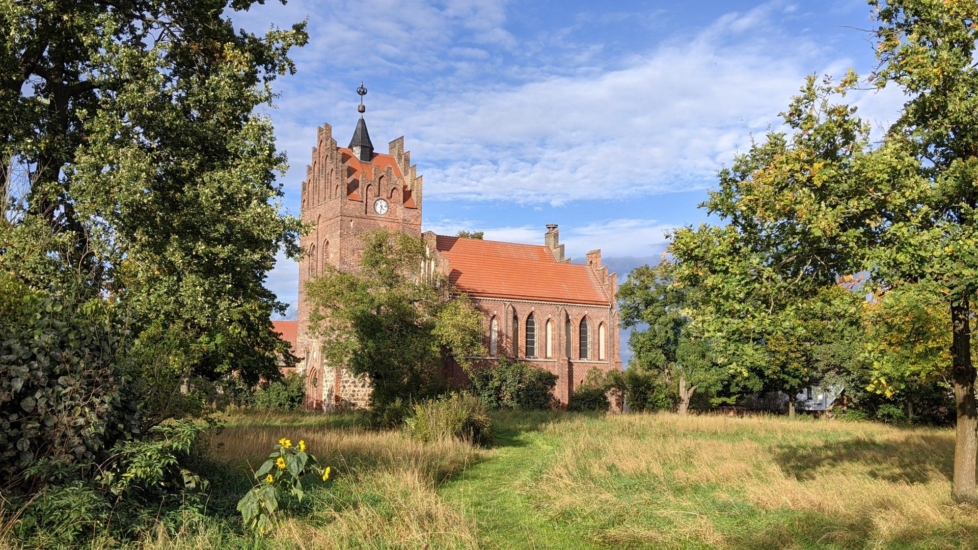
This brick hall building with a polygonal eastern end and a wooden western roof tower is beautiful and well preserved.
1
0
Lots of wetness, lots of moor. But no mosquitoes. Yay
0
0
Absolutely great food on an island. Unfortunately not on Mondays and Tuesdays.
0
0
Beautiful sandy beach, huge and goes right to the water.
0
0
Maybe we should take another look at certain scribblers.
0
0
A really rustic area. The footbridge is old, the railings are rotten and have fallen over. The planks you walk on are great though. There is a risk of tripping though.
0
0
Frequently Asked Questions
How many bus station hiking trails are available around Wusterhausen/Dosse?
There are 21 bus station hiking trails in the Wusterhausen/Dosse region, offering a variety of options for different preferences and fitness levels. These routes are designed to be easily accessible via public transport.
What kind of terrain can I expect on hikes around Wusterhausen/Dosse?
The region around Wusterhausen/Dosse is characterized by picturesque and varied topography, including rolling hills, expansive fields, and tranquil riverside paths along the Dosse River. Many trails also feature forest-rich shore paths around the Kyritz lake chain, such as the Untersee and Klempowsee. The routes are generally on easily-accessible paths with minimal gradients, making them suitable for most hikers.
Are there any easy bus-accessible hikes suitable for beginners or families?
Yes, there are 9 easy hikes accessible by bus around Wusterhausen/Dosse. These often include loops around Lake Dosse, the Untersee, or routes offering views of Klempowsee and the Wusterhausen Town Hall. An example is the Boardwalk at Untersee – Untersee (Lower Lake) loop from Bantikow, which offers a scenic and manageable distance.
What natural features or landmarks can I see along these bus station trails?
Many bus station trails in Wusterhausen/Dosse combine natural beauty with cultural points of interest. You can explore the historic old town of Wusterhausen/Dosse, enjoy views of the Dosse River and Lake Dosse, or discover parts of the Rhinluch Nature Park. Notable natural highlights include the Insl Kyritz (Love Island) and the Lakeside beach at Kyritzer Untersee. You might also encounter unique natural monuments like the Lonely Oak in Rhinluch.
Are there any circular routes starting from bus stations?
Yes, many of the bus-accessible routes in Wusterhausen/Dosse are circular, allowing you to start and end your hike at the same bus stop. For instance, the Bench with a view of the Untersee – View of Lake Klempow loop from Wusterhausen/Dosse is a moderate circular route that offers diverse scenery.
What is the best time of year to go hiking from bus stations in Wusterhausen/Dosse?
The region is beautiful year-round, but spring and autumn are particularly recommended for hiking. During these seasons, the Rhinluch Nature Park and surrounding woodlands offer vibrant colors and pleasant temperatures. Waterside walks along the Dosse River and the Kyritz lake chain are enjoyable from spring through early autumn.
Are the bus station trails in Wusterhausen/Dosse dog-friendly?
Generally, the hiking trails in the Wusterhausen/Dosse region are dog-friendly, especially those through natural landscapes and along the lakeshores. It's always advisable to keep dogs on a leash, especially in nature protection areas like the Rhinluch Nature Park, and to be mindful of local regulations. Always carry water for your dog and dispose of waste properly.
What do other hikers say about the bus station trails in Wusterhausen/Dosse?
The bus station trails around Wusterhausen/Dosse are highly rated by the komoot community, with an average score of 4.5 out of 5 stars from over 700 reviews. Hikers often praise the tranquil riverside experiences, the picturesque lake views, and the combination of natural scenery with charming historic towns.
Are there any longer, more challenging bus-accessible hikes?
While most routes are easy to moderate, there are longer options available. For example, the Bantikow Castle – Wusterhausen/Dosse Beach loop from Bantikow is a moderate 10.3 km route that provides a good distance for those looking for a longer day out. There is also 1 difficult trail listed, for experienced hikers seeking a greater challenge.
Can I find places to eat or rest near the bus station hiking trails?
Yes, Wusterhausen/Dosse itself, as well as nearby towns like Kyritz, offer charming historic centers with options for refreshments and rest. Some routes may pass by specific highlights like the Kynitz Island (INSL) with ferry and restaurant, providing convenient spots to take a break and enjoy a meal.
What are the typical distances and durations for these bus station hikes?
The bus station hikes around Wusterhausen/Dosse vary in length, with many moderate routes ranging from 9 to 12 kilometers. For instance, the Untersee (Lower Lake) – Lakeside beach at Kyritzer Untersee loop from Bantikow is about 10.5 km and takes around 2.5 to 3 hours to complete, depending on your pace and stops.
Most popular routes around Wusterhausen/Dosse
Most popular attractions around Wusterhausen/Dosse

Get inspired with the komoot mobile app


Explore more
Browse the best Hikes in other regions.
