The best traffic-free bike rides around Lutzerath
4.5
(3823)
20,575
riders
161
rides
No traffic touring cycling routes around Lutzerath are set within Germany's Vulkaneifel region, characterized by its volcanic past and distinctive geographical features such as crater lakes. The municipality is situated on a high ridge, framed by dales, woods, and meadows, offering varied and scenic routes. Cyclists can navigate through idyllic valleys like the Weiherbachtal, Erdenbach, and Litzbach, which feature meandering paths. The region's network includes routes along disused railway lines, providing relatively flat and relaxed cycling experiences.
Best no traffic…
Last updated: July 11, 2026
5.0
(5)
21
riders
26.2km
01:47
420m
420m
Moderate bike ride. Good fitness required. Mostly paved surfaces. Suitable for all skill levels.
6
riders
Easy bike ride. Great for any fitness level. Mostly paved surfaces. Suitable for all skill levels.

Sign up for free
3
riders
Easy bike ride. Great for any fitness level. Mostly paved surfaces. Suitable for all skill levels.
2
riders
18.3km
01:23
290m
290m
Moderate bike ride. Good fitness required. Mostly paved surfaces. Suitable for all skill levels.
4
riders
Easy bike ride. Great for any fitness level. Mostly paved surfaces. Suitable for all skill levels.
Get access to more routes and recommendations from other explorers.
Sign up for free
Already have an account?
Our route recommendations are based on thousands of hikes, rides, and runs completed by other people on komoot.
Start today with a free account
Your next adventure awaits.
Login or Signup


Tips from the Community

very wide, not technical but funny
1
0

The fairy-tale fountain at the Alten Postplatz tells a story. Here, on this spot, it is at its most beautiful.
7
0
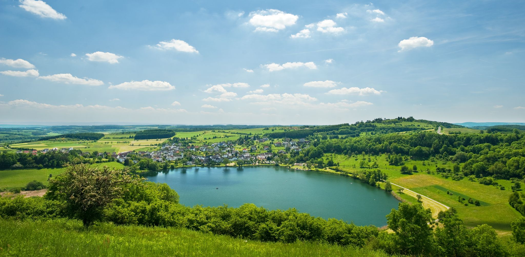
The Ulmen Maar lies 420 meters above sea level today, covers an area of 5.5 hectares, and is 36 meters deep. The bubbles at the maar's edge demonstrate that volcanism is still active. They bear witness to a turbulent past—but rest assured, there's no eruption in sight! A wall of various rocks and ash, up to 20 meters thick, surrounds the cone. For those interested, these testimonies to this explosive past are beautifully displayed in St. Matthias Church. This unique wall, with its different colored layers and rounded inclusions, is worth seeing for more than just geologists. The slopes of the maar basin are covered with a beautiful forest, which can be explored on a circular walk. A detour to the medieval castle ruins, from which the Crusaders once launched their campaigns, is recommended. The view from the crater rim over the maar and the Eifel beyond will take your breath away. Whether after a sweaty hike or a long drive, the blue of the Ulmer Eifel lake is all too tempting in summer. However, bathing in the maar is prohibited because it is designated as a nature and water protection area.
6
0
The lower castle has completely disappeared. You can still see the beginning of the ring that connected the lower castle and the Ulmen city wall, a two-story outer wall of the palace, as well as a cistern and some foundation walls of other buildings. The old part of Ulmen Castle was built around 1074 AD and likely rests on the remains of a Roman settlement. In the Middle Ages, Ulmen Castle was further expanded and divided into the upper castle, whose remains of the walls still exist, and the lower castle, which extended to the banks of the maar river. Two knightly families lived in the castle, which is believed to have never been attacked or destroyed until 1673 due to its size. Only the Sun King's troops succeeded. It was rebuilt, but fell again in 1689 during the War of the Succession. However, Ulmen Castle was also rebuilt this time, with only the city wall being abandoned. With the invasion of Napoleon's soldiers, Ulmen also became French and later Prussian. The empty castle, whose last descendant died in 1801, was auctioned to a merchant from Cochem, who sold it as a quarry. When a devastating fire burned Ulmen to the ground in the 19th century, the residents of Ulmen rebuilt their houses with stones from the castle. That's why you can still see a coat of arms on some of the stables today. It wasn't until the early twentieth century that Ulmen Castle was declared a listed building and became the property of the municipality of Ulmen. The castle is always freely accessible.
7
0


Beautiful place for peace and quiet, the door is always open.
1
0

A beautiful country road leads over the hills here before descending into the valley towards Cochem.
0
0

Beautiful square with a fountain and places to stop for a drink.
3
0
Frequently Asked Questions
How many no-traffic touring cycling routes are available around Lutzerath?
Lutzerath and its surroundings offer a wide selection of car-free touring cycling routes. You'll find over 160 routes, with options ranging from easy, leisurely rides to more challenging tours through the scenic Vulkaneifel landscape.
What is the best time of year for no-traffic touring cycling in Lutzerath?
The Vulkaneifel region around Lutzerath is beautiful for cycling from spring through autumn. Spring brings blooming meadows, while summer offers warm weather for longer rides. Autumn provides stunning foliage, especially along routes like the Maare-Mosel Cycle Path. Always check local weather forecasts before heading out.
Are there any easy, family-friendly no-traffic cycling routes in Lutzerath?
Yes, Lutzerath is well-suited for family-friendly cycling, especially on routes that follow disused railway lines, known for their gentle gradients. The Weiherbachtal Circular Trail – Bench by the Old Oak loop from Lutzerath is an easy option, covering just under 6 km with minimal elevation gain, perfect for a relaxed family outing.
Can I bring my dog on the no-traffic cycling routes around Lutzerath?
Many of the natural paths and disused railway lines in the Vulkaneifel are suitable for cycling with dogs, provided they are well-behaved and kept on a leash. The Maare-Mosel Cycle Path, a popular route accessible from Lutzerath, generally allows dogs. Always ensure your dog is comfortable with cycling distances and that you carry enough water for both of you.
Are there circular no-traffic touring cycling routes available near Lutzerath?
Absolutely. Many routes in the region are designed as loops, allowing you to start and end in the same location. For example, the Waldhof loop from Lutzerath offers a moderate 14.7 km ride, providing a great way to explore the local scenery without retracing your steps.
What kind of landscapes and viewpoints can I expect on these routes?
The no-traffic routes around Lutzerath traverse the unique Vulkaneifel landscape, characterized by volcanic features, idyllic dales, dense woods, and lush meadows. You can enjoy panoramic views of the region, such as from the Eifelblick Achterhöhe, and explore romantic valleys like the Weiherbachtal. Highlights like the Panoramic view of the Moselle bend below the Calmont summit offer breathtaking vistas.
Where can I park my car when starting a no-traffic cycling tour in Lutzerath?
Lutzerath, being a recreational resort, offers various parking options for visitors. Look for designated public parking areas within the village. For routes like the Maare-Mosel Cycle Path, there are often specific parking lots at the trailheads in nearby towns such as Daun or Bernkastel-Kues, which are easily accessible from Lutzerath.
Is it possible to rent a bike in Lutzerath for these tours?
Yes, the region is cyclist-friendly, and you can find bike rental options in Lutzerath and surrounding towns. E-bike rentals are also available, which can be particularly helpful for tackling some of the longer or more varied terrain in the Vulkaneifel.
What are some notable attractions or landmarks along the no-traffic routes?
Beyond the natural beauty, you can discover interesting landmarks. The Upper Castle of Ulmen – Ulmener Maar loop from Lutzerath takes you past historical sites. The region is also known for its crater lakes (Maare) and offers viewpoints like the Pinnerkreuz Viewpoint, providing stunning vistas of the volcanic landscape and the Moselle valley.
Are there cafes or pubs along the no-traffic cycling routes in Lutzerath and the Vulkaneifel?
Yes, the Vulkaneifel region is well-equipped to cater to cyclists. You'll find bike-friendly cafes, pubs, and restaurants in Lutzerath and the charming villages along popular routes like the Maare-Mosel Cycle Path. These establishments often provide refreshments and local specialties, perfect for a break during your tour.
How do other touring cyclists rate the no-traffic routes around Lutzerath?
The no-traffic touring cycling routes around Lutzerath are highly regarded by the komoot community, with an average rating of 4.26 stars. Cyclists often praise the quiet, well-maintained paths, the diverse volcanic landscapes, and the opportunity to explore the region's natural beauty away from vehicle traffic.
Most popular routes around Lutzerath
Most popular attractions around Lutzerath

Get inspired with the komoot mobile app


Explore more
Browse the best Cycling routes in other regions.
