The best hikes from bus stations around Rascheid
4.5
(10500)
37,647
hikers
7
hikes
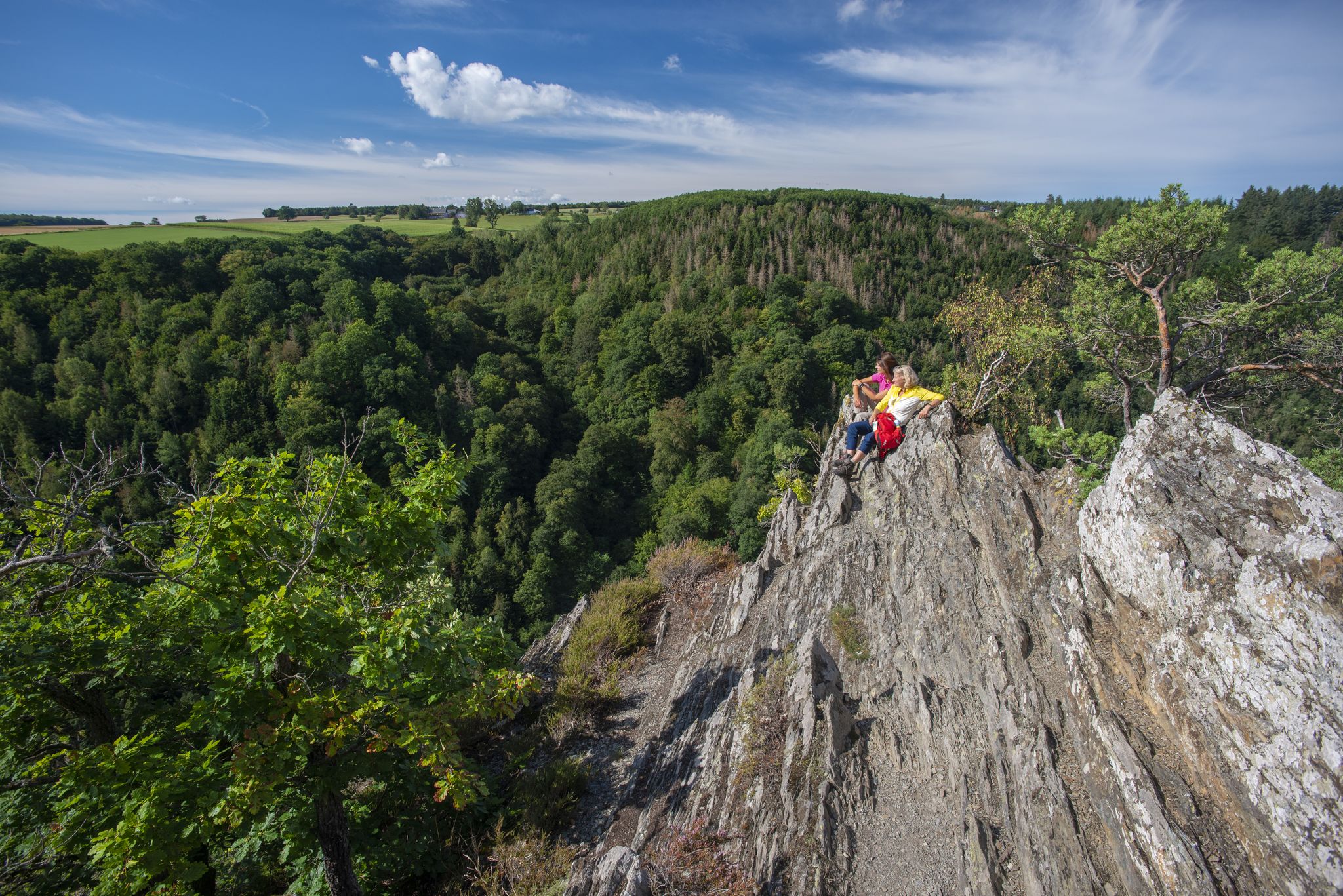
Bus station hiking trails around Rascheid are situated in the Hunsrück region, a low mountain range characterized by extensive forests and rolling hills. The area features diverse landscapes, including natural stream sections along the Rasbach and open fields. Ascending some trails provides wide views over the Hunsrück, including the Erbeskopf, and into the distant Eifel region. This varied terrain offers options for different hiking preferences.
Best bus station hiking trails around Rascheid
- The most popular bus station hiking route is St. Anna Chapel Rascheid – Hunsrückbahn Viaduct loop from Rascheid, a 2.8 miles (4.5 km) trail that takes 1 hour 16 minutes to complete. This route passes by the historic St. Anna Chapel.
- Another top favourite among local hikers is Old Paths – Rascheider Observation Tower loop from Rascheid, an easy 4.2 miles (6.8 km) path. This trail leads to the Rascheider Observation Tower, offering panoramic views.
- Local hikers also love the Heidelberg – St. Anna Chapel Rascheid loop from Rascheid, a 2.2 miles (3.5 km) trail leading through varied local scenery, often completed in about 56 minutes.
- Hiking around Rascheid is defined by its extensive forests, rolling hills, and scenic stream valleys, often featuring observation towers with wide views. The network offers options for different ability levels, primarily focusing on easy routes.
- The routes in Rascheid are highly rated by the komoot community with an average score of 4.5 stars from over 9,900 reviews. More than 37,800 hikers have used komoot to explore Rascheid's varied terrain.
Last updated: June 27, 2026
4.0
(4)
19
hikers
4.50km
01:17
100m
100m
Easy hike. Great for any fitness level. Easily-accessible paths. Suitable for all skill levels.
4.8
(5)
23
hikers
Easy hike. Great for any fitness level. Easily-accessible paths. Suitable for all skill levels.

Sign up for free
5.0
(1)
6
hikers
4.27km
01:12
80m
80m
Easy hike. Great for any fitness level. Easily-accessible paths. Suitable for all skill levels.
10
hikers
6.83km
01:52
100m
100m
Easy hike. Great for any fitness level. Easily-accessible paths. Suitable for all skill levels.
4
hikers
2.91km
00:48
40m
50m
Easy hike. Great for any fitness level. Easily-accessible paths. Suitable for all skill levels.
Get access to more routes and recommendations from other explorers.
Sign up for free
Already have an account?
Our route recommendations are based on thousands of hikes, rides, and runs completed by other people on komoot.
Start today with a free account
Your next adventure awaits.
Login or Signup

Other adventures around Rascheid

Tips from the Community

The Rascheid community's barbecue hut can be booked for parties and family celebrations. It's also ideal for a hiking break, with a beautiful view.
0
0

It was in good condition and had a great view.
0
0

Here you can buy food and drinks with card or cash. There's even a cutting board, knife, bread, and cold cuts available. You can also charge your bike. Restrooms are available on-site.
0
0

From the tower you have a wonderful panoramic view over the Hunsrück to the Hohe Acht😍
0
0
From the tower you have a wonderful panoramic view over the Hunsrück to the Hohe Acht😍
1
0

Local fruit varieties were planted as part of a so-called land consolidation process between Rascheid and the St. Anna Chapel as path accompaniment. A wonderful measure to preserve the cultural landscape.
0
0
Recreational area with a large hut and covered barbecue. The facilities can also be rented for private celebrations.
0
0

Really great for photo opportunities, where can you still find old tracks on a hiking trail?
0
1
Frequently Asked Questions
How many hiking trails are accessible directly from bus stations around Rascheid?
There are 7 hiking routes around Rascheid that are easily accessible from local bus stations. All of these routes are rated as easy, making them suitable for a wide range of hikers.
Are the bus-accessible hiking trails around Rascheid suitable for beginners or families?
Yes, all 7 routes listed are rated as easy, making them ideal for beginners, families with children, or anyone looking for a relaxed outdoor experience. The trails often feature varied terrain, including scenic meadow passages and natural stream valleys, as highlighted in the region's characteristics.
Are there circular hiking routes available from Rascheid's bus stations?
Absolutely. Many of the bus-accessible routes around Rascheid are circular, allowing you to start and end your hike at the same point. Examples include the St. Anna Chapel Rascheid – Hunsrückbahn Viaduct loop from Rascheid and the Heidelberg – St. Anna Chapel Rascheid loop from Rascheid.
What natural features or landmarks can I expect to see on these bus-accessible hikes?
The trails offer diverse scenery within the Hunsrück region, including lush forests, rolling hills, and natural stream sections like the Rasbach. You can also find routes that lead to viewpoints. For instance, the Old Paths – Rascheider Observation Tower loop from Rascheid takes you towards the Nationalparkblick Observation Tower, offering wide views over the Hunsrück and Erbeskopf.
Are there any historical or cultural points of interest along the bus-accessible routes?
Yes, some routes incorporate historical elements. The St. Anna Chapel Rascheid – Hunsrückbahn Viaduct loop from Rascheid passes by the historic St. Anna Chapel, adding a cultural dimension to your hike. The region also has a rich history, with sites like the Züscher Hammer nearby, though not directly on these specific bus-accessible routes.
What is the typical duration of these bus-accessible hikes?
The duration of these hikes varies, but most are relatively short, ranging from approximately 1 to 2 hours. For example, the Rascheider Observation Tower loop from Rascheid can be completed in under an hour, while the Old Paths – Rascheider Observation Tower loop from Rascheid takes around 1 hour and 50 minutes.
What do other hikers enjoy most about hiking in Rascheid?
The area is highly rated by the komoot community, with an average score of 4.5 stars. Reviewers often praise the peaceful immersion in nature, the well-maintained trail network, and the diverse landscapes of the Hunsrück, which offer both challenging climbs and gentle paths.
Are there any specific viewpoints accessible from the bus station hikes?
Yes, several routes offer rewarding views. The Old Paths – Rascheider Observation Tower loop from Rascheid is a good option, as it leads towards the Nationalparkblick Observation Tower, providing stunning panoramic views over the Hunsrück, Erbeskopf, and into the distant Eifel region.
What kind of terrain can I expect on these easy bus-accessible trails?
You can expect a pleasant variety of terrain. While all routes are easy, they traverse the Hunsrück's characteristic lush forests and rolling hills. You'll find sections with scenic meadow passages and natural stream valleys, offering a diverse and engaging walking experience without significant difficulty.
Is Rascheid part of any larger long-distance hiking trails?
Yes, Rascheid is situated along the Saar-Hunsrück Steig, a renowned 410-kilometer long-distance trail. A stage of this trail, specifically between Hermeskeil and Kell am See, passes directly through Rascheid, offering breathtaking views and connecting the region to a wider network of hiking adventures.
Most popular routes around Rascheid
Most popular attractions around Rascheid

Get inspired with the komoot mobile app


Explore more
Browse the best Hikes in other regions.
