The best traffic-free bike rides around Hasel
4.4
(49)
309
riders
40
rides
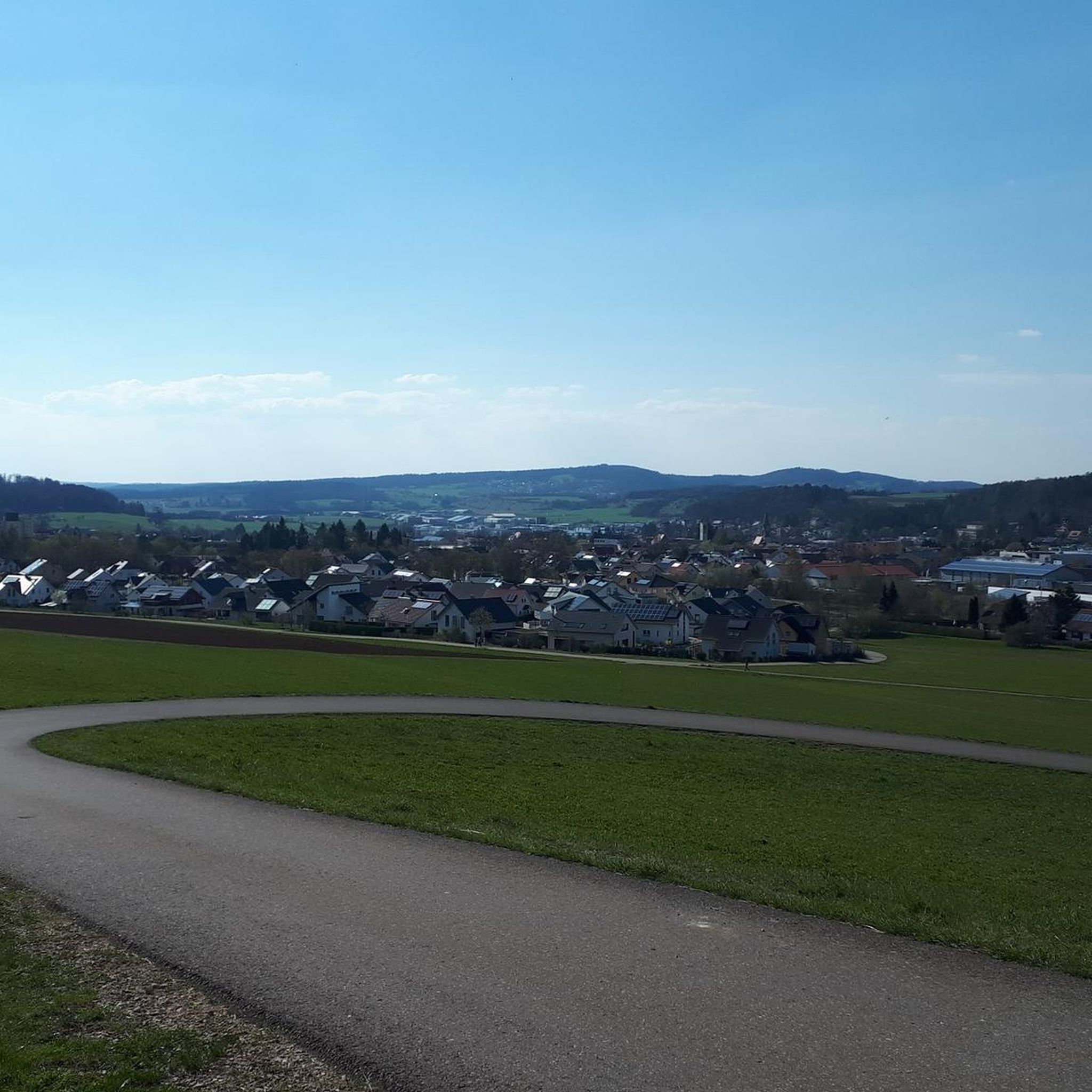
No traffic gravel bike trails around Hasel traverse a landscape characterized by dense forests, rolling hills, and river valleys within the Black Forest region. The terrain often includes varied surfaces suitable for gravel biking, from forest tracks to quieter country roads. This area provides routes with significant elevation changes, offering both challenging climbs and scenic descents. The natural environment features a mix of woodland and open areas, typical of the southern Black Forest.
Best no traffic gravel bike trails around Hasel
- The most popular no traffic gravel bike trail is Idyllic Murg Valley stream – Bad Säckingen Old Town loop from Rickenbach, a 18.4 miles (29.7 km) trail that takes 2 hours 20 minutes to complete. This difficult route features over 1,750 feet (530 m) of elevation gain through varied terrain.
- Another top favourite among local gravel bikers is Car-free Belchen Road – Todtnauerli Tunnel loop from Schopfheim West, a difficult 46.0 miles (74.1 km) path. This extensive route includes over 5,000 feet (1,500 m) of climbing, leading through scenic Black Forest landscapes.
- Local gravel bikers also love the Hands of Steel Trail Section C – Maienbühl Trail Section C loop from Maulburg, a 18.4 miles (29.6 km) trail leading through forest sections and open views, often completed in about 2 hours 22 minutes.
- Gravel biking around Hasel is defined by dense forests, river valleys, and significant elevation changes. The network offers options for various ability levels, from moderate to difficult routes.
- The routes in Hasel are highly rated by the komoot community with an average score of 4.6 stars from over 30 reviews. More than 200 gravel bikers have used komoot to explore Hasel's varied terrain.
Last updated: August 21, 2026
4.3
(6)
27
riders
29.7km
01:52
530m
530m
Hard gravel ride. Very good fitness required. Mostly paved surfaces. Suitable for all skill levels.
4.0
(2)
15
riders
74.4km
05:21
1,550m
1,550m
Hard gravel ride. Very good fitness required. Mostly paved surfaces. Suitable for all skill levels.

Sign up for free
4.7
(3)
17
riders
Moderate gravel ride. Good fitness required. Mostly paved surfaces. Suitable for all skill levels.
4.7
(3)
13
riders
30.0km
02:08
650m
650m
Hard gravel ride. Very good fitness required. Mostly paved surfaces. Suitable for all skill levels.
5.0
(4)
18
riders
35.9km
02:19
670m
670m
Hard gravel ride. Very good fitness required. Mostly paved surfaces. Suitable for all skill levels.
Get access to more routes and recommendations from other explorers.
Sign up for free
Already have an account?
Our route recommendations are based on thousands of hikes, rides, and runs completed by other people on komoot.
Start today with a free account
Your next adventure awaits.
Login or Signup
Popular around Hasel

Tips from the Community

The Murgtal-Schluchtweg leads through an impressive landscape with steep rock faces, dense forest, and the rushing Murg. A varied section where you can experience the wild side of the Black Forest particularly intensely. Ideal for everyone who likes to be out in nature.
0
0

The tunnel is just on the way. But it's an interesting experience - especially if the lights fail... But don't panic, the tunnel isn't long!
0
0
The Dinkelberg trails are simply beautiful!
0
0


The Hohe-Flum Tower stands on the highest point of the Dinkelberg, at 535 meters above sea level. The 13.5-meter-high tower was built in 1874. Sixty-two steps lead up to the platform. From there, one has a magnificent panoramic view in all directions. To the south, one can see the Swiss Jura plateau and, in good weather, the Alps beyond. To the west, the view extends to the Vosges Mountains, and to the north and east, to the Black Forest. The Entegast, Zeller Blauen, Hohe Möhr, and other peaks are also visible.
5
0
A magnificent vantage point with panoramic views of the Belchen and the surrounding valleys. Perfect for photos, a short rest, and enjoying nature.
0
0
A quiet panoramic road to Belchen – completely car-free, ideal for cyclists and hikers. A pleasant climb with fantastic views along the way.
2
0
A quiet panoramic road to Belchen – completely car-free, ideal for cyclists and hikers. A pleasant climb with fantastic views along the way.
0
0
Frequently Asked Questions
How many traffic-free gravel bike trails are available around Hasel?
There are over 40 dedicated traffic-free gravel bike trails around Hasel, offering a wide range of experiences for different skill levels. While most are rated as difficult, there are also moderate and easy options available for a more relaxed ride.
What kind of terrain can I expect on the gravel bike trails near Hasel?
The trails around Hasel primarily feature rural gravel roads, often winding through the scenic Black Forest landscape. You can expect a mix of forest paths, open stretches, and some challenging climbs, providing a true gravel biking experience with minimal traffic.
Are there any circular gravel bike routes around Hasel?
Yes, many of the gravel bike trails around Hasel are designed as circular routes, allowing you to start and end at the same point. For example, the Idyllic Murg Valley stream – Bad Säckingen Old Town loop from Rickenbach offers a beautiful circular tour through varied terrain.
What are the elevation gains like on the gravel trails in Hasel?
The gravel trails around Hasel, situated in the Black Forest, can feature significant elevation gains, reflecting the region's mountainous character. For instance, the Car-free Belchen Road – Todtnauerli Tunnel loop from Schopfheim West includes over 1,500 meters of ascent, offering rewarding climbs and breathtaking views.
What natural features or landmarks can I see along the gravel bike routes?
The routes often pass through stunning natural landscapes and near interesting landmarks. You might encounter features like the Wehra Gorge or the Murgtalpfad Rock Tunnels and Waterfall. The region is also known for its impressive stalactite caves, such as the Erdmannshöhle Hasel, which could be a point of interest near your ride.
Are there any family-friendly traffic-free gravel bike trails in Hasel?
While many trails are rated for experienced riders, there are options suitable for families looking for a less strenuous ride. The Hohe Flum Lookout Tower – View of Schopfheim loop from Schopfheim Schlattholz is a moderate route that offers scenic views without extreme difficulty, making it a good choice for active families.
What do other gravel bikers enjoy most about riding in Hasel?
The area is highly rated by the komoot community, with an average score of 4.6 stars. Reviewers often praise the quiet, traffic-free nature of the routes, the challenging climbs, and the stunning views of the Black Forest. The diverse terrain and well-maintained gravel paths are also frequently highlighted.
Are there any routes that offer particularly good viewpoints?
Absolutely. The mountainous terrain of the Black Forest ensures many routes offer spectacular vistas. The Hohe Flum Lookout Tower – View of Schopfheim loop from Schopfheim Schlattholz, for example, provides excellent panoramic views of the surrounding landscape and the town of Schopfheim.
Can I find routes that combine gravel biking with other attractions?
Yes, some routes allow you to combine your ride with visits to nearby attractions. You could explore the Rheinfelden Hydropower Plant or the Narrow woodland trails in the Wehra Gorge, which are often accessible from the gravel paths, adding a cultural or natural exploration element to your ride.
What is the best time of year for gravel biking in Hasel?
Spring and autumn are generally considered the best seasons for gravel biking in Hasel. In spring, the Black Forest comes alive with vibrant dogwood and redbud trees, and water flows freely from the mountainsides. Autumn offers cooler temperatures and beautiful fall foliage, making for a picturesque riding experience. Summer can also be pleasant, especially in the shaded forest sections.
Are there any beginner-friendly traffic-free gravel routes?
While many routes are challenging, there are options for beginners. Look for routes marked as 'easy' or 'moderate' difficulty. These typically have less elevation gain and smoother surfaces, providing a good introduction to gravel biking in the region. The guide offers one easy route and ten moderate routes to choose from.
Most popular attractions around Hasel

Get inspired with the komoot mobile app


Explore more
Browse the best Gravel rides in other regions.
