The best traffic-free bike rides around Unterroggenburger Wald
4.6
(19)
139
riders
28
rides
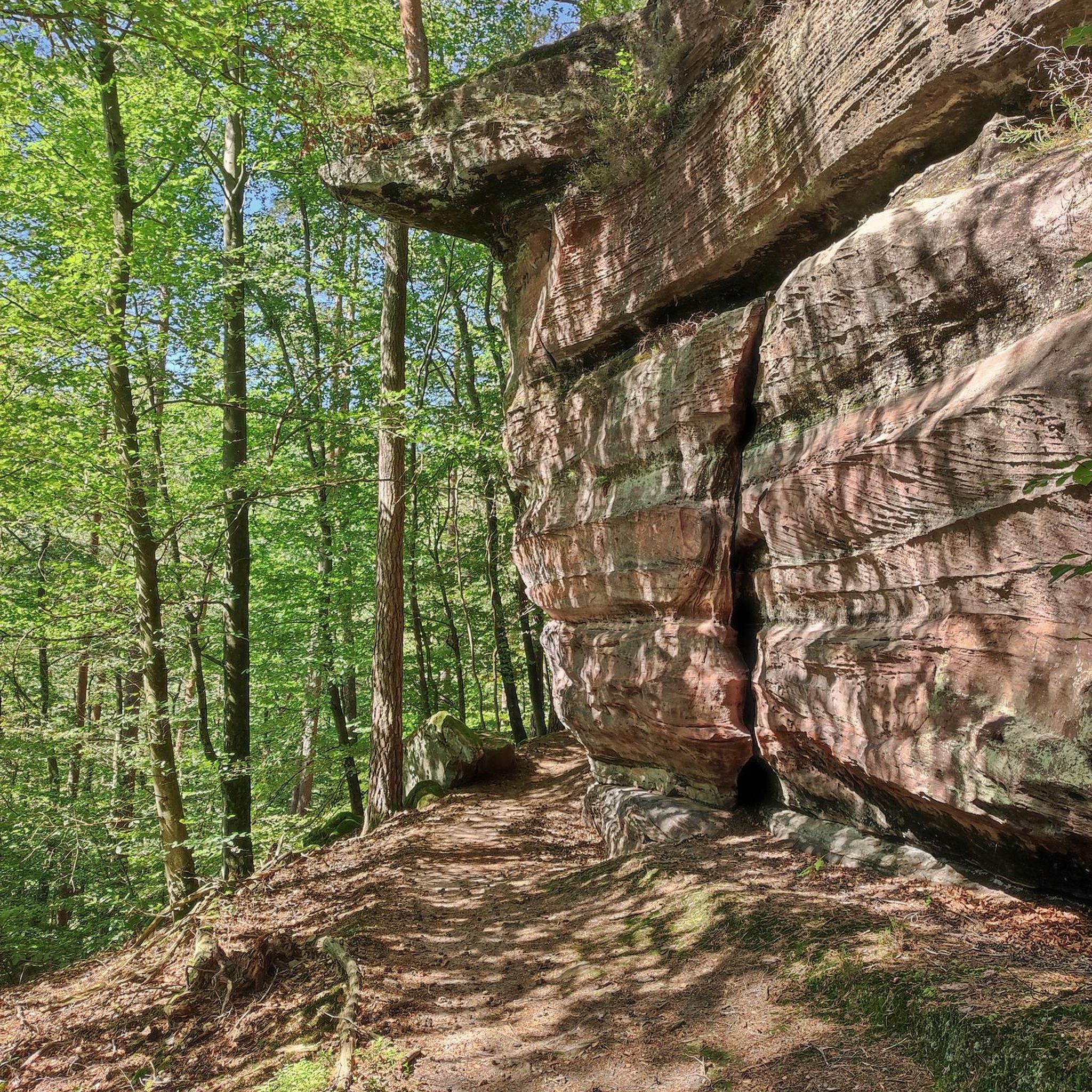
Gravel biking around Unterroggenburger Wald offers a network of no traffic gravel bike trails through a predominantly forested and uninhabited area in Bavarian Swabia. This region is characterized by managed woodlands, providing numerous paths suitable for exploration. Natural features include the protected Ingstetter Weiher, with its surrounding reed beds and silting zones, adding ecological value to the landscape. The terrain includes varied elevation gains, making it suitable for different fitness levels.
Best no traffic gravel bike trails around Unterroggenburger Wald
- The most popular no traffic gravel bike trail is Iller Cycle Path – Rushing Iller River loop from Weißenhorn, a 36.2 miles (58.2 km) trail that takes 2 hours 54 minutes to complete. This route features moderate elevation changes through the local landscape.
- Another top favourite among local gravel bikers is Rushing Iller River – Iller Cycle Path loop from Weißenhorn, a difficult 62.4 miles (100.4 km) path. This longer route offers significant elevation gain, traversing varied terrain.
- Local gravel bikers also love the Rushing Iller River – Iller Cycle Path loop from Weißenhorn, a 25.3 miles (40.8 km) trail leading through forested areas and along river paths, often completed in about 2 hours 15 minutes.
- Gravel biking around Unterroggenburger Wald is defined by managed woodlands, river paths, and protected natural areas like the Ingstetter Weiher. The network offers options for different ability levels, from moderate rides to more challenging routes with notable elevation gains.
- The routes in Unterroggenburger Wald are highly rated by the komoot community with an average score of 4.5 stars from more than 10 reviews. More than 100 gravel bikers have used komoot to explore Unterroggenburger Wald's varied terrain.
Last updated: October 14, 2026
3.8
(4)
34
riders
58.2km
02:53
170m
170m
Moderate gravel ride. Good fitness required. Mostly paved surfaces. Suitable for all skill levels.
4.5
(2)
13
riders
100km
05:27
390m
390m
Hard gravel ride. Very good fitness required. You may need to push your bike for some segments of this route.

5.0
(3)
14
riders
40.9km
02:14
130m
130m
Moderate gravel ride. Good fitness required. Mostly paved surfaces. Suitable for all skill levels.
12
riders
53.0km
02:48
160m
160m
Moderate gravel ride. Good fitness required. Mostly paved surfaces. Suitable for all skill levels.
5.0
(1)
15
riders
54.3km
03:05
290m
290m
Moderate gravel ride. Good fitness required. Mostly paved surfaces. Suitable for all skill levels.
Get access to more routes and recommendations from other explorers.
Already have an account?
Our route recommendations are based on thousands of hikes, rides, and runs completed by other people on komoot.
Start today with a free account
Your next adventure awaits.
Popular around Unterroggenburger Wald
Tips from the Community

Here you can have a good and cozy stop and always meet cyclists with pleasure.
0
0

Magnificent reservoir. A nice place to take a break.
0
0


Well-maintained, safe crossing over the canal.
1
0

The railway line used to be Kelmünz - Babenhausen
0
0

The hiking and cycling path runs in a straight line alongside the Iller River. The path is gravelled and grassy in the middle. Alongside the cycle path, you can see the floodplain forest. Between the Iller River and the cycle path, there is a grassy strip about 3 meters wide. Wildlife can probably be spotted here frequently, as there is a hunting lodge in between. At least the fish were also taken into consideration at the weir. A fish ladder is located along the edge.
0
0

The bike path runs along the bottom of the dam, but there are several places to access the dam. There are plenty of anglers on the dam.
2
0
Easily rideable without any special equipment. A wonderful bike path to enjoy.
1
0
Frequently Asked Questions
How many traffic-free gravel bike trails are available in Unterroggenburger Wald?
The Unterroggenburger Wald area offers a wide selection of traffic-free gravel bike trails. You'll find over 25 routes specifically curated for a peaceful gravel biking experience, ranging from easy to difficult.
What makes the Unterroggenburger Wald ideal for traffic-free gravel biking?
The Unterroggenburger Wald is a predominantly forested and uninhabited area, making it perfect for traffic-free gravel biking. Its extensive network of forest paths and dedicated cycle routes, like sections of the Iller Cycle Path, ensures a serene experience away from cars. The region's natural beauty, including the protected Ingstetter Weiher, adds to its appeal for nature lovers.
Are there family-friendly no-traffic gravel routes in the Unterroggenburger Wald?
Yes, there are several family-friendly options. While many routes offer moderate challenges, some are suitable for families looking for a relaxed ride. Look for routes with lower elevation gains and shorter distances for a more enjoyable family outing. The quiet forest paths are generally safe for children to ride on.
Can I bring my dog on these gravel trails?
Generally, dogs are welcome on most public trails in Bavaria, including those in the Unterroggenburger Wald, provided they are kept on a leash and you clean up after them. Always be mindful of wildlife and other trail users. It's advisable to check local regulations for specific protected areas or nature reserves you might pass through.
When is the best time of year to go gravel biking in Unterroggenburger Wald?
The best seasons for gravel biking in Unterroggenburger Wald are spring, summer, and autumn. Spring offers fresh greenery and blooming nature, while summer provides warm weather for longer rides. Autumn is particularly scenic with vibrant fall foliage. Winter can be challenging due to snow and ice, making some trails impassable.
What kind of terrain and elevation can I expect on these routes?
The terrain in Unterroggenburger Wald primarily consists of well-maintained gravel paths and forest tracks. You can expect varied elevation profiles, from relatively flat sections along river paths to more challenging climbs within the forest. For example, the Iller Cycle Path – Rushing Iller River loop from Weißenhorn covers 58.2 km with about 166 meters of elevation gain, offering a moderate ride. More difficult routes can feature over 300 meters of ascent.
What natural features or landmarks can I see along the way?
You'll encounter several interesting natural features and landmarks. A notable natural monument is the Ingstetter Weiher, a protected pond with surrounding reed beds and alder stands. Additionally, you might pass by the Roggenburg pond or the impressive Roggenburg Abbey, offering a blend of nature and cultural sights.
Are there circular gravel bike routes available?
Yes, many of the gravel bike routes in the Unterroggenburger Wald are designed as loops, allowing you to start and end at the same point. An example is the Iller Cycle Path – Iller Cycle Route loop from Weißenhorn, which is a moderate 53 km ride. These circular routes are convenient for exploring the region without needing a return trip arrangement.
Where can I park when starting a gravel bike tour in the area?
Parking is generally available in the towns and villages surrounding the Unterroggenburger Wald, such as Weißenhorn or Roggenburg. Look for designated parking areas near trailheads or public parking lots within these communities. Always check local signage for any parking restrictions or fees.
What do other gravel bikers enjoy the most about gravel biking in Unterroggenburger Wald?
The komoot community highly rates the gravel biking experience in Unterroggenburger Wald, with an average score of 4.5 stars. Reviewers often praise the tranquility of the forested paths, the absence of traffic, and the beautiful natural scenery, especially around the Ingstetter Weiher. The variety of routes, from moderate to challenging, also receives positive feedback.
Are there cafes or accommodation options near the gravel trails?
Yes, you'll find cafes, pubs, and accommodation options in the nearby towns and villages like Roggenburg and Weißenhorn. For example, the Autenrieder Brewery Inn and Beer Garden offers a place to refresh. These places are typically a short ride from the main forest areas, providing convenient stops for refreshments or overnight stays.
Can I access these gravel bike trails by public transport?
Public transport options to the Unterroggenburger Wald region are available, primarily via bus services connecting to towns like Weißenhorn and Roggenburg. From these towns, you can often cycle directly to the trailheads. It's advisable to check local bus schedules and policies regarding bicycle transport in advance.
Most popular routes around Unterroggenburger Wald
Most popular attractions around Unterroggenburger Wald

Get inspired with the komoot mobile app


Explore more
Browse the best Gravel rides in other regions.
