The best hikes from bus stations around Mittweida
4.6
(15584)
52,451
hikers
129
hikes
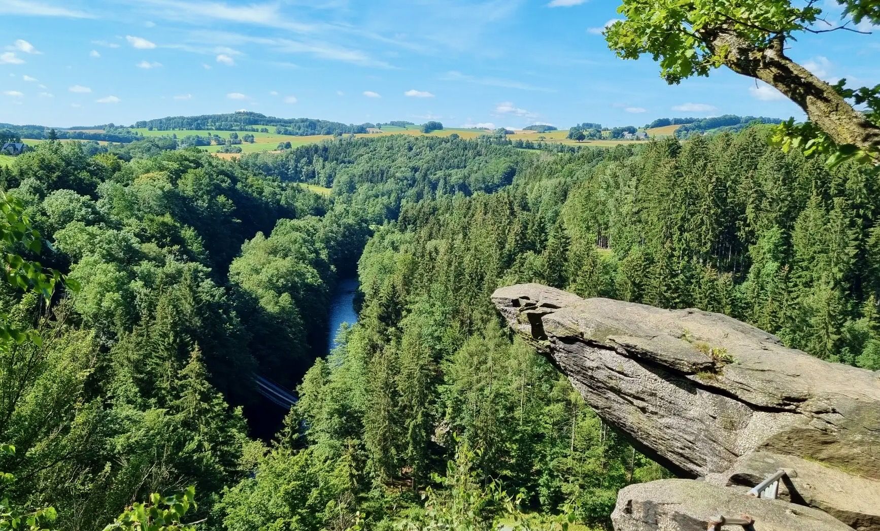
Bus station hiking trails around Mittweida offer access to the varied landscapes of Central Saxony, Germany. The region is characterized by the meandering Zschopau River and its valley, which winds through parts of the Ore Mountains. Dense forests and hills define much of the terrain, providing numerous opportunities for outdoor exploration. Notable features include Kriebstein Castle, situated on a hill overlooking the Zschopau, and the Kriebstein Dam.
Best bus station hiking trails around Mittweida
- The most popular bus station hiking…
Last updated: June 26, 2026
4.8
(600)
1,769
hikers
23.3km
06:30
400m
400m
Hard hike. Very good fitness required. Sure-footedness, sturdy shoes and alpine experience required.
4.5
(156)
545
hikers
8.48km
02:23
150m
150m
Moderate hike. Good fitness required. Mostly accessible paths. Sure-footedness required.

Sign up for free
4.5
(134)
429
hikers
Moderate hike. Good fitness required. Mostly accessible paths. Sure-footedness required.
4.8
(284)
866
hikers
Moderate hike. Good fitness required. Mostly accessible paths. Sure-footedness required.
4.7
(35)
157
hikers
21.6km
05:52
300m
300m
Hard hike. Very good fitness required. Easily-accessible paths. Suitable for all skill levels.
Get access to more routes and recommendations from other explorers.
Sign up for free
Already have an account?
Our route recommendations are based on thousands of hikes, rides, and runs completed by other people on komoot.
Start today with a free account
Your next adventure awaits.
Login or Signup
Popular around Mittweida


Tips from the Community

The Dreiwerdener Bridge, an attractive stone structure that was rebuilt after the flood damage of 2002. You should walk to the middle of the bridge to enjoy the beautiful view of the river valley and the Dreiwerdener weir and to convince yourself that the Zschopau is rich in fish. https://www.mittweida.de/fileadmin/Tourismus/Wandern/schweizerwald.pdf
0
0
Behind the inscription stone from 1880, a wooden sign with a „romantic“ poem and the picture of a blackbird rises. But this bird did not give the place its name. Below the bank rock, there was once a ford and a ferry point, where logs were pulled from the river on a rope - from this came „Amsel“ - and loaded onto carts. Next to the rock, the old haulage road can still be recognized. Recently, a covered rest area has invited visitors to linger here. View overgrown, from the rest area you don't see much of the Zschopau. https://www.mittweida.de/fileadmin/Tourismus/Wandern/schweizerwald.pdf
0
0

With an aviary and animal enclosure - a lovely little park.
1
0

Liebenhainer Mühle first mentioned in 1378
0
0


It's just incredibly beautiful here 😊.
0
0
It's just incredibly beautiful here 😊.
1
0
Frequently Asked Questions
How many bus-accessible hiking trails are available around Mittweida?
There are over 130 hiking routes around Mittweida that are easily accessible by bus, offering a wide range of options for different preferences and fitness levels. These trails allow you to explore the scenic landscapes without needing a car.
What kind of terrain can I expect on bus-accessible hikes near Mittweida?
The bus-accessible trails around Mittweida often lead through diverse terrain. You can expect paths winding along the picturesque Zschopau River, through idyllic forests, and past historical medieval mining areas. Many routes also feature gentle ascents and descents, particularly around the Zschopau Valley and Kriebstein Dam.
What is the best time of year to go hiking from a bus station in Mittweida?
Spring and autumn are generally considered the best seasons for hiking around Mittweida. In spring, you'll experience awakening flora and mild temperatures, while autumn offers stunning colorful foliage. The trails are well-maintained, making them enjoyable in various conditions.
Are the bus-accessible hiking trails around Mittweida well-rated by other hikers?
Yes, the hiking trails around Mittweida are highly regarded by the komoot community. With an average rating of 4.6 stars from over 14,800 reviews, hikers often praise the region's natural beauty, well-marked paths, and the convenience of public transport access.
Are there family-friendly hiking routes accessible by bus in Mittweida?
Absolutely. Many routes are suitable for families, offering easier walks along the Zschopau River or around the Kriebstein Dam. For example, the area around the Kriebstein Dam provides pleasant paths, and there's even a climbing forest nearby for a playful outdoor experience.
Can I bring my dog on bus-accessible hiking trails in Mittweida?
Most hiking trails in the Mittweida region are dog-friendly, allowing you to enjoy the natural surroundings with your canine companion. It's always recommended to keep dogs on a leash, especially in nature protection areas or near livestock, and to carry waste bags.
Are there any circular hiking routes that start and end at a bus stop in Mittweida?
Yes, there are several excellent circular routes. A moderate option is the Ringethal Tree Park – Ruins of Raubschloss Ringethal loop from Ringethal, which is 8.5 km long. Another moderate choice is the Ruins of Raubschloss Ringethal – Raubschloss Castle Ruins loop from Falkenhain, covering 7.2 km.
What natural features or landmarks can I see on bus-accessible hikes around Mittweida?
You can discover a wealth of natural beauty and historical landmarks. Many trails follow the scenic Zschopau River, offering tranquil views. The impressive View of Kriebstein Castle and the Kriebstein Dam are prominent features on several routes. You might also encounter remnants of medieval mining areas and dense forests.
Are there any challenging bus-accessible hikes for experienced hikers?
For experienced hikers seeking a challenge, the View of Kriebstein Castle – Kriebstein Castle loop from Mittweida is a difficult 23 km route with over 400 meters of elevation gain. This trail offers extensive views and a rewarding experience.
Are there any cafes or pubs near the bus-accessible hiking trails in Mittweida?
While specific establishments vary, the region around Mittweida, especially near popular attractions like Kriebstein Castle or in the town centers accessible by bus, often has options for refreshments. It's advisable to check local listings for cafes and pubs along your chosen route.
Can I find routes that explore the Zschopau Valley from a bus stop?
Yes, the Zschopau Valley is a central feature for hiking in Mittweida. A great option is the moderate Zschopau Bridge (Dreiwerden) – Old Zschopau Valley Trail loop from Mittweida, which covers nearly 17 km and allows you to immerse yourself in the valley's beauty.
Are there bus-accessible trails that offer views of castles or historical sites?
Many trails incorporate historical elements. The area around Kriebstein Castle is particularly rich in history and offers stunning views. You can also find routes that pass by other castles and monasteries in the broader region, such as those mentioned in the Castles around Mittweida guide, including Rochlitz Castle.
Most popular routes around Mittweida
Most popular attractions around Mittweida

Get inspired with the komoot mobile app


Explore more
Browse the best Hikes in other regions.
