The best hikes from bus stations around Mayen
4.4
(1351)
5,842
hikers
127
hikes
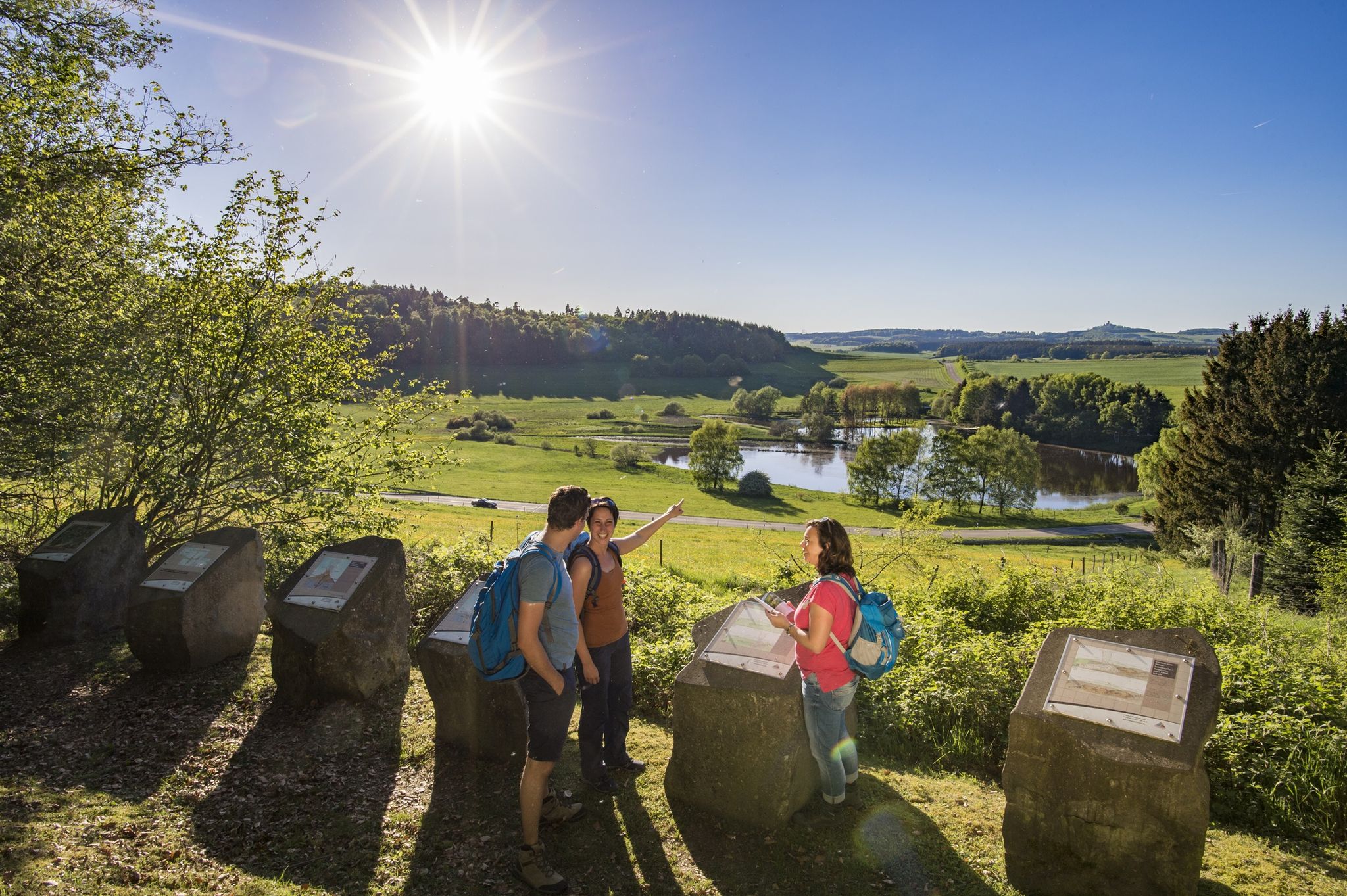
Bus station hiking trails around Mayen traverse the unique landscapes of the Volcanic Eifel region. This area is characterized by picturesque hills, valleys, and solidified volcanic formations. Hikers can explore idyllic forests and flowering mountain heaths, offering diverse terrain for outdoor activities. The region's geology provides varied elevation changes and scenic vistas.
Best bus station hiking trails around Mayen
- The most popular bus station hiking route is Mayen Bridge Gate – Path to Eiterbachweiher loop from Mayen, a 5.5…
Last updated: June 27, 2026
4.7
(45)
155
hikers
Moderate hike. Good fitness required. Mostly accessible paths. Sure-footedness required.
4.2
(27)
98
hikers
8.78km
02:36
200m
200m
Moderate hike. Good fitness required. Mostly accessible paths. Sure-footedness required.

Sign up for free
4.8
(50)
159
hikers
Hard hike. Good fitness required. Sure-footedness, sturdy shoes and alpine experience required.
4.5
(13)
87
hikers
6.15km
01:41
100m
100m
Easy hike. Great for any fitness level. Easily-accessible paths. Suitable for all skill levels.
4.5
(11)
88
hikers
Moderate hike. Good fitness required. Easily-accessible paths. Suitable for all skill levels.
Get access to more routes and recommendations from other explorers.
Sign up for free
Already have an account?
Our route recommendations are based on thousands of hikes, rides, and runs completed by other people on komoot.
Start today with a free account
Your next adventure awaits.
Login or Signup


Tips from the Community

The „Trimbser Schweiz“ so named after the rock formations between Hausen and Trimbs.
0
0


Undoubtedly, one of the most imposing parts of the former city fortifications of Mayen is the Mühlenturm (Mill Tower). It and its counterpart, the Vogelsturm (Bird Tower), are the only two largely intact round towers of the old 14th-century fortification. On the stretch between the Wittbender Tor (Wittbend Gate) and the Brückentor (Bridge Gate), in addition to the round Mühlenturm, other tower structures – including two half-towers and a so-called Erkerturm (oriel tower) – secured the wall and the city's forefield. Above the inflow of the Barwinkel stream, there was also a projecting defensive structure; the stream powered a mill inside the city, which likely gave its name to the Mühlenturm located just a few meters away. The four-story Mühlenturm also had to secure the terrain on the opposite bank of the Nette. Its upper floor shows walled-up embrasures and loopholes, which once formed an open crenellated crown before the conical roof. Unlike the other gates and towers, it has never lost this roof. In 1906, our tower was last renovated under the city master builder Eugen de Witt. Source: https://www.blick-aktuell.de/Mayen/Der-Muehlenturm-79159.htm
3
0
The northern gate of the city fortifications, which still exists today, is the gatehouse located on the Nette river, built between 1299 and 1354. It secured the crossing of the Nette and primarily served as the city entrance from the direction of Koblenz, which is why it also bears the name "Koblenzer Tor" (Koblenz Gate). Since there are no signs of a slot in the wall for a portcullis, it is assumed that a drawbridge to the bridge pier on the Nette was used to secure the gate. Due to the flood in 1598, the gatehouse collapsed along with the outer gate. However, the chiseled number 1599 testifies that the gatehouse was rebuilt just one year later. From the beginning of the 19th century until 1855, the gatehouse was used as a prison. The city coat of arms, added in 1911, is still visible today. Source: Jonas Breithaupt, University of Koblenz-Landau, 2015
3
0

It's worth spending some time here.
1
0

The Luisenplatz Hut is picturesquely situated above Mayen, nestled in the city forest and the gentle hills of the Eifel region. It is considered one of the most beautiful viewpoints in the area and invites hikers to rest and enjoy the breathtaking panoramic views. On the popular "Förstersteig" (Forester's Trail) hiking route, this spot is described as a highlight of the tour – offering a "stunning panoramic view over Mayen, the Maifeld region, and all the way to the Rhine." Just a few steps from the hut is a trigonometric survey point, which underscores the unique topographical location of the site. This prominent point was once used for geodetic measurements.
1
0
The Eiterbachweiher pond is located near Kürrenberg (a district of Mayen) in the Vorderwald or Vorderer Stadtwald of Mayen, nestled in the so-called Eiterbach valley.
1
0

Beautiful view of the Nette
0
0
Frequently Asked Questions
How many bus station hiking trails are available around Mayen?
There are over 120 hiking routes accessible from bus stations around Mayen, offering a wide range of options for all skill levels. You can find 66 easy, 49 moderate, and 9 difficult trails.
What kind of landscapes can I expect on bus-accessible hikes in Mayen?
Mayen is nestled in the Volcanic Eifel region, so you can expect diverse landscapes shaped by its volcanic past. Trails often lead through picturesque hills and valleys, idyllic forests, and past flowering mountain heaths, offering panoramic views that can extend to the Hunsrück, Taunus, and Westerwald areas.
Are there any easy, family-friendly bus station hikes in Mayen?
Yes, there are many easy routes suitable for families. For a pleasant walk right from Mayen, consider the Mühlenturm Mayen – Mayen Bridge Gate loop, which is an easy 6.1 km trail. The region also features the "Witch's Path" (Hexenpfad), a shorter, family-friendly option of about 3 kilometers with gentle elevation changes.
Can I find circular routes accessible by bus in Mayen?
Absolutely. Many of the bus-accessible trails around Mayen are circular routes, perfect for returning to your starting point without needing to retrace your steps. An example is the moderate Mayen Bridge Gate – Path to Eiterbachweiher loop, which is nearly 9 km long.
What are some notable natural attractions I can see on these hikes?
The Volcanic Eifel offers several natural highlights. You might encounter the stunning Laacher Lake, a beautiful caldera lake, or discover the impressive Genoveva Cave. For waterfall enthusiasts, the Nette Waterfall and the Elzbach Waterfall at the Pyrmonter Mill are also accessible in the wider region.
Are there any challenging bus-accessible hikes for experienced hikers?
Yes, for those seeking a more demanding experience, there are difficult routes available. The Old Vineyard Trimbser Obermark – Kretzers Lay Viewpoint loop is a challenging 8.4 km trail that offers rewarding views and a good workout.
What is the best time of year for hiking near Mayen's bus stations?
The best seasons for hiking in Mayen are typically spring and autumn. In spring, the mountain heaths are particularly vibrant with blossoms, while autumn offers beautiful colorful foliage. The weather during these times is generally mild and pleasant for outdoor activities.
What do other hikers enjoy most about the bus station trails in Mayen?
The komoot community highly rates the trails around Mayen, with an average score of 4.4 stars from over 1400 ratings. Hikers often praise the diverse volcanic landscapes, the well-maintained paths, and the accessibility of many routes via public transport, making it easy to explore the region's natural beauty.
Are there any routes that offer views of historical landmarks?
Yes, some routes provide views of historical sites. For instance, the Vulkanpark Climbing Forest – View of Bürresheim Castle loop offers glimpses of the impressive Bürresheim Castle, a 12th-century landmark that majestically overlooks the town.
Can I find longer, moderate hikes accessible by bus?
Certainly. If you're looking for a longer, moderate challenge, consider the Eiterbachweiher and Shelter – View of the Eifel Countryside loop. This route spans over 16 km and provides extensive views of the Eifel landscape, requiring good fitness but offering a rewarding experience.
Most popular routes around Mayen
Most popular attractions around Mayen

Get inspired with the komoot mobile app


