The best traffic-free bike rides around Coles
45
riders
13
rides
Gravel biking around Coles, a region centered near Ourense, Spain, offers a diverse landscape characterized by river valleys, historical Roman bridges, and varied terrain. The area features a mix of rolling hills and more challenging ascents, providing routes that traverse both natural and historical points of interest. This region is well-suited for gravel biking, with paths that explore reservoirs and thermal spring areas. The routes often follow river courses and wind through the countryside, offering a blend of cultural landmarks…
Last updated: July 10, 2026
5
riders
Hard gravel ride. Very good fitness required. Mostly paved surfaces. Suitable for all skill levels.
3
riders
119km
09:31
2,420m
2,420m
Hard gravel ride. Very good fitness required. Mostly paved surfaces. Suitable for all skill levels.

Sign up for free
2
riders
22.8km
01:49
430m
430m
Moderate gravel ride. Good fitness required. Mostly paved surfaces. Suitable for all skill levels.
1
riders
Hard gravel ride. Very good fitness required. Mostly paved surfaces. Suitable for all skill levels.
5
riders
35.4km
02:44
610m
610m
Hard gravel ride. Very good fitness required. Mostly paved surfaces. Suitable for all skill levels.
Get access to more routes and recommendations from other explorers.
Sign up for free
Already have an account?
Our route recommendations are based on thousands of hikes, rides, and runs completed by other people on komoot.
Start today with a free account
Your next adventure awaits.
Login or Signup
Popular around Coles
Tips from the Community

General tourist information, free maps and brochures, cultural events calendar, details on accommodation and restaurants, guided tours, and train and bus timetables. Assistance with provincial plans, ecotourism, and sustainable tourism recommendations. Provides maps, brochures, and guidance for discovering Ourense and its surroundings.
1
0
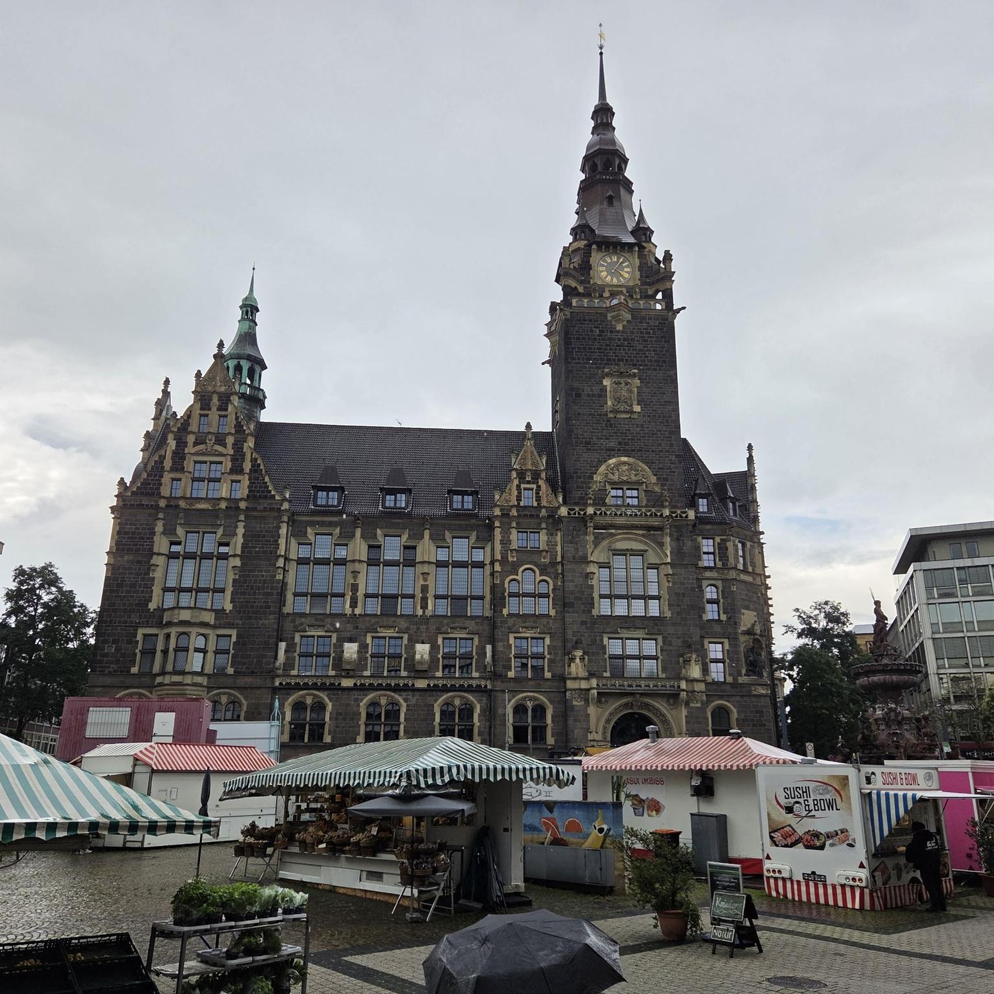
Ourense's Plaza Mayor is one of the most emblematic spaces in the historic center: It's a porticoed square with a slight incline, making it unique in Galicia. The slope is used to create a very photogenic perspective. Since the Middle Ages, it has been the city's administrative and social center. Markets, public events, and neighborhood meetings were held here. Notable buildings: City Hall: a 19th-century neoclassical building with an elegant façade and balconies. Palaces and noble houses: several properties with heraldic shields and typical Galician galleries.
2
0
They are located in the historic center of Ourense, on Rúa das Burgas / Praza das Burgas, next to the Barbaña River. They are perfectly integrated into the urban environment, near the Cathedral and the Roman Bridge. Explored since Roman times, these waters were the origin of the city (Aquis Auriensis), and the remains include a 1st-century AD pool-sanctuary and votive stones dedicated to an indigenous deity. The water flows at approximately 64–68°C, with a flow rate of about 300 liters per minute. Rich in minerals such as metasilicates, fluoride, lithium, bicarbonate, and sodium, they are recommended for pruritic skin conditions and rheumatism. Recent studies support their beneficial effect on acne after washing with thermal water.
2
0
Location: in the municipality of Pereiro de Aguiar (Ourense), on the Loña River, a tributary of the Miño. Uses: water supply, irrigation, hydroelectric power generation, fishing; it is not navigable or suitable for swimming. Circular walk: approximately 4 km (3.7 km to be exact), easy difficulty, ideal for families and dogs—although they must be kept on a leash—offering shade, rest areas, and beautiful views.
1
0
Location: in the municipality of Pereiro de Aguiar (Ourense), on the Loña River, a tributary of the Miño. Uses: water supply, irrigation, hydroelectric power generation, fishing; it is not navigable or suitable for swimming. Circular walk: approximately 4 km (3.7 km to be exact), easy difficulty, ideal for families and dogs—although they must be kept on a leash—offering shade, rest areas, and beautiful views.
1
0
It spans the Miño River, linking the historic center of Ourense with the A Ponte neighborhood. It was built in the 1st century AD as a branch of the Via Nova (Via XVIII), connecting Bracara Augusta (Braga) with Asturica Augusta (Astorga). Only traces of the original Roman phase remain, such as rusticated stonework at the ends near the banks. It suffered damage during the Middle Ages; in 1228, under Bishop Lorenzo and with the support of Ferdinand III, it was rebuilt with pointed arches and renovated approaches. Until the 17th century, the bridge repeatedly collapsed. The final work was directed by Melchor de Velasco Agüero around 1660, establishing its current appearance.
1
0
The Roman bridge in Ourense, known as Ponte Vella or Puente Mayor, over the Miño River, was built in the 1st century AD as part of a branch of the Via Nova (Eighteenth Century). According to tradition, it dates back to the time of Trajan, although its construction characteristics place it close to the time of Augustus. Of that first bridge, only a few cushioned ashlars from the bases remain, as silent witnesses of the past.
1
0

Frequently Asked Questions
How many no-traffic gravel bike trails are available around Coles?
There are 9 dedicated no-traffic gravel bike trails around Coles featured in this guide. These routes offer a variety of distances and elevations, perfect for exploring the region's natural beauty without vehicle interference.
What kind of terrain can I expect on the gravel bike trails near Coles?
The gravel bike trails around Coles, particularly those near Ourense, feature diverse terrain. You'll encounter a mix of unpaved roads, forest paths, and riverside trails. Expect some challenging climbs and descents, as many routes are rated as 'difficult' due to significant elevation changes, such as the Roman Bridge of Ourense – Cachamuíña Reservoir loop with over 2400 meters of elevation gain.
Are there any circular gravel bike routes around Coles?
Yes, many of the no-traffic gravel bike trails around Coles are designed as circular routes, allowing you to start and finish at the same point. For example, the Allariz Roman Bridge loop from Mármoles and the Cachamuíña Reservoir loop from Tanatorio are excellent options for a full-circle adventure.
What natural features or landmarks can I see along the gravel bike trails?
The trails around Coles offer access to several notable natural features and historical landmarks. You can explore the Outariz Hot Springs, the historic Ponte Vella (Roman Bridge of Ourense), and the serene Cachamuíña Reservoir. The As Burgas Hot Springs – A Boutureira Waterfall loop even takes you past a beautiful waterfall.
Are there any routes suitable for families or beginners?
While many routes in this guide are rated 'difficult' due to significant elevation, the 'no traffic' nature makes them safer for all riders. For families or beginners, it's recommended to carefully review the elevation profiles and distances. Shorter sections of routes or exploring the flatter areas around the Cachamuíña Reservoir might be more suitable, but be prepared for varied surfaces.
Can I find routes that include historical sites?
Absolutely. The region around Coles is rich in history. Several routes incorporate historical sites, such as the Roman Bridge of Ourense loop. You can also find highlights like the As Burgas Roman Baths and the Monastery of San Pedro de Rocas near some of the trails.
What is the longest no-traffic gravel bike trail in this guide?
The longest no-traffic gravel bike trail featured in this guide is the Roman Bridge of Ourense – Cachamuíña Reservoir loop from Rabaza de Abaixo, spanning nearly 120 kilometers with substantial elevation gain, offering a full day's adventure for experienced riders.
Are there any viewpoints or scenic spots along the trails?
Yes, the diverse landscape around Coles provides numerous scenic opportunities. The Pedra Longa Viewpoint offers panoramic vistas, and many trails along the Miño River or around the reservoirs provide beautiful natural scenery. The challenging elevations often reward riders with stunning views of the Galician countryside.
What is the average difficulty of these gravel bike trails?
All the no-traffic gravel bike trails listed in this guide are rated as 'difficult'. This is primarily due to the significant elevation changes and longer distances involved. Riders should be prepared for sustained climbs and descents on varied gravel surfaces.
Are there any routes that pass by hot springs?
Yes, the region is famous for its thermal waters. The As Burgas Hot Springs – A Boutureira Waterfall loop passes directly by the renowned As Burgas Hot Springs. Additionally, the Outariz Hot Springs and Outariz and Burga de Canedo Thermal Baths are easily accessible from several routes, offering a unique post-ride relaxation opportunity.
What is the shortest no-traffic gravel bike trail in this guide?
The shortest no-traffic gravel bike trail in this guide is the Gravel loop from Barrocás, which covers approximately 38 kilometers. While shorter, it still presents a 'difficult' rating due to its elevation profile, making it a challenging ride for its length.
Most popular attractions around Coles

Get inspired with the komoot mobile app


Explore more
Browse the best Gravel rides in other regions.
