The best city hikes and walks in Nettetal
4.5
(27028)
105,116
hikers
54
hikes
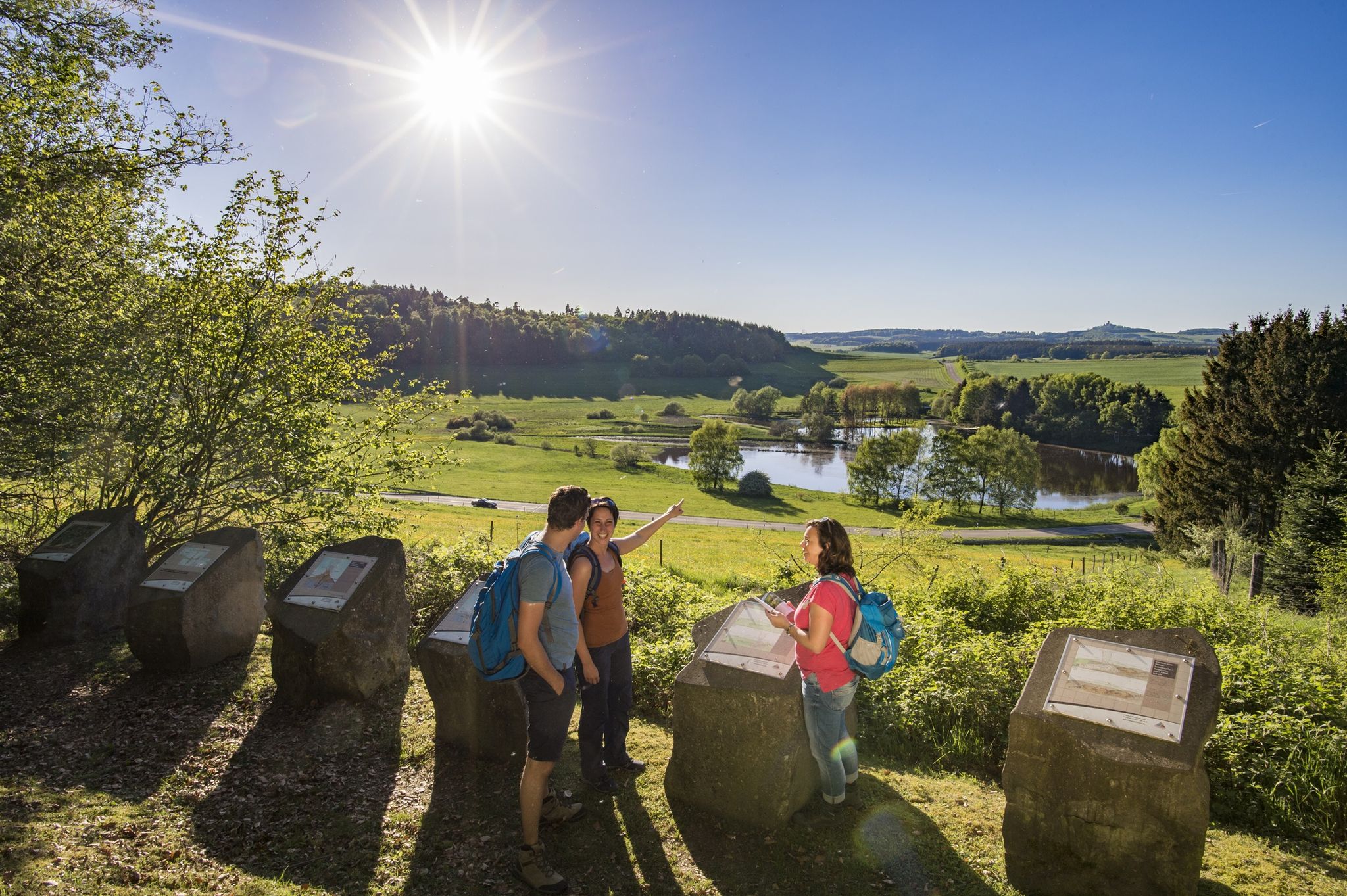
Urban hiking trails in Nettetal are characterized by a diverse landscape within the Maas-Schwalm-Nette Nature Park, featuring numerous lakes, extensive forests, and meandering rivers. The region's terrain includes areas shaped by historical damming and peat extraction, contributing to its unique natural environment. Hikers can explore paths through woodlands, alongside water bodies like the Nette-Seen, and discover areas with varied elevations.
Best urban hiking trails in Nettetal
- The most popular urban hiking route is Hiking loop from Polch, a 2.4 miles (3.9 km) trail that takes 1 hour to complete, offering easy access to the local surroundings.
- Another top favourite among local hikers is Nette Bridge loop from Landkreis Mayen-Koblenz, an easy 1.4 miles (2.3 km) path. This route provides views of the River Nette and its forested banks.
- Local hikers also love the Chapel on Wingertsberg – View of Kruft loop from Kruft, a 3.3 miles (5.4 km) trail leading through varied local scenery, often completed in about 1 hour 25 minutes.
- Hiking in Nettetal is defined by its abundant lakes, extensive forest areas, and the meandering River Nette. The network offers options for both easy and moderate ability levels, catering to a wide range of hikers.
- The routes in Nettetal are highly rated by the komoot community with an average score of 4.5 stars from over 3800 reviews. More than 16000 hikers have used komoot to explore Nettetal's varied terrain.
Last updated: July 9, 2026
5
hikers
3.90km
01:01
30m
30m
Easy hike. Great for any fitness level. Easily-accessible paths. Suitable for all skill levels.
12
hikers
Easy hike. Great for any fitness level. Easily-accessible paths. Suitable for all skill levels.

Sign up for free
1
hikers
5.36km
01:25
50m
50m
Easy hike. Great for any fitness level. Easily-accessible paths. Suitable for all skill levels.
3.8
(5)
24
hikers
6.63km
01:44
50m
50m
Easy hike. Great for any fitness level. Easily-accessible paths. Suitable for all skill levels.
4.2
(5)
19
hikers
4.21km
01:07
40m
50m
Easy hike. Great for any fitness level. Easily-accessible paths. Suitable for all skill levels.
Get access to more routes and recommendations from other explorers.
Sign up for free
Already have an account?
Our route recommendations are based on thousands of hikes, rides, and runs completed by other people on komoot.
Start today with a free account
Your next adventure awaits.
Login or Signup
Popular around Nettetal

Tips from the Community

These basalt figures were placed in the Feilsgraben in Mayen. Of course, the "monster", the hare, against which the 7 "fought" is also visible.
0
0

Here Komoot has marked a normal path, which however goes directly through the Nette via a ford.
0
0

The current „Alte Rathaus“ (Old Town Hall) was built in 1717 in the baroque architectural style on the northeastern edge of the market square using regional building materials (the typical basalt lava stone) and features a hipped mansard roof construction as well as a square clock tower with an octagonal superstructure made of regional slate with a sound opening. In 1945, many buildings in Mayen's city center were destroyed during bombings. However, the Alte Rathaus suffered only minor damage, allowing it to continue to be used as an administrative seat and thus as a building for council banquets and meetings, as well as for dance and festive events. With the construction of a new administrative seat, the town hall later also moved to the Mayener Rosenstraße area. Today, the Alte Rathaus serves as a „Haus des Gastes“ (House of the Guest), where the municipal tourist information is located on the lower floor. However, festive events or receptions are still frequently held in the former meeting room of the Alte Rathaus. Source: Anne Gasper, Universität Koblenz-Landau, 2015
2
0
Undoubtedly, one of the most imposing parts of the former city fortifications of Mayen is the Mühlenturm (Mill Tower). It and its counterpart, the Vogelsturm (Bird Tower), are the only two largely intact round towers of the old 14th-century fortification. On the stretch between the Wittbender Tor (Wittbend Gate) and the Brückentor (Bridge Gate), in addition to the round Mühlenturm, other tower structures – including two half-towers and a so-called Erkerturm (oriel tower) – secured the wall and the city's forefield. Above the inflow of the Barwinkel stream, there was also a projecting defensive structure; the stream powered a mill inside the city, which likely gave its name to the Mühlenturm located just a few meters away. The four-story Mühlenturm also had to secure the terrain on the opposite bank of the Nette. Its upper floor shows walled-up embrasures and loopholes, which once formed an open crenellated crown before the conical roof. Unlike the other gates and towers, it has never lost this roof. In 1906, our tower was last renovated under the city master builder Eugen de Witt. Source: https://www.blick-aktuell.de/Mayen/Der-Muehlenturm-79159.htm
4
0
The northern gate of the city fortifications, which still exists today, is the gatehouse located on the Nette river, built between 1299 and 1354. It secured the crossing of the Nette and primarily served as the city entrance from the direction of Koblenz, which is why it also bears the name "Koblenzer Tor" (Koblenz Gate). Since there are no signs of a slot in the wall for a portcullis, it is assumed that a drawbridge to the bridge pier on the Nette was used to secure the gate. Due to the flood in 1598, the gatehouse collapsed along with the outer gate. However, the chiseled number 1599 testifies that the gatehouse was rebuilt just one year later. From the beginning of the 19th century until 1855, the gatehouse was used as a prison. The city coat of arms, added in 1911, is still visible today. Source: Jonas Breithaupt, University of Koblenz-Landau, 2015
4
0

The Brückentor (Bridge Gate) is one of Mayen's few remaining medieval city gates and once served as the most important entrance for travelers coming from Koblenz. Today, this historic building houses the Mayen Carnival Museum, which brings the city's long tradition of "Faasenaacht" (Carnival Night) to life.
1
0

A very beautiful market square with beautiful buildings (town hall, church, and castle). Plenty of cafés and restaurants, bakeries, etc., offer opportunities for a rest and refreshment.
11
0

Every three years, a symposium with international artists takes place. Stone sculptures made from basalt, the stone quarried in the Mayen mining area, are created there. The unsold pieces can be viewed here.
2
0
Frequently Asked Questions
How many urban hiking trails are available in Nettetal?
Nettetal offers a diverse selection of over 50 urban hiking trails, catering to various preferences and fitness levels. These routes allow you to explore the unique blend of natural and semi-natural features within the town's vicinity.
What kind of landscapes can I expect on urban hikes in Nettetal?
Urban hikes in Nettetal often lead you through a picturesque mix of landscapes. You'll encounter the region's characteristic lakes, such as the Krickenbeck Lakes and De Wittsee, as well as extensive forest areas like the Grenzwald. Some routes may also feature moor and heath areas, and the meandering River Nette is a frequent companion.
Are there easy urban hikes suitable for beginners or casual walkers in Nettetal?
Yes, Nettetal is very welcoming for beginners and casual walkers. The majority of urban trails, specifically 47 out of 53, are rated as easy. These routes typically feature gentle terrain and shorter distances, perfect for a relaxed stroll. An example is the Hiking loop from Polch, which offers a pleasant and accessible experience.
What are some interesting landmarks or natural features to see along urban trails in Nettetal?
Urban hikes in Nettetal can lead you past several intriguing sights. You might discover historical structures like Hausen-1 Tunnel or the impressive Nette Viaduct and Tunnel. Nature lovers can seek out the Nette Waterfall or explore unique geological formations like the Nettetal Rock Trail and the Barbaraweg with Former Slate Mines.
Are there any urban hiking routes that are circular?
Many of Nettetal's urban hiking routes are designed as circular paths, offering convenient starting and ending points. For instance, the Nette Bridge loop from Landkreis Mayen-Koblenz is a great option for a self-contained walk, allowing you to return to your starting location without retracing your steps.
What do other hikers say about the urban trails in Nettetal?
The urban trails in Nettetal are highly regarded by the komoot community, boasting an average rating of 4.5 out of 5 stars from over 3,800 reviews. Hikers frequently praise the region's diverse scenery, well-maintained paths, and the peaceful atmosphere found even within the urban-adjacent areas.
Are there any urban hikes that feature historical sites or cultural points of interest?
Yes, several urban hikes in Nettetal incorporate historical and cultural elements. You might find routes that pass by old mills like Leuthermühle or Nelsenmühle, or even ancient sites such as the Old Vineyard Trimbser Obermark. The Chapel on Wingertsberg – View of Kruft loop from Kruft is another example that combines natural beauty with a notable landmark.
Can I find urban trails that are suitable for families with children?
Absolutely. Given that most urban trails in Nettetal are rated as easy, they are generally very suitable for families. The gentle terrain and shorter distances make them ideal for walks with children. Consider routes that explore the lake areas or local parks for an enjoyable family outing.
Are there any urban hikes that offer views or elevated perspectives?
While Nettetal's terrain is generally gentle, some urban hikes do offer pleasant views. The Chapel on Wingertsberg – View of Kruft loop from Kruft, for example, provides scenic vistas. The Maas Escarpment, though not always directly urban, also features picturesque wet biotopes and elevated sections that can be accessed from nearby trails.
What is the best time of year to go urban hiking in Nettetal?
Nettetal's urban trails can be enjoyed year-round. Spring brings blooming flora around the lakes and forests, while summer offers lush greenery. Autumn transforms the woodlands with vibrant colors, and even in winter, the serene landscapes around the frozen lakes can be quite beautiful. The relatively easy nature of most trails makes them accessible in various conditions.
Are there any urban routes that pass by water features other than lakes?
Yes, beyond the numerous lakes, many urban routes in Nettetal follow the course of the River Nette, which meanders through forested areas. You might also encounter sections of the historic North Canal. The Vogelsturm, Mayen – St. Veit Park and Church loop from Mayen Ost, for instance, offers a varied urban experience that may include local water features.
Most popular routes in Nettetal
Most popular attractions in Nettetal

Get inspired with the komoot mobile app


