The best family-friendly hikes and walks in Hardt
4.5
(36975)
137,675
hikers
25
hikes
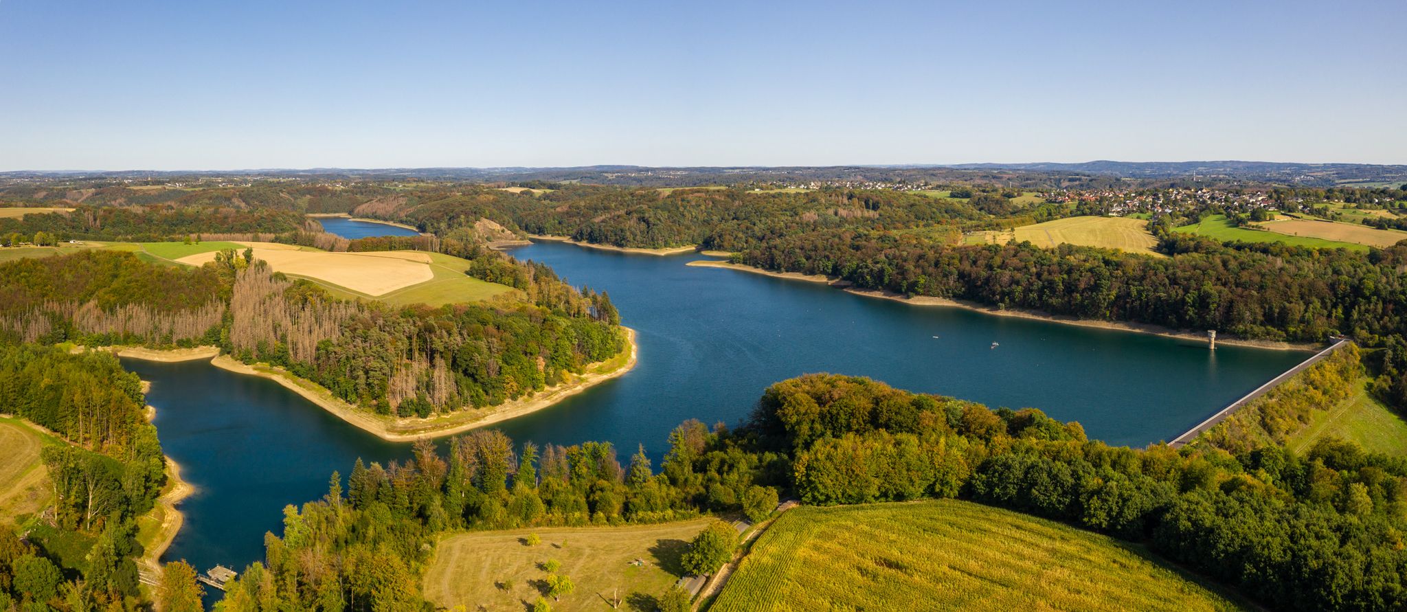
Family friendly hiking trails in Hardt traverse a landscape characterized by gentle hills, woodlands, and small water features. The region offers accessible routes suitable for various ages and abilities, focusing on natural scenery. These trails often follow streams and lead to viewpoints, providing opportunities for outdoor activity in a natural setting.
Best family friendly hiking trails in Hardt
- The most popular family friendly hiking route is St. Rochus Chapel, Sand – Gut Lerbach Milk Station loop from Hardt, a…
Last updated: August 5, 2026
4.7
(211)
614
hikers
5.79km
01:38
130m
130m
Easy hike. Great for any fitness level. Easily-accessible paths. Suitable for all skill levels.
4.9
(81)
281
hikers
4.97km
01:20
60m
60m
Easy hike. Great for any fitness level. Easily-accessible paths. Suitable for all skill levels.

Sign up for free
4.3
(56)
171
hikers
Easy hike. Great for any fitness level. Easily-accessible paths. Suitable for all skill levels.
4.6
(28)
130
hikers
4.16km
01:12
110m
110m
Easy hike. Great for any fitness level. Easily-accessible paths. Suitable for all skill levels.
4.6
(17)
61
hikers
4.76km
01:22
120m
120m
Easy hike. Great for any fitness level. Easily-accessible paths. Suitable for all skill levels.
Get access to more routes and recommendations from other explorers.
Sign up for free
Already have an account?
Our route recommendations are based on thousands of hikes, rides, and runs completed by other people on komoot.
Start today with a free account
Your next adventure awaits.
Login or Signup
Popular around Hardt
Other adventures in Hardt

Tips from the Community

On hot, sunny days, this hollow path, carved into the soft loess soil by the growth of trees on both sides, is a very welcome, shady respite from the open fields. Following the ascent, the hiker reaches the beautiful, half-timbered St. Rochus Chapel.
10
0
"But perhaps the time is not yet ripe for it (...) lest one day they bring disaster upon one another and their peoples. And if they should do so nevertheless, may the good Lord in his counsel decree that at least afterwards, when the disaster has already befallen them all, they will find their way back to one another and make peace in this world once and for all." Thus writes Otfried Preußler (born 1923 in Reichenberg, Bohemia), best known as a children's book author, in his work "The Flight to Egypt. Royal Bohemian Part." While his lines are about the German and Czech inhabitants of the Kingdom of Bohemia in the context of the story, his statement is actually universally and timelessly valid.
9
0
"The hiker is immersed in the history of the old castle [Bensberg Castle] during the Franco-Prussian Wars when visiting the French and Prussian-Austrian military cemeteries in the neighboring Hardt Forest," reads the description of this section of the Bergisches Land Trail No. 13, which covers 10 kilometers and also includes the two military cemeteries (though the graves themselves are no longer preserved). For the complete route description, see =>> https://www.bergisches-wanderland.de/bergische-streifzuege/alle-streifzuege/13-bensberger-schlossweg-bergisch-gladbach-101-km
9
0

Caution! The cave is currently closed due to rockfall.
4
0

<< Blücher Mine in the Hardt Nature Reserve >> "... Historical Development Industrial mining began here when the Blücher mining area was claimed on July 28, 1847. Advances in the zinc industry at that time led to a veritable zinc rush in the Bensberg ore district, in which Belgian businessmen played a significant role. The Blücher Mine was officially awarded to Charles Détilleux, a Belgian entrepreneur living in Paris, on June 28, 1850. At the same time, he was awarded the Napoleon Mine in the western part of the deposit. The mines, named after the Waterloo opponents, were managed jointly from the outset. They received permission to establish an associated ore processing plant in March 1855. All rights and facilities were transferred in 1857 to the Rheinischer Bergwerks-Aktienverein Saturn, which was founded in Cologne in the same year by predominantly Belgian shareholders. In the first years of operation, zinc ore was predominantly extracted from the older, pre-industrial dumps. The previously worthless zinc ore had simply been dumped by the "old men." For example, in 1854, approximately 3,800 quintals of zinc ore concentrate were extracted compared to only 13 quintals of lead ore concentrate. In the following years, this ratio normalized until it reached approximately 1 to 7 in 1862, thus adjusting to the geological conditions of the deposit. The underground mining operations also initially achieved good results, particularly at the 40- and 70-meter levels. In 1861, the machine shaft was modernized with a new steam boiler. The processing plant was expanded to include new crushing and rolling mills, as well as setting machines, and relocated upslope. Neighboring mining areas were acquired to enable permanent operation. In November 1862, the Katzbach and Wahlstatt mines were integrated. For a short time, the Blücher mine became one of the most profitable mines in the region, especially for the Saturn company. The number of employees rose to almost 280. Zinc production, in particular, was of great importance and was surpassed at the time only by the Lüderich mine. In 1869, other neighboring companies were incorporated, including Galvani, Madonna, and Norma. The "Consolidated Blücher Mine" now comprised 13 mining areas, extending across almost the entire Hardt forest area. THE FOLLOWING HISTORY AND FURTHER INFORMATION: https://www.kuladig.de/Objektansicht/KLD-267703
0
0
<< The Cox Mine >> Habitat for rare animals and plants "In the heart of Bergisch Gladbach, in the southwest of the Lerbach Forest, lies the former dolomite mine "Cox," a valuable piece of nature worthy of protection. Dolomite mining at the Cox Mine has left its mark. The original forest area at this location became a mine in 1969, and the forest dwellers fled to other parts of the Lerbach Forest. This begs the question: What is worth protecting about a quarry that destroyed intact forest areas? It neither arose naturally nor was it deliberately created as a habitat after the dolomite was extracted for the production of high-quality mirror glass. Originally, the pit was to be filled in and recultivated as a forest after mining was completed. This would have brought things full circle. Welcome to the "Cox Mine" In front of you is the "Cox Mine" nature reserve. Similar to the Wahner Heide, Königsforst, or Gierather Wald nature reserves, the Cox Mine is also open for walks and nature observation. You are cordially invited to explore the beauty of the mine site. Our visitor guidance system explains the special features of the area along the designated circular trail (aerial map). This circular trail is marked by oak fence posts with red-painted heads. Along the trail, you will find further information panels and a viewing point on the edge of the mine. To the east of the nature reserve, there are other worthwhile hiking destinations in the Lerbacher Forest and its surroundings. The History of the Cox Mine The Cox Mine is a product of modern times. In 1969, a dolomite deposit of exceptional purity was discovered at this location in the Lerbacher Forest. The dolomite found, which was particularly low in iron, was open-cast mined until around 1985 and used in glassworks in Cologne-Porz to produce high-quality mirror glass. The resulting pit was supposed to be completely filled in after mining was completed. However, rare animal and plant species, normally found only in river floodplains, quickly settled in the resulting habitat niche. For this reason, the Cox Pit was designated a nature reserve by the Cologne District Government in 1996. https://www.rbk-direkt.de/naturschutzgebiet-grube-cox.aspx
0
0

Lots of narrow, winding footpaths where no car has ever driven. This is the kind of thing I go to *nature* for. Hurry, the nature conservation authorities haven't closed them yet.
2
1
From the bench by the Lerbach stream, you can look out into an idyllic wetland. Supposedly, "special species" live there. But when asked, the authorities declined to reveal which ones exactly. Is this even true? The neighboring sand piles, embankments, and embankments are very popular with children for playing. This is permitted because the mine site—unlike the surrounding Hardt Nature Reserve—is exempt from nature conservation. https://nsg.naturschutzinformationen.nrw.de/nsg/de/fachinfo/gebiete/gesamt/GL-066
6
0
Frequently Asked Questions
How many family-friendly hiking trails are available in Hardt?
You'll find over 25 family-friendly hiking trails in Hardt, all rated as easy. This guide features 26 routes specifically curated for families, ensuring a pleasant outdoor experience for all ages.
What kind of natural features can we expect to see on family hikes in Hardt?
Hardt's family-friendly trails often lead through diverse natural settings. You can explore areas with beautiful lakes like the Cadets' Pond in the Milchborn Valley and Maiden's Pond. Many routes also follow the scenic Milchbornbach Stream, offering tranquil waterside walks.
Are there any historical sites or landmarks to discover along the trails?
Yes, some trails in Hardt offer glimpses into the region's past. For instance, you might encounter the Historic Washing Place Kaltenbroich, a notable historical site, or unique natural monuments like the Remarkable Root Trees.
Are the family-friendly trails in Hardt suitable for young children or strollers?
All 26 family-friendly routes in Hardt are classified as easy, making them generally suitable for young children. While many paths are well-maintained, specific stroller accessibility can vary. Trails like the Grube Cox Lakes – View of Grube Cox Pond loop offer relatively flat terrain, ideal for a relaxed family outing.
What do other hikers enjoy most about the family-friendly trails in Hardt?
The komoot community highly rates the trails in Hardt, with an average score of 4.5 stars. Reviewers often praise the well-maintained paths, the peaceful natural surroundings, and the accessibility for families. Many appreciate the variety of easy loops that allow for enjoyable walks without significant elevation changes.
Are there any circular routes recommended for families?
Absolutely! Many of the family-friendly trails in Hardt are circular, perfect for a convenient day out. The St. Rochus Chapel, Sand – Gut Lerbach Milk Station loop is a great example, offering a pleasant round trip through the local scenery.
Can we find good viewpoints or scenic spots on these family hikes?
Yes, several trails offer lovely views. The View of Cologne – Nature Friends House Hardt loop, for instance, provides scenic vistas, including distant views of Cologne, making for memorable family photos.
Are dogs allowed on the family-friendly hiking trails in Hardt?
Generally, dogs are welcome on hiking trails in Hardt, especially on the more natural paths. It's always recommended to keep your dog on a leash, especially in nature protection areas or when encountering other hikers and wildlife. Please ensure you clean up after your pet.
What is the typical duration and distance of these family-friendly hikes?
The family-friendly hikes in Hardt typically range from 4 to 6 kilometers in distance and can be completed in about 1.5 to 2 hours, depending on your pace and stops. For example, the Milchbornbach Stream – Grube Cox Lakes loop is around 5 kilometers long, offering a comfortable duration for families.
Are there places to rest or have a picnic along the family trails?
Many trails in Hardt pass by natural spots ideal for a break. You might find benches or open areas perfect for a picnic. The Shelter at the Milchborntal Pond is a specific highlight that offers a designated spot for rest and shelter.
Most popular routes in Hardt
Most popular attractions in Hardt

Get inspired with the komoot mobile app


Explore more
Browse the best Hikes in other regions.
