The best family-friendly hikes and walks in Myldingi Naturreservat
4.7
(226)
915
hikers
14
hikes
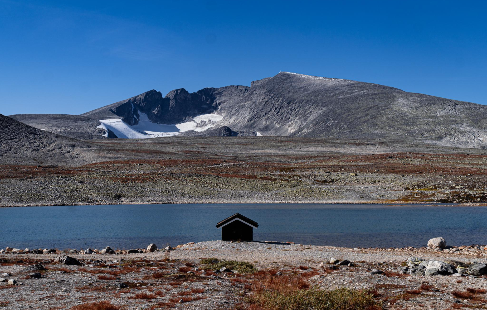
Family friendly hiking trails in Myldingi Naturreservat traverse diverse landscapes shaped by Quaternary geological formations. The reserve features varied terrain with elevations ranging from 700 to 1,300 meters, offering expansive views. An extensive network of well-maintained trails caters to different fitness levels, including paths through open areas and varied natural settings.
Best family friendly hiking trails in Myldingi Naturreservat
- The most popular family friendly hiking route is Gammelsætra Cabins loop from Bjørnhollia, a 8.9 miles (14.3 km) trail that…
Last updated: July 8, 2026
4.7
(53)
209
hikers
14.3km
04:06
310m
310m
Moderate hike. Good fitness required. Mostly accessible paths. Sure-footedness required.
4
hikers
10.7km
03:23
420m
420m
Moderate hike. Good fitness required. Easily-accessible paths. Suitable for all skill levels.

Sign up for free
5
hikers
16.9km
06:02
380m
380m
Hard hike. Very good fitness required. Mostly accessible paths. Sure-footedness required.
4.6
(51)
202
hikers
13.9km
03:56
300m
300m
Moderate hike. Good fitness required. Easily-accessible paths. Suitable for all skill levels.
4.5
(43)
169
hikers
Moderate hike. Good fitness required. Easily-accessible paths. Suitable for all skill levels.
Get access to more routes and recommendations from other explorers.
Sign up for free
Already have an account?
Our route recommendations are based on thousands of hikes, rides, and runs completed by other people on komoot.
Start today with a free account
Your next adventure awaits.
Login or Signup
Popular around Myldingi Naturreservat
Other adventures in Myldingi Naturreservat

Tips from the Community

Illmanndalen is a stunning mountain valley that runs along the south of the main Rondane massif. It can be used to link the popular DNT cabins at Bjørnhollia and Rondvassbu. The trail shadows the northern banks of the beautiful Illmannåe.
0
0

The suspension bridge at the starting point is currently being renovated and therefore crossing it is not possible.
1
0

All too often words like "epic" and "awesome" are used to describe a place. About midway between Rondvassbu and Bjørnhollia, along the Illmanndalen valley you will find a series of alpine tarns where the scenery is on another level that leaves you lost for words. A place to pause and just take it all in. Note that the lakes may freeze over well into summer and are generally not considered suitable for swimming.
2
0
Spoilt for choice? The signpost near Bjørnhollia certainly highlights the fact there are plenty of worthwhile destinations and adventures to experience from this excellent base.
0
0

This trail, surrounded by nature, connects Bjørnhollia to Musvoldsætra.
0
0

Great hikes start on the bridge over the river
0
0
Grey santolina can be found everywhere here
0
0
Great path through the Heiligenkraut
1
0
Frequently Asked Questions
How many family-friendly hiking trails are there in Myldingi Naturreservat?
Myldingi Naturreservat offers a wide selection of routes suitable for families, with over 14 hiking trails. Among these, you'll find 3 easy routes perfect for a relaxed family outing, and 8 moderate trails for those looking for a bit more adventure.
What is the best time of year for family hikes in Myldingi Naturreservat?
The diverse landscapes and varied terrain of Myldingi Naturreservat make it enjoyable throughout the warmer months. Summer is particularly popular for family walks, offering pleasant weather and full access to the extensive trail network. However, spring and early autumn also provide beautiful scenery and comfortable hiking conditions.
Are there any circular family walks in Myldingi Naturreservat?
Yes, Myldingi Naturreservat features several excellent circular routes that are ideal for families. One popular option is the Myldingi Nature Reserve loop from Gammelgarden, which leads through diverse natural landscapes. Another great choice is the Gammelsætra Cabins loop from Bjørnhollia, offering varied terrain and views of historic cabins.
What kind of natural features can we expect to see on family hikes in Myldingi Naturreservat?
Myldingi Naturreservat is characterized by its unique Quaternary geological formations and varied elevations, ranging from 700 to 1,300 meters. This means families can enjoy diverse natural landscapes, expansive views, and paths winding through different types of terrain. You might also encounter historic cabins along certain routes, adding a cultural element to your exploration.
What do other hikers enjoy most about hiking in Myldingi Naturreservat?
The area is highly rated by the komoot community, with an average score of 4.7 stars from over 220 ratings. Reviewers often praise the well-maintained trail network, the diverse and scenic vistas, and the opportunities for hikers of all abilities, making it a fantastic destination for family adventures.
Are there any easy trails suitable for families with young children or toddlers?
Yes, Myldingi Naturreservat has 3 easy routes that are well-suited for families with young children or toddlers, providing a gentle introduction to hiking. These trails offer a chance to enjoy nature without overly challenging terrain, ensuring a pleasant experience for everyone.
Is parking available near the family-friendly trailheads?
While specific parking details vary by trailhead, Myldingi Naturreservat is generally accessible by car, and parking facilities are typically available near popular starting points for trails. It's always a good idea to check the specific route details on komoot for the most accurate information on parking options for your chosen hike.
Can we bring our dog on family hikes in Myldingi Naturreservat?
Many trails in Myldingi Naturreservat are dog-friendly, allowing your furry family members to join the adventure. However, it's important to keep dogs on a leash, especially in nature reserve areas, to protect wildlife and ensure a pleasant experience for all visitors. Always check local regulations for specific routes.
What are some moderate family-friendly trails for a slightly longer adventure?
For families seeking a bit more challenge, Myldingi Naturreservat offers 8 moderate trails. The Gammelsætra Cabins loop from Atnsjømyrene naturreservat is a great option, providing a rewarding experience through scenic landscapes. Another excellent choice is the Start of Strømburunden Trail – Sæterhaugen loop from Atnsjømyrene naturreservat, which offers varied terrain and beautiful views.
Are there opportunities to see wildlife on the family trails?
Myldingi Naturreservat is a natural haven, and while wildlife sightings are never guaranteed, the diverse natural landscapes provide habitats for various species. Keeping an eye out quietly and respectfully can offer opportunities to spot local wildlife, adding an exciting element to your family hike.
What should we pack for a family hike in Myldingi Naturreservat?
Given the varied elevations and terrain, it's wise to pack layers of clothing suitable for changing weather conditions. Essential items include comfortable hiking shoes, water, snacks, sun protection, and a basic first-aid kit. For longer hikes, consider bringing a map or using the komoot app for navigation, and remember to pack out everything you pack in.
Most popular routes in Myldingi Naturreservat

Get inspired with the komoot mobile app


Explore more
Browse the best Hikes in other regions.
