The best hikes from bus stations around Briercliffe
4.6
(1496)
12,452
hikers
9
hikes
Bus station hiking trails around Briercliffe offer access to a diverse landscape characterized by elevated peaks, picturesque waterways, and expansive open moorland. The region features distinctive millstone grit outcrops and scenic vistas over the Thursden Valley. Numerous reservoirs, such as Hurstwood Reservoir, are integrated into the trail network, providing pleasant lakeside paths. This area provides a variety of trails suitable for different abilities.
Best bus station hiking trails around Briercliffe
- The most popular bus station hiking route is Walverden Reservoir…
Last updated: June 23, 2026
4.5
(2)
3
hikers
18.3km
05:27
540m
540m
Hard hike. Very good fitness required. Easily-accessible paths. Suitable for all skill levels.
4
hikers
6.40km
01:49
140m
140m
Easy hike. Great for any fitness level. Easily-accessible paths. Suitable for all skill levels.

Sign up for free
5.0
(1)
4
hikers
3.38km
00:56
60m
60m
Easy hike. Great for any fitness level. Easily-accessible paths. Suitable for all skill levels.
3
hikers
4.96km
01:25
120m
120m
Easy hike. Great for any fitness level. Easily-accessible paths. Suitable for all skill levels.
2
hikers
Hard hike. Very good fitness required. Easily-accessible paths. Suitable for all skill levels.
Get access to more routes and recommendations from other explorers.
Sign up for free
Already have an account?
Our route recommendations are based on thousands of hikes, rides, and runs completed by other people on komoot.
Start today with a free account
Your next adventure awaits.
Login or Signup
Popular around Briercliffe
Other adventures around Briercliffe

Tips from the Community

stunning 360 views from the top of the rocks
0
0
Sunning views from the tops of the rocks overlooking Upper Gorple reservoir
0
0

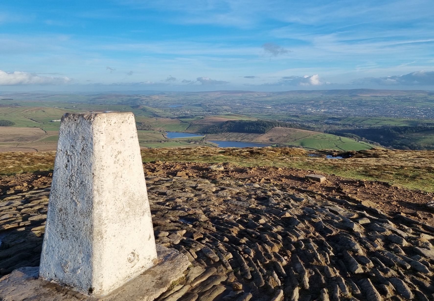
TP3090 - Extwistle Hill S4670 FB Height 241.968m #979 County of Lancashire Trig Pillar List. South Pennines Trig Pillar List.
0
0

Extwistle Hall Burlney | A WORLD IN RUINS | Urbex Photography https://share.google/Kdak1FCYfuBusVPOW
0
0
T:UK - Extwistle Hill https://share.google/Lk9q1TssHicNThV0R
0
0

The climb can be hard work up to Lad Law but there are good view to be had on a clear day.
0
0
Boulsworth Hill is the highest point in the South Pennines and the only summit in the area that rises above 500m above sea level. It is also one of only two Marilyns in the South Pennines.
0
0

Extwistle Hall is a Grade II listed manor located high on the moors of Briercliffe. Originally part of land owned by Kirkstall Abbey, it was sold to Robert Parker, whose family, prominent in the area, built the Tudor-style hall in 1585. The Parkers lived in the hall for nearly 200 years before relocating to Cuerden Hall in around 1718.
1
0
Frequently Asked Questions
How many bus station hiking trails are available around Briercliffe?
There are 10 dedicated hiking trails around Briercliffe that conveniently start directly from bus stations, making it easy to explore the region without a car.
Are there easy bus station hikes in Briercliffe suitable for beginners or families?
Yes, Briercliffe offers 6 easy bus station hikes perfect for beginners or families. These routes typically feature gentler terrain and shorter distances. An example is the Craven Heifer loop from Queen Street Mill, which is just over 3 km long.
What kind of landscapes can I expect on bus station hikes in Briercliffe?
The bus station hikes in Briercliffe traverse a diverse range of landscapes. You'll encounter elevated peaks, picturesque waterways, woodlands, and expansive open moorland. Many routes offer stunning panoramic views across the South Pennines and scenic vistas over the Thursden Valley, often featuring distinctive millstone grit outcrops.
Are there any circular bus station routes in Briercliffe?
Yes, many of the bus station hikes in Briercliffe are circular, allowing you to return to your starting point without retracing your steps. For instance, the Walverden Reservoir – Abbot Stone loop from Queen Street Mill is a challenging circular route, while the Extwistle Hill Trig Point – Extwistle Hall loop offers an easier circular option.
What are some notable natural features or attractions I might see on these trails?
Along the bus station trails, you can discover several natural features and attractions. Highlights include the tranquil Hurstwood Reservoir and Clowbridge Reservoir, offering pleasant lakeside paths. You might also encounter beautiful waterfalls like Lumb Falls or the iconic Brontë Bridge and Brontë Waterfall.
Are the bus station hiking trails in Briercliffe dog-friendly?
Many of the trails around Briercliffe are suitable for dogs, especially those that traverse open moorland and woodlands. However, always keep dogs under control, particularly near livestock or in nature conservation areas. Check specific route details on Komoot for any restrictions or recommendations.
What do other hikers enjoy most about hiking in Briercliffe?
The hiking trails around Briercliffe are highly rated by the Komoot community, with an average score of 4.6 stars from over 1,300 reviews. Hikers frequently praise the diverse landscapes, stunning panoramic views, and the variety of routes suitable for different abilities. The convenience of starting directly from bus stations is also a popular highlight.
Are there any longer or more challenging bus station hikes available?
Yes, for those seeking a greater challenge, Briercliffe offers 2 difficult and 2 moderate bus station hikes. The most challenging is the Walverden Reservoir – Abbot Stone loop from Queen Street Mill, which spans over 18 km and involves significant elevation gain, typically taking around 5.5 hours to complete.
Can I find routes that pass by reservoirs or other water bodies?
Absolutely. Several bus station routes in Briercliffe incorporate reservoirs into their paths. For example, the Walverden Reservoir – Pendle Bridleway loop from Queen Street Mill offers pleasant walks alongside water, as does the Haggate Drinking Fountain – Walverden Reservoir loop.
Are there any viewpoints or trig points accessible from bus stations?
Yes, you can reach several viewpoints and trig points directly from bus stations. The Extwistle Hill Trig Point – Extwistle Hall loop from Queen Street Mill is an easy route that takes you to a prominent local peak, offering expansive views across the region.
Most popular attractions around Briercliffe

Get inspired with the komoot mobile app


Explore more
Browse the best Hikes in other regions.
