The best family-friendly hikes and walks around Salir
4.5
(2033)
7,053
hikers
14
hikes
Family friendly hiking trails around Salir, located in Portugal's Algarve region, traverse diverse landscapes including rolling hills, extensive cork oak forests, and rocky outcrops. The area features notable natural landmarks such as Rocha da Pena, a prominent rocky structure reaching 479 meters, and Fonte Benémola Natural Park, characterized by typical Barrocal scenery and a year-round stream. These varied terrains provide a range of outdoor experiences suitable for different fitness levels.
Best family friendly hiking trails around Salir
- The most popular…
Last updated: October 8, 2026
4.5
(50)
121
hikers
4.46km
01:19
130m
130m
Easy hike. Great for any fitness level. Easily-accessible paths. Suitable for all skill levels.
4.4
(7)
13
hikers
7.55km
02:11
190m
200m
Moderate hike. Good fitness required. Easily-accessible paths. Suitable for all skill levels.

4.5
(4)
14
hikers
10.9km
02:56
140m
140m
Moderate hike. Good fitness required. Easily-accessible paths. Suitable for all skill levels.
9
hikers
13.3km
03:36
190m
190m
Moderate hike. Good fitness required. Easily-accessible paths. Suitable for all skill levels.
4.7
(3)
8
hikers
6.70km
02:03
200m
200m
Moderate hike. Good fitness required. Easily-accessible paths. Suitable for all skill levels.
Get access to more routes and recommendations from other explorers.
Already have an account?
Our route recommendations are based on thousands of hikes, rides, and runs completed by other people on komoot.
Other adventures around Salir

Tips from the Community

At the entrance to Salir, the road winds between ancient stone walls that still enclose vegetable gardens and small farms. Here and there, waterwheels and old water-powered mills appear, living memories of a time when the land was the heart of rural life. A serene, bucolic, and enchanting setting.
1
0
Here, the dirt trail passes the Faranhão mill, almost at the top of Eira de Agosto, over 500 meters above sea level. From here, the view stretches between the mountains and the sea. It's one of those places that calls for a pause and a moment to simply contemplate.
1
0
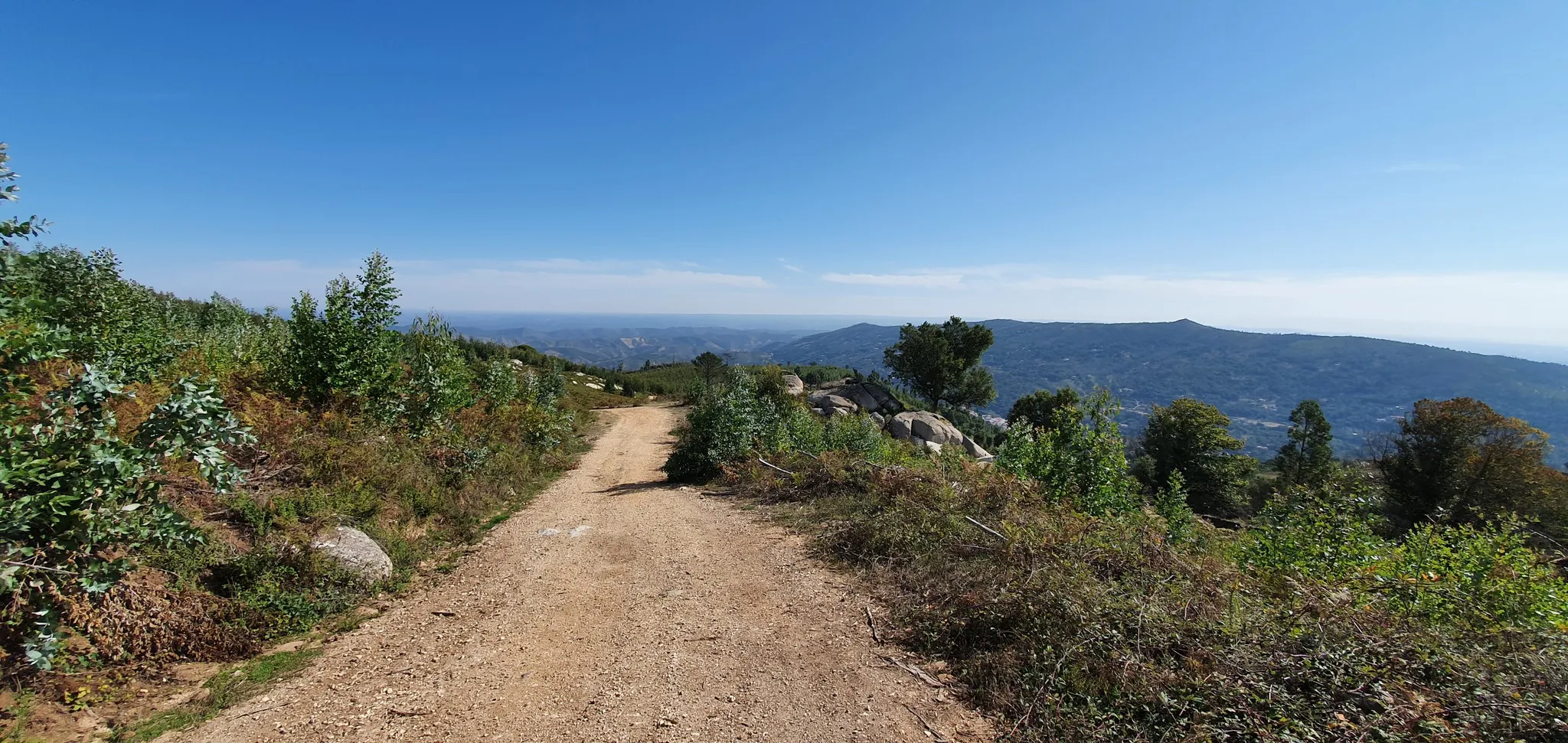
From here, you have a window overlooking the vastness of the Serra do Caldeirão. And on clear days (which are almost all around here), your view reaches all the way to the southern coast. A stunning landscape, ready to take your breath away.
1
0

The Igreja Matriz de Salir, also known as the Igreja de São Sebastião, is a religious monument in the village of Salir, in the municipality of Loulé, in the Algarve, Portugal. This church is situated on a hill overlooking the village of Salir. Inside, the decorative elements are striking, in Baroque style, with gilded carvings on the side altars and the main altar. The altar of the souls in purgatory is particularly interesting, as it was one of the few remaining elements of the original church, along with the exterior buttresses. Also noteworthy is the wooden statue of the patron saint, made in the 17th century.
0
0
To the south is S. Brás de Alportel, and towards the southwest Loulé; to the west, which leads to Salir, Alte and S.Bartolomeu de Messines; towards the north the old EN2 continues, via Ameixial to Almodôvar; towards the northeast, where Cachopo and Martinlongo are located; and already signposted for Nascente Alcoutim. It is a very wooded area, where you can find excellent walking trails and beautiful views. Tia Bia organises romantic picnics. Surprise your partner with a walk followed by a surprise picnic. They have different menus available! The restaurant is closed for dinner on Sundays and Mondays. Opening hours Tuesday to Saturday from 12:00 to 15:00 and from 19:00 to 21:00
1
0
Tia Bia is a restaurant and local accommodation located in Barranco do Velho, at the foot of Serra do Caldeirão, an area of rare scenic beauty, with ancient fountains and 5 km from the international motocross circuit of Cortelha. Area with many wild boars and other species. A pleasant refuge in the mountains, 30 km from the beaches of Vilamoura and Quarteira, the island of Faro and Albufeira. 30 km from Faro International Airport. 50 km from the border of Vila Real de Santo António/Ayamonte. Barranco do Velho is a formidable crossroads in the middle of the Serra do Caldeirão.
1
0
Barranco do Velho is a mountain village in the south of the Serra do Caldeirão in the Portuguese Algarve in the municipality of Loulé. The village was merged with the freguesia Salir in the administrative reorganization of 2013. The village is located on the N2, which used to be the main road from Faro to Lisbon. The landscape is dominated by cork oaks, holm oaks and strawberry trees. For many Portuguese it is a popular hunting ground. The main activity of the people in the region is cork extraction. There is a nature trail in the village with the theme of biodiversity. There are also several hiking trails through the village, for example the 300-kilometre long-distance hiking trail (GR trail) Via Algarviana (GR13). The church on a hill above the village is relatively new. It was built in 1944, financed by two brothers from Germany who both owned a house there.
2
0

Simple hike but superb scenery
0
1
Frequently Asked Questions
How many family-friendly hiking trails are available around Salir?
There are over 15 family-friendly hiking trails around Salir, ranging from easy strolls to moderate adventures. This selection ensures there's something for every family to enjoy, with manageable distances and gentle paths.
What makes the hiking trails around Salir suitable for families?
The trails around Salir are ideal for families due to their varied landscapes, including rolling hills, cork oak forests, and picturesque villages. Many routes feature gentle ascents and well-maintained paths, making them accessible for children. You'll find options that are both easy and moderately challenging, ensuring a good fit for different energy levels.
Are there any circular routes suitable for families in Salir?
Yes, several family-friendly circular routes are available. A great option is the Barranco do Velho — circular route (PR17), which offers a pleasant loop through rural landscapes. Another popular choice is the View of Rocha da Pena Cliffs – View of Rocha da Pena loop, providing stunning views.
What natural landmarks or points of interest can we see on family hikes?
Families can discover a variety of natural landmarks. The prominent Rocha da Pena offers magnificent views and is vibrant with wildflowers in spring. You can explore the Crest Trail of Rocha da Pena or enjoy the Trig Point and Panoramic View at Rocha da Pena. The Fonte Benémola Natural Park, with its year-round stream, is home to diverse plant and animal life, including otters. Don't miss the Source of the Benémola Stream or the Fonte Benémola Local Protected Landscape.
What is the best time of year for family hiking in Salir?
The best time for family hiking in Salir is typically spring (March to May) and autumn (September to November). During these seasons, the weather is mild and pleasant, and the landscapes are particularly beautiful, with wildflowers blooming in spring. Summer can be hot, so early mornings or late afternoons are recommended if hiking during July and August.
Are there any trails that pass by historical sites or cultural points?
Yes, some trails offer a glimpse into the region's history. The area around Salir features picturesque villages and traditional architecture. You can also visit the ruins of the 12th-century Moorish Castle of Salir, an Almohad fortress, which provides a fine viewpoint over the green slopes of the Serra do Caldeirão. The Old Stone Well – Salir's rural paths loop is a great option for cultural insights.
Are dogs allowed on the family-friendly hiking trails around Salir?
Many trails in the Salir region are dog-friendly, allowing you to bring your furry family members along. However, it's always advisable to keep dogs on a leash, especially in natural parks or areas with livestock, and to carry water for them, particularly during warmer months.
What do other hikers say about the family-friendly trails in Salir?
The family-friendly trails around Salir are highly rated by the komoot community, with an average score of 4.5 stars. Reviewers often praise the quiet woodlands, the well-marked paths, and the beautiful natural scenery, making them perfect for a relaxing family outing.
Is parking available near the trailheads for family hikes?
Yes, parking is generally available near the trailheads, especially for popular routes. For example, trails around Rocha da Pena often have designated parking areas. When planning your hike, it's a good idea to check the specific route details for parking information to ensure convenience for your family.
Are there any cafes or places to eat near the family hiking trails?
Salir village itself offers cafes and pubs where you can refresh after your hike. For trails further afield, such as those near Barranco do Velho, you might find small local establishments. It's always a good idea to pack snacks and water, especially for longer family outings, and check local opening hours if you plan to stop at a specific cafe.
What is the typical duration of an easy family hike in Salir?
Easy family hikes around Salir typically range from 1 to 2.5 hours, covering distances of 4 to 7 kilometers. For example, the Barranco do Velho — circular route (PR17) takes approximately 1 hour and 19 minutes to complete, making it a perfect short walk for families.
Are there any waterfalls to discover on family hikes in the area?
While the region is known for its natural springs and streams, you can find the Barrocal Waterfall, which adds a lovely natural feature to the landscape. The Fonte Benémola Natural Park, with its year-round Menalva stream, also offers beautiful water features and lush surroundings.
Most popular attractions around Salir

Get inspired with the komoot mobile app


Explore more
Browse the best Hikes in other regions.
