
The best running trails in Bodega Ridge Provincial Park
19
runners
3
runs
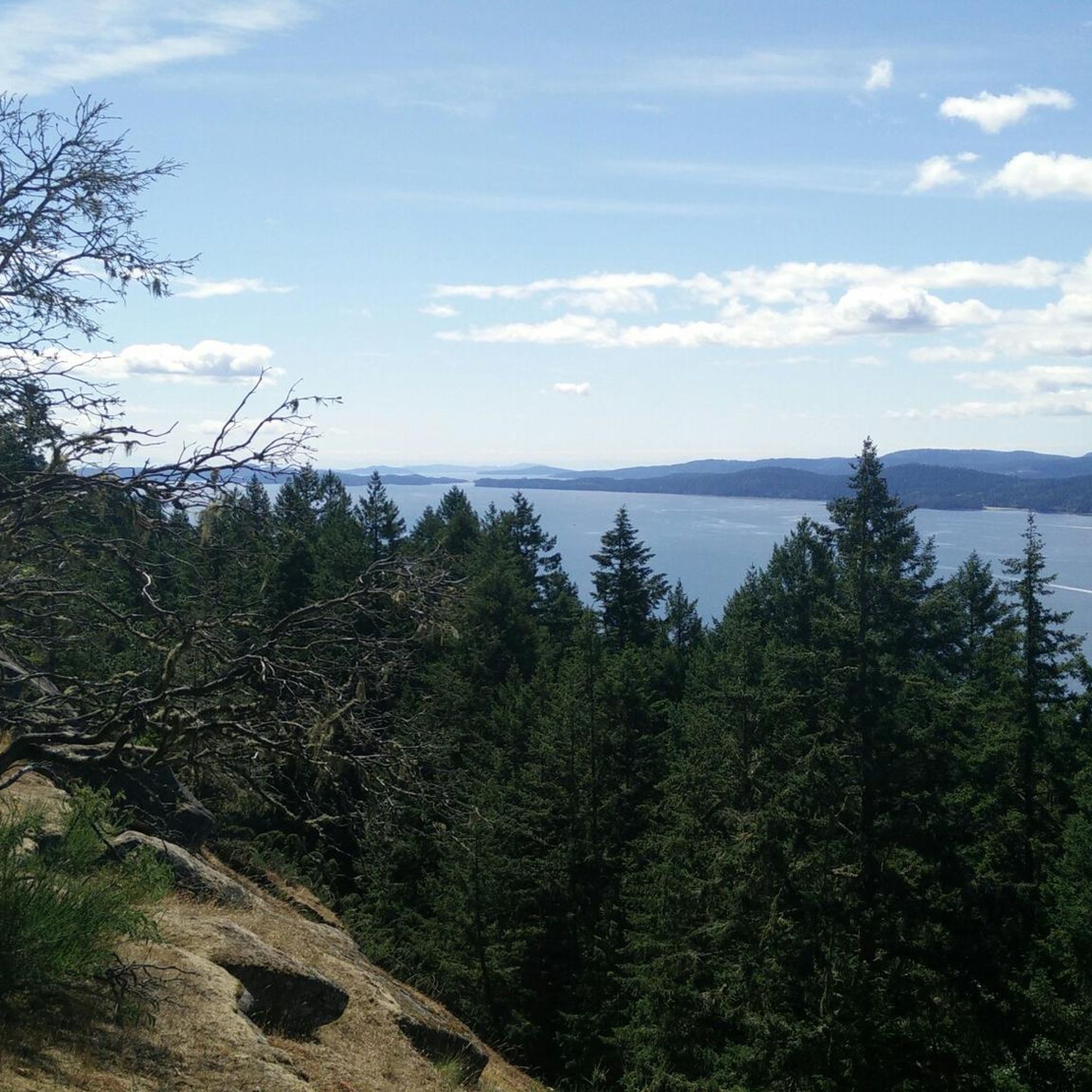
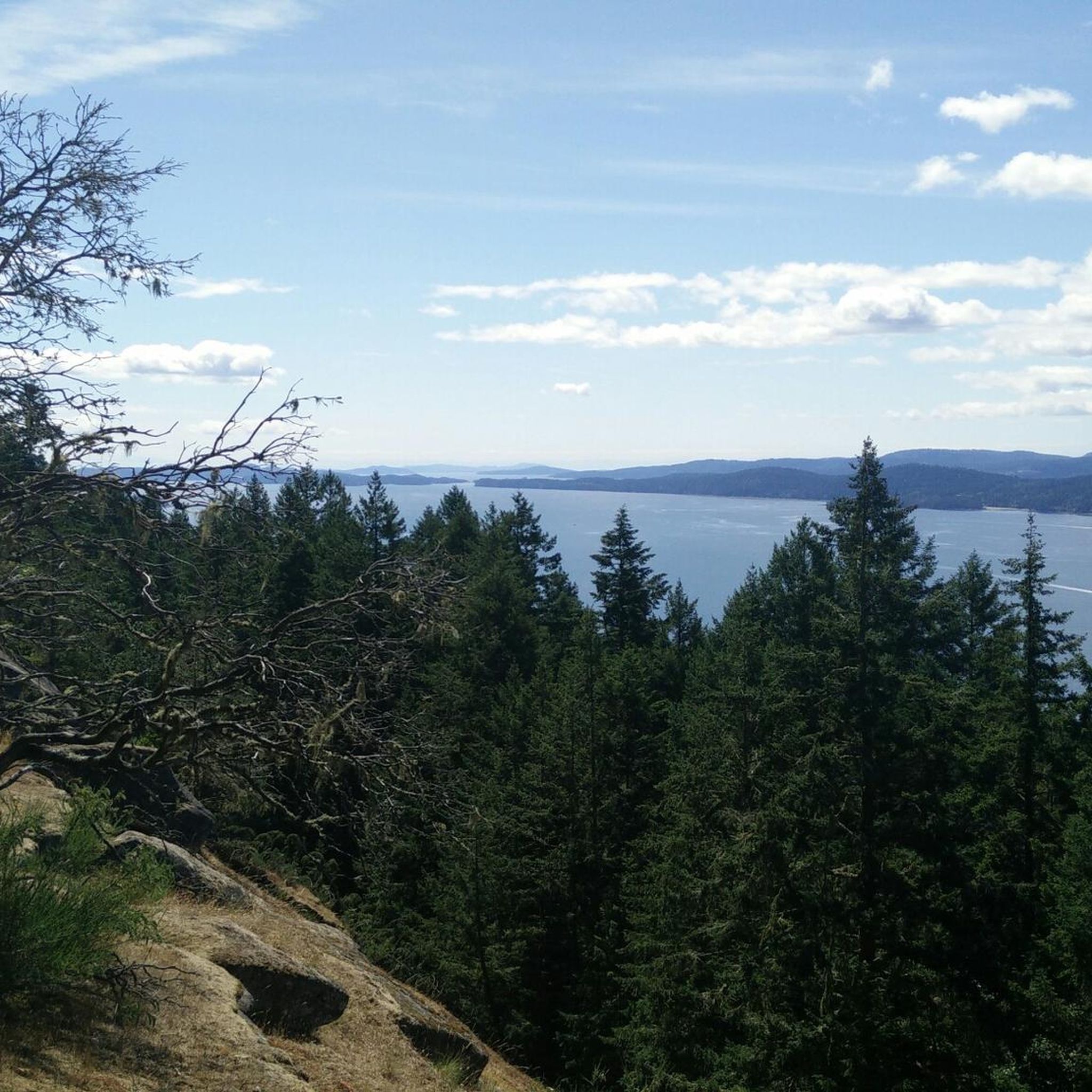
Jogging in Bodega Ridge Provincial Park offers routes across a 4-kilometer ridge that ascends over 300 meters above sea level. The park's terrain includes forested areas, open cliff edges, and varied paths, providing an engaging experience for runners. These running routes traverse diverse plant communities and offer views of the Trincomali Channel and Vancouver Island. The trails are characterized by a mix of uphill sections and shaded forest paths.
Best jogging routes in Bodega Ridge Provincial Park
- The most popular jogging route is St. Mary Lake Beach loop from Fernwood Rd at Walkers Hook Rd (NB), a 6.6 miles (10.6 km) trail that takes 1 hour 7 minutes to complete. This route offers a mix of terrain with some elevation gain.
- Another top favourite among local runners is Running loop from Fernwood Rd at Walkers Hook Rd (NB), a moderate 5.3 miles (8.6 km) path. This trail winds through forested sections with occasional open views.
- Local runners also love the Running loop from Lawnhill Drive Park Reserve, a 4.0 miles (6.5 km) trail leading through varied landscapes, often completed in about 42 minutes.
- Jogging in Bodega Ridge Provincial Park is defined by its prominent ridge, dense Douglas fir forests, and open cliff-edge sections. The network offers options for different ability levels, primarily focusing on moderate trails.
- The guide includes highly-rated routes that showcase the best of the region's landscape. More than 10 runners have used komoot to explore Bodega Ridge Provincial Park's varied terrain.
Last updated: July 6, 2026
4
runners
10.5km
01:07
110m
110m
Moderate run. Good fitness required. Mostly paved surfaces. Suitable for all skill levels.
3
runners
8.56km
00:55
90m
90m
Moderate run. Good fitness required. Mostly paved surfaces. Suitable for all skill levels.

Sign up for free
3
runners
6.35km
00:41
100m
100m
Moderate run. Good fitness required. Mostly paved surfaces. Suitable for all skill levels.
5
runners
6.57km
00:42
90m
90m
Moderate run. Good fitness required. Mostly paved surfaces. Suitable for all skill levels.
4
runners
Hard run. Very good fitness required. Mostly paved surfaces. Suitable for all skill levels.
Our route recommendations are based on thousands of hikes, rides, and runs completed by other people on komoot.
Start today with a free account
Your next adventure awaits.
Login or Signup
Popular around Bodega Ridge Provincial Park
Frequently Asked Questions
What kind of terrain can I expect on the running routes in Bodega Ridge Provincial Park?
The running routes in Bodega Ridge Provincial Park offer a diverse terrain. You'll find a mix of uphill sections, forested paths winding through dense Douglas fir and Western red cedar, and open cliff-side trails. The park's centerpiece is a 4-kilometer ridge that ascends 328 meters, providing an engaging and scenic workout with varied surfaces.
Are there any long-distance running trails available in the park?
Yes, for those looking for a longer run, the St. Mary Lake Beach loop from Quarry Drive - Baker Road Linear Park Reserve is a challenging option, covering 17.2 km with significant elevation gain. It's rated as difficult, offering a substantial workout.
What are the typical distances of jogging routes in Bodega Ridge Provincial Park?
The jogging routes in the park vary in length. For example, you can find moderate trails like the St. Mary Lake Beach loop from Fernwood Rd at Walkers Hook Rd (NB) at 10.6 km, or the Running loop from Lawnhill Drive Park Reserve which is 6.5 km. There's a range to suit different preferences.
What are the best viewpoints or scenic spots along the running trails?
From the ridge's summit, runners are treated to spectacular panoramic vistas of the Trincomali Channel, Vancouver Island, and the Strait of Georgia. The main trail also opens up along the cliff edge, providing breathtaking views after traversing forested areas.
Are there any easy jogging trails suitable for beginners in Bodega Ridge Provincial Park?
While all routes listed are rated as moderate or difficult, the park's trails generally involve some elevation gain due to the prominent ridge. The Running loop from Lawnhill Drive Park Reserve, at 6.5 km, might be a good starting point for those comfortable with moderate terrain and some elevation.
What natural features or wildlife might I encounter while jogging?
Bodega Ridge Provincial Park is rich in natural beauty. You might spot raptors such as bald eagles, peregrine falcons, and turkey vultures, as its high cliffs are vital habitats for them. The park also features unique plant communities like hairy manzanita and Gray's desert-parsley, rare grasslands, Douglas fir forests, and vibrant wildflowers near sandstone formations.
Is there parking available for runners at Bodega Ridge Provincial Park trailheads?
The main trail is accessible via Cottage Way. While the park is a day-use area, specific details on designated parking lots for runners are not provided. It's advisable to check local signage upon arrival.
What should I know about facilities and amenities in Bodega Ridge Provincial Park?
Bodega Ridge Provincial Park is a day-use only area with no developed facilities. Visitors should plan accordingly and bring their own water and any other necessities. It's crucial to remain on designated trails and exercise caution near cliff edges due to steep, unbarricaded drop-offs.
What is the best time of year to go jogging in Bodega Ridge Provincial Park?
The park offers engaging trails year-round, but conditions can vary. The forested sections provide shade on warmer days, which can be pleasant during summer. For specific seasonal conditions, it's always best to check local weather forecasts before your visit.
Are there any loop running routes in Bodega Ridge Provincial Park?
Yes, several routes are designed as loops, offering a continuous running experience. Examples include the Running loop from Fernwood Rd at Walkers Hook Rd (NB) and the Running loop from Wildwood Crescent Park Reserve, both providing scenic circular paths.
What makes the running experience in Bodega Ridge Provincial Park unique?
The park's unique appeal for runners lies in its prominent 4-kilometer ridge, offering both a physical challenge and stunning panoramic views of the Trincomali Channel, Vancouver Island, and the Strait of Georgia. The varied terrain, from dense forests to open cliff edges, combined with diverse plant life and potential wildlife sightings, creates a truly immersive outdoor running experience.
Most popular routes in Bodega Ridge Provincial Park

Get inspired with the komoot mobile app


Explore more
Browse the best Running Trails & Routes in other regions.
