The best walks and hikes in Larch Hills Trails Recreation Site
4.6
(11)
64
hikers
4
hikes
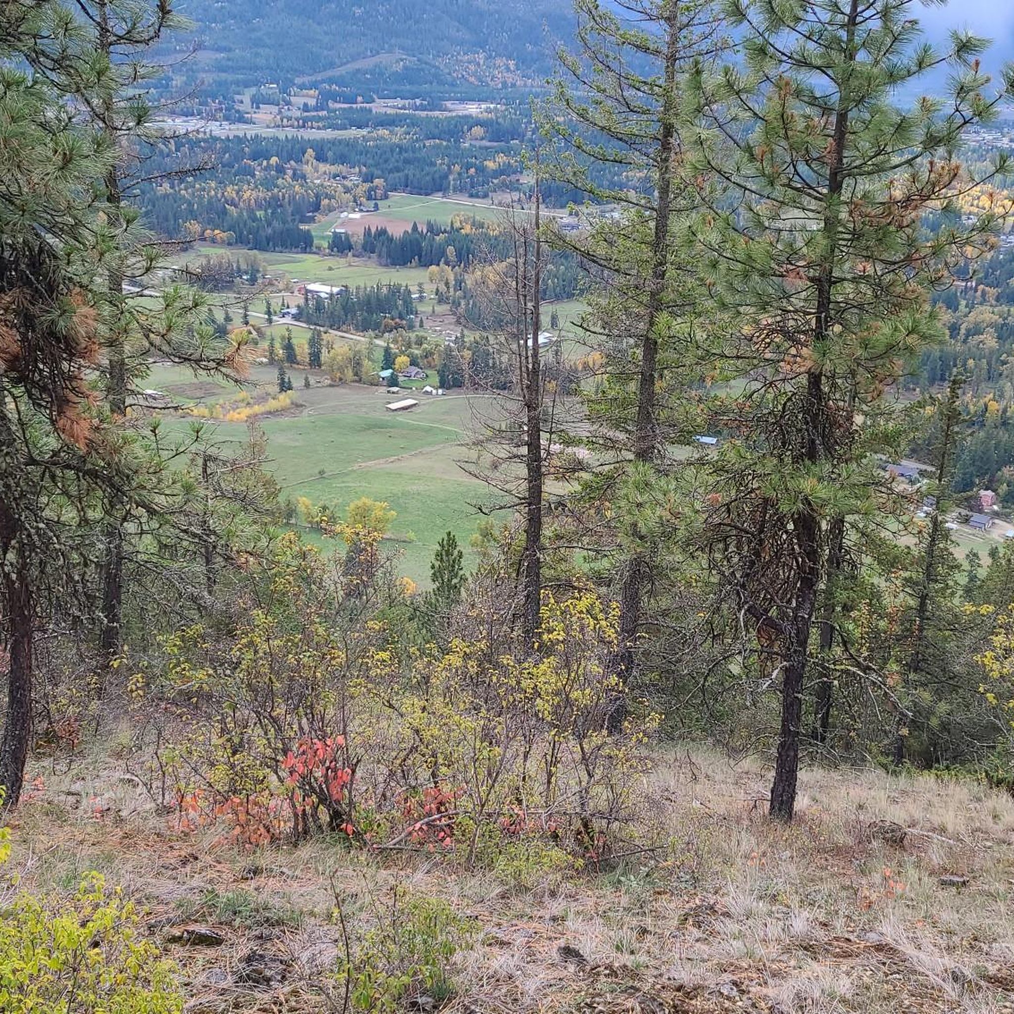
Hiking in Larch Hills Trails Recreation Site offers an extensive network of pathways through varied landscapes. The region features diverse forest environments, including sections with old-growth trees, and trails that lead through dense fir and hemlock forests. Hikers can explore wetland fens and interpretive loops, with higher trails providing panoramic views over surrounding valleys. The site provides well-maintained trails suitable for various skill levels.
Best hiking trails in Larch Hills Trails Recreation Site
- The most popular hiking route is Hiking…
Last updated: July 9, 2026
3
hikers
4.17km
01:08
60m
60m
Easy hike. Great for any fitness level. Easily-accessible paths. Suitable for all skill levels.
4.9
(8)
44
hikers
5.18km
01:42
230m
220m
Easy hike. Great for any fitness level. Easily-accessible paths. Suitable for all skill levels.

Sign up for free
5.0
(2)
6
hikers
926m
00:20
60m
60m
Easy hike. Great for any fitness level. Easily-accessible paths. Suitable for all skill levels.
14.5km
05:07
830m
830m
Hard hike. Very good fitness required. Easily-accessible paths. Suitable for all skill levels.
4.0
(1)
11
hikers
5.99km
01:33
30m
30m
Easy hike. Great for any fitness level. Easily-accessible paths. Suitable for all skill levels.
Our route recommendations are based on thousands of hikes, rides, and runs completed by other people on komoot.
Start today with a free account
Your next adventure awaits.
Login or Signup
Popular around Larch Hills Trails Recreation Site
Tips from the Community

Reinecker Creek tumbles through a narrow forested canyon on its way to Margaret Falls, carving through the rock that gives this trail its dramatic scenery. The creek flows year-round, with spring snowmelt and periods of heavy rain creating particularly impressive cascades and fast-moving water. Moss-covered boulders, cedar trees, and the constant sound of rushing water make the creek a defining feature of the Margaret Falls Trail.
0
0
This short forest trail follows Reinecker Creek through a lush canyon of moss-covered rock walls and towering cedars. Wooden bridges and boardwalks help navigate the damp terrain, while the sound of rushing water accompanies much of the walk. The route's most distinctive feature is a natural rock passage near the end of the trail, just before reaching Margaret Falls.
0
0

This wide trail follows along the shoreline of Shuswap Lake across boardwalks and through parklands. You'll pass by a viewing platform, benches, and picnic areas which will all invite you to stop for a while to enjoy the stunning views across the water.
0
0

Shuswap Lake, which has over 400 kilometers of navigable coastline, is home to several species of salmonids, such as chinook salmon, coho salmon, sockeye salmon, rainbow trout, and lake trout. These fish are of great importance for recreational fishing in the area.
0
0

From a viewing platform at the end of the trail, you can take in the majesty of the 90-foot, two-step Margaret Falls.
0
0
You can see a portion of the Salmon Arm of Shuswap Lake from this spot in the trees along the trail.
0
0
This spot along the trail is where Reinecker Creek flows into Heralds Bay. You're treated to sweeping views of the bay and the end of the waterway that feeds the flow of Margaret Falls.
0
0

Shaw Road is a dirt road that ends at the start of hiking trails. There are a few pull-out spots at the end of the road where cars can park. Still, if you don't have 4-wheel drive or good tires to take the rough road up to this parking area, you can also park at the end of 40 Street Southeast at the 4 corners Junction and use the network of trails there to access East Peak Trail, and other trails around Mount Ida.
0
0
Frequently Asked Questions
What kind of terrain can I expect on the hiking trails in Larch Hills Trails Recreation Site?
The Larch Hills Trails Recreation Site offers a diverse range of terrain. You'll find paths winding through various forest types, including sections with old-growth trees, dense firs, and hemlocks. Some trails also lead through unique wetland fens. Many routes utilize former logging roads or grass-covered paths that are groomed for skiing in winter, providing varied surfaces for hiking.
Are there any easy, family-friendly hiking loops in the Larch Hills area?
Yes, there are several easy options perfect for families. A great choice is the Hiking loop from Upper Violet Creek Provincial Park, which is about 4 km long and passes through beautiful forest. Another gentle option is the Margaret Falls Trail, a short 0.9 km path leading to a scenic waterfall.
Where can I find panoramic views or scenic overlooks in Larch Hills Trails Recreation Site?
For spectacular vistas, you'll want to explore the higher trails within the Larch Hills network. While specific viewpoints aren't always named, routes like the challenging East Peak Trail — Salmon Arm offer significant elevation gain, rewarding hikers with panoramic views over the surrounding valleys and potentially the lake and mountains mentioned in the Larch Hills Traverse.
Are dogs allowed on the hiking trails in Larch Hills Trails Recreation Site?
Generally, dogs are welcome on many trails in the Larch Hills Recreation Site, but it's always best to check specific trail regulations. For an enjoyable walk with your canine companion, consider the Raven Trail, an easy 6 km route that offers a pleasant forest experience.
What is the best time of year to go hiking in Larch Hills Trails Recreation Site?
The Larch Hills Trails Recreation Site is excellent for hiking throughout the year. Spring and summer offer lush greenery and comfortable temperatures. Fall is particularly stunning when the larches turn golden, providing a vibrant display. Even in winter, certain snowshoe trails are suitable for hiking once the snow has melted, or for snowshoeing when covered.
Are there any circular hiking routes available?
Yes, the area features several circular routes. A popular option is the Margaret Falls loop — Herald Provincial Park, which is an easy 5.2 km trail that takes you through scenic landscapes and past the beautiful Margaret Falls. The Hiking loop from Upper Violet Creek Provincial Park is another great circular choice.
What kind of wildlife might I encounter while hiking in Larch Hills?
Given the remote and natural setting of the Larch Hills trails, you may encounter various wildlife. This includes common forest animals and potentially larger mammals like bears. It's always advisable to be prepared, carry bear spray, and know how to react to wildlife encounters to ensure a safe and respectful experience.
What do other hikers enjoy most about the Larch Hills Trails Recreation Site?
The Larch Hills Trails Recreation Site is highly rated by the komoot community, with an average score of 4.6 stars. Reviewers often praise the extensive and well-maintained trail network, the diverse forest environments, and the peaceful, immersive natural experience. The variety of trails suitable for different skill levels is also frequently highlighted.
Is there parking available at the trailheads in Larch Hills?
Yes, access to the Larch Hills trails is typically via gravel forestry roads, and parking is generally available at designated trailheads. The Main Chalet area is a common starting point for many trails, including a 4km forest hiking loop that connects several snowshoe trails in summer. Always check local signage for specific parking instructions.
How many hiking trails are there in Larch Hills Trails Recreation Site?
The Larch Hills Trails Recreation Site boasts an extensive network of trails. While primarily known for its winter cross-country skiing, many of these trails are also suitable for hiking in the warmer months. Komoot currently lists 4 dedicated hiking routes, but the overall network is much larger, offering numerous possibilities for exploration.
Most popular routes in Larch Hills Trails Recreation Site

Get inspired with the komoot mobile app


Explore more
Browse the best Hikes in other regions.
