The best walks and hikes around Shaver Lake
5.0
(3)
39
hikers
14
hikes
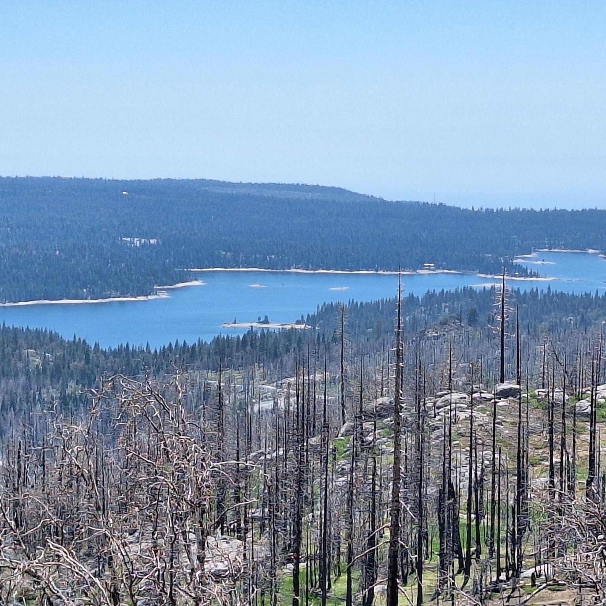
Hiking around Shaver Lake offers access to diverse landscapes within the Sierra Nevada Mountains. The region features dense forests of evergreens and red firs, rolling mountainous terrain, and significant granite outcroppings. Shaver Lake itself provides a focal point, with trails often leading to its shores and offering views of the water. The area includes both lower elevation woodlands and higher alpine settings, providing varied hiking experiences.
Best hiking trails around Shaver Lake
- The most popular hiking route is Shaver Lake Lakeview Trail, an easy 3.0 miles (4.8 km) trail that takes 1 hour 20 minutes to complete. This path offers views of the lake and surrounding forest.
- Another top favourite among local hikers is Stevenson Falls Trail, an easy 3.5 miles (5.7 km) path. This route leads to enchanting waterfall views.
- Local hikers also love the Granite Ridge Loop, a 2.5 miles (4.0 km) trail leading through mixed woodlands and offering views of the surrounding terrain, often completed in about 1 hour 7 minutes.
- Hiking around Shaver Lake is defined by diverse forests, mountainous terrain, and alpine settings. The network offers options for different ability levels, from easy loops to more difficult ascents.
- The routes in Shaver Lake are highly rated by the komoot community with an average score of 5.0 stars from over 5 reviews. More than 30 hikers have used komoot to explore Shaver Lake's varied terrain.
Last updated: October 11, 2026
4
hikers
5.67km
01:38
160m
100m
The Stevenson Falls Trail offers a unique hiking experience in the Sierra National Forest, combining paved accessibility with stunning natural beauty. As you walk along the historic "Million Dollar Road," you'll be treated to breathtaking views of the High Sierra and the San Joaquin River Valley, culminating at the majestic Stevenson Creek Falls. This easy 3.5-mile (5.7 km) hike, with 528 feet (161 metres) of elevation gain, takes about 1 hour and 38 minutes, making it a perfect outing for families and those seeking a rewarding, less strenuous adventure.
When planning your visit, remember that the trail is largely exposed, so shade is minimal. It's highly recommended to start your hike early in the morning, especially during warmer months, to avoid the heat and protect dog paws from the hot paved surface. Spring is an ideal time to go, as the waterfall is at its most impressive after snowmelt, and you might catch a display of wildflowers.
What sets this route apart are its historical elements, including the "Million Dollar Road" itself, built for the Big Creek Hydroelectric Project, and two fascinating man-made caves (adits) that you can explore. These features, combined with the impressive Stevenson Falls, considered one of California's tallest, make this a truly distinctive destination among Stevenson Falls hiking trails.
4.80km
01:20
90m
80m
Embark on an easy hike along the Shaver Lake Lakeview Trail, a 3.0-mile (4.8 km) route that offers a gentle climb of 298 feet (91 metres). You can expect to complete this hike in about 1 hour and 20 minutes. The path winds through mixed forestlands, where towering pines and evergreens create a peaceful atmosphere. As you go, you will find granite outcrops and, in spring, wildflowers. Make sure to stop at Black Rock for wide views of the shimmering alpine lake and surrounding mountains. You will also see shoreline cliffs as the trail follows the water's edge.
The Shaver Lake Lakeview Trail is a popular spot, so you might encounter other hikers, especially on weekends. If you prefer a quieter experience, consider starting your hike early in the morning or visiting on a weekday. It is a good idea to carry a trail GPS device, as some parts of the route can be tricky to follow. This will help you stay on track and enjoy your outing without getting lost.
Located within the vast Sierra National Forest, this trail offers a classic mountain lake experience. It is a multi-use route, meaning you might share the path with mountain bikers or trail runners. The trail provides excellent opportunities to observe the local flora and fauna of the Sierra Nevada foothills. It is a great way to connect with nature and enjoy the beauty of the region.

1
hikers
3.96km
01:07
80m
80m
Embark on the Granite Ridge Loop for an easy hiking experience through the natural landscape of Sierra National Forest. This pleasant route covers 2.5 miles (4.0 km) with a gentle elevation gain of 267 feet (81 metres), making it perfect for a quick outdoor escape. You can expect to enjoy fresh air and peaceful sounds as you navigate the trail, likely encountering diverse flora and fauna along the way.
Planning your visit is straightforward; the trail is generally accessible, and you should find parking available at the trailhead. Before heading out, always check local conditions, especially if you are visiting during different seasons, to ensure you have the best possible experience. No specific permits or fees are mentioned for this accessible route, which you can complete in about 1 hour and 6 minutes.
The Granite Ridge Loop offers a refreshing escape into the outdoors, providing a chance to connect with nature without a strenuous effort. While specific details for this particular loop are not extensively documented, its location within Sierra National Forest suggests a typical forest environment, ideal for those seeking a tranquil walk. It's a great option if you are looking for a short, easy hike to enjoy the natural surroundings.
5.94km
01:41
120m
120m
Embark on the Fishing Club and Stevenson Cove Loop, an easy hiking route spanning 3.7 miles (5.9 km) with a gentle elevation gain of 395 feet (120 metres), typically completed in about 1 hour and 41 minutes. You will wander through winding terrain, passing mixed woodlands of evergreens and red firs. Look for mossy patches and vibrant wildflower meadows as the trail leads you toward the serene shoreline of Shaver Lake. Enjoy expansive views of the lake, reflecting the surrounding forestlands and distant summits, all while towering pines offer welcome shade. Keep an eye out for local wildlife along the way.
Parking is generally available, making access to the trailhead straightforward for your hike. If you plan to bring your furry friends, a stroller, or need wheelchair access, the area around Stevenson Creek Falls is particularly accommodating. Consider starting your hike early in the morning, especially during warmer months, to enjoy cooler temperatures and a more peaceful experience. Should you wish to fish in Shaver Lake, remember to secure a valid fishing permit beforehand.
This loop offers a relaxing outdoor experience within the Sierra National Forest, making it a great choice for hikers of all levels. The trail's path along Shaver Lake provides a unique opportunity to observe the interplay between the forest and the water, with the possibility of spotting various local species. It stands out as an accessible and scenic option for those looking to connect with nature in a tranquil setting.
2.97km
01:09
330m
0m
Hike the moderate 1.8-mile Tollhouse Rock from Tollhouse Road route, gaining 1088 feet for views of the Sierra Nevada mountains.
Get access to more routes and recommendations from other explorers.
Already have an account?
Our route recommendations are based on thousands of hikes, rides, and runs completed by other people on komoot.
Start today with a free account
Your next adventure awaits.
Popular around Shaver Lake
Tips from the Community

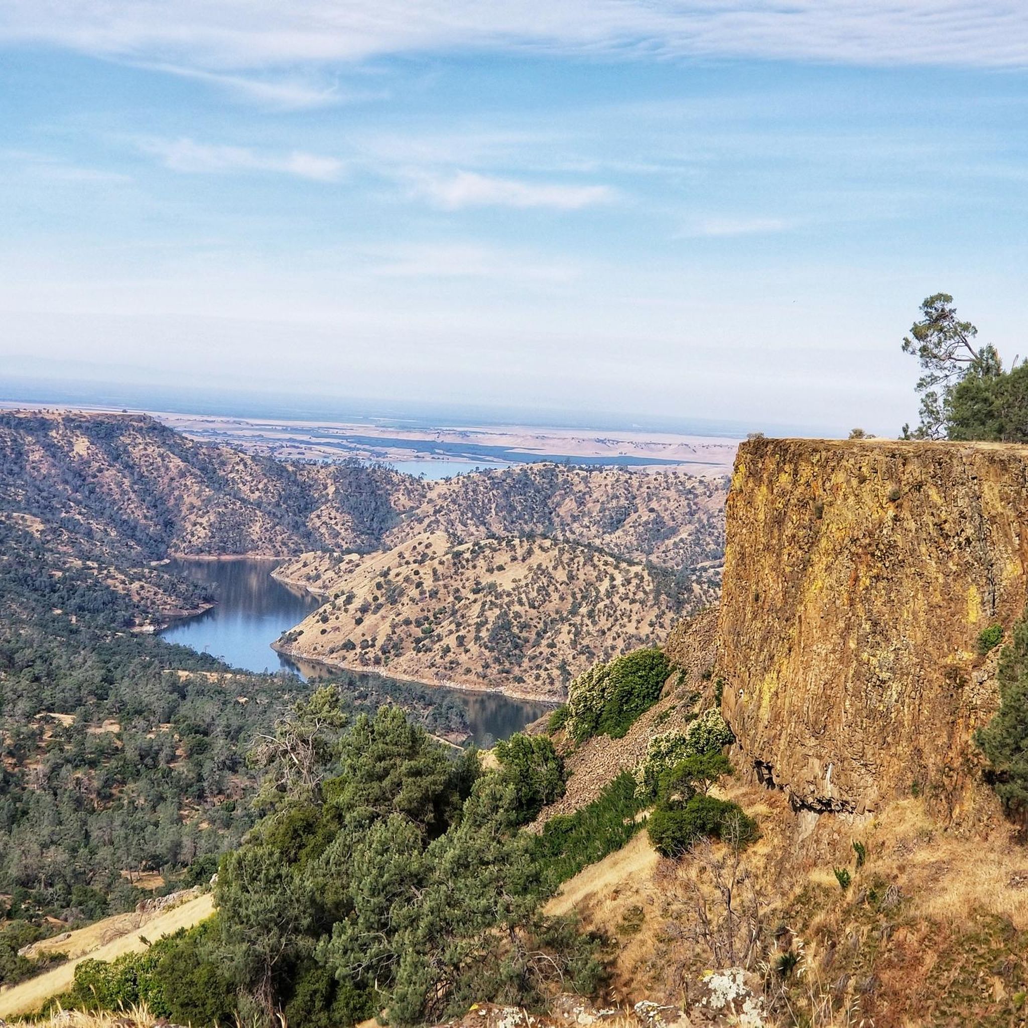
Stevenson Creek, now part of a hydroelectric project at Shaver Lake, no longer flows as consistently as it once did. Stevenson Creek Falls is an amazing waterfall, with a total drop of around 1,200 feet across four major leaps of 380, 260, 250, and 180 feet, interspersed with smaller cascades. While the falls run dry in summer due to stream regulation, spring brings in water flow, creating roaring falls dropping into the San Joaquin River canyon.
0
0
Frequently Asked Questions
How many hiking trails are available around Shaver Lake?
There are 15 diverse hiking routes around Shaver Lake, catering to various skill levels. You'll find 7 easy trails, 5 moderate options, and 3 more challenging routes for experienced hikers.
What kind of terrain can I expect on hikes near Shaver Lake?
The Shaver Lake area offers a rich variety of terrain. You can expect to hike through lush mixed woodlands of evergreens and red firs, discover mossy patches, and traverse rolling mountains. Many trails feature beautiful meadows and impressive granite outcroppings, especially as you gain elevation.
Are there any easy, family-friendly hikes around Shaver Lake?
Yes, Shaver Lake has several easy, family-friendly options. The Shaver Lake Lakeview Trail is a great choice, offering rewarding views of the lake. Another excellent option is the Granite Ridge Loop, which is also considered easy and suitable for beginners.
Where can I find trails with waterfalls near Shaver Lake?
For a beautiful waterfall experience, consider the Stevenson Falls Trail. This easy route leads you to the enchanting Stevenson Falls, offering picturesque views.
What are some scenic viewpoints or natural features to look out for?
Shaver Lake is renowned for its stunning natural beauty. Many trails offer breathtaking panoramic views, such as those found on the more strenuous Bald Mountain Trail. You can also enjoy the crystal-clear waters of Shaver Lake itself, which reflect the towering pine trees and majestic mountains. The area is also home to diverse wildlife, including deer and squirrels, offering opportunities for spotting animals during your hike.
Are there any challenging hikes for experienced trekkers?
Absolutely. For those seeking a more strenuous adventure, the region offers trails like the Power Line OHV Trail, which is rated as difficult. The surrounding wilderness areas, such as the Dinkey Lakes Wilderness, also provide true alpine experiences with demanding routes through meadows and past pristine lakes.
What is the best time of year to go hiking in Shaver Lake?
Shaver Lake offers year-round outdoor experiences. While summer is popular for water sports and hiking, spring brings vibrant wildflowers and pleasant temperatures. Fall offers beautiful foliage, and winter transforms the area into a wonderland for snow activities, though some higher elevation trails may be inaccessible due to snow.
Are there any circular hiking routes available?
Yes, there are several circular routes to enjoy. The Granite Ridge Loop is an easy option, and the Fishing Club and Stevenson Cove Loop provides another easy, scenic circuit around the lake's edge.
What do other hikers say about the trails around Shaver Lake?
The hiking trails around Shaver Lake are highly regarded by the komoot community, with an average rating of 5.0 stars. Hikers frequently praise the stunning lake views, the peaceful forest atmosphere, and the variety of trails suitable for all abilities.
Are dogs allowed on the hiking trails?
Many trails in the Shaver Lake area are dog-friendly, but leash rules and specific regulations can vary depending on the exact location within the Sierra National Forest. It's always best to check local signage or the specific trail's guidelines before heading out with your furry friend.
Is there parking available at the trailheads?
Parking is generally available at popular trailheads around Shaver Lake, though specific facilities and potential fees can vary. It's advisable to check the details for your chosen route in advance, especially during peak season, to ensure a smooth start to your hike.
Most popular routes around Shaver Lake

Get inspired with the komoot mobile app


Explore more
Browse the best Hikes in other regions.
