Top 20 Natural Monuments around Hattstedtermarsch
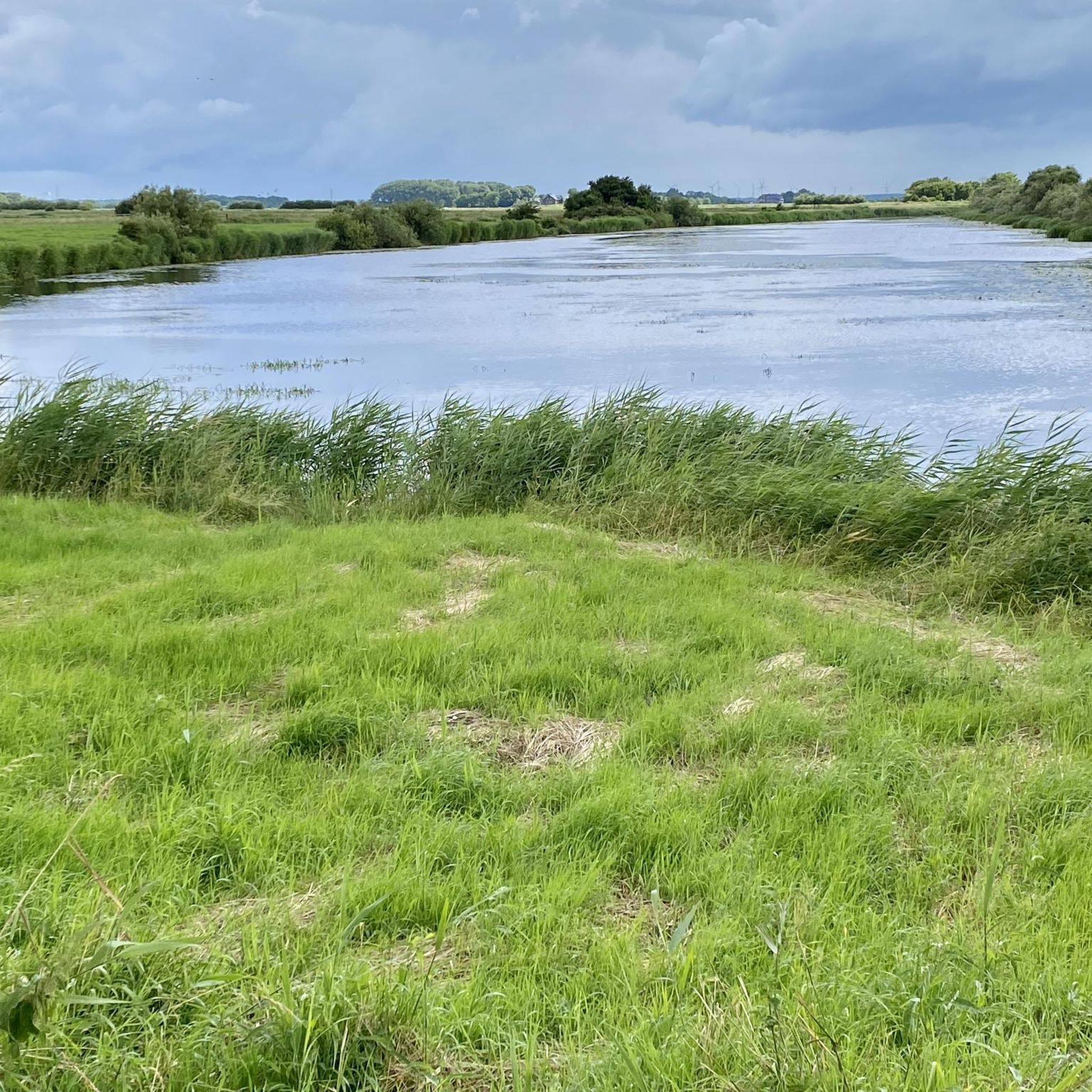
Best natural monuments around Hattstedtermarsch are characterized by the vast, open North Sea landscape and its significant ecological importance. The region offers a unique natural experience, featuring extensive wetlands and diverse habitats. It is located in close proximity to the UNESCO World Heritage Wadden Sea, a globally important ecosystem shaped by tides. Visitors can explore dikes, salt marshes, and various viewpoints offering vistas of the Wadden Sea and the Halligen.
Best natural monuments around Hattstedtermarsch
- The most popular natural monuments…
Last updated: August 18, 2026
Lüttmoorsiel Seawall and View over the Beltringharder Koog
Highlight • Viewpoint
Translated by Google •
Tip by

Beltringharder Polder
Highlight • Natural Monument
Translated by Google •
Tip by

Sign up now to discover places like this
Get recommendations on the best single tracks, peaks, & plenty of other exciting outdoor places.
Sign up for free
Fuhlehörn Beach
Highlight • Beach
Translated by Google •
Tip by

Wester-Spätinge Nature Reserve
Highlight • Natural Monument
the current outer dike was built in 1579 to protect against storm surges and land reclamation.
The dike …
Translated by Google •
Tip by

View of the salt marshes and dike at Simonsberg (Wadden Sea National Park)
Highlight • Viewpoint
Translated by Google •
Tip by
Sign up for free to discover even more natural monuments around Hattstedtermarsch.
Sign up for free
Already have an account?
Start today with a free account
Your next adventure awaits.
Login or Signup



Tips from the Community

The Beltringharder Koog is an impressive nature reserve in North Friesland, Schleswig-Holstein. The Koog was embanked in 1987 and covers an area of 3,350 hectares, making it the largest nature reserve on the Schleswig-Holstein mainland. It was created in response to storm surges and today serves to protect the coast and promote biodiversity in the region. The Beltringharder Koog has a variety of habitats, including saltwater and freshwater lagoons, wet grassland and tidal floodplains. These diverse biotopes provide habitat for numerous species of birds that breed or rest here. Over 100,000 waders and water birds use the Koog throughout the year, making it a paradise for birdwatchers. Commonly seen species include greylag geese and black-necked grebes. For visitors, there are well-developed hiking and cycling trails that lead through the diverse landscape of the Koog. Tours that start at Lüttmoorsiel and lead along the dike to Lüttmoorsee and further are particularly recommended. Observation huts and viewing platforms on these routes offer excellent opportunities to observe wildlife in its natural environment. The Koog is also an example of successful cooperation between nature conservation organizations such as NABU, the Wadden Sea Conservation Station and the WWF. Together they ensure that this unique ecosystem is protected and cared for.
1
0

Beltringharder Koog is the name of the embankment of part of the Schleswig-Holstein Wadden Sea in the area of Nordstrand Bay, which was completed in 1987. This measure effectively connected the former island of Nordstrand to the mainland and thus made it part of a peninsula. Wikipedia
3
0
Great to drive. 10,000 hectares of salt marshes, a unique habitat 👍🍀
3
0

From this dike, you reach infinite horizons. You have views of the sea, but also of the halligens and the Beltringharder Koog. As you evolve near mudflats, many sea wading birds better known as wading birds are visible. Oystercatchers, curlews, sandpipers, sandpipers. All these birds find their pantries in the mud. You also see many sheep. The salty grass they eat makes their meats tastier.
5
2

Here you will find numerous herbs and plants that you can pick for the local kitchen. But watch out, some are protected.
3
0
Magnificent Ausssicht with a clear view of Nordstrandischmoor and the "salt lagoon and the Beltringharder Koog". These natural lagoons no longer exist on the Schleswig-Holstein Wadden Sea coast as a result of dike construction measures. Today there are three artificial lagoons: the Rantum basin on Sylt, the Kronenloch in Speicherkoog Dithmarschen and the Beltringharder Koog. Important breeding colonies of the rare terns, avocets and plovers are found on the artificial islands of the lagoon. Large flocks of wading birds gather there during high water migration periods. As a result, these are not salt marshes in the classic sense. https://www.beltringharderkoog.de/der-beltringharder-koog/salzwasserlagune
10
1
If you are lucky you can watch the whole herd of sheep being herded together to be washed. Washing once a year prevents the spread of ectoparasites.
6
0
As from almost every dyke top, you have a good view of the Wadden Sea and countless 4-legged dyke keepers with wool on the cross 🤠 . The question of happiness to the so-called happy sheep was answered with "bleating".🤣 Incidentally, you look over to Nordstrand from the top of the Simonsberg dyke
5
0
Frequently Asked Questions
What unique natural features define the Hattstedtermarsch region?
The Hattstedtermarsch region is characterized by its vast, open North Sea landscape, extensive wetlands, and diverse habitats. It is in close proximity to the UNESCO World Heritage Wadden Sea, a globally important ecosystem shaped by tides. You'll find significant dike landscapes, salt marshes, and waterways like the Arlau River.
Where can I experience the Wadden Sea near Hattstedtermarsch?
The Hattstedtermarsch region offers several points to experience the Wadden Sea. You can enjoy stunning vistas from viewpoints like View of the salt marshes and dike at Simonsberg (Wadden Sea National Park). Mudflat hiking is also possible, especially from locations like Lüttmoorsiel, which offers guided tours to the Hallig Nordstrandischmoor.
Are there specific nature reserves to explore in Hattstedtermarsch?
Yes, the region is home to significant nature reserves. The Beltringharder Koog Nature Reserve is Schleswig-Holstein's largest mainland nature reserve, vital for birdwatching and diverse habitats. Another important area is the Wester-Spätinge Nature Reserve, known for its swamp and water areas that serve as breeding and resting grounds for numerous birds.
What kind of wildlife can I expect to see in Hattstedtermarsch?
The Hattstedtermarsch region, especially areas like the Beltringharder Koog, is a paradise for birdwatchers. You can observe many sea wading birds such as oystercatchers, curlews, and sandpipers. The salt marshes and wetlands provide habitat for a rich variety of specialized flora and fauna. You'll also frequently see sheep grazing on the dikes.
What are some of the best viewpoints in Hattstedtermarsch?
For expansive views, visit View of the salt marshes and dike at Simonsberg (Wadden Sea National Park), offering vistas of the Wadden Sea and salt marshes. Another excellent spot is Lüttmoorsiel Seawall and View over the Beltringharder Koog, where you can see the sea, the Halligen, and the vast Beltringharder Koog.
Are there hiking opportunities near the natural monuments in Hattstedtermarsch?
Absolutely. The dikes and nature reserves around Hattstedtermarsch offer numerous hiking opportunities. You can find various routes, from easy strolls to more moderate paths, that allow you to explore the unique landscape. For detailed routes, check out the Hiking around Hattstedtermarsch guide.
What are some easy hiking trails in the Hattstedtermarsch area?
For easy hikes, consider routes like the 'Beltringharder Koog Dike – Lüttmoordamm loop from Badestelle Lüttmoorsiel' (7.7 km) or the 'View over the Beltringharder Koog – Aarlau lock pumping station loop from Kleiner Deichhof' (4.6 km). These trails offer gentle terrain and beautiful scenery. More options can be found in the Easy hikes around Hattstedtermarsch guide.
Can I go cycling in the Hattstedtermarsch region?
Yes, the region's dike landscapes are perfect for cycling. Sections of the North Sea Coastal Cycle Route pass through, offering expansive views of the marshland and the North Sea. Many routes are suitable for leisurely rides, often with sheep grazing alongside the paths.
Is Hattstedtermarsch suitable for family visits?
Many natural monuments and areas in Hattstedtermarsch are family-friendly. Highlights like Fuhlehörn Beach offer sandy areas for relaxation and are starting points for mudflat walks. Nature reserves like Beltringharder Koog also provide accessible paths for families to enjoy the outdoors and observe wildlife.
What is the best time to visit the natural monuments in Hattstedtermarsch?
The Hattstedtermarsch region is beautiful year-round, but spring and summer offer pleasant weather for outdoor activities like hiking and cycling. Birdwatching is particularly rewarding during migration seasons in spring and autumn. Winter can offer unique, tranquil walks with crisp air and wide-open skies, though some facilities might have reduced hours.
Are there sandy beaches in the Hattstedtermarsch area?
While much of the North Sea coast is characterized by mudflats, Fuhlehörn Beach is one of the few sandy beaches on Nordstrand. It provides a great spot to relax, swim, and serves as a starting point for mudflat walks.
What should I wear when visiting the natural monuments in Hattstedtermarsch?
Given the coastal and marshland environment, it's advisable to wear layers, as the weather can change quickly. Waterproof and windproof outerwear is recommended, especially near the dikes. Sturdy, comfortable walking shoes or boots are essential for exploring trails and dikes, and rubber boots are ideal if you plan to venture into the mudflats.
Most popular routes around Hattstedtermarsch
Most popular attractions around Hattstedtermarsch

Get inspired with the komoot mobile app


Explore more
Extend your search for the best caves by checking out these guides of the top ones around Hattstedtermarsch:
