Top 20 Natural Monuments around Spital am Semmering
Best natural monuments around Spital am Semmering are found in the Styrian region of Austria, which serves as a base for exploring impressive natural areas. The surrounding landscapes feature dramatic limestone formations, alpine plateaus, and deep valleys, characteristic of the Northern Limestone Alps. This region is known for its geological features and diverse ecosystems, offering various recreational opportunities. Visitors can explore prominent mountain ranges and unique natural formations.
Best natural monuments around Spital am Semmering
- The most popular natural monuments…
Last updated: July 7, 2026
Preinerwand Summit Cross
Highlight • Summit
Translated by Google •
Tip by

Luckerte Wand Rock Formation and Viewpoint
Highlight • Viewpoint
Translated by Google •
Tip by

Sign up now to discover places like this
Get recommendations on the best single tracks, peaks, & plenty of other exciting outdoor places.
Sign up for free
Törlweg Rock Arch
Highlight • Natural Monument
Translated by Google •
Tip by
Hochwechsel
Highlight • Summit
Translated by Google •
Tip by

Stuhleck Summit
Highlight • Summit
Translated by Google •
Tip by

Sign up for free to discover even more natural monuments around Spital am Semmering.
Sign up for free
Already have an account?
Start today with a free account
Your next adventure awaits.
Login or Signup
Popular around Spital am Semmering

Central Alps Trail Eastern Section – Discover Austria
Hiking around Spital am Semmering
MTB Trails around Spital am Semmering
Cycling around Spital am Semmering
Road Cycling Routes around Spital am Semmering
Mountain Hikes around Spital am Semmering
Gravel biking around Spital am Semmering
Running Trails around Spital am Semmering
Other adventures around Spital am Semmering

Tips from the Community

At the Törlweg gorge, the trail leads impressively up through a narrow rocky gully toward the Rax Plateau. This passage exudes a true alpine flair and makes the ascent varied and exciting. A striking landmark along the trail, it's a memorable stopover.
4
0
At the Preinerwand Cross (1,783 m), you reach one of the most striking vantage points in the Rax. From here, the view extends far over the Vienna Basin, the surrounding valleys, and, on a clear day, all the way to the peaks of the Alps. An impressive spot that rewards the climb with an unforgettable panorama.
8
0

Beautiful, striking breakthrough. Steep, rocky path.
2
0

Great view, challenging to drive, really fun
4
0
Great view, challenging to drive
4
0


The mountain ridge of the Wechsel stretches for over 15 km - the eastern Austrian low mountain range on the border between Lower Austria and Styria 🌲 Its three most lofty peaks each rise over 1,700 m ⛰️ Thanks to its mountain landscapes, which range from lovely to challenging, the Wechsel is considered a hiking destination for families on the one hand - and a local recreation area for experienced hikers and climbers on the other 🥾 The Hochwechsel, as the highest peak, offers particularly worthwhile views: the panoramic view stretches from Semmering and Rax to the Schneeberg 🌄 In good weather, even Burgenland, Styria, Hungary and Slovenia can be seen 😎 From mid-May to mid-November, a wonderful rest in the Wetterkoglerhaus is also tempting 🧃 www.wieneralpen.at/ausflugsziel-in-den-wiener-alpen-entdecken/a-hochwechsel-im-wechselgebirge
10
0
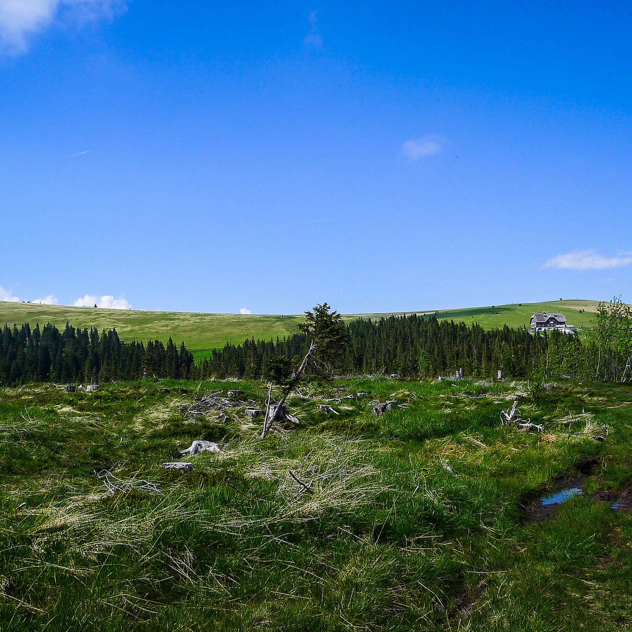
The Stuhleck is, together with the Wechsel, one of the easternmost peaks in the Alps that still rises above the tree line. The Alois Günther House is located at the summit. From the Pfaffensattel, a mountain pass (1372 m) between the towns of Rettenegg and Steinhaus am Semmering, an unpaved toll road that is only open in summer leads to the summit. The Alpannonia Central Alpine Trail, an Austrian long-distance hiking trail, also leads up and over the summit. 📖 www.de.wikipedia.org/wiki/Stuhleck
7
1
Frequently Asked Questions
What are some of the most prominent natural monuments near Spital am Semmering?
The region around Spital am Semmering offers several impressive natural monuments. Among the most popular are the Preinerwand Summit Cross, which provides striking views over the Vienna Basin, and the Luckerte Wand Rock Formation and Viewpoint, known for its unique hole through the rock and panoramic Schneeberg views. Another notable feature is the Törlweg Rock Arch, a dramatic stone gate along an alpine trail. Beyond these, the broader Rax-Schneeberg Group and Hochschwab Massif are significant natural areas.
What unique geological features can I explore in the natural monuments around Spital am Semmering?
The natural monuments in this area are characterized by their dramatic geology. You can find impressive limestone formations, alpine plateaus, and deep valleys, especially within the Rax-Schneeberg Group and Hochschwab Massif. Specific features include the unique rock arch at Törlweg Rock Arch and the distinctive hole in the rock at Luckerte Wand Rock Formation and Viewpoint. The Hochschwab Massif is also known for its extensive karst formations and numerous caves.
Are there hiking trails near these natural monuments?
Yes, the natural monuments around Spital am Semmering are excellent starting points for various hiking experiences. The Rax-Schneeberg Group and Hochschwab Massif offer extensive networks of trails, from leisurely walks to challenging summit ascents. For more detailed routes, you can explore the Hiking around Spital am Semmering guide, which includes routes like the Kampalpe Summit Cross loop and trails leading to Stuhleck Summit.
What kind of views can I expect from the natural monuments?
The natural monuments offer breathtaking panoramic views. From the Preinerwand Summit Cross, you can see far over the Vienna Basin and surrounding valleys. The Luckerte Wand Rock Formation and Viewpoint provides a great Schneeberg panorama. From the Stuhleck Summit, you'll experience an indescribable panorama, often with a clear view of distant Alpine peaks. The Heukuppe, the highest peak on the Rax, also offers stunning vistas, especially at sunrise and sunset.
Are there family-friendly natural monuments or activities near Spital am Semmering?
While specific 'family-friendly' categories aren't always assigned, many areas offer accessible options. The Rax cable car provides easy access to the Rax plateau, allowing families to enjoy alpine views and shorter walks without strenuous climbs. The Bärenschützklamm, though a day trip, offers an adventurous experience with its system of bridges and ladders, suitable for active families. Always check specific trail difficulties before heading out with children.
What is the best time to visit the natural monuments around Spital am Semmering?
The best time to visit largely depends on the activity. For hiking and exploring the alpine plateaus, late spring to early autumn (May to October) offers the most favorable weather conditions. During winter, areas like the Heukuppe on the Rax are popular for ski tours and snowshoe hikes, but require appropriate gear and experience. Some tours, like the one to Preinerwand Summit Cross, are possible year-round.
What kind of wildlife can I observe in these natural areas?
The natural areas around Spital am Semmering are rich in diverse flora and fauna. The Hochschwab Massif, in particular, is known for its significant wildlife populations, including Europe's largest population of chamois, ibexes, red deer, and rare birds like snow grouse. The Rax-Schneeberg Group also features unique alpine vegetation and is a protected area for its diverse ecosystems.
Are there opportunities for running or cycling near the natural monuments?
Yes, the region offers various outdoor sports. For running enthusiasts, the Running Trails around Spital am Semmering guide features routes like the Hühnerkogel loop. Cyclists can find suitable paths in the Cycling around Spital am Semmering guide, with options such as the Friedrichhütte loop. These activities allow you to experience the natural beauty from a different perspective.
What do visitors enjoy most about the natural monuments in this region?
Visitors frequently highlight the stunning panoramic views and the sense of achievement after reaching summits like the Preinerwand Summit Cross or Stuhleck Summit. The unique geological formations, such as the Törlweg Rock Arch and the Luckerte Wand Rock Formation, are also highly appreciated for their visual appeal and photographic opportunities. The alpine flair and varied trails make for memorable stopovers and exciting ascents.
Is the Bärenschützklamm considered a natural monument near Spital am Semmering?
While not directly within Spital am Semmering, the Bärenschützklamm (Bear's Protection Gorge) near Mixnitz is a renowned natural monument in Styria and is accessible as a day trip. It's a dramatic gorge with roaring waterfalls and deep ravines, traversed by an impressive system of 164 wooden bridges and ladders, offering an exhilarating hiking experience.
Are there any mountain huts or refreshment stops near the natural monuments?
Yes, several mountain huts are available in the larger natural areas. For instance, the Stuhleck Summit hosts the Alois Günther House. Near the Törlweg Rock Arch, the Otto shelter is just a few steps away. The Hochschwab Massif also features numerous mountain huts, making it convenient for multi-day treks and providing places to rest and refuel.
How accessible are these natural monuments by public transport?
While Spital am Semmering itself is accessible, reaching some of the more remote natural monuments often requires a combination of public transport and then hiking or a short drive. The Rax cable car offers easy access to the Rax plateau. For specific trailheads, it's advisable to research local bus connections or consider carpooling, as direct public transport to every starting point might be limited.
Most popular routes around Spital am Semmering
Most popular attractions around Spital am Semmering

Get inspired with the komoot mobile app


Explore more
Extend your search for the best caves by checking out these guides of the top ones around Spital am Semmering:
