The 9 Most Amazing Peaks around Basadingen-Schlattingen
Mountain peaks near Basadingen-Schlattingen are characterized by a gentle rolling landscape with elevated areas and natural features. The municipality itself has a mean elevation of 410 meters, with its highest point reaching 568 meters. This region offers scenic beauty, hiking opportunities, and historical significance. The area provides various elevated points and natural sites for exploration.
Best mountain peaks around Basadingen-Schlattingen
- The most popular mountain peaks is Town Hall of Stein am Rhein, a historical site that was constructed between…
Last updated: June 23, 2026
Town Hall of Stein am Rhein
Highlight • Historical Site
Translated by Google •
Tip by

Hochwacht Wildensbuch Observation Tower
Highlight • Viewpoint
Translated by Google •
Tip by

Sign up now to discover places like this
Get recommendations on the best single tracks, peaks, & plenty of other exciting outdoor places.
Sign up for free
View of Schaffhausen and the Rhine from Feuerthalen Bridge
Highlight • Viewpoint
Translated by Google •
Tip by

Wangen Pier on Lake Constance
Highlight • Bridge
Translated by Google •
Tip by

Mammern Train Station
Highlight • Rest Area
Translated by Google •
Tip by

Sign up for free to discover even more peaks around Basadingen-Schlattingen.
Sign up for free
Already have an account?
Start today with a free account
Your next adventure awaits.
Login or Signup

Tips from the Community

Nice sleepy place on the Rhine
2
0

Very pretty to look at and a central square in this quaint town.
9
0

From here you have a beautiful view over the tracks to the old station building of Mammern station.
2
0

The historic town hall of Stein am Rhein was built and renovated in several phases. The first phase took place between 1539 and 1542 when the original building was constructed. Later, in 1746, the truss construction was added. Over the years, the town hall has also served as a cloth, grain and department store. In 1900 it was renovated and given its current appearance with a bay window and impressive paintings.
9
2

The historical pictures come from the history painter Carl von Häberlin from Stuttgart, the coats of arms and figures from Christian Schmidt from Zurich. The Gothic Great Council Hall contains, among other things, the famous coat of arms collection from 1542 and a collection of weapons (15th-18th centuries). The city council has met since 1542 in the small council chamber, which was furnished in 1766 with gilded paneling in the Rococo style.
6
0

Beautiful shore area in Wangen, where you can also swim without any problems. Dogs 🐕 are also welcome...
2
0

The most striking building with great murals. The town hall was built in 1539-1542, the half-timbered construction in 1745/46. For a long time it also served as a cloth, grain and department store. It got its present form in 1898-1900. At that time the market hall was closed and the bay window and the paintings were attached.
6
0

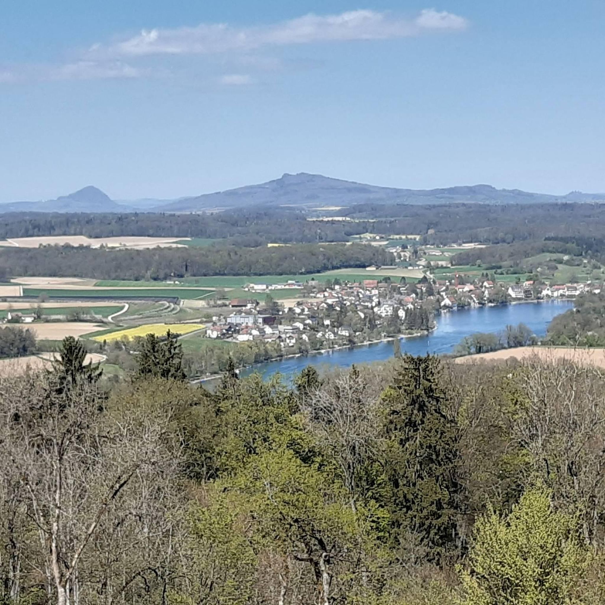
The little town of Stein am Rhein is located where Lake Constance becomes the Rhine again. It is famous for its well-preserved old town with painted facades and half-timbered houses, for which it received the very first Wakker Prize in 1972.
10
0
Frequently Asked Questions
What kind of elevated areas and natural features can I explore around Basadingen-Schlattingen?
The region around Basadingen-Schlattingen is characterized by a gentle rolling landscape with several elevated areas and natural features. You can explore historical sites like the Town Hall of Stein am Rhein, enjoy panoramic views from the Hochwacht Wildensbuch Observation Tower, or visit picturesque spots like the Blauseeli. The Buechberg and Generalstand also offer scenic beauty and hiking opportunities.
Are there historical sites among the elevated areas near Basadingen-Schlattingen?
Yes, the region has several elevated areas with historical significance. The Buechberg, for instance, has archaeological finds from the Neolithic period. The Generalstand is another historical elevated point offering stunning views. Additionally, the Town Hall of Stein am Rhein is a notable historical site constructed between 1539 and 1542, known for its well-preserved old town center.
Where can I find the best panoramic views around Basadingen-Schlattingen?
For excellent panoramic views, consider visiting the Hochwacht Wildensbuch Observation Tower. This 37-meter high wooden tower offers a viewing platform at 33 meters, providing extensive vistas of the Hegau, Black Forest, and even the Alps on clear days. The Generalstand also offers stunning views over vineyards and the surrounding landscape.
What are some family-friendly options for exploring the elevated areas?
Many of the elevated areas and natural features are suitable for families. The Hochwacht Wildensbuch Observation Tower is family-friendly, with tables, benches, and a barbecue area nearby. The Blauseeli offers an easy circular hiking route with a picnic site, perfect for a family outing. The View of Schaffhausen and the Rhine from Feuerthalen Bridge is also considered family-friendly.
Are there easy hiking trails near the elevated areas of Basadingen-Schlattingen?
Yes, there are several easy hiking options. The Buechberg offers easy circular hiking routes. The Blauseeli features an easy 3.6-kilometer circular route with moderate elevation gain. For a short and rewarding hike, consider the route from Fischingen to the Groot, the highest point in the Canton of Thurgau, which offers beautiful forest paths and panoramic views.
What outdoor activities can I do near these elevated areas?
Beyond hiking, you can enjoy various outdoor activities. There are gravel biking routes, such as the 'Nussbaumersee – Helfenberg Castle Ruins loop from Stammheim' or the 'Town Hall of Stein am Rhein – View of Stein am Rhein loop from Diessenhofen'. Running trails are also available, including a 'Running loop from Schlattingen' or routes around Diessenhofen. You can find more details on these activities in the Gravel biking around Basadingen-Schlattingen, Hiking around Basadingen-Schlattingen, and Running Trails around Basadingen-Schlattingen guides.
What is the highest point in the broader Thurgau region?
While Basadingen-Schlattingen itself has a highest point of 568 meters, the highest point in the broader Canton of Thurgau is the Groot, reaching 991.1 meters. It is located in Mosnang, in the neighboring Canton of St. Gallen, but marks the highest elevation of the Thurgau canton. A popular route leads from Fischingen to the Groot, offering panoramic views.
Are there any dog-friendly spots among the elevated areas or natural features?
Yes, the region offers dog-friendly options. For example, the Wangen Pier on Lake Constance has a beautiful shore area where dogs are welcome. Many of the natural hiking trails, such as those around the Buechberg or Blauseeli, are also suitable for walks with dogs, provided they are kept on a leash where necessary.
What do visitors enjoy most about the elevated areas around Basadingen-Schlattingen?
Visitors particularly appreciate the scenic beauty, the variety of hiking opportunities, and the historical significance of the elevated areas. The panoramic views from spots like the Hochwacht Wildensbuch Observation Tower are highly rated. The well-preserved old town of Stein am Rhein and the tranquil natural settings like the Blauseeli also receive positive feedback.
Can I find circular hiking routes in the area?
Yes, circular hiking routes are available. The Buechberg offers easy circular trails for exploring the local landscape. The Blauseeli also features a picturesque circular hiking route of about 3.6 kilometers, perfect for enjoying nature and a picnic.
Are there places to eat or relax near the elevated areas?
Yes, you can find places to eat and relax. The varied hiking trail passing through vineyards over Schlattingen to the Generalstand continues to the idyllic Schupfen inn by the river. Near the Hochwacht Wildensbuch Observation Tower, there are tables, benches, and a barbecue area. The View of Schaffhausen and the Rhine from Feuerthalen Bridge area also features small cafes and bars.
What is the best time of year to visit the elevated areas around Basadingen-Schlattingen?
The elevated areas and natural features around Basadingen-Schlattingen can be enjoyed throughout much of the year. Spring and autumn offer pleasant temperatures for hiking and vibrant natural colors. Summer is ideal for enjoying the Blauseeli and its picnic spots, as well as for activities like gravel biking. Even in winter, some trails can be explored, though conditions may vary.
Most popular routes around Basadingen-Schlattingen
Most popular attractions around Basadingen-Schlattingen

Get inspired with the komoot mobile app


