Top 4 Natural Monuments around Disserth And Trecoed
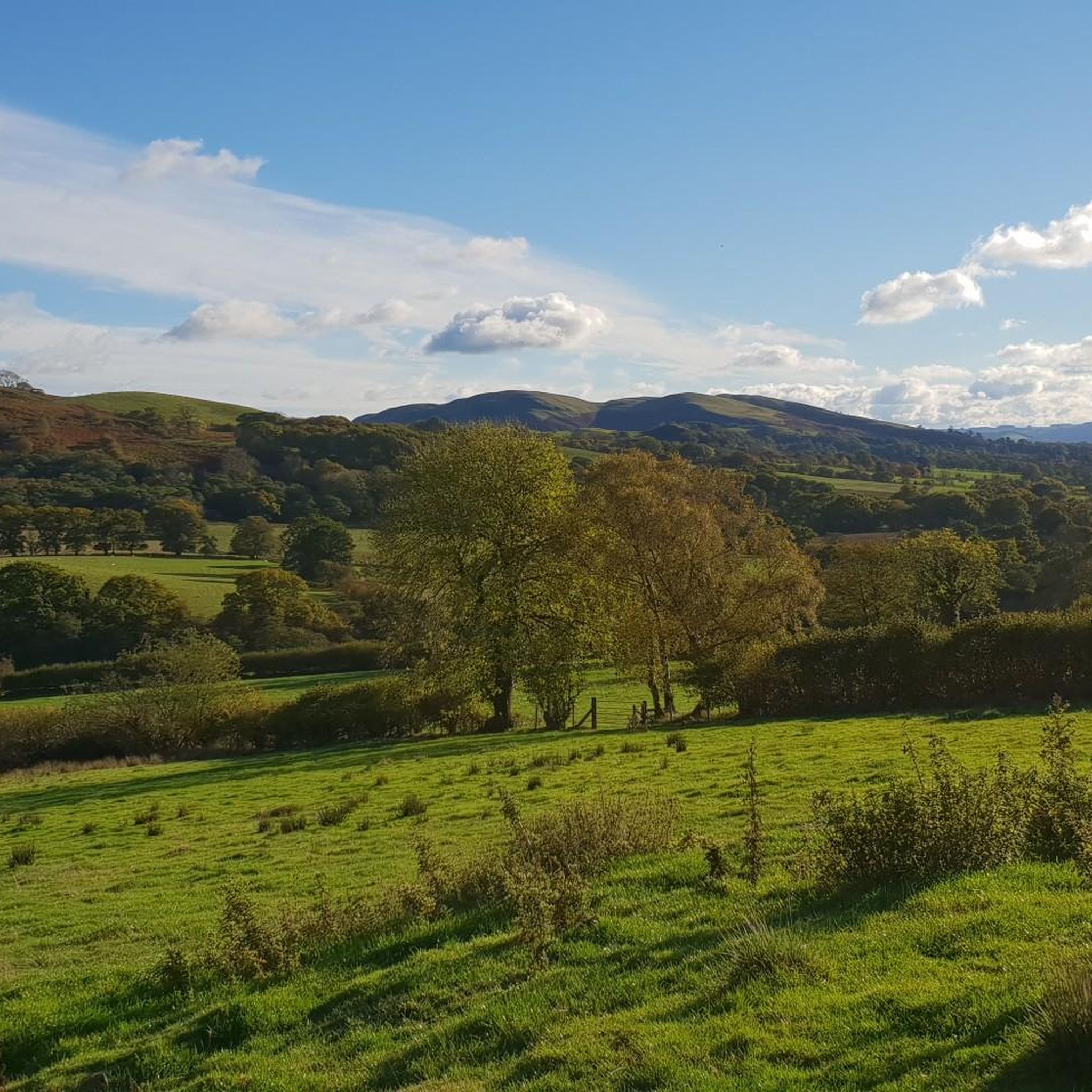
Best natural monuments around Disserth And Trecoed include a variety of natural features, from waterfalls to prominent hill summits. The region, situated in Mid Wales, offers diverse landscapes for exploration. These natural monuments provide opportunities for outdoor activities, including hiking and enjoying scenic views. The area is characterized by its hills, woodlands, and water features, making it a destination for those seeking natural environments.
Best natural monuments around Disserth And Trecoed
- The most popular natural monuments is Water-Break-Its-Neck Waterfall,…
Last updated: July 1, 2026
Water-Break-Its-Neck Waterfall
Highlight • Waterfall
There's a high and low path so you can enjoy both viewpoints.
Tip by

Moelfre Trig Point
Highlight • Natural Monument
You can hike Moelfre along with Garth Hill in one long hike. See my route details here: komoot.com/tour/264906708
Tip by

Sign up now to discover places like this
Get recommendations on the best single tracks, peaks, & plenty of other exciting outdoor places.
Sign up for free
Aberedw Hill Summit
Highlight • Viewpoint
Tip by
Gwaunceste Hill (542 m) Trig Point
Highlight • Natural Monument
Tip by
Gorllwyn Summit Cairn and Trig Point
Highlight • Viewpoint
Tip by
Start today with a free account
Your next adventure awaits.
Login or Signup
Tips from the Community

Gwaunceste Hill 542m P165 (1778ft) TP3545 - Gwaun-Ceste Hill S5648 Welsh Dewey
0
0

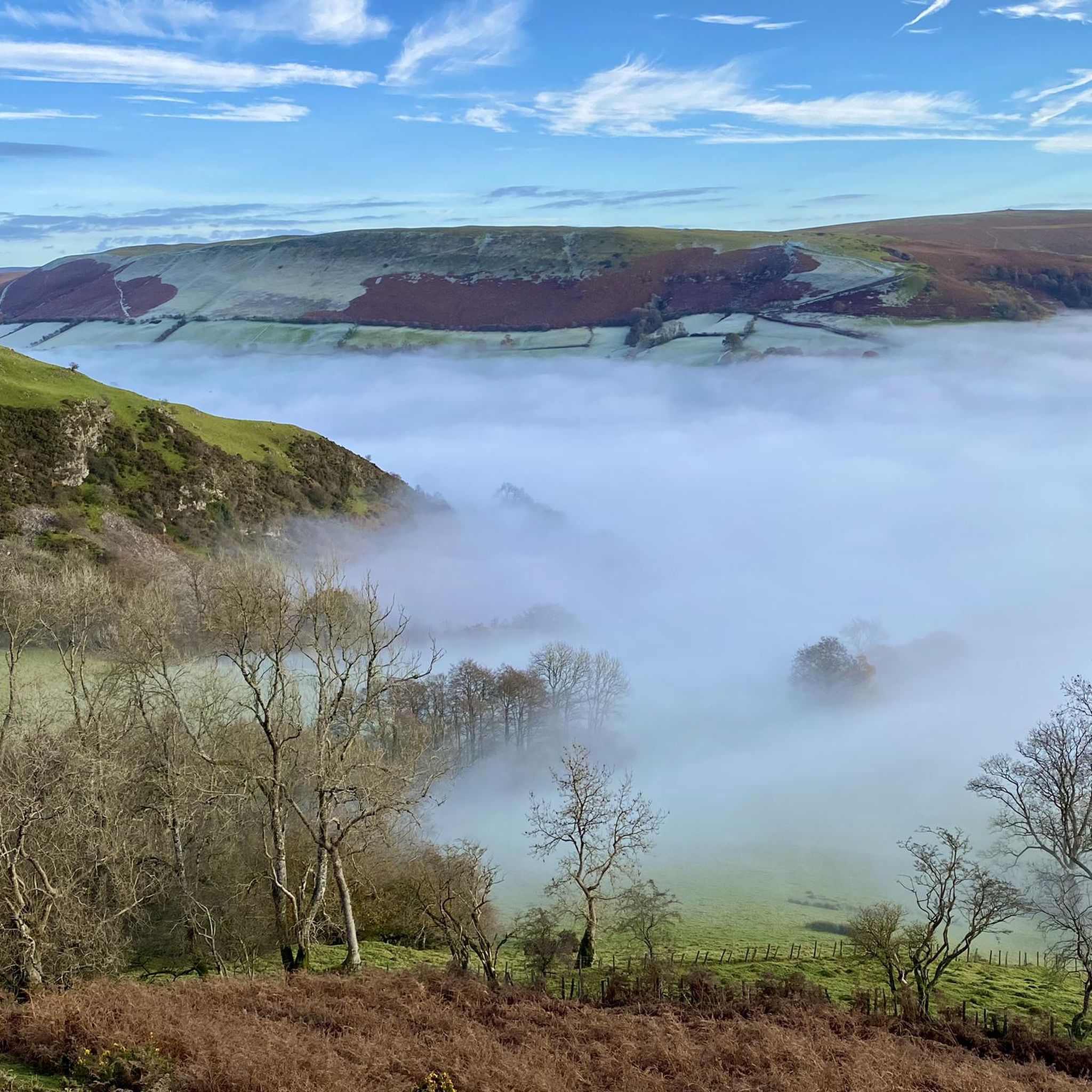
At 441m, Moelfre ("The Bold / Barren Hill") is a Welsh listed Bridget. The trig point is located about 100m East, and a whole 1m lower than the actual summit. It's heather moorland (likely boggy!) terrain. Extensive views on offer in most directions, including views across the Duhonw valley to the South-East.
2
0
The fine rainbow mist surrounding the unusually named Water-break-its-neck waterfall creates a humid micro-climate in this lush green gorge. There's a high and low path so you can enjoy both viewpoints.
3
0

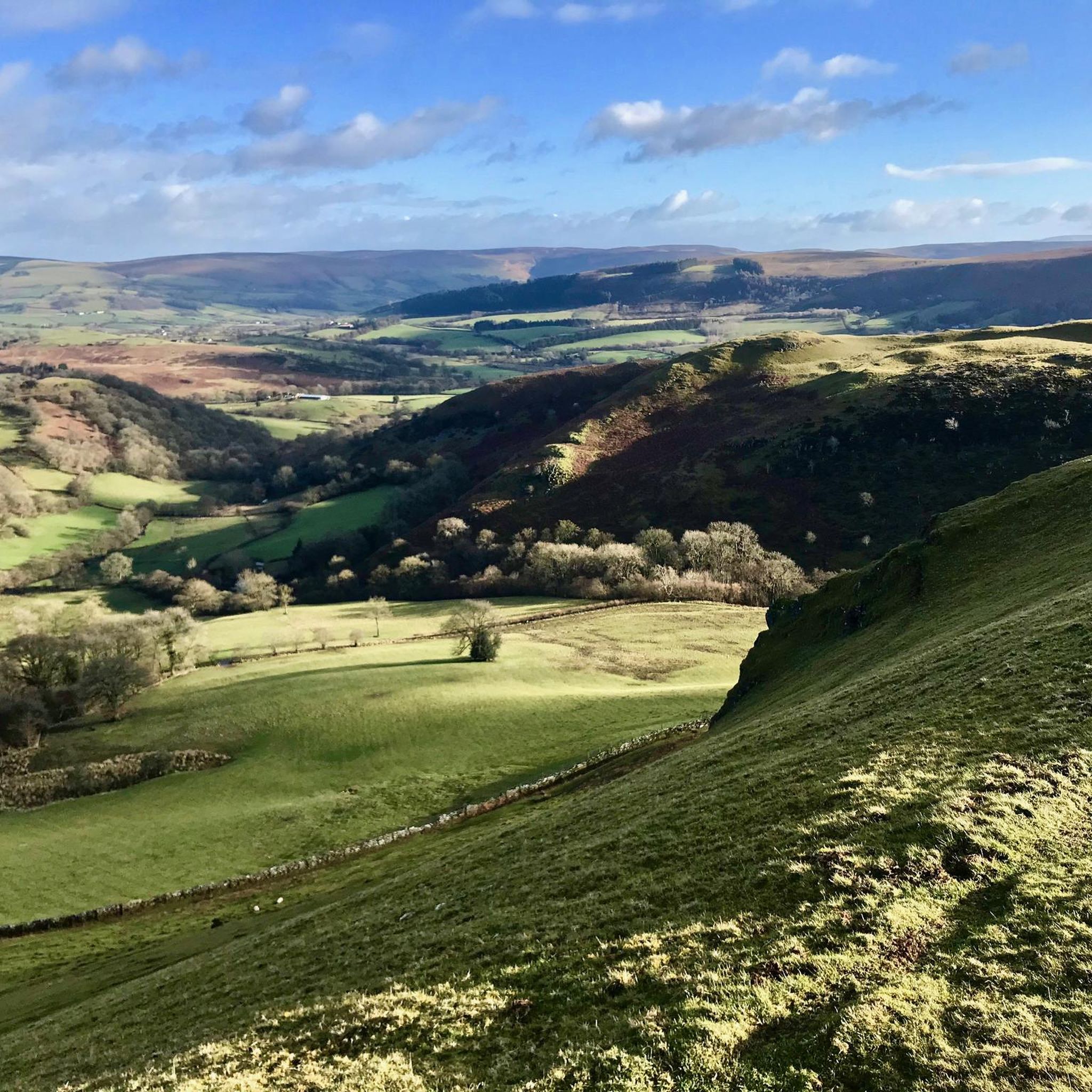
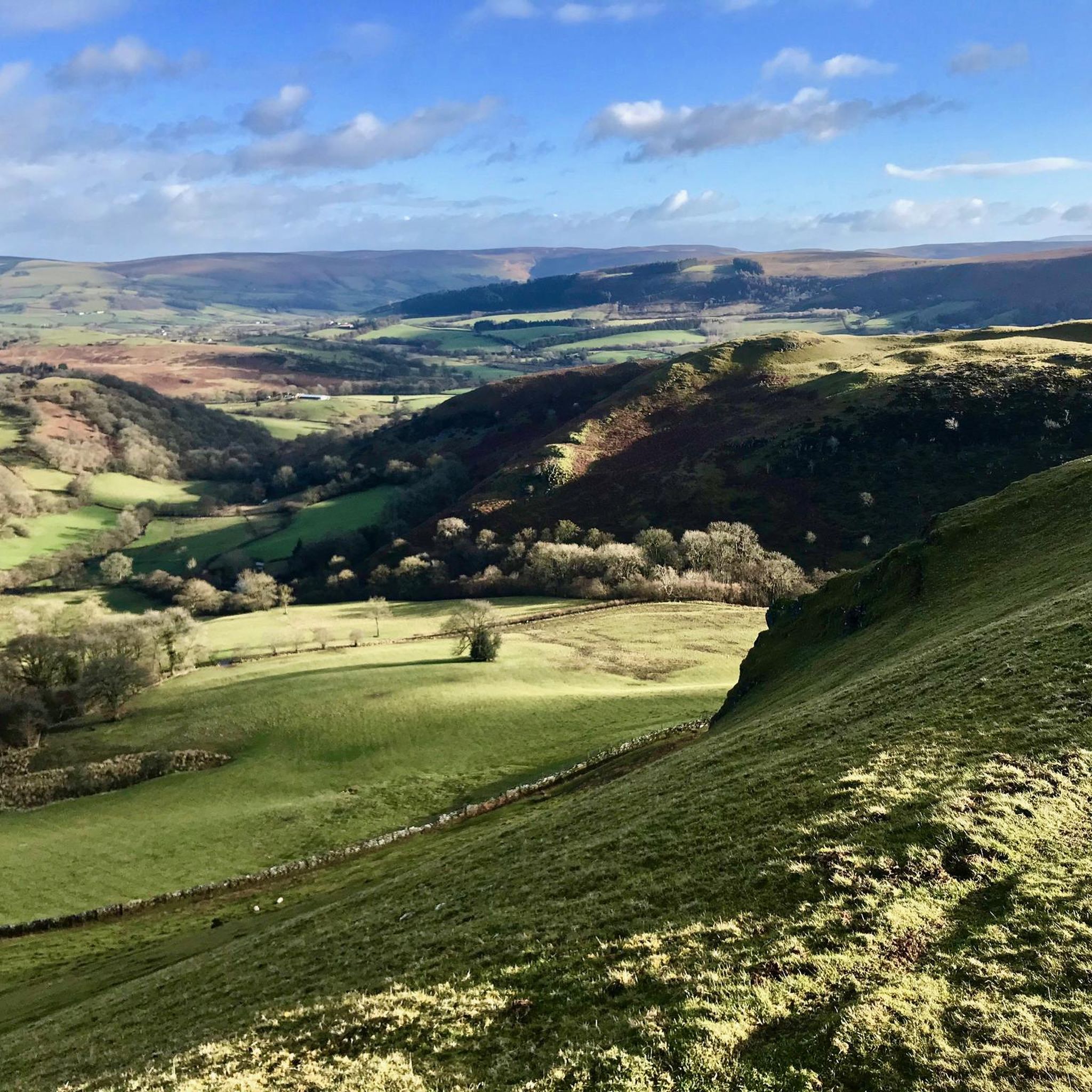
Gwaunceste Hill (Welsh: Bryn Gwaun-cest) is a 542-metre-high hill in the county of Powys in east Wales. It falls within the communities of Gladestry and Glascwm around 4 km east of the village of Hundred House and about 2 km north of the hamlet of Glascwm. The headwaters of the River Arrow gather on the eastern slopes of the hill. Drainage of its western slopes is into the River Edw, a tributary of the River Wye. Two subsidiary tops to the southeast and southwest are both known as ‘Little Hill’. It is a UK listed Marilyn.
2
0
Gorllwyn, at 2,011 feet (612 m) is a subsidiary summit of Drygarn Fawr, located on a remote moorland plateau of the Cambrian Mountains. The summit is grassy and is surrounded by peat bog. There is a shelter cairn and a trig point. To the west is Drygarn Fawr, its large cairns making it a very distinctive feature in an otherwise featureless plateau. Drygarn Fawr is separated from Gorllwyn by the pass of Bwlch y Ddau Faen. To the east the plateau continues towards Y Gamriw. Radnor Forest lies further to the east. It is a UK listed Nuttall.
2
0
Aberedw Hill is a summit in the Mid Wales region or range in Wales, United Kingdom of Great Britain. Aberedw Hill is 451 metres high. It is listed as a UK Marilyn.
4
0
A lovely decent sized hump with a trig point on the outskirts of Builth Wells. Nice viewing point. Height 441m. You can hike Moelfre along with Garth Hill in one long hike. See my route details here: https://www.komoot.com/tour/264906708
3
0
Frequently Asked Questions
What unique natural attractions can I find around Disserth And Trecoed?
The region offers diverse natural attractions. One notable spot is Water-Break-Its-Neck Waterfall, known for its fine rainbow mist and the humid micro-climate it creates in a lush green gorge. You can also explore several prominent hill summits like Aberedw Hill Summit and Moelfre Trig Point, which offer extensive views of the Mid Wales landscape.
Are there family-friendly natural monuments around Disserth And Trecoed?
Yes, Water-Break-Its-Neck Waterfall is considered family-friendly. It's a magical place for all ages to connect with nature, offering opportunities for splashing and exploring in the stream. There are also various waymarked walking trails through Warren Wood, suitable for different activity levels, including an easy 'Waterfall Walk'.
What kind of views can I expect from the natural monuments in the area?
Many natural monuments in Disserth And Trecoed are summits and viewpoints, offering panoramic vistas. For instance, Aberedw Hill Summit (451 meters high) and Moelfre Trig Point (441 meters high) provide extensive views in most directions, including across the Duhonw valley. Gwaunceste Hill (542 m) Trig Point also offers significant views from its elevated position.
What outdoor activities can I do near these natural monuments?
The natural monuments are excellent starting points for various outdoor activities. You can find numerous hiking routes, such as the 'Llandrindod Wells loop via Cefnylls Castle' or easier options like the 'Llandrindod Wells Lake – Journey's End loop'. For cyclists, there are road cycling routes like the 'Rhayader Town Clock – Rhayader Clock Tower loop'. You can explore more options on the Hiking around Disserth And Trecoed and Road Cycling Routes around Disserth And Trecoed guide pages.
Are there any historical natural features or monuments to explore?
While not a natural monument in the traditional sense, the Afon Elan Suspension Bridge in the Rhayader area (part of the wider Elan Valley) offers a unique historical and scenic experience. This quaint rope bridge, reportedly built in 1904, is a point of interest for those exploring the Elan Valley, despite being closed since 1988. Its historical significance and unique architectural style make it a worthwhile stop. You can learn more about it on Wikipedia.
What is the best time to visit the natural monuments in Disserth And Trecoed?
The best time to visit can depend on the specific monument. For Water-Break-Its-Neck Waterfall, it is particularly spectacular after rain when the water flow is strong, creating a more impressive display. During dry spells, the flow can reduce significantly. Generally, spring and autumn offer pleasant temperatures for hiking and exploring the summits.
Are there dog-friendly options among the natural monuments?
Many of the natural monuments and surrounding trails in Disserth And Trecoed are suitable for dog walking, provided dogs are kept under control, especially around livestock. Warren Wood, home to Water-Break-Its-Neck Waterfall, offers waymarked trails that are popular with dog walkers. Always check local signage for specific restrictions.
What kind of geological features can be observed in the natural monuments?
The region's natural monuments showcase various geological features. The lush green gorge of Water-Break-Its-Neck Waterfall is a prime example of water erosion shaping the landscape. The numerous hill summits like Gorllwyn Summit Cairn and Trig Point, Gwaunceste Hill, and Aberedw Hill are part of the Mid Wales region's characteristic hilly terrain, often featuring heather moorland and, in some areas, peat bog.
What do visitors enjoy most about the natural monuments in Disserth And Trecoed?
Visitors particularly appreciate the scenic beauty and the opportunities for outdoor exploration. The 'fine rainbow mist' and 'humid micro-climate' at Water-Break-Its-Neck Waterfall are often highlighted. The extensive views from summits like Moelfre Trig Point and the sense of accomplishment from reaching these high points are also highly valued by the komoot community.
Are there easy walking trails to access the natural monuments?
Yes, there are options for easy walks. For instance, Warren Wood, where Water-Break-Its-Neck Waterfall is located, offers an easy 'Waterfall Walk'. Additionally, the wider area around Disserth And Trecoed has several easy hiking routes, such as the 'Llandrindod Wells Lake – Journey's End loop', which are suitable for a relaxed exploration of the natural surroundings. You can find more easy routes on the Easy hikes around Disserth And Trecoed guide page.
What are the highest natural monuments in the Disserth And Trecoed area?
Among the natural monuments listed, Gwaunceste Hill stands out as one of the highest at 542 meters. Gorllwyn Summit Cairn and Trig Point is also significant at 612 meters, located on a remote moorland plateau. These summits offer challenging hikes and rewarding views.
Most popular attractions around Disserth And Trecoed

Get inspired with the komoot mobile app


Explore more
Extend your search for the best caves by checking out these guides of the top ones around Disserth And Trecoed:
