Top 14 Natural Monuments around Corwen
Best natural monuments around Corwen are found in the scenic Dee Valley of North Wales. The region is characterized by its mountainous terrain, ancient river systems, and significant geological features. These natural features provide opportunities for outdoor exploration and offer diverse landscapes. The area's geology includes formations like Silurian mudstones and Denbigh Grits, shaped by ancient seas and glacial activity.
Best natural monuments around Corwen
- The most popular natural monuments is Horseshoe Falls, a man-made monument that diverts water…
Last updated: October 31, 2026
Cadair Bronwen Summit Cairn
Highlight • Natural Monument
Tip by

Moel Fferna
Highlight • Viewpoint
Tip by

Sign up now to discover places like this
Get recommendations on the best single tracks, peaks, & plenty of other exciting outdoor places.
Horseshoe Falls
Highlight • Monument
Tip by

World's End Road and Ford (Eglwyseg Valley)
Highlight (Segment) • Trail
Tip by

River Rapids Access Point – Clwydian Range and Dee Valley
Highlight • Viewpoint
Tip by

Sign up for free to discover even more natural monuments around Corwen.
Already have an account?
Start today with a free account
Your next adventure awaits.
Tips from the Community

Riding from New Brighton side the ascent is a fairly steady incline but is a sustained effort from the start. At the top it flattens out and the surface isn't great, there are plently of pot holes and loose gravely surface.. but after that the descent starts properly and its fantastic, a great road surface, winding and steep but you can let it go and build up some real speed, an absolutely fantastic ride down. I didn't notice the ford being slippy but others have warned so be aware.
0
0

The Llantysilio Green weir, more commonly known as the Horseshoe Falls, is a 140-meter-long, horseshoe-shaped weir designed by Thomas Telford in 1808 to divert water from the River Dee into the Llangollen Canal. This prominent structure is a significant piece of engineering and a feature of the World Heritage Site, providing water for the canal and attracting tourists with its unique design and surrounding landscape. The Llantysilio Green Car Park is a designated access point for visiting the falls. In the late 19th century a long piece of wood, about 30cm wide, floated on the water here to deflect floating debris away from the canal intake. It was fixed at one end. It’s visible in the photo, taken c.1890. Some trippers couldn’t resist the temptation to walk along it, ignoring a warning sign nearby, if they weren’t spotted by the “waterman” in charge of the sluice. Local residents took a dim view of such “unheeding folly”. 😂😂
4
1

The loop from Llandrillo going anticlockwise is very steady and pleasant. But be prepared for substantial bog trotting in the central part of the valley passing the area marked as Gwern Wynodl. Even with newish goretex boots, we came away with wet feet. Good boots and gaiters, or wellies for that section highly recommended. Return section (first section if doing it clockwise) is also pretty boggy in parts. It also seemed like a bit more of a slog doing it clockwise.
0
0
Located on the River Dee, near to Llantysilio, this masterpiece of Thomas Telford Engineering is where the Pontcysllte Aqueduct and Canal World Heritage site begins. He designed this weir to draw water from the River Dee in to the canal, and it became a stunning addition to the landscape. At 460ft (140M) long, it’s a sight to behold.
6
0
The area is popular with walkers, cyclists and tourists. The Offa's Dyke Path passes through World's End. World's End lies on a single track road from the small village of Minera near Wrexham, which crosses Esclusham Mountain and the Ruabon Moors to a public car park at the top of the Eglwyseg valley. The road crosses the Eglwyseg River by a ford, then goes on towards Pentre Dŵr, under the Horseshoe Pass, leading eventually to Llangollen or onto the Panorama in Trevor. Near World’s End is the manor house Plas Ucha yn Eglwyseg, built in 1563. It was for a time the home of John Jones Maesygarnedd, one of the signatories of the death warrant for Charles I of England. The building is said to stand on the site of a hunting lodge of Owain ap Cadwgan, prince of Powys, where Owain carried Nest (daughter of Rhys ap Tewdwr) when he stole her away from her husband Gerald de Windsor in 1109.
3
0

I really cant stress how slippy the ford is and wet and painful
1
0
The distinctively shaped weir, which is 460 feet (140 m) long, helps create a pool of water that can enter the Llangollen Canal (via an adjacent valve house and flow meter). The canal west of Pontcysyllte Aqueduct and the construction of the weir were authorised by an Act of Parliament obtained in 1804 by the Ellesmere Canal Company. The canal was a navigable feeder, which supplied water to the Ellesmere Canal beyond Pontcysyllte, and to the Chester Canal, to which it connected near Nantwich. Thomas Telford was the civil engineer responsible for the design, and the canal and feeder were completed in 1808.
3
1

At 2,070 feet (630 m), Moel Fferna is the highest point in the Clwydian Range and Dee Valley Area of Outstanding Natural Beauty. However, it belongs to the wider Berwyn Range, which reaches its apex on Cadair Berwyn to the southwest. It's possible to link both on a long walk, along with other summits in the range. The Dee Valley is a good base for hikes to Moel Fferna, with plenty of accommodation options and places to eat and drink.
2
0
Frequently Asked Questions
What are some unique natural monuments to explore near Corwen?
Beyond the well-known spots, consider visiting World's End Road and Ford (Eglwyseg Valley). This nature reserve features woods and moorland, popular with walkers and cyclists, and includes a unique ford crossing. Another interesting site is Caer Drewyn Hillfort, which, while an Iron Age fort, is built from local Denbigh Grits and offers a blend of natural setting and ancient human history, with rare lichens on its stones.
Are there any natural monuments suitable for families with children?
Yes, Horseshoe Falls is a family-friendly natural monument. It's a striking man-made weir on the River Dee, part of a World Heritage Site, offering beautiful views and an interesting engineering marvel. Additionally, Coed Pen y Pigyn, an ancient woodland directly adjoining Corwen town centre, provides accessible trails with animal sculptures and the chance to spot red squirrels, making it ideal for relaxed family strolls.
What kind of hiking opportunities are available around Corwen's natural monuments?
The region offers diverse hiking. For mountain enthusiasts, Cadair Bronwen Summit Cairn in the Berwyn range provides opportunities for ridge walks, though be prepared for potentially boggy sections. For easier walks, the Dee Valley offers gentle river walks, and the Dee Valley Way provides amazing views and wildlife spotting. You can find more options for easy hikes in the area by checking out the Easy hikes around Corwen guide.
Where can I experience spectacular views of the landscape?
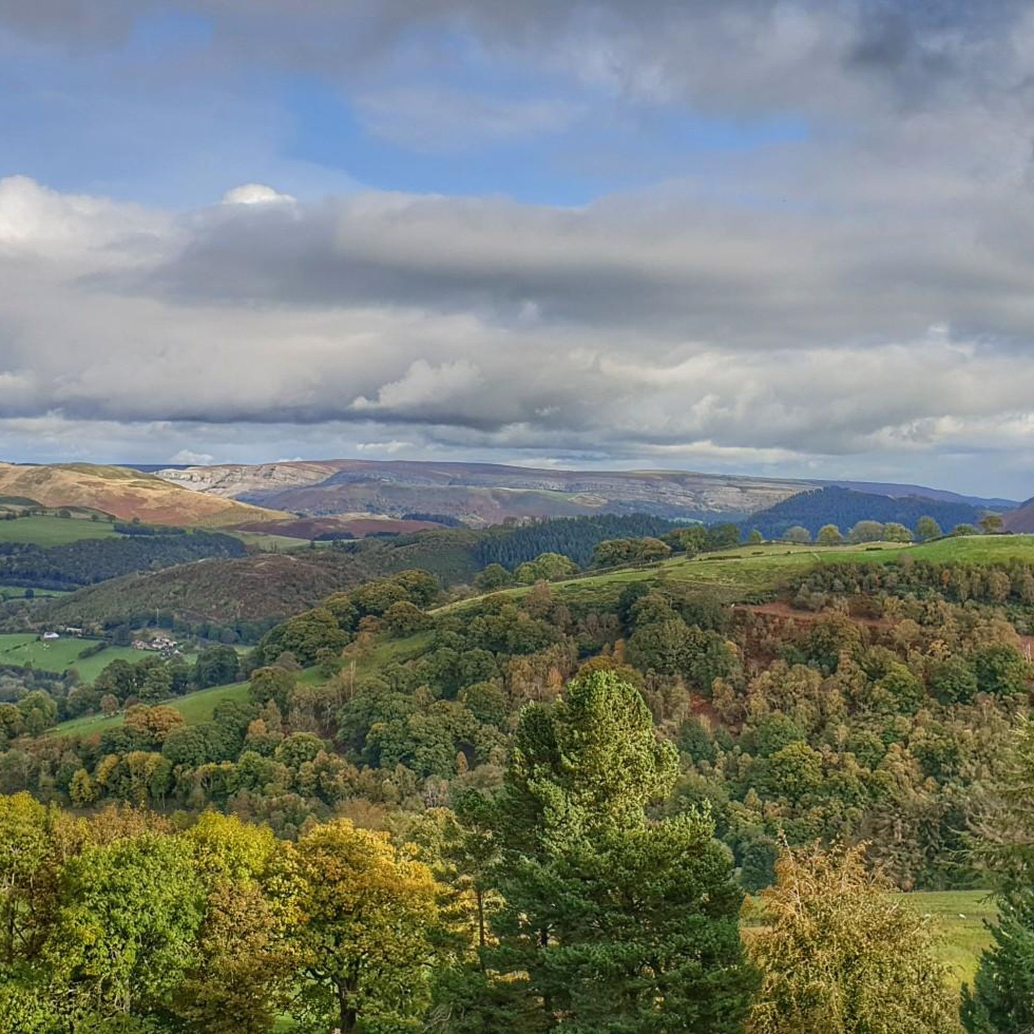
For panoramic vistas, head to Moel Fferna, the highest point in the Clwydian Range and Dee Valley Area of Outstanding Natural Beauty. Its summit offers expansive views. The Berwyn Mountains in general provide 'great views' and a sense of solitude. The Dee Valley also boasts 'spectacular scenery' along its ancient river course.
What are the geological highlights of the Corwen area?
The Dee Valley itself is a significant geological feature, shaped by glaciers and ice sheets. The cliffs behind Corwen were formed around 425 million years ago from Silurian mudstones and hard Denbigh Grits. These same Denbigh Grits were used to construct the ramparts of Caer Drewyn Hillfort, showcasing the direct link between the natural geology and ancient human activity in the area.
Are there any natural monuments that are also historically significant?
Yes, Horseshoe Falls is a prime example. While a natural monument due to its river setting, it's also a significant historical site and an engineering masterpiece designed by Thomas Telford in 1808 to divert water into the Llangollen Canal, forming part of a World Heritage Site. Chirk Castle, though primarily a castle, is set within 480 acres of estate parkland that is designated a Site of Special Scientific Interest due to its natural biodiversity.
Can I go cycling near the natural monuments in Corwen?
Absolutely. The area around Corwen is excellent for cycling. World's End Road and Ford (Eglwyseg Valley) is particularly popular with cyclists, offering a scenic single-lane road through a nature reserve. For more cycling routes, you can explore the Road Cycling Routes around Corwen guide or the Gravel biking around Corwen guide.
What is the best time of year to visit the natural monuments around Corwen?
The natural monuments around Corwen offer beauty year-round. Spring and summer provide lush greenery and warmer weather ideal for hiking and outdoor activities. Autumn brings vibrant foliage to the woodlands and valleys. While some mountain paths can be boggy, the region's natural beauty, including the Berwyn Mountains and Dee Valley, can be appreciated in all seasons, with winter offering a sense of solitude.
Are there any natural monuments that are particularly good for wildlife spotting?
Coed Pen y Pigyn, an ancient woodland adjacent to Corwen town, is home to red squirrels, a rare species in Wales, making it an excellent spot for wildlife observation. The Dee Valley Way, following the River Dee, also provides opportunities for spotting various wildlife in its natural habitat.
Where can I find information about walking trails with different difficulty levels?
For easy walks, the Easy hikes around Corwen guide offers several options, including trails near Horseshoe Falls. For intermediate to challenging routes, the Berwyn Mountains, including ascents to Cadair Bronwen Summit Cairn and Moel Fferna, provide more strenuous options. Llyn Brenig, a bit further afield, also offers numerous walking routes with varying difficulties and 'spectacular views'.
Are there any natural monuments that are part of a larger protected area?
Yes, Moel Fferna is the highest point in the Clwydian Range and Dee Valley Area of Outstanding Natural Beauty (AONB). The wider Berwyn Range, which includes Moel Fferna and Cadair Bronwen Summit Cairn, is a significant part of this protected landscape. You can learn more about these areas at visitwales.com.
What are some options for circular walks around Corwen's natural monuments?
A circular walk taking in Caer Drewyn Hillfort and the Corwen Cutting offers fantastic views of the surrounding natural landscape. For mountain walks, the loop from Llandrillo going anticlockwise to Cadair Bronwen Summit Cairn is a steady and pleasant option, though some sections can be boggy. Llyn Brenig, while further out, also features the Two Lakes Walking Trail, which is a winding path through trees and forest tracks.
Most popular attractions around Corwen
Get inspired with the komoot mobile app


Explore more
Extend your search for the best caves by checking out these guides of the top ones around Corwen: