Top 7 Natural Monuments around San Bernardino
Best natural monuments around San Bernardino are characterized by diverse landscapes, including mountains, valleys, and forests. The region features significant natural formations, from high peaks to unique geological sites. These areas offer a range of outdoor experiences, preserving natural beauty and providing opportunities for exploration. San Bernardino County encompasses various natural monuments, including those within the San Bernardino National Forest.
Best natural monuments around San Bernardino
- The most popular natural monuments is Etiwanda Falls, a waterfall that offers a…
Last updated: October 11, 2026
Etiwanda Falls
Highlight • Waterfall
Tip by

Box Springs Mountain Peak
Highlight • Summit
Tip by

Sign up now to discover places like this
Get recommendations on the best single tracks, peaks, & plenty of other exciting outdoor places.
Heart Rock Trail
Highlight • Trail
Tip by
Pilot Rock
Highlight • Viewpoint
Tip by

Rim of the World Scenic Byway
Highlight (Segment) • Viewpoint
Tip by

Sign up for free to discover even more natural monuments around San Bernardino.
Already have an account?
Start today with a free account
Your next adventure awaits.

Tips from the Community

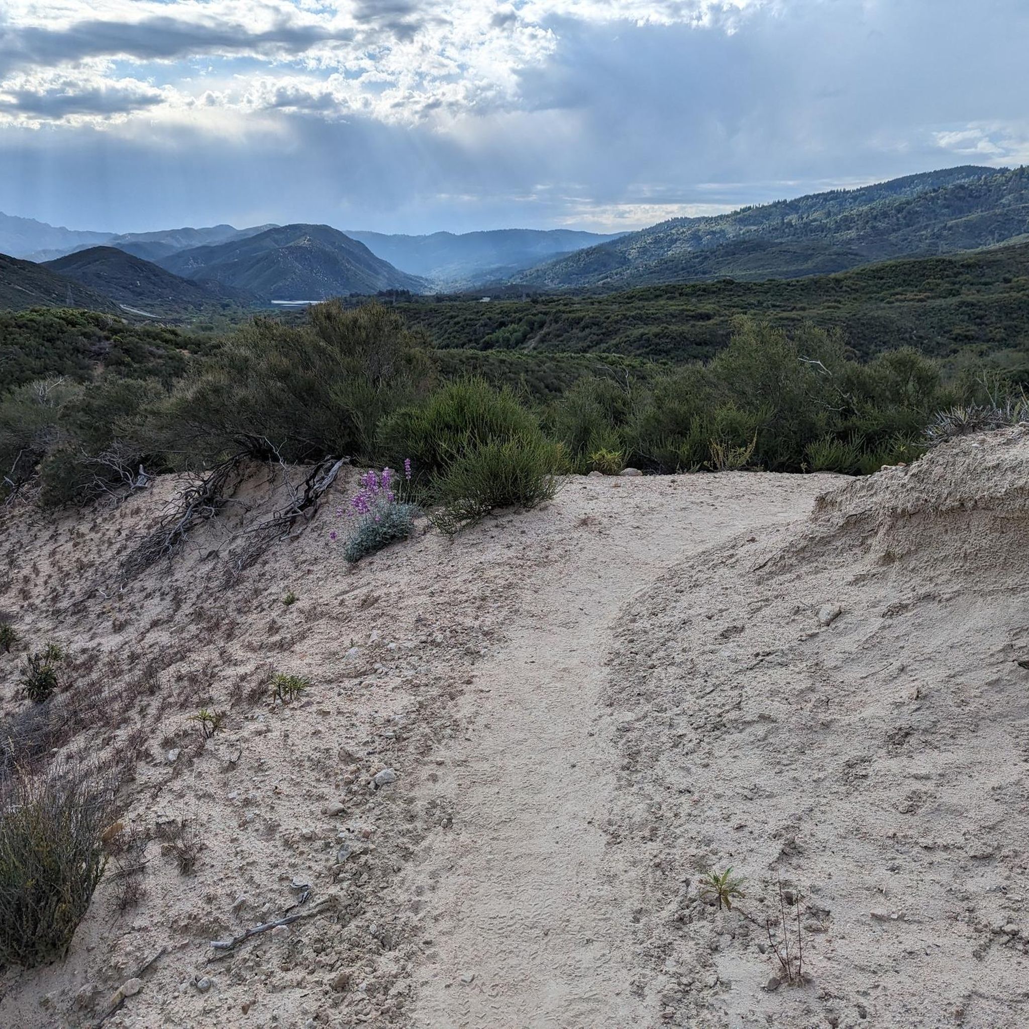
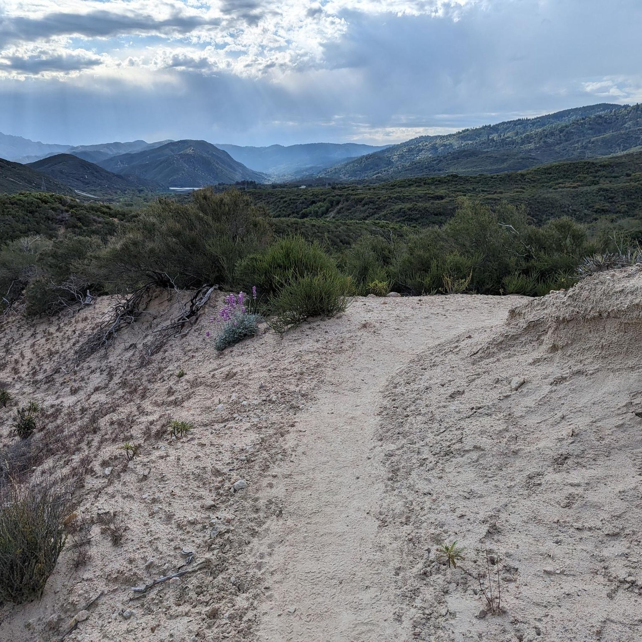
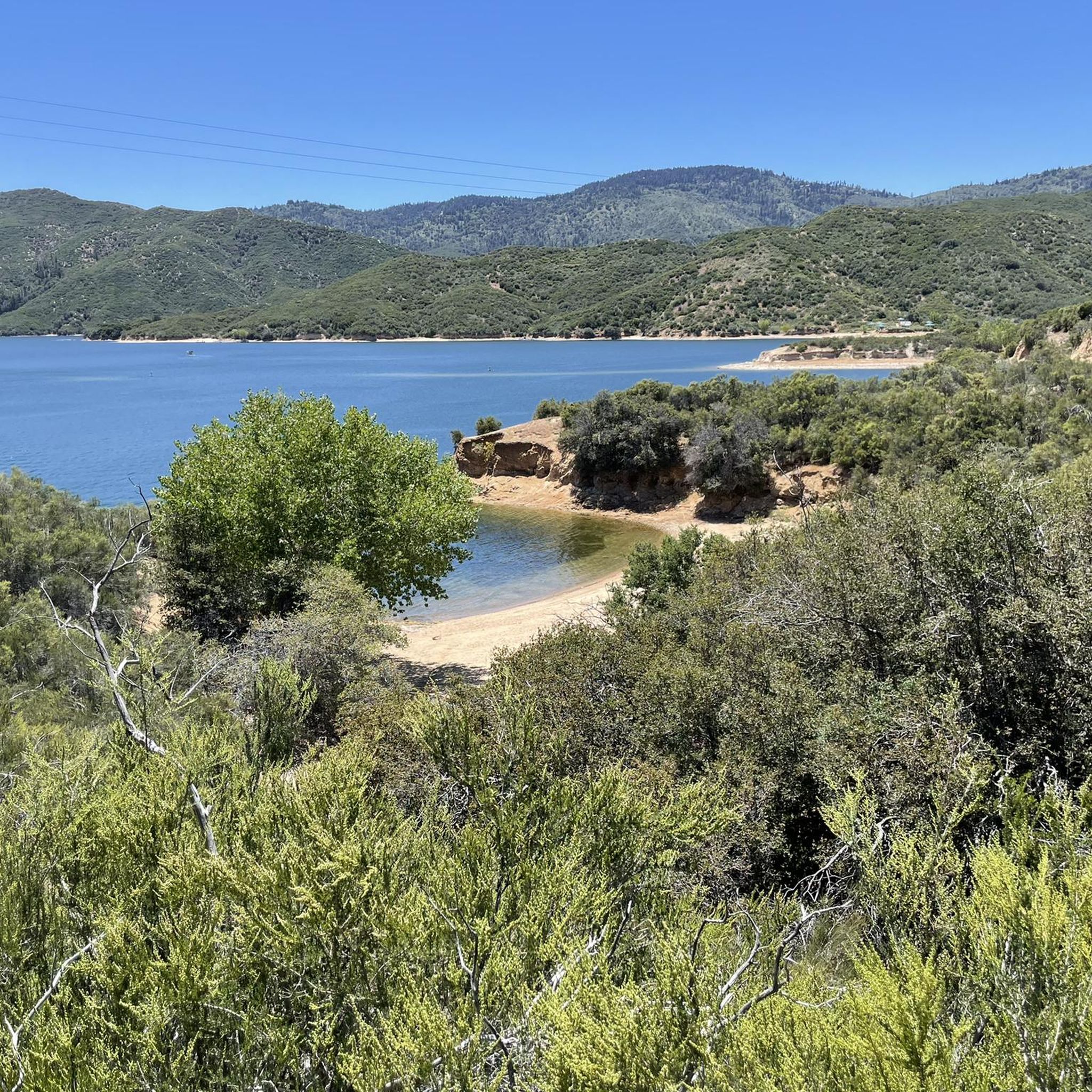
Follow the OHV route (2N33) for a rugged hike with dirt roads, rocky sections, and big views over Silverwood Lake and the surrounding hills from Pilot Rock. Expect moderate climbs, limited shade, and some loose footing—great for those wanting a backcountry feel close to Lake Arrowhead. Bring plenty of water and offline maps.
0
0

This windy but picturesque stretch is just a small part of the 110-mile-long Rim of the World Scenic Byway. Here, you'll enjoy great views of the San Bernardino Mountains as you navigate the curves, but please proceed with caution. As you ascend from San Bernardino, the climate shifts dramatically from desert to mountainous oasis.
0
0

Box Springs Mountain Reserve is located on 3,400 beautiful acres of land that overlook the cities of Riverside and Moreno Valley. The Reserve once was covered in dense Coastal Sage Scrub, but recent wildfires have allowed non-native grasses to thrive. Visitors should be conscious of their activities while visiting the Reserve in order to protect wildlife and their delicate ecosystem.
0
0

The wonderfully wooded trail leads you over a short distance to a rock in which the water has washed an almost perfect heart shape over many years. A great destination for lovers and lovers of nature!
3
1
Close to the suburbs of Los Angeles, the hike to Etiwanda Falls is short enough for a stroll, but takes away the stress of the big city. Especially on a hot day you will enjoy the shady canyon with the cool water besides the beautiful scenery. You can park your car at the North Etiwanda Preserve Parking Lot which is also the trailhead. The park opens at 6.30 a.m.
1
0
Frequently Asked Questions
What are some popular natural monuments to visit around San Bernardino?
The region offers a variety of natural monuments. Popular choices include Etiwanda Falls, known for its short, shady hike, and Box Springs Mountain Peak, which provides expansive views over Riverside and Moreno Valley. Another favorite is Pilot Rock, offering rugged hiking and views of Silverwood Lake.
Are there family-friendly natural monuments around San Bernardino?
Yes, several natural monuments are suitable for families. Etiwanda Falls offers a refreshing, short hike through a shady canyon, perfect for a family stroll. The Heart Rock Trail is another wonderful option, leading to a unique heart-shaped rock formation.
What unique geological formations can I see around San Bernardino?
San Bernardino County is home to several striking geological formations. You can explore the extinct volcanic cinder cone of Amboy Crater in the Mojave Desert, or witness the impressive stalactite and stalagmite formations within Mitchell Caverns. Rainbow Basin is known for its vibrant, multi-colored sedimentary rock, and the Trona Pinnacles offer surreal tufa formations rising from the lakebed.
What is the best time of year to visit the natural monuments in San Bernardino?
The best time to visit depends on the specific monument and activity. The San Bernardino National Forest offers diverse climates; lower elevations are pleasant in spring and fall, while higher mountain areas are ideal for summer hiking. Winter brings opportunities for snow recreation in the mountains. For desert monuments like Amboy Crater, cooler months (fall to spring) are generally more comfortable.
Are there waterfalls to visit around San Bernardino?
Yes, the region features several beautiful waterfalls. Etiwanda Falls is easily accessible and offers a pleasant hike. Within the San Bernardino National Forest, you can also find two of Southern California's tallest waterfalls, Big Falls and Bonita Falls, offering more challenging treks.
What are some popular hiking trails near San Bernardino's natural monuments?
Beyond the specific highlights, the San Bernardino National Forest offers hundreds of miles of trails. For a challenging experience, consider the trails leading to Mount San Gorgonio, Southern California's tallest peak. Shorter, scenic options include the hike to Etiwanda Falls or the Heart Rock Trail. For a backcountry feel, the route to Pilot Rock provides rugged terrain and views.
What are the difficulty levels of hiking trails near San Bernardino's natural monuments?
Trail difficulties vary significantly. Hikes like Etiwanda Falls and Heart Rock Trail are generally considered easy to moderate. Trails to viewpoints like Pilot Rock and Box Springs Mountain Peak are typically intermediate, involving moderate climbs and sometimes rugged terrain. More challenging routes, such as those to Mount San Gorgonio, are suitable for experienced hikers.
Can I spot wildlife at the natural monuments in San Bernardino?
Yes, the diverse ecosystems, particularly within the San Bernardino National Forest, support a variety of wildlife. Visitors might spot mule deer, bighorn sheep, and even black bears. The numerous wilderness areas, such as San Gorgonio and Cucamonga, provide protected habitats for these species.
What other outdoor activities can I do near the natural monuments?
Beyond exploring the monuments themselves, the San Bernardino area offers a wide range of outdoor activities. You can find numerous routes for running, cycling, and mountain biking. Lakes like Big Bear Lake and Lake Gregory provide opportunities for fishing, boating, and scenic walks. The Rim of the World Scenic Drive is also popular for scenic exploration.
Where can I find the best viewpoints of the San Bernardino mountains?
For sweeping vistas, the Rim of the World Scenic Byway offers spectacular views of the valley and mountains. Box Springs Mountain Peak provides panoramic views overlooking Riverside and Moreno Valley. Additionally, Pilot Rock offers rugged views over Silverwood Lake and the surrounding hills.
Are permits required for hiking in certain natural monument areas?
Yes, permits may be required for certain wilderness areas, particularly for overnight stays or specific trails within the San Bernardino National Forest. For example, wilderness permits are often needed for areas like the San Gorgonio Wilderness. It's advisable to check with the local forest service or park authorities for specific requirements before your visit.
Are there dog-friendly natural monuments in the San Bernardino area?
Many natural areas in San Bernardino County are dog-friendly, but regulations can vary by specific park, trail, or wilderness area. It's always best to check the rules for the particular natural monument you plan to visit. Generally, dogs are welcome on leash in many parts of the San Bernardino National Forest, but may be restricted in sensitive wildlife areas or specific trails.
Most popular attractions around San Bernardino

Get inspired with the komoot mobile app


Explore more
Extend your search for the best caves by checking out these guides of the top ones around San Bernardino:
