Top 6 Natural Monuments on the Åland Islands
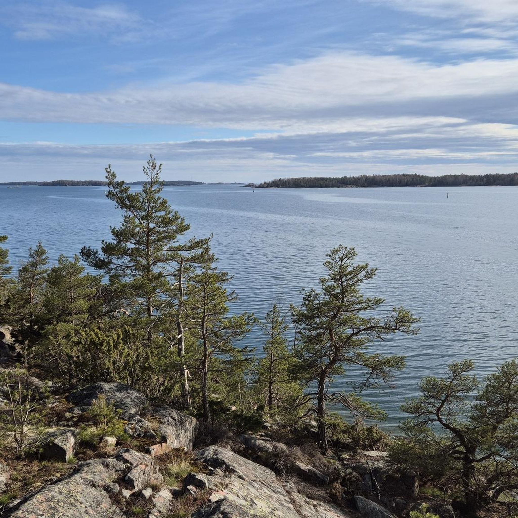
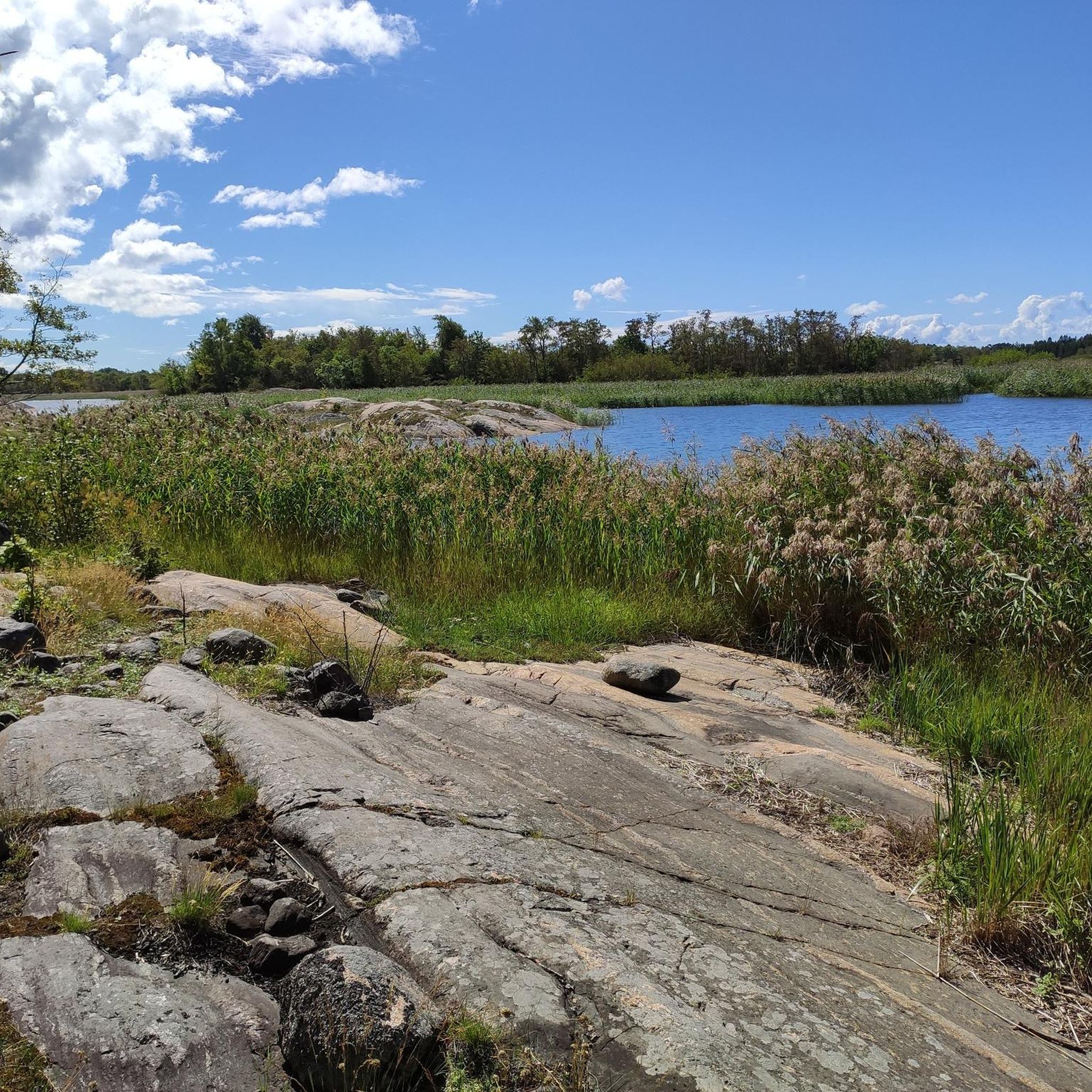
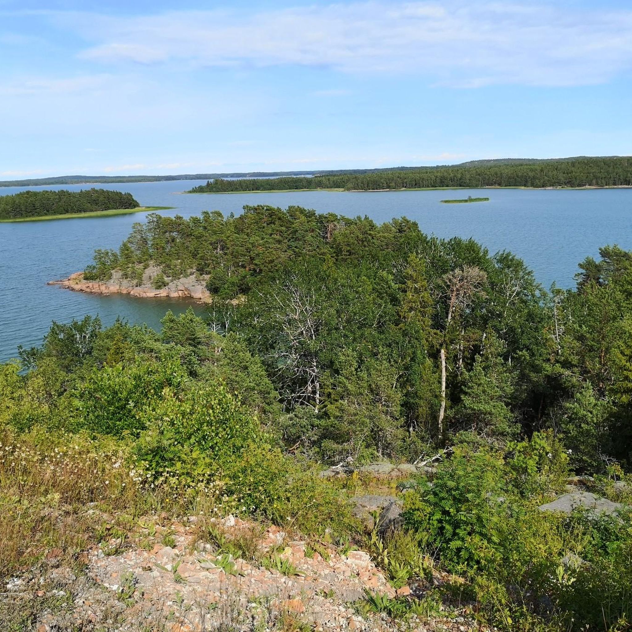
Best natural monuments on the Åland Islands feature a diverse landscape characterized by an expansive archipelago, rocky coastlines, and dense forests. This autonomous region of Finland offers unique geological formations, including ancient rock formations and glacial features. The islands provide opportunities to explore varied natural environments, from serene nature reserves to panoramic viewpoints.
Best natural monuments on the Åland Islands
- The most popular natural monuments is Ingbyberget Viewpoint, Trollkyrkan Cave, and Stone Fields, a viewpoint that offers a hike…
Last updated: October 9, 2026
The Ship’s Bow
Highlight • Natural Monument
Showing Translation
Tip by

Ramsholmen Nature Reserve
Highlight • Forest
Translated by Google •
Tip by

Sign up now to discover places like this
Get recommendations on the best single tracks, peaks, & plenty of other exciting outdoor places.
Glacial Boulder Field
Highlight • Natural Monument
Translated by Google •
Tip by

The Cave
Highlight • Cave
Showing Translation
Tip by
The Castle Courtyard
Highlight • Natural Monument
THE STEEP CLIFF TO THE BOTTOM OF THE CAVE IS 6 METERS. BUT TO THE ROCKS IT IS A BIT MORE. MR. …
Showing Translation
Tip by
Ingbyberget Viewpoint, Trollkyrkan Cave, and Stone Fields
Highlight • Viewpoint
Tip by

Nåtö–Jungruskär Nature Reserve
Highlight • Natural Monument
Translated by Google •
Tip by

Lichen and Moss Trail
Highlight • Trail
Translated by Google •
Tip by

View Above the Ruins of Russian Fortifications on Kalen, Kökar
Highlight • Historical Site
Tip by
Start today with a free account
Your next adventure awaits.

Other adventures on the Åland Islands

Tips from the Community

THE BLOCKS SCATTERED HERE WERE CARRIED BY THE INLAND ICE 15,000 YEARS AGO. BUT THEY DID NOT GO FAR. MANY OF THEM DID NOT GO FURTHER THAN TWENTY METERS FROM THE CLIFF FROM WHICH THEY ONCE BROKE OFF. THEY DID SO BECAUSE THE ÅLAND RAPAKIVI GRANITE TENDS TO BREAK INTO STRAIGHT-LINED BLOCKS. A STONE LIKE THIS WAS HURLED HERE IN FEBRUARY 1996. THE HUGE SHIP ARCH HERE ON THE STEEP, ACCORDING TO A THEORY BY MR. PAUL MÖRN, WAS BROUGHT DOWN IN 1823. THEN IN JANUARY, "A STRONG EARTHQUAKE WAS REGISTERED IN THIS COMMUNITY". IT SEEMS QUITE POSSIBLE THAT THE AVALANCHE CAUSED THE VIBRATIONS IN THE EARTH MENTIONED IN A PUBLICATION FROM THE LAST CENTURY. MR. MÖRN WEIGHED THE ARCHES UP TO 1,070,000 KG. THE HEIGHT IS ELEVEN METERS AND THE WIDTH AT THE BASE IS: 7.5 METERS. THE EXCLUSIVE FORM OF THE ROCK HAS INSPIRED AT LEAST ONE ARCHITECT. IN LA DÉFENSE, IN PARIS, THERE IS A SKYSCRAPER WITH EXACTLY THE SAME PROPORTIONS. SO IF YOU SEE SOMEONE LURKING HERE WITH MEASURING TAPES AND DRAWING PENCILS, HE IS PROBABLY A FRENCH ARCHITECT.
2
0
THIS IS THE ENTRANCE TO THE CASTLE COURTYARD. THE STEEP CLIFF TO THE BOTTOM OF THE CAVE IS 6 METERS. BUT TO THE ROCKS IT IS A BIT MORE. MR. PAUL MÖRN MEASURED THE SOIL LAYER OF THE COURTYARD AT 30 CENTIMETERS, ONE FOOT. IT CONSISTS OF MELTED PLANTS THAT HAVE BEEN DEPOSITED IN LAYERS SINCE THE END OF THE ICE AGE. -WITH KIND PERMISSION OF THE AUTHOR. IT IS DIFFICULT TO SAY HOW THE CASTLE COURTYARD WAS FORMED. PERHAPS IT WAS THE SEA SPRITE WHO CAME HERE TO RELEASE THE FOREST SPRITE FOR COMPANY. WHAT WE DO KNOW IS THAT THE OLD VOLLMAR TROBERG SAW THE SEA SPRITE NEARBY. HE IS A TINY OLD GREY MAN WITH LONG HAIR. -WHAT THE FOREST ROAD LOOKS LIKE IS UNKNOWN. BUT KEEP YOUR EYES OPEN IN THESE CLIFFS.
1
0

Zelten bei Mitternachtsstimmung mit Ausblick auf die Archipelagen - Blick auf den Hafen und den Überwachungsturm der Küstenwacht. Ungestörtes Zelten möglich. Camping in the midnight atmosphere with a view of the archipelago - view of the harbor and the coast guard monitoring tower. Undisturbed camping possible. Several of the ancient and historical monuments of Kökar are situated on Kalen, remnants of seal hunting activities both from the early Bronze Age and the late Iron Age, as well as extensive remnants of Russian fortifications from the First World War, and of Finnish fortifications from the Second World War. Today, there are only ruins left of the fortifications, but the place is still worth visiting. On Kalen there are also barrows, a labyrinth and mounds of stones that were used for making train oil during the Iron Age. There is a walking trail leading through the area. You can choose a longer or a shorter distance. A map of the walking trail can be collected at the office of the Kökar municipality, weekdays between 10 am and 2 pm. Remnants from the World Wars 1915-1918 Russian coastal battery In spring 1915, the first Russians came to Kökar to set up a small radio- and surveillance post at Kalen. The following year they started to build a coastal battery, as part of a larger defense system, called ”Åbo-Åland Archipelago Position”. By the autumn of 1917, the battery was partly operational and consisted of three 120mm twin-guns with double barrels, placed behind concrete walls. A few hundred meters to NW there were a barracks compelx for the crew, 100-150 men, and for the workers. From the battery a small railroad for horse-towed wagons led down to the harbour at Sandvik. The construction works continued until January 1918, when they were stopped due to the turbulent situation in Finland and Russia. The battery was never finished. In the same year Finland, Sweden and Germany decided that the fortifications on Åland had to be destroyed. Accordingly, the coastal battery on Kökar was demolished in 1919. The military equipment was taken over by the Finnish Navy, the barracks were sold, and finally the permanent constructions were destroyed. 1939-1940 Finnish costal fortifikation In the beginning of the Winter War, Kökar was fortified for the second time. Finnish troops arrived on December 2, 1939, and set up a temporary costal fort, consisting of three 152 mm naval guns. Although Soviet bomber aircrafts regularly flew over Kökar, they never attacked, and the battery never opened fire. After the declaration of peace on March 13, 1940, it was decided to build a permanent fort. This new phase started in April 1940, when 30 swedish construction workers arrived. Together with local workers from Kökar they started to build in reinforced concrete. The work were, however, abruptly halted in early July, after Soviet demands that Åland had to be demilitarized. The guns and the barracks were dismantled and transported to Alskär in the Turku archipelago, where a new temporarry fort was set up. Finally, in Oktober 1940, the half-finished constructions on Kökar were once again demolished. 1941-1945 Finnish costal fortifikation In the first days of the Continutation War, Kökar was fortified for the third time in only 25 years. The same coastal guns were brought back, and during the following years a strong permanent fort was built. The main constuctions were three emplacements for 152 mm guns, one range-finding tower, one bunker, several machine-gun nests, and approximately 30 buildings. The largest project was a 50 m long tunnel blasted into the rock, containing technical facilities for electricity and ventilation, a fire-control station, and accomodation for 120 men. In a side tunnel there was a small field hostpital, with facilities for surgery and for treating the wounded and for surgical operations. In the cease-fire treaty signed by Finland and the Soviet Union in September 1944, it was stated that Åland once again had to be demilitarized. The fort was dismantled and the guns, ammunition and barracks were transported back to Alskär. In the spring of 1945, the very strong constructions were finally destroyed by the use of several tons of explosives.
1
0
Ramsholmen is a deciduous forest area. Deciduous forests were a natural part of the Åland landscape until the 18th century. However, changes in agricultural practices contributed to the overgrowth of most deciduous forest areas during the 19th century. Today, this type of cultural landscape is only maintained in a limited number of areas. The deciduous forest is our most species-rich natural type. During the spring and summer months, the floral splendor is intoxicating. Enjoy a landscape full of wood anemones, cowslips, clipped ash trees, hazel groves, and shore meadows, or simply poke your nose into the greenery and identify orchids, lilies, and other rare plants with the help of the field flora. The abundant occurrence of the strongly fragrant, garlicky wild garlic (Swedish: Ramslök) probably gave this area its name. Every year in July, the hay is harvested in a very unique way. The hay from the meadows and the leaves of the ancient, clipped ash trees are harvested as fodder for the animals. Ramsholmen also boasts considerable birdlife. Seabirds, waders, and other species breed here or forage in the diverse landscape. Torpfjärden, east of Ramsholmen, is one of Åland's most beautiful bird areas.
1
0

An enchanted world at the end of July, even when it rains. A variety of mosses, lichens, fungi. So pretty! The cup lichen Cladonia coccifera is in bloom.
0
0

Beautiful nature reserve with hiking trail.
0
0

In spring there are beautiful forest meadows in bloom! This is worth a trip, even a longer one. I recommend to visit in last half of may, as the scenery is simply breathtaking!
0
0
Frequently Asked Questions
What are some unique geological features to explore on the Åland Islands?
The Åland Islands offer fascinating geological formations. You can visit the Glacial Boulder Field, characterized by challenging terrain with scree and large rock formations. Another notable site is Källskär Island, known for a peculiar ice-age rock formation resembling a cauldron, accessible by excursions from Kökar during summer. The Geta Caves also feature impressive caves and stately rock formations.
Which natural monuments are suitable for families with children?
Several natural monuments on the Åland Islands are family-friendly. Ingbyberget Viewpoint, Trollkyrkan Cave, and Stone Fields offers a short, easy hike suitable for children, with a small cave and a viewing platform. Ramsholmen Nature Reserve and Nåtö–Jungruskär Nature Reserve both feature accessible forest trails. The Geta Caves area also has a shorter 'Trollstigen' trail specifically designed for families with younger children, while the Lichen and Moss Trail provides an enchanting, easy walk through a diverse forest.
Where can I find the best scenic views among the natural monuments?
For breathtaking scenic views, consider visiting Ingbyberget Viewpoint, which offers a viewing platform after a pleasant forest hike. The Geta Caves (Grottstigen nature trail) in Geta also provide panoramic sea views. Additionally, the View Above the Ruins of Russian Fortifications on Kalen, Kökar offers expansive vistas of the archipelago.
What is the best time of year to visit the natural monuments on the Åland Islands?
The Åland Islands offer different appeals throughout the year. Spring is ideal for witnessing wildflowers, such as wild anemones and primroses, especially in areas like Ramsholmen Nature Reserve and Nåtö–Jungruskär Nature Reserve, which are known for their blooming forest meadows. Summer provides warm days perfect for outdoor activities like cycling, sailing, and kayaking. Autumn brings a vibrant tapestry of colors to the landscapes. Migratory birds can be observed in both spring and autumn.
Are there any natural monuments that also have historical significance?
Yes, the View Above the Ruins of Russian Fortifications on Kalen, Kökar combines natural beauty with rich history. This site features remnants of seal hunting activities from the Bronze and Iron Ages, as well as extensive ruins of Russian fortifications from World War I and Finnish fortifications from World War II. A walking trail leads through the area, allowing visitors to explore both the natural landscape and historical structures.
What types of outdoor activities can I do near the natural monuments?
The Åland Islands offer a wide range of outdoor activities. You can enjoy cycling on the region's flat terrain, with routes like the 'Järsö Route Loop' or 'The Old Postal Route' available. For running enthusiasts, there are trails such as the 'Lilla Holmen Beach – Mariehamn Marina loop'. Mountain biking is also popular, with routes like 'Kvarnbo träsk – Brantsböle träsk loop'. You can find more details on these activities in the Cycling on the Åland Islands, Running Trails on the Åland Islands, and MTB Trails on the Åland Islands guides.
Are there any natural monuments that are particularly good for hiking?
Absolutely. The Grottstigen nature trail in Geta is considered one of the best hiking trails, offering impressive caves and rock formations, though it can be challenging. For a more moderate experience, the trail leading to Kalen, Kökar is an excellent choice. Easier options include the Ramsholmen Nature Reserve and the Lövö Nature Trail, both suitable for all skill levels.
What kind of flora and fauna can I observe in the natural monuments?
The natural monuments on the Åland Islands are rich in biodiversity. In spring, Ramsholmen Nature Reserve is adorned with wild anemones, bear garlic, and wild primroses, and features coastal meadows with orchids. The Lichen and Moss Trail showcases a variety of mosses, lichens, and fungi. The archipelago is also a significant area for migratory birds, especially during spring and autumn.
Can I find natural monuments that are suitable for bouldering?
Yes, the area around the Geta Caves (Grottstigen nature trail) in northern Åland is a popular spot for bouldering, offering impressive rock formations that attract climbers.
Are there any natural monuments near Mariehamn?
Yes, Ingbyberget Viewpoint, Trollkyrkan Cave, and Stone Fields is located about 8 km from Mariehamn, making it easily accessible by bike or car. Additionally, Lilla Holmen, a picturesque beach surrounded by green forests, is also near Mariehamn and known for its natural beauty.
What makes the Åland archipelago itself a natural monument?
The Åland archipelago, comprising over 6,500 islands, is a natural wonder in its own right. Its expansive and diverse landscape, from rocky coastlines to lush forests, offers countless opportunities to experience nature. Visitors can explore its unique natural formations like giant's kettles, striking rock formations, and wide stone fields, making the entire archipelago a significant natural attraction.
Most popular routes on the Åland Islands
Most popular attractions on the Åland Islands

Get inspired with the komoot mobile app


Didn’t find what you were looking for?
Find even more amazing natural monuments on the Åland Islands by checking out the top Highlights region by region:
Explore more
Extend your search for the best caves by checking out these guides of the top ones on the Åland Islands:
