Top 6 Mountain Passes around Meyrueis
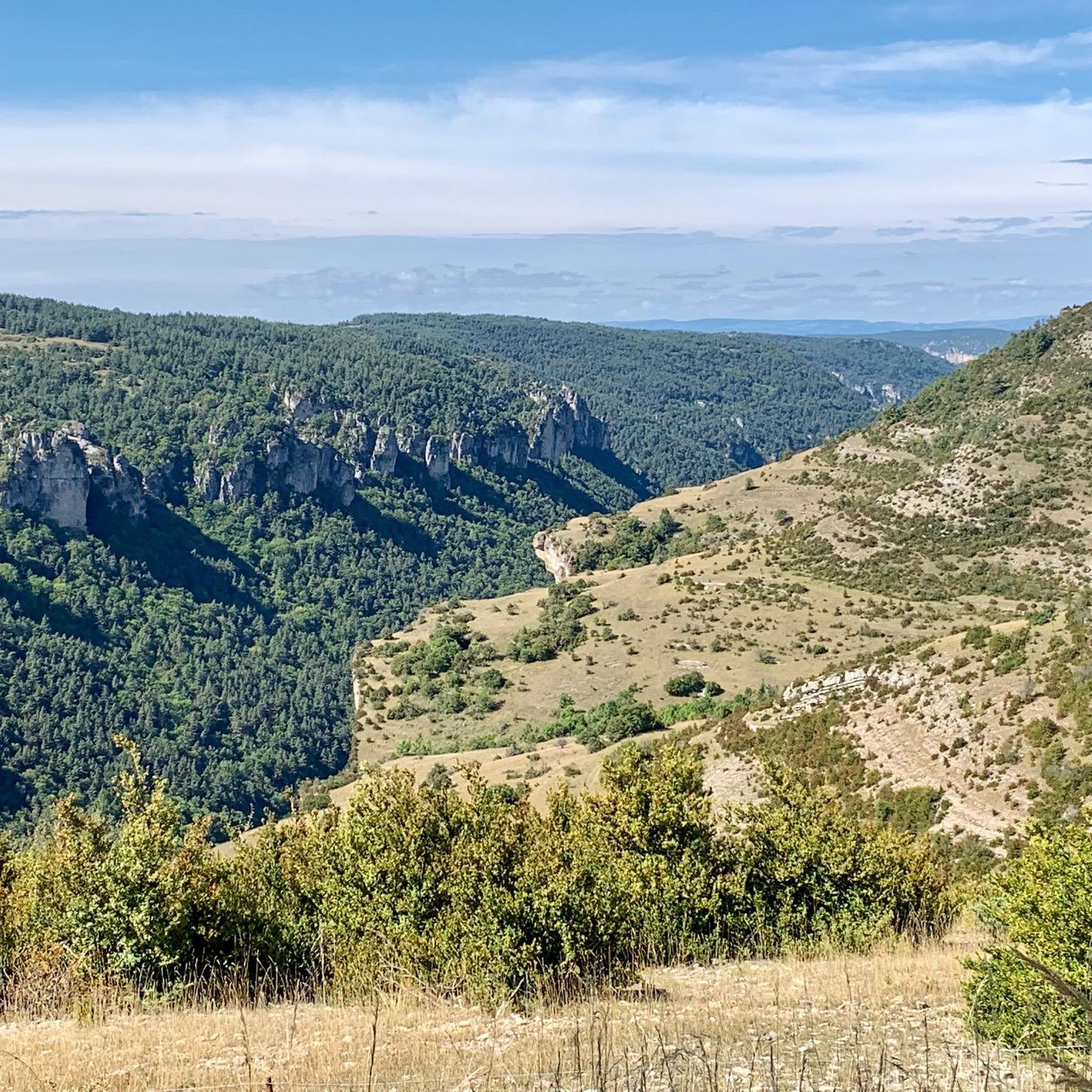
Mountain passes around Meyrueis are situated in the heart of the Cévennes and Grands Causses, offering access to the region's diverse landscapes. This area features limestone plateaus, deep valleys, and mountainous terrain within the Cévennes National Park. The passes provide routes connecting various valleys and plateaus, showcasing the natural and geological characteristics of the Massif Central.
Best mountain passes around Meyrueis
- The most popular mountain passes is Malène Hill, a viewpoint that features hairpin bends. The serpentines offer views…
Last updated: July 4, 2026
Minier Pass
Highlight • Mountain Pass
Translated by Google •
Tip by

Lusette Pass
Highlight • Mountain Pass
Translated by Google •
Tip by

Sign up now to discover places like this
Get recommendations on the best single tracks, peaks, & plenty of other exciting outdoor places.
Sign up for free
Malène Hill
Highlight (Segment) • Viewpoint
Translated by Google •
Tip by

Perjuret Pass
Highlight • Mountain Pass
Translated by Google •
Tip by

Salidès Pass
Highlight • Trail
Translated by Google •
Tip by

Sign up for free to discover even more mountain passes around Meyrueis.
Sign up for free
Already have an account?
Start today with a free account
Your next adventure awaits.
Login or Signup
Popular around Meyrueis
Meyrueis to La Roque-Sainte-Marguerite – GR 62A in France
Walking to the rhythm of the Causses — The GRP Tour du Causse Méjean
Hike and wild camp in the Cevennes — a Tour of Mount Aigoual (GR 66)
Lonely Cevennes: The beautiful south of France
Road Cycling Routes around Meyrueis
Hiking around Meyrueis
Cycling around Meyrueis
MTB Trails around Meyrueis
Running Trails around Meyrueis

Gravel biking around Meyrueis
Other adventures around Meyrueis


Tips from the Community

This pass, discreetly nestled among the fir trees, is a great road and pedestrian crossing. It also allows cyclists and gravel enthusiasts to take the trails that go a little deeper into the coniferous forests.
0
0

Great climb, 9% for 4km. Tough but feels good
0
0

Beautiful place but difficult to climb, the bends before the refuge are more than 11%
1
0

Splendid panorama, a beautiful climb and descent
0
0

22.60 km and “Height difference” 1033m between Le Vigan and Col!
1
0

The Col du Minier with an altitude of 1,264 meters is located on the watershed between the Mediterranean Sea and the Atlantic Ocean. It is also located near a small waterfall, which is very useful for cooling off.
0
0


A nice tour but a part in the forest made impracticable by the cuts of wood which destroy any landmark donations for me course to review with the trace of the mountain bike 10
0
0
Frequently Asked Questions
What makes the mountain passes around Meyrueis unique?
The mountain passes around Meyrueis are unique for their location within the Cévennes and Grands Causses, offering diverse landscapes from limestone plateaus to deep valleys. They provide breathtaking panoramic views, challenging routes for cyclists, and insights into the region's natural and cultural heritage, all within the Cévennes National Park.
Which mountain passes offer the best panoramic views?
Several passes provide stunning vistas. The Malène Hill is known for its hairpin bends offering spectacular views of the valley. The Col du Perjuret features expansive vistas of the wild Cévennes landscape, while the Col de Montmirat offers immense panoramic views of the Tarn valley and the Causse Méjean. The Col du Rey, located within the Cévennes National Park, also provides sweeping views over the Cévennes valleys.
Are there any historically significant mountain passes in the area?
Yes, the Col du Perjuret has a historical connection to cycling, being the site of a career-ending crash during the 1960 Tour de France, with a monument in Roger Rivière's memory nearby. The area around Col de Montmirat also historically featured megalithic structures, including a Christianized menhir.
What kind of cycling challenges do these passes offer?
The mountain passes around Meyrueis present rewarding challenges for cyclists. For example, the Col du Perjuret is known for its steep gradients and sharp turns. The Col de Montmirat is a Category 2 climb with an average grade of around 4.9% and a total ascent of about 449 meters over 9.1 kilometers from Ispagnac. The Lusette Pass is described as a beautiful and steep pass, with percentages between 8% and 14% over 18km from Vigan.
What natural features can I expect to see around the passes?
You can expect to see dramatic wild landscapes, especially around the Col du Perjuret. The surrounding areas are also a habitat for wild orchids, particularly beautiful when in bloom. The Minier Pass is located near a small waterfall, and the Col de Montmirat is notable for its geological significance as a 'geological bridge' between limestone plateaus and Mont Lozère.
Are there hiking opportunities near the mountain passes?
Yes, the region offers numerous hiking opportunities. For instance, you can find trails like the 'Pauparelle - loop starting from Meyrueils' or 'Dargilan – loop on the Causse Noir' which are accessible from the area. You can explore more options in the Hiking around Meyrueis guide.
What are the best times to visit the mountain passes around Meyrueis?
Visiting in the morning is often recommended for cooler temperatures and softer light, enhancing the visual appeal of the passes. While specific seasonal recommendations vary, spring and autumn generally offer pleasant weather for outdoor activities like cycling and hiking, with blooming wildflowers in spring and vibrant foliage in autumn.
Are there any mountain passes suitable for families or less experienced visitors?
While many passes offer challenging routes, the general beauty and accessibility of the region mean that scenic drives through passes like the Col du Perjuret or Col de Montmirat can be enjoyed by families. For those looking for less strenuous activities, viewpoints along the passes provide easy access to stunning scenery without requiring extensive physical exertion.
What do visitors enjoy most about the mountain passes in this region?
Visitors particularly enjoy the spectacular views, the challenging yet rewarding cycling experiences, and the sense of wildness and tranquility. The Malène Hill is praised for its hairpin bends and valley views, while the Salidès Pass is noted for its splendid panorama. The komoot community has upvoted these routes over 35 times, sharing more than 16 photos, highlighting their appeal.
Can I find mountain biking trails near these passes?
Yes, the area around Meyrueis offers various mountain biking trails. You can find routes like 'Mount Aigoual – Mont Aigoual loop' or 'Meyrueis village – Singletrack to Meyruis loop' that traverse the diverse terrain. For more details, refer to the MTB Trails around Meyrueis guide.
Where is the Col du Rey located and what does it offer?
The Col du Rey is located in the heart of the Cévennes National Park, at an altitude of nearly 1,000 meters. It serves as a passage between the French valley and the Tarnon valley. It is particularly valued for the panoramic views it offers over the Cévennes valleys below, making it ideal for those seeking sweeping mountain vistas. Accessing it from Saint-Germain-de-Calberte allows visitors to immerse themselves in the National Park.
Most popular routes around Meyrueis
Most popular attractions around Meyrueis

Get inspired with the komoot mobile app


Explore more
See even more epic mountain passes by checking out these guides around Meyrueis:
