Top 3 Natural Monuments around Albiez-Montrond
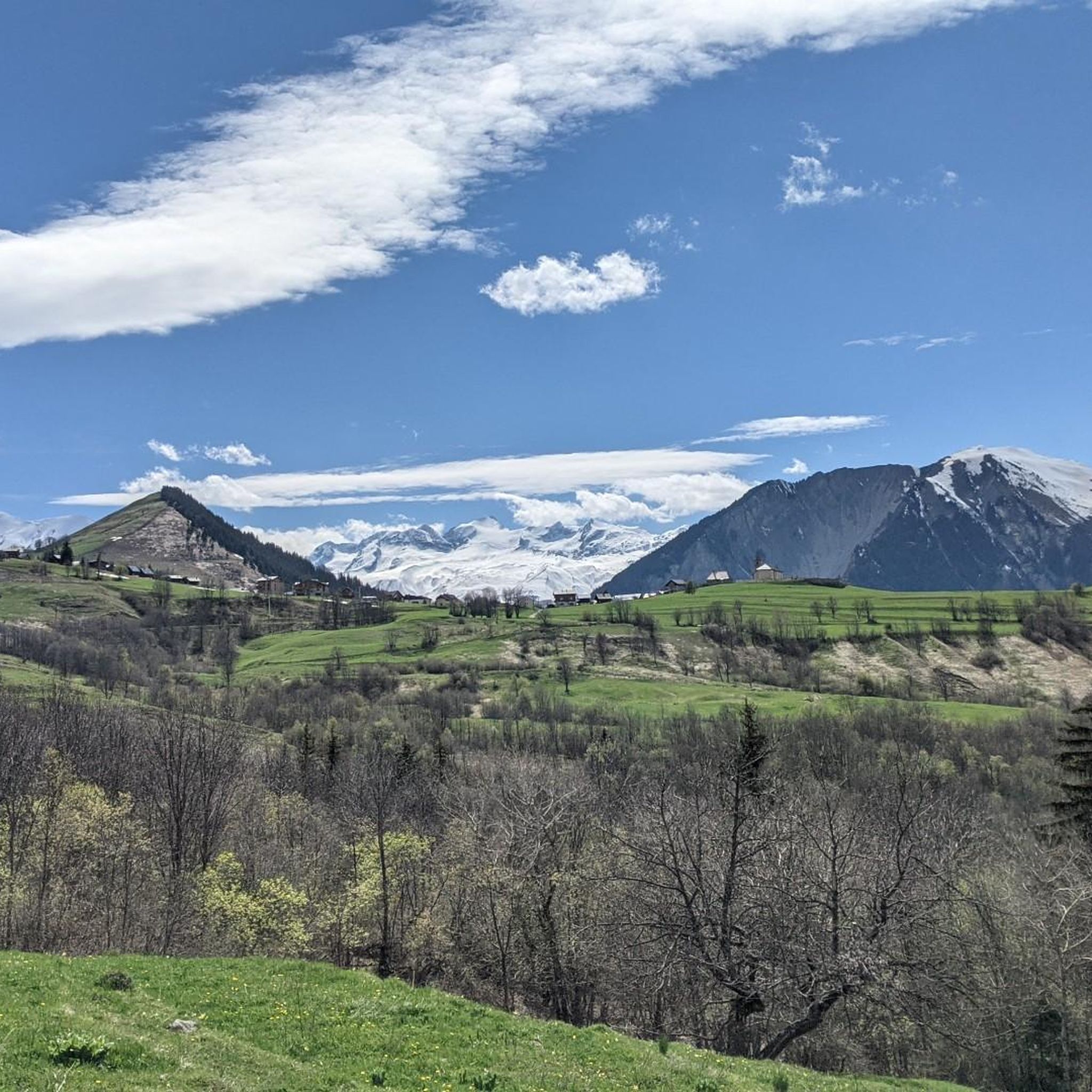
Best natural monuments around Albiez-Montrond are found in the heart of the French Alps, offering a landscape shaped by powerful tectonic forces and erosion. This region is characterized by its dramatic mountain peaks and passes, providing a diverse natural environment. The area is particularly known for its iconic geological formations, such as the Aiguilles d'Arves, which dominate the skyline. Visitors can explore a variety of natural features that showcase the alpine environment.
Best natural monuments around Albiez-Montrond
- The most popular…
Last updated: October 19, 2026
Col du Galibier
Highlight • Mountain Pass
Translated by Google •
Tip by

Col de la Croix de Fer
Highlight • Mountain Pass
Translated by Google •
Tip by

Sign up now to discover places like this
Get recommendations on the best single tracks, peaks, & plenty of other exciting outdoor places.
Pontet Lake
Highlight • Lake
Translated by Google •
Tip by

Signal de la Grave
Highlight • Summit
Translated by Google •
Tip by

Les Aiguilles d’Arves
Highlight • Summit
Translated by Google •
Tip by

Sign up for free to discover even more natural monuments around Albiez-Montrond.
Already have an account?
Start today with a free account
Your next adventure awaits.
Tips from the Community

The Galibier offers breathtaking views.
14
1
A fantastic mountain, making this climb was very challenging, the asphalt is in excellent condition and the gradients are regular.
14
0
A majestic mountain that must be approached with respect.
12
0
The Col du Galibier from Briançon is a climb located in the Grand Briançonnais region. This climb is 34.8 kilometers long, with a positive elevation gain of 1,398 meters. The Col du Galibier from Briançon has an average gradient of 4%.
31
1

A clear mountain lake where swimming is permitted at your own risk. It's a lovely walk around the lake. In summer, there's a food truck with benches.
0
0


The Col de la Croix de Fer culminates at an altitude of 2063 meters. It is the big neighbor of the Col du Glandon, another crossing point between the Maurienne and Oisans valleys. The Tour de France has used this pass 21 times. It is one of the most beautiful in France, a must-visit point for any mountain-loving cyclist!
1
0

A magnificent alpine lake, perched above the La Grave ski area. The lake is a quiet escape from the hustle and bustle of all the surrounding bike parks and ski areas, and makes a great destination. This is made all the better as the trails leading to this lake offer brilliant riding terrain, with technical and engaging uphill and downhill singles.
0
0
Frequently Asked Questions
What are the most prominent natural monuments in the Albiez-Montrond region?
The most iconic natural monument is undoubtedly Les Aiguilles d’Arves, known for its distinctive trilogy of peaks and dramatic geological formation. Other significant natural monuments include the high mountain passes like Col du Galibier, reaching 2,642 meters, and Col de la Croix de Fer, both legendary in cycling history and offering stunning alpine scenery.
Are there family-friendly natural monuments or activities around Albiez-Montrond?
Yes, for families, the area around Les Aiguilles d’Arves offers accessible options. The "Promenade Savoyarde de Découverte des Aiguilles d'Arves" (PSD) is a 1.5 to 2-hour route suitable for strollers and those with reduced mobility, featuring interactive markers. Additionally, Pontet Lake is a beautiful alpine lake at 1,982 meters, perfect for a refreshing dip on warm days and offering splendid views, making it a great family destination.
What kind of geological features can I expect to see in the natural monuments of Albiez-Montrond?
The region's natural monuments showcase spectacular geological formations resulting from powerful tectonic forces and millions of years of erosion. Les Aiguilles d’Arves, for instance, are composed of "Flysch du Cheval Noir et des Aiguilles d'Arves," forming a dramatic and jagged silhouette that dominates the landscape. You'll encounter high mountain passes, deep valleys, and impressive rock formations characteristic of the French Alps.
What outdoor activities can I do near these natural monuments?
The Albiez-Montrond area is excellent for various outdoor activities. You can find numerous hiking trails, from easy walks to challenging treks, and cycling routes, including legendary climbs like the Col du Galibier. Mountain biking is also popular. For detailed routes, explore the hiking, cycling, and MTB guides around Albiez-Montrond.
Are there specific viewpoints to admire the natural monuments?
Yes, there are several excellent viewpoints. From various points around Albiez-Montrond, especially from hamlets like La Villette, you can enjoy exceptional views of Les Aiguilles d’Arves. The Col du Mollard also offers a splendid panorama. Another highly rated spot is the Bench at the L'Aiguillon viewpoint, which provides extensive vistas of the Romanche valley, the Écrins massif, and its glaciers at 2,096 meters.
What is the best time of year to visit the natural monuments in Albiez-Montrond?
The best time to visit largely depends on your preferred activities. For hiking and cycling, late spring (June) through early autumn (September) offers pleasant weather and accessible trails. During winter, the plateau du Chalmieu is popular for snowshoeing with views of Les Aiguilles d’Arves, but many high mountain passes will be closed due to snow.
Are there any natural lakes or water features to visit?
Yes, Pontet Lake is a very beautiful alpine lake located at an altitude of about 2,000 meters. It offers a stunning view of the region and is a great spot to cool off with a swim on hot days. It's a tranquil escape from more strenuous activities.
Where can I find parking when visiting natural monuments or starting hikes?
Specific parking options vary by location. For example, when approaching Les Aiguilles d’Arves, you can find parking at the Chalmieu Relay Parking Lot (1900m) in Albiez-Montrond. Many mountain passes and viewpoints, such as Col de la Croix de Fer, also have designated parking areas. It's advisable to check specific route descriptions for detailed parking information.
Can I find food or refreshments near the natural monuments?
Yes, some natural monument areas offer refreshment options. For instance, after a hike, you can enjoy a break at the Chalet du Croë, located amidst mountain pastures near Les Aiguilles d’Arves, which offers snacks. The summit of Col de la Croix de Fer also hosts a warm and welcoming hostel where you can rehydrate and regain strength with regional food.
What makes the natural monuments around Albiez-Montrond popular with visitors?
Visitors are drawn to the dramatic alpine scenery, the challenge of iconic mountain passes like Col du Galibier, and the breathtaking views from spots like the Bench at the L'Aiguillon viewpoint. The unique geological formations of Les Aiguilles d’Arves and the serene beauty of Pontet Lake also contribute to the region's appeal, offering diverse experiences for outdoor enthusiasts.
Are there any long-distance treks or challenging routes for experienced hikers?
For experienced hikers, the "Tour of the Needles of Arves" is a multi-day trek that circumnavigates Les Aiguilles d’Arves. This route involves high passes, technical trails, and significant elevation changes, and can also be undertaken with local mountain guides. You can find challenging routes like "Les aiguilles d'arves – Basse du Gerbier, 2541 m loop" in the hiking guide for Albiez-Montrond.
What should I wear when visiting the natural monuments, especially for hiking?
Given the alpine environment, it's essential to dress in layers. Even in summer, weather can change rapidly. Bring waterproof and windproof outer layers, sturdy hiking boots, and sun protection. For higher altitudes or cooler seasons, warmer clothing, hats, and gloves are recommended. Always check the local weather forecast before heading out.
Most popular routes around Albiez-Montrond
Most popular attractions around Albiez-Montrond

Get inspired with the komoot mobile app


Explore more
Extend your search for the best caves by checking out these guides of the top ones around Albiez-Montrond:
