Top 6 Mountain Passes around Moclinejo
Best mountain passes around Moclinejo are found within the mountainous landscape of the Axarquía region of Málaga. These elevated routes offer scenic paths and function as mountain passes for outdoor enthusiasts. The area is characterized by its natural landscape, including olive groves, vineyards, and terraced farmland, reflecting its agricultural heritage. Many paths were historically used as trade routes, connecting agricultural communities and offering insights into the region's past.
Best mountain passes around Moclinejo
- The most popular mountain passes is Climb…
Last updated: August 11, 2026
Climb to Puerto del León from Málaga
Highlight (Segment) • Climb
Translated by Google •
Tip by

Bolina Pass
Highlight • Mountain Pass
Translated by Google •
Tip by
Sign up now to discover places like this
Get recommendations on the best single tracks, peaks, & plenty of other exciting outdoor places.
Sign up for free
Puerto del León Descent
Highlight (Segment) • Viewpoint
Translated by Google •
Tip by
⭐ End of the Pass to Olias
Highlight • Viewpoint
Translated by Google •
Tip by

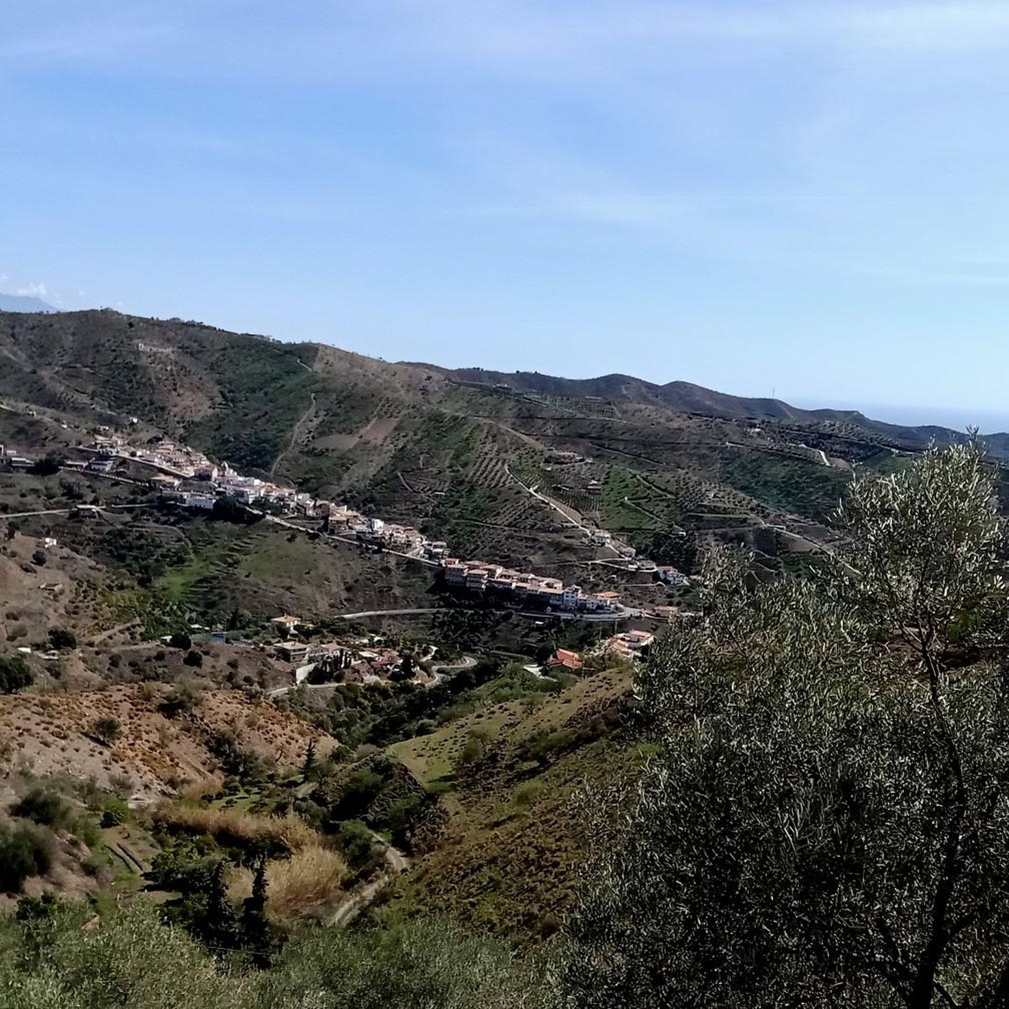
View of the Mountains Between Fuente Reina and Olías
Highlight (Segment) • Viewpoint
Translated by Google •
Tip by

Start today with a free account
Your next adventure awaits.
Login or Signup
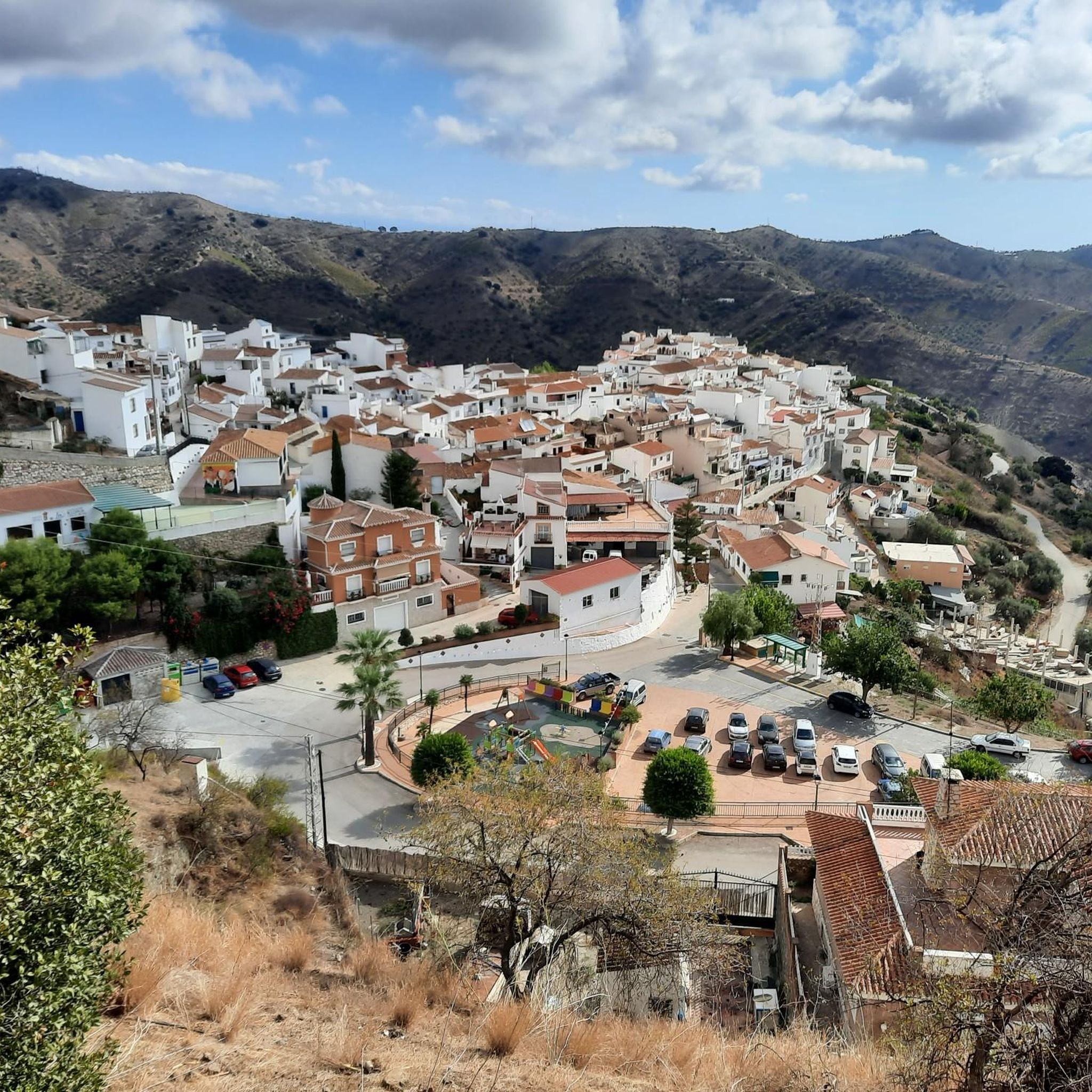
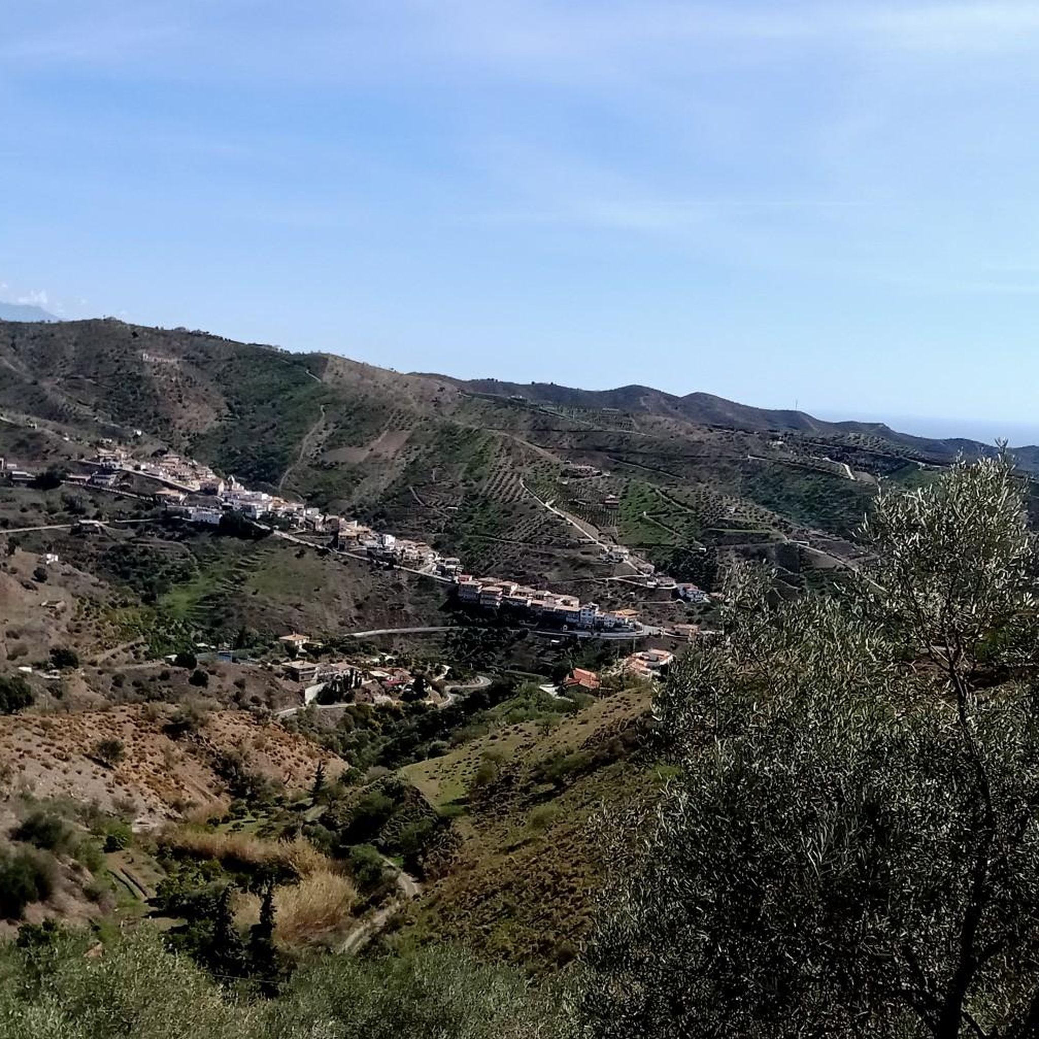
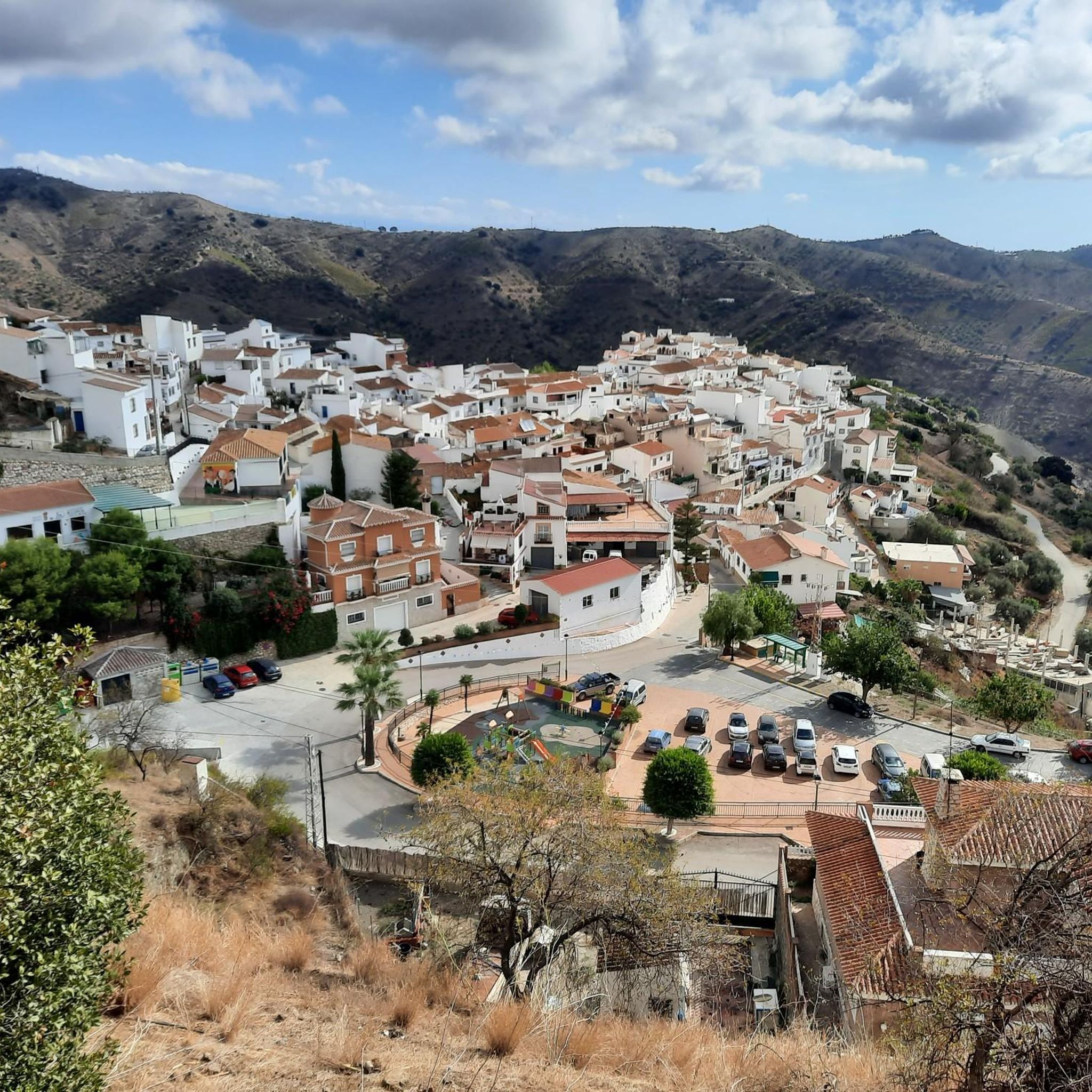
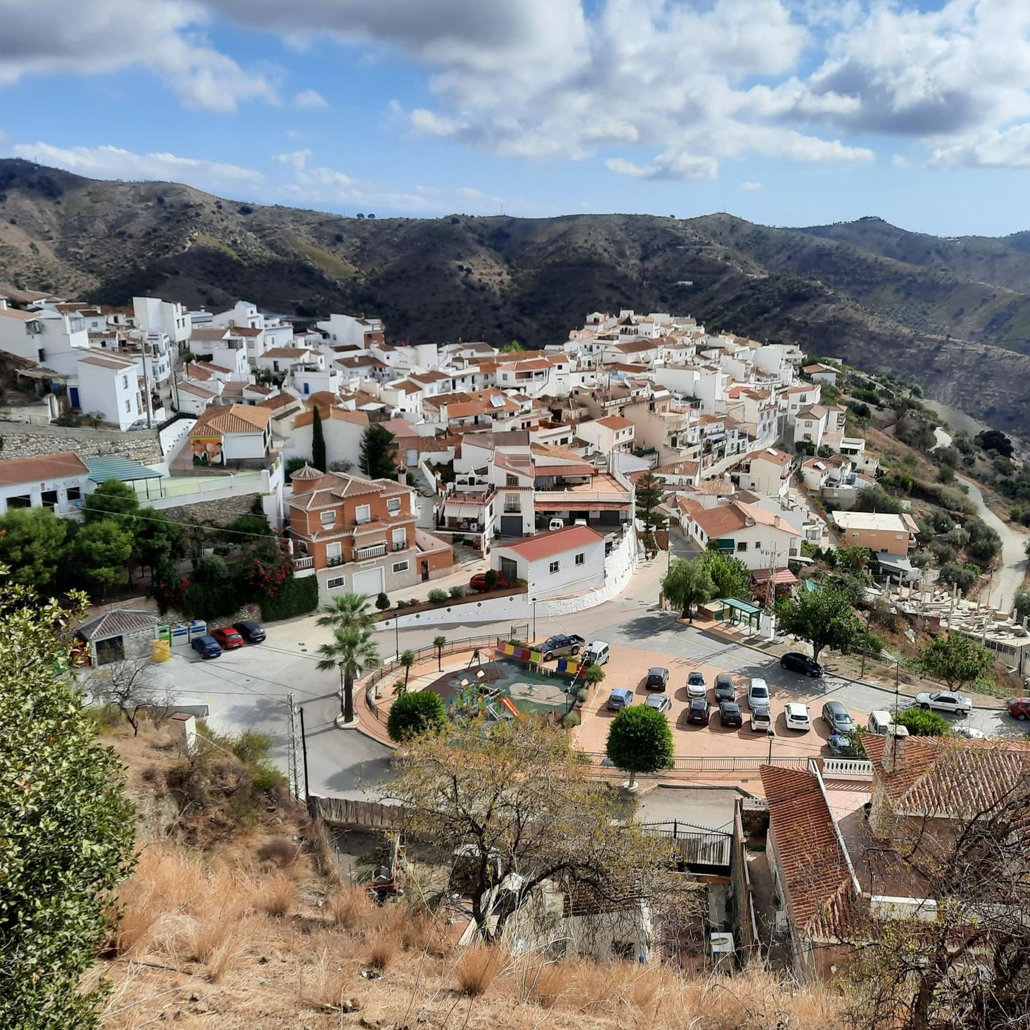
Tips from the Community

A point, a crossroads, with good views.
0
0
At the end of the climb we find this viewpoint with a table and shade under trees, with beautiful views, an ideal place to stop for a bite to eat and recharge our batteries 😜
0
0

Views from the top of the port
0
0

Nice climb from Malaga!
0
0
A crossroads with good views, a landmark
0
0

The section between Fuente Reina and the mountain village of Olías offers many wonderful views of the mountains with changing perspectives of the hinterland and the sea - wonderful.
0
0

Long but steady climb from Malaga city centre, very nice views from over the city and Med.
2
0

One of the HCs around Malaga's mountains, allegedly the most famous one, due to its closeness to the Costa del Sol's city. The climb kicks-off right in the middle of the city center, leaving the town through its nord-east gates, and getting right into the Montes de Malaga natural reserve. The climb is stunning: at times shaded by the trees (not something you can take for granted in the region!), offers stunning views of Malaga and its mountains. The gradient is pretty uneven: after an initial steep section getting out of Malaga, the climb eases its bite, and the central section alternate easier sectors (3-4%) to steeper ones (up to 14%!); there's even some short downhill stretches that will get your legs to recover just long enough to tackle the next section! Arrived to the last 5km, it gets more aggressive: consistently hovering around 8-10%, it leads you past Fuente de La Reina and summit just a few hundreds meters later. Might be a good idea to turn around and ride back to that cafe to refill and recover!
1
1
Frequently Asked Questions
What kind of views can I expect from the mountain passes around Moclinejo?
The elevated routes around Moclinejo offer spectacular panoramic views. You can see the entire Axarquía region, extending to the Mediterranean Sea, the Vélez Valley, and distant mountain ranges like Tejeda, Almijara, and the Sierra de las Nieves. Specific highlights like the Climb to Puerto del León from Málaga provide great views of Málaga city and the sea, while the Bolina Pass also offers good vistas.
Are there any historically significant mountain passages in the area?
Yes, many paths around Moclinejo hold cultural and historical significance. For instance, the route from Moclinejo to Totalán via Cerro Piedras Blancas historically served as a trade route between agricultural communities. These paths offer a glimpse into the region's agricultural traditions, winding through almond trees, vineyards, and terraced farmland. Moclinejo itself is part of the Ruta de la Pasa (Raisin Route), connecting several picturesque white villages.
What are some popular hiking routes that incorporate these mountain passes?
One popular route is the circular path from Moclinejo to Loma de Cela Alto, which winds through mountains and olive groves along the Camino de Cela, offering breathtaking panoramic views. Another option is the route from Moclinejo to Totalán via Cerro Piedras Blancas, which features a more challenging ascent and diverse landscapes. For more hiking options, you can explore the hiking guide for Moclinejo.
Can I connect to larger trail networks from the mountain passes near Moclinejo?
Absolutely. Some of these passages are integrated into longer-distance paths. For example, the ridge between the Benagalbón River and the Granadillas Stream is part of the Great Axarquía Path (GR 242) and eventually connects to the Great Málaga Path (GR-249) at Rincón de la Victoria Beach, allowing for extended hiking adventures.
What kind of natural environment will I experience on these mountain passes?
You will be immersed in the authentic rural landscapes of Andalusia. The area is characterized by olive groves, vineyards, almond trees, and diverse Mediterranean flora and fauna. Routes like the Moclinejo Route to Loma de Cela Alto take you through these natural settings, offering a true experience of the region's natural beauty.
Are there challenging climbs for cyclists or hikers?
Yes, there are several challenging sections. The Climb to Puerto del León from Málaga steadily ascends to 900 meters with sections reaching 11-12% gradient, making it a significant challenge. The Bolina Pass also features a steep section before its summit. The route from Moclinejo to Totalán via Cerro Piedras Blancas includes a more challenging ascent to Cerro Piedras Blancas.
What are the best times to visit the mountain passes around Moclinejo?
Given that some routes, like the ridge between the Benagalbón River and the Granadillas Stream, have no shade and are along farm tracks where vehicles may pass, it's generally less suitable for hot days. Spring and autumn offer more moderate temperatures, making them ideal for exploring these mountain passes. Early mornings in summer can also be pleasant before the heat sets in.
Are there any scenic descents to enjoy?
Yes, the Puerto del León Descent is a highly scenic road with continuous views of Malaga. It's well-maintained and features several twists with tunnels, providing an enjoyable and memorable experience.
What other outdoor activities can I do near the mountain passes of Moclinejo?
Beyond hiking, the region offers excellent opportunities for road cycling and mountain biking. You can find various routes catering to different skill levels. For more details, check out the Road Cycling Routes around Moclinejo and MTB Trails around Moclinejo guides.
Are there good viewpoints for resting or picnicking?
Yes, several spots offer excellent views and opportunities to rest. The End of the Pass to Olias highlight, for example, features a viewpoint with a table and shade under trees, making it an ideal place to stop for a bite to eat and recharge. The View of the Mountains Between Fuente Reina and Olías also provides many wonderful views.
What kind of terrain should I expect on the mountain passes?
The terrain varies from winding paths through olive groves and vineyards to steeper inclines and mountainous sections. Some parts, particularly along the ridge between the Benagalbón River and the Granadillas Stream, are along farm tracks. It's advisable to wear appropriate footwear and be prepared for diverse surfaces.
What makes the mountain passes around Moclinejo unique compared to other trails?
The mountain passes around Moclinejo offer a unique blend of natural beauty, historical significance, and diverse outdoor activities. They provide not just stunning panoramic views of the Axarquía region and the Mediterranean, but also an immersion into traditional Andalusian rural life, passing through ancient trade routes and agricultural landscapes. The connection to larger trail networks like the GR 242 and GR-249 also allows for extended exploration.
Most popular routes around Moclinejo
Most popular attractions around Moclinejo

Get inspired with the komoot mobile app


Explore more
See even more epic mountain passes by checking out these guides around Moclinejo:
