Top 8 Natural Monuments around Puebla De Alcocer
Natural monuments around Puebla De Alcocer are located in the Extremadura region of Spain, featuring diverse natural attractions. The landscape is characterized by large reservoirs, imposing rock formations, and Mediterranean vegetation. These areas offer opportunities for outdoor activities within a tranquil environment. The region's natural beauty provides varied experiences for visitors.
Best natural monuments around Puebla De Alcocer
- The most popular natural monuments is Garcia de Sola Reservoir, a lake distinguished by its imposing rock formations and lush vegetation.…
Last updated: July 1, 2026
Garcia de Sola Reservoir
Highlight • Lake
Translated by Google •
Tip by

Cerro Masatrigo
Highlight • Summit
Translated by Google •
Tip by
Sign up now to discover places like this
Get recommendations on the best single tracks, peaks, & plenty of other exciting outdoor places.
Sign up for free
Canal de las Dehesas – Guadiana Natural Trail
Highlight • Trail
Translated by Google •
Tip by
La Serena Reservoir and Masatrigo Hill
Highlight • Lake
Translated by Google •
Tip by
Masatrigo Mountain and La Serena Reservoir
Highlight • Lake
Translated by Google •
Tip by

Sign up for free to discover even more natural monuments around Puebla De Alcocer.
Sign up for free
Already have an account?
Start today with a free account
Your next adventure awaits.
Login or Signup

Tips from the Community

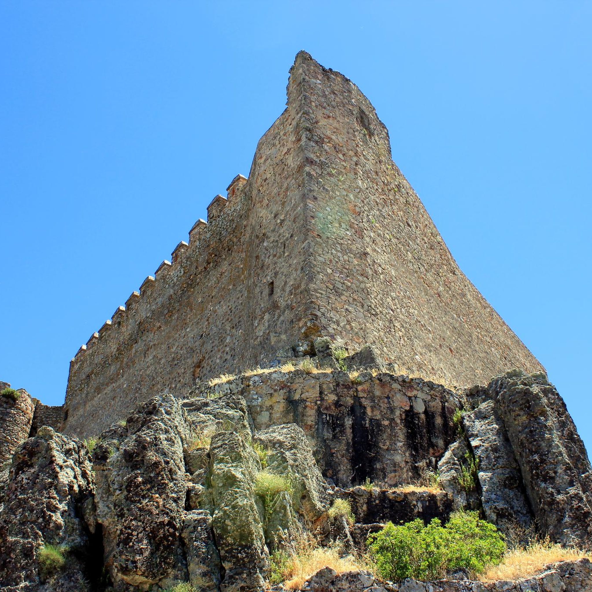
The García de Sola Reservoir, also known as Puerto Peña, is located on the Guadiana River, in the La Siberia Extremeña region (Badajoz). It was built in 1962 as part of the Badajoz Plan and has a capacity of 554 hm³. It is an emblematic site for its natural, scenic, and recreational value.
5
0
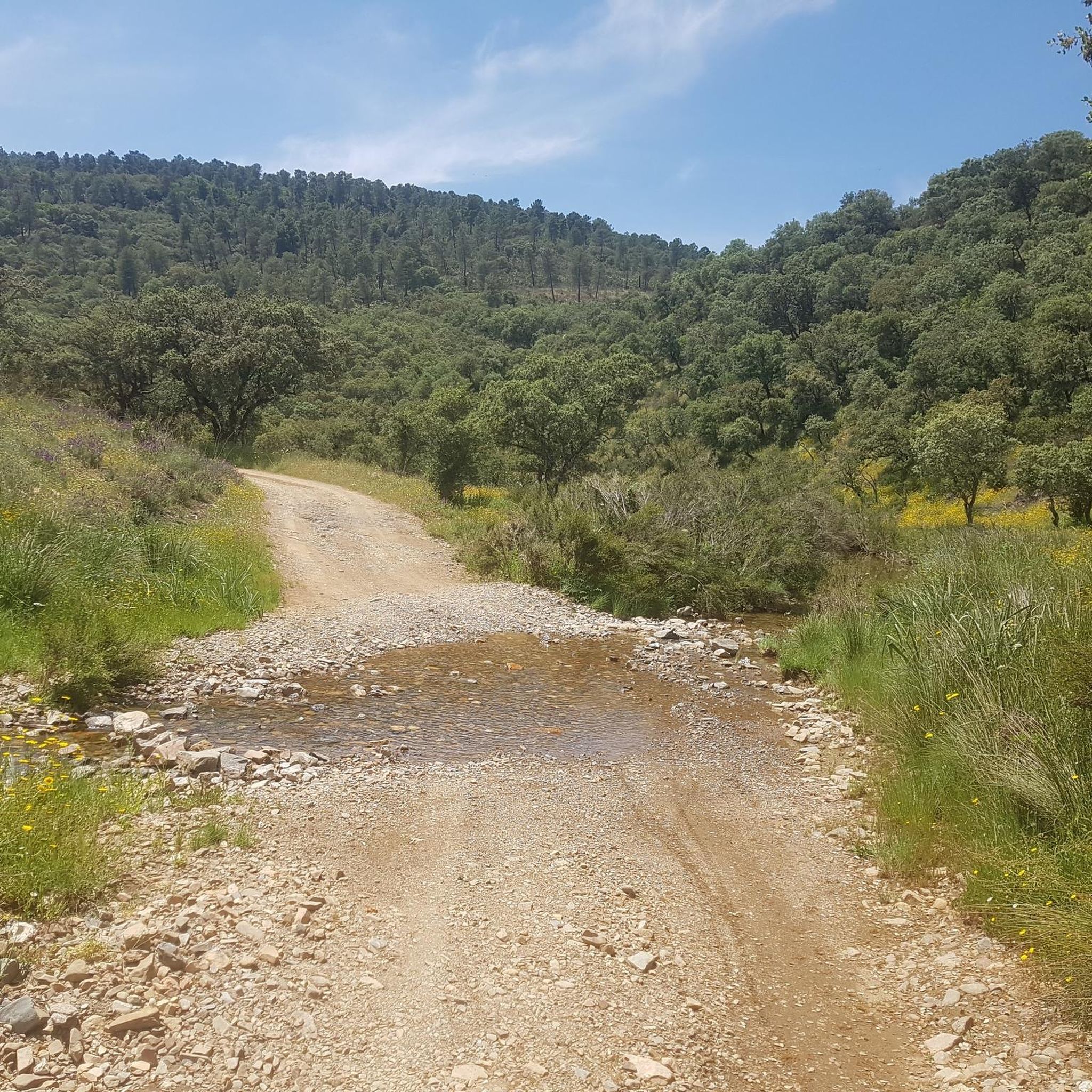
The Canal de las Dehesas is part of the Guadiana Nature Trail (GR-114), a route that runs along the Guadiana River basin from Albacete to Huelva. It's very popular for cycling and hiking.
5
0
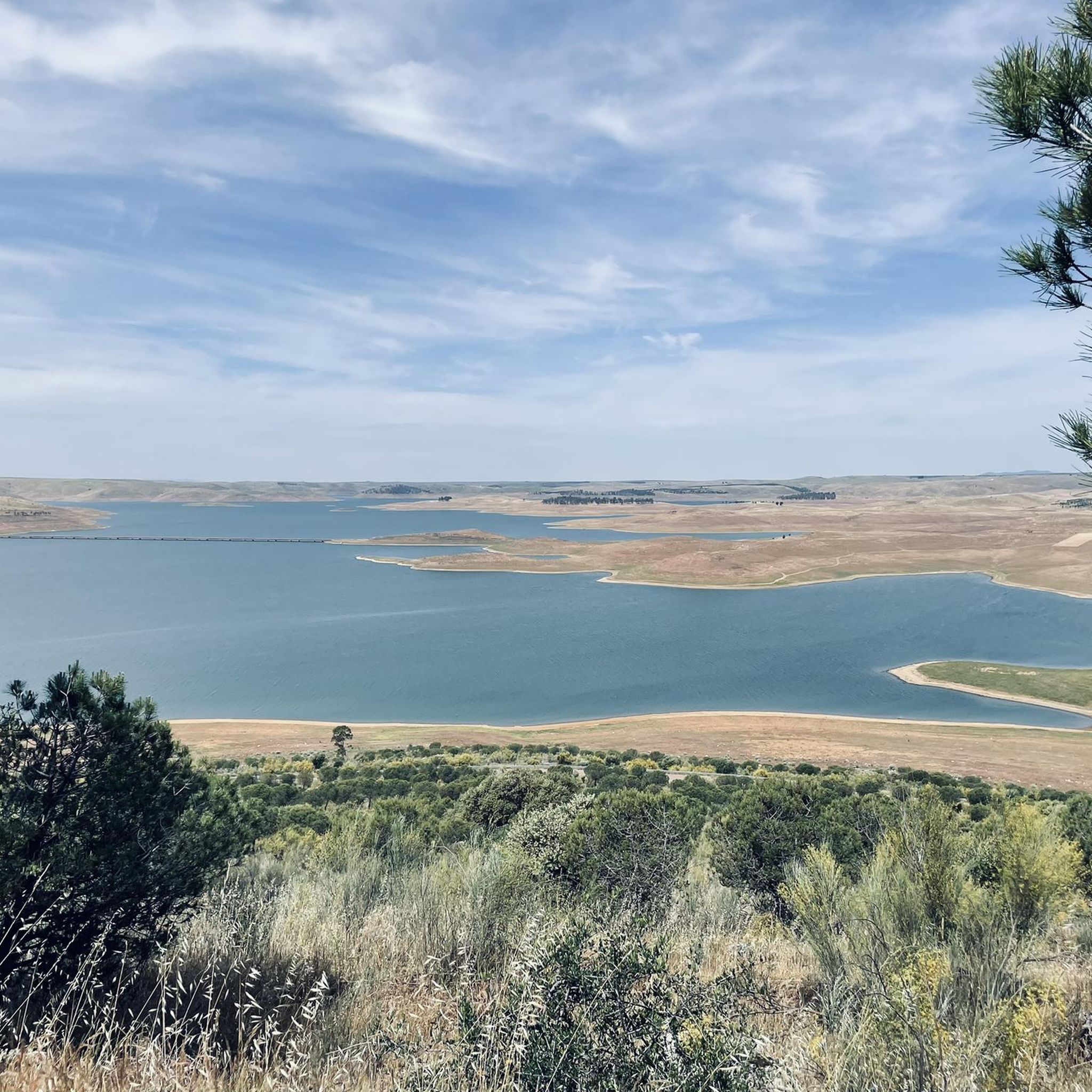
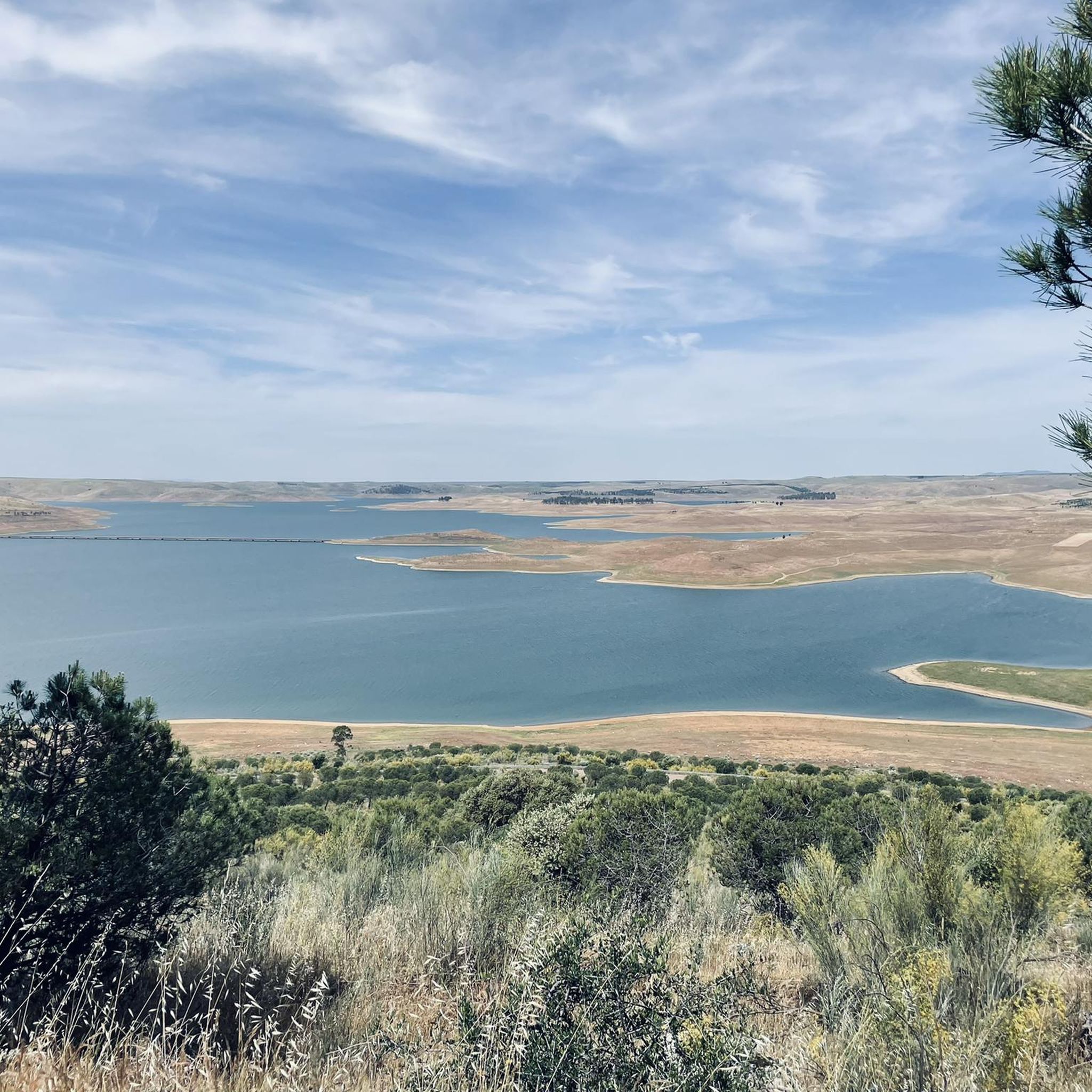
Cerro Masatrigo is a hill located in the municipality of Esparragosa de Lares. This hill is known for its almost perfect conical shape, which has earned it the nickname "the magic mountain." It rises 501 meters above sea level and 161 meters above the surrounding terrain. After the construction of the La Serena Dam, Cerro Masatrigo became a peninsula surrounded by the waters of the reservoir.
6
0

This spectacular reservoir was built during the 1960s. The reflection of the sunsets in the water and the surrounding landscape make it a must-see if you're exploring the Guadiana Nature Trail.
0
1

Stage 2. Herrera del Duque/Orellana la Vieja 88 kilometers. 1,020 meters of elevation gain. Compared to the previous stage, the second day of the trip is a pleasant walk through the vast rural and livestock plains of the Guadiana River, passing through the pastures of the García de Sola and Orellana reservoirs. The first contact with the inland sea of García de Sola is the serene river environment of the beaches and piers of Peloche; when the reservoir level is high, the water reaches the town streets. The route continues along a fairly quiet and scenic road to the Puerto Peña dam, tracing the curves and inlets of the reservoir's shore. Puerto Peña is a narrowing in the course of the Guadiana River that was used to build the García de Sola dam. There is also an active tourism center and hiking trails. The surroundings of the river gorge and the canyon's cliffs are an important wildlife reserve. There is a large colony of griffon vultures, white and black storks, cranes, falcons, eagle owls, buzzards, and kites, and it is possible to see flocks of the rare long-tailed wagtail. The mountain range is a lush forest populated by strawberry trees, holm oaks, cork oaks, pines, eucalyptus, pyrénergos, and the rest of the scrubland typical of Mediterranean forests. The route crosses the Puerto Peña gorge and continues along the Canal de las Dehesas track, one of the large canals built along the middle course of the Guadiana River during the Badajoz Plan hydraulic project. The path is completely flat and the surface is excellent. In some places, panels display environmental values and interesting landscape features. In spring, the rockrose flowers fill the green hills of the dehesas with white dots. The kilometers fly by on a bike, contemplating the meanders of the Orellana Reservoir. At the Casas de Don Pedro junction, the Guadiana Nature Trail turns toward Talarrubias and, before reaching it, enters a Cordel de Merinas (Merinas Cordillera) toward the Roman site of Lacimurga. The ruins are on the banks of the reservoir; it was a strategic crossing for the Guadiana River for centuries, even before the Romans built walls and expanded a primitive oppidum from the 5th century BC, founding a powerful Roman city of the Flavian dynasty on the plains of the Guadiana and Zújar rivers. The road surface is excellent for gravel bikes; it climbs along the foothills of the Maribáñez mountain range, passes through Orellana de la Sierra, and ends the stage in Orellana la Vieja.
0
1
Cerro Masatrigo is a hill located in the municipality of Esparragosa de Lares. This hill is known for its almost perfect conical shape, which has earned it the nickname "the magic mountain" It rises 501 meters above sea level and 161 meters above the surrounding terrain. After the construction of the La Serena Dam, Cerro Masatrigo became a peninsula surrounded by the waters of the reservoir.
7
0
The García de Sola Reservoir is an impressive work of engineering located in the Extremadura region, near Talarrubias, in the province of Badajoz. The reservoir is located in an environment of great beauty, surrounded by imposing rock formations and dense vegetation composed of Mediterranean forests, pine forests and eucalyptus trees. It is a place of great value for birdlife, with species such as the griffon vulture, black vulture, black stork, golden eagle and peregrine falcon.
5
0

Located in the middle of the La Serena Reservoir and at 501 meters above sea level, it offers us wonderful views at 360 degrees. The Masatrigo hill, for sure, will surprise us with its shape and its curious name. It is called this way because for many its shape is assimilated to a pile of wheat.
1
1
Frequently Asked Questions
What are some of the most popular natural monuments to visit around Puebla de Alcocer?
Visitors frequently enjoy the Garcia de Sola Reservoir, known for its impressive rock formations and rich birdlife. Another favorite is Cerro Masatrigo, a distinctive summit offering panoramic views. The Cíjara Nature Reserve is also a popular choice for its extensive forest areas.
Are there family-friendly natural monuments in the area?
Yes, the Garcia de Sola Reservoir is considered family-friendly, offering a beautiful environment with opportunities for enjoying nature by the water. Its diverse landscapes and birdlife can be engaging for all ages.
What kind of wildlife can I expect to see at these natural monuments?
The natural monuments around Puebla de Alcocer are rich in birdlife. At the Garcia de Sola Reservoir and particularly at Puerto Peña, you can spot griffon vultures, black vultures, black storks, golden eagles, and peregrine falcons. The area is a significant wildlife reserve, also home to cranes, falcons, eagle owls, buzzards, kites, and the rare long-tailed wagtail.
What outdoor activities are available near the natural monuments?
The region offers various outdoor activities. You can find numerous cycling routes, including MTB trails, road cycling routes, and touring bicycle routes. Hiking is also popular, with trails like the Canal de las Dehesas – Guadiana Natural Trail offering scenic walks.
Are there hiking trails suitable for different difficulty levels?
Yes, you can find trails of varying difficulty. For example, the route to Cerro Masatrigo is considered intermediate, offering a serene environment for nature lovers. The Canal de las Dehesas – Guadiana Natural Trail is also rated intermediate and is popular for both cycling and hiking.
What is the best time of year to visit the natural monuments for birdwatching?
The García de Sola Reservoir and Puerto Peña are renowned for their significant birdlife year-round. However, spring and autumn are generally excellent for birdwatching, as migratory species pass through the area, adding to the resident populations of vultures, storks, and eagles.
Can I find accommodation or cafes near Cerro Masatrigo or Garcia de Sola Reservoir?
While specific cafes or accommodations directly adjacent to Cerro Masatrigo or Garcia de Sola Reservoir are not detailed in the guide, the surrounding towns and municipalities in the Extremadura region, such as Puebla de Alcocer, Herrera del Duque, or Talarrubias, would offer services like cafes, pubs, and accommodation options for visitors.
What makes the García de Sola Reservoir unique?
The García de Sola Reservoir is unique for its combination of impressive engineering and natural beauty. It's set amidst imposing rock formations and lush Mediterranean, pine, and eucalyptus forests. It's also a crucial habitat for a wide array of bird species, making it a prime spot for birdwatching, especially at Puerto Peña.
What is the significance of Cerro Masatrigo?
Cerro Masatrigo is notable for its distinctive, almost perfect conical shape, which has earned it the nickname 'pile of wheat' or 'magic mountain'. Located within the La Serena reservoir area, it stands at approximately 500 meters, offering breathtaking panoramic views of the surrounding landscape and a tranquil environment.
Are there any natural trails that are also good for cycling?
Yes, the Canal de las Dehesas – Guadiana Natural Trail is part of the GR-114 route and is very popular for both cycling and hiking. It features a completely flat and excellent surface, making it suitable for various types of bicycles, including gravel bikes, and offers scenic views along the Guadiana River basin.
What kind of vegetation can be found in the natural monuments?
The natural monuments are characterized by rich Mediterranean vegetation. You'll find Mediterranean forests, pine forests, and eucalyptus trees, especially around the García de Sola Reservoir. The route to Cerro Masatrigo is also enveloped by exuberant Mediterranean vegetation. In spring, rockrose flowers add white dots to the green hills of the dehesas.
What are the highlights of the Cíjara Nature Reserve?
The Cíjara Nature Reserve is a significant forest area located in the northeast of the province of Badajoz, within the La Siberia region. It's appreciated for its extensive natural landscapes and biodiversity, bordering Cáceres, Toledo, and Ciudad Real, offering a vast protected environment for exploration.
Most popular routes around Puebla De Alcocer
Most popular attractions around Puebla De Alcocer

Get inspired with the komoot mobile app


Explore more
Extend your search for the best caves by checking out these guides of the top ones around Puebla De Alcocer:
