Top 6 Natural Monuments around Morón De La Frontera
Natural monuments around Morón De La Frontera are characterized by diverse landscapes, from mountain ranges to river gorges. Situated between the Sierra Sur and La Campiña region of Seville, the area features unique geological formations and rich biodiversity. These natural areas offer opportunities for outdoor activities such as hiking and cycling. The region's appeal is further enhanced by fertile agricultural lands and a network of rivers and springs.
Best natural monuments around Morón De La Frontera
- The most popular natural…
Last updated: July 1, 2026
Zaframagón Viaduct
Highlight • Bridge
It was built to span the Guadalporcún River crossing …
Translated by Google •
Tip by

Peñón de Zaframagón Nature Reserve
Highlight • Natural Monument
Translated by Google •
Tip by
Sign up now to discover places like this
Get recommendations on the best single tracks, peaks, & plenty of other exciting outdoor places.
Sign up for free
El Chaparro de la Vega
Highlight • Natural Monument
Translated by Google •
Tip by

Peñón de Algámitas
Highlight • Summit
Translated by Google •
Tip by

Pico del Terril
Highlight • Summit
Translated by Google •
Tip by
Sign up for free to discover even more natural monuments around Morón De La Frontera.
Sign up for free
Already have an account?
Start today with a free account
Your next adventure awaits.
Login or Signup

Tips from the Community


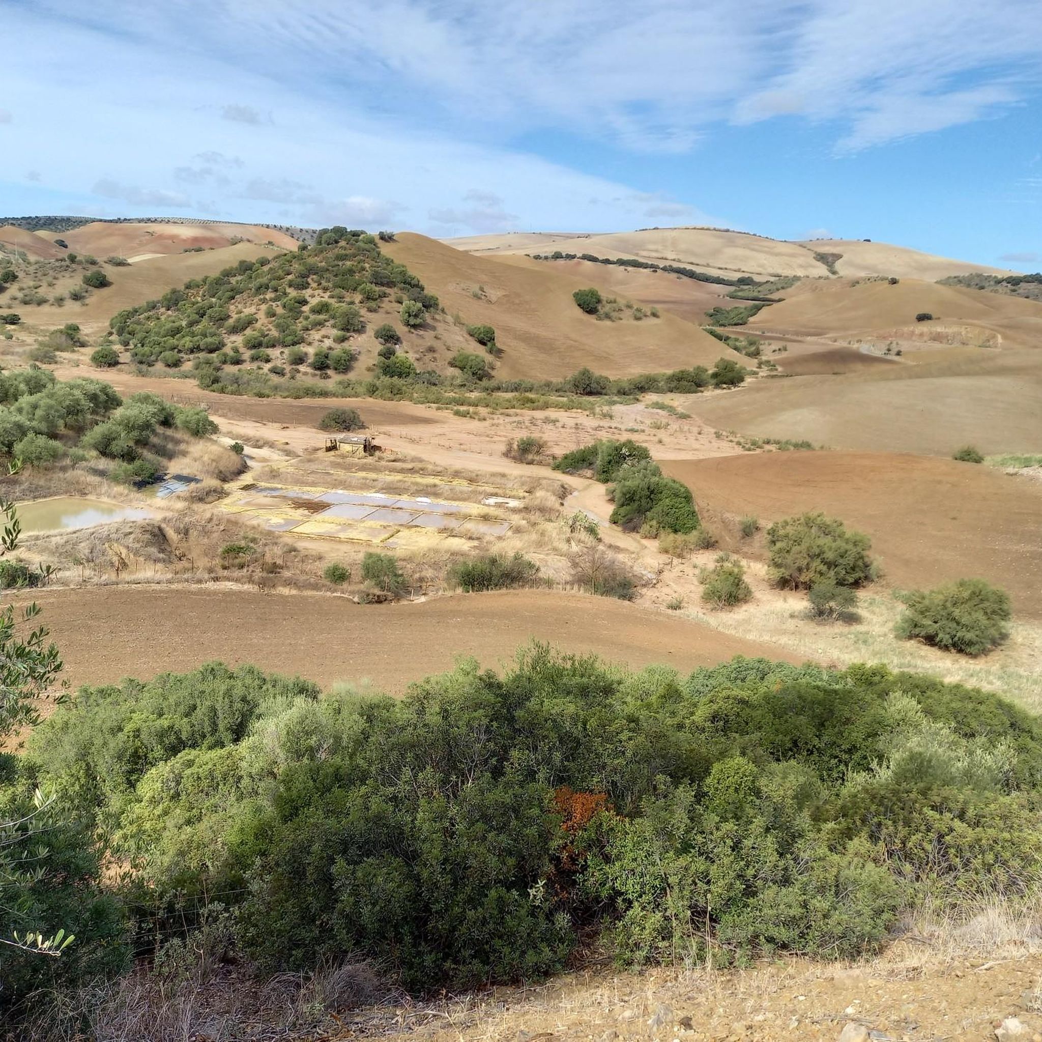
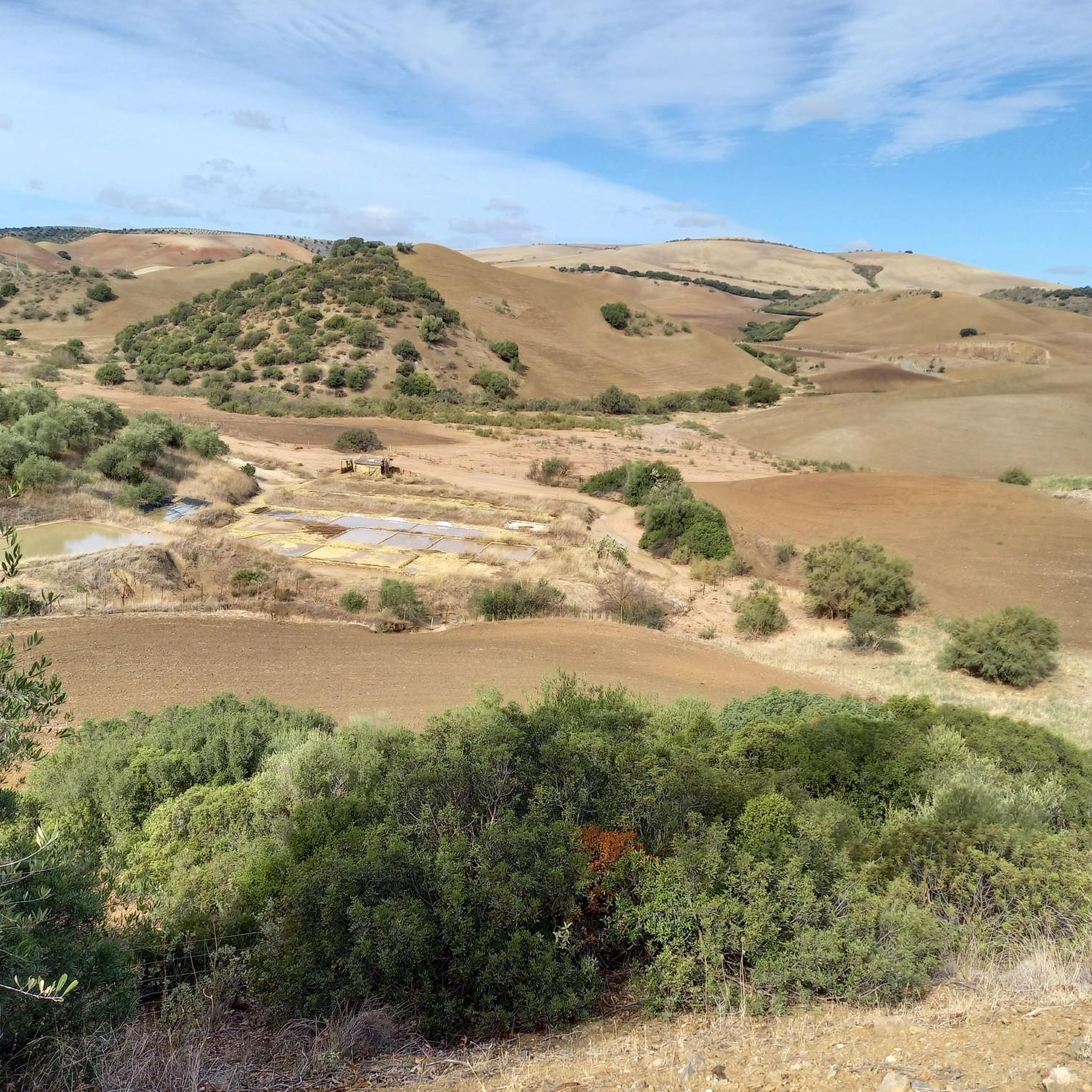
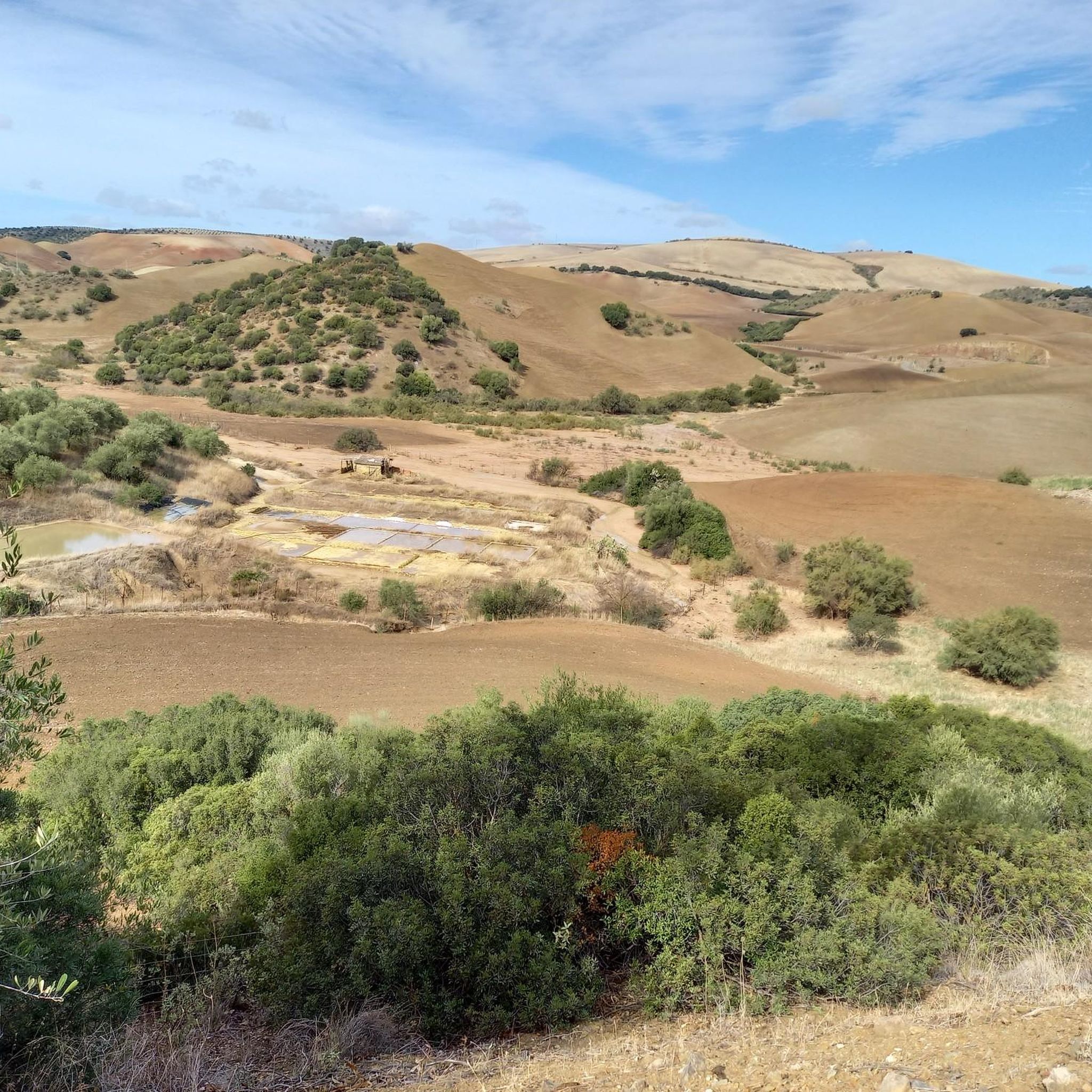
A 135-meter-long viaduct, built using rectangular truncated pyramidal pilasters with mortared ashlars, is formed by the repetition of seven identical arches. It was built to span the Guadalporcún River crossing before it meets the Guadamanil River. The latter originates in the Sierra de la Lebrona mountain range in the municipality of Pruna (Seville) and flows into the Guadalporcún River just a few meters from the viaduct. The confluence of the rivers has created a wide floodplain. From this railway infrastructure, there is a privileged view of the Estrechón Canyon, a natural passage carved by the Guadalporcún River to traverse the foothills of the Zaframagón Rock. Just below, on the left bank of the Guadalporcún, we find the ruined building of what was once the Zaframagón mill. A little further west, other ruins can be seen. It is a small town built for workers on the railway line construction site.
8
0

The Peñón de Algámitas is an impressive rock formation located in the Sierra del Tablón, in the province of Seville, Andalusia. With an altitude of 1,121 metres, it is one of the highest points in the province and offers spectacular views of the surrounding area.
6
0
This rock is known for its impressive landscape and its value as a natural viewing point over the surrounding olive groves. Typical vegetation includes holm oaks, cork oaks, wild olive trees and other Mediterranean species. In addition, it is a popular place for recreational and sporting activities such as hiking and climbing.
4
0
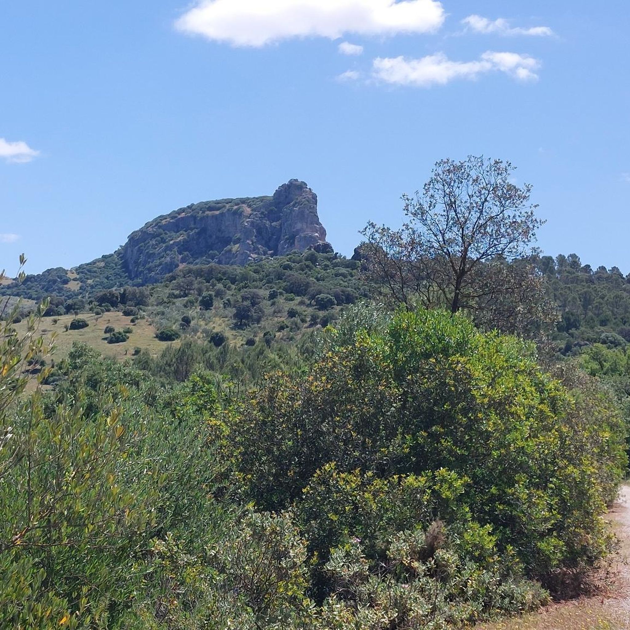
The Peña de Zaframagón is an impressive natural formation located in the Sierra de Grazalema, on the border of the provinces of Cádiz and Seville in Spain. This formation is one of the highest points in the region, with an altitude of 584 meters above sea level. The area is known for its sharp cliffs and the beautiful nature that surrounds it. One of the highlights of the Peña de Zaframagón is the Garganta del Estrechón, a deep gorge carved by the Guadalporcún River. Here you will also find unique landscapes such as pools, marmitas de gigante (large kettles) and small waterfalls. The area is an important nature reserve and is home to various flora and fauna, including the largest colony of fulvus in Andalusia and one of the largest in Europe.
8
0

If you're based in Ronda, White Village Tours offers bikes and transport to cycle from Olvera to Puerto Serrano. whitevillagetours.com/routes/via-verde
4
0

Frequently Asked Questions
What unique natural features can I expect to see around Morón de la Frontera?
The region boasts diverse landscapes, including impressive geological formations like the sharp cliffs of the Peñón de Zaframagón Nature Reserve and the deep Garganta del Estrechón gorge with its unique pools and 'marmitas de gigante'. You'll also find ancient trees such as El Chaparro de la Vega, and the distinctive mountain range of Sierra de Esparteros.
Are there opportunities for hiking or cycling near the natural monuments?
Yes, the area is excellent for outdoor activities. The Vía Verde de la Sierra, an old railway line, is perfect for walking and cycling, offering 36 kilometers of scenic routes through tunnels and over viaducts. The Sierra de Esparteros also provides numerous hiking opportunities. For more detailed routes, you can explore the Cycling around Morón De La Frontera or Gravel biking around Morón De La Frontera guides.
Which natural monuments are suitable for families with children?
For families, El Chaparro de la Vega is a great choice, featuring a large, ancient oak tree where playful activities often take place. The Pico del Terril also offers a simple and short route to the highest point in Seville, making it suitable for a family outing without significant technical difficulty.
What kind of wildlife can be observed in the natural areas?
The Peñón de Zaframagón Nature Reserve is particularly notable as it hosts the largest colony of Griffon Vultures (fulvus) in Andalusia and one of the largest in Europe. The Vía Verde de la Sierra also offers opportunities to observe these majestic birds. The region's diverse ecosystems support various flora and fauna, especially around the river systems and lagoons.
What are the highest points or best viewpoints in the region?
The highest point in the province of Seville is Pico del Terril, reaching 1,129 meters above sea level, offering panoramic views. The Peñón de Algámitas, at 1,121 meters, is the second highest and provides spectacular vistas over the surrounding olive groves. The Zaframagón Viaduct also offers privileged views of the Estrechón Canyon and the Zaframagón Rock.
Are there any historical elements integrated with the natural monuments?
Yes, the Vía Verde de la Sierra is a prime example, as it follows an old railway line, showcasing engineering marvels like tunnels and viaducts within a natural setting. The Zaframagón Viaduct itself is a historical structure, and nearby you can find ruins of an old mill and a small town built for railway workers, blending natural beauty with industrial heritage.
What is the best season to visit the natural monuments around Morón de la Frontera?
While the region can be enjoyed year-round, spring (March to May) and autumn (September to November) generally offer the most pleasant weather for outdoor activities like hiking and cycling, with milder temperatures and vibrant landscapes. Spring also brings blooming wildflowers, and the Fátima Pilgrimage takes place in mid-May under El Chaparro de la Vega.
Are there any challenging routes for experienced hikers or climbers?
For those seeking a challenge, the Peñón de Algámitas offers a relatively easy climb for most of its ascent, but the final meters to the summit require some scrambling and hand-use, making it more challenging. The area around the Peñón de Zaframagón Nature Reserve, with its sharp cliffs and gorges, also presents opportunities for more demanding exploration.
What are some lesser-known natural spots or 'hidden gems' in the area?
Beyond the main highlights, the fertile agricultural lands of La Campiña, with their extensive olive groves and sunflower fields, offer serene natural beauty. The Guadaíra River's 'green corridor' is also an area being recovered and improved, providing peaceful spots for nature observation. Many man-made lagoons and springs, though agricultural in origin, support rich biodiversity and can be tranquil places to explore.
What should I bring for a day of hiking or exploring these natural monuments?
It's advisable to bring comfortable hiking shoes, sufficient water, sun protection (hat, sunscreen), and appropriate clothing layers, as temperatures can vary. Binoculars are recommended for wildlife viewing, especially for observing the Griffon Vultures at Peñón de Zaframagón. A camera is also a must to capture the stunning landscapes.
Are there any natural areas with water features like rivers or waterfalls?
Yes, the Garganta del Estrechón within the Peñón de Zaframagón Nature Reserve is a deep gorge carved by the Guadalporcún River, featuring unique landscapes with pools and small waterfalls. The Guadaíra River also traverses the region, contributing to the hydrography with its 'green corridor' and supporting local biodiversity.
Most popular routes around Morón De La Frontera
Most popular attractions around Morón De La Frontera

Get inspired with the komoot mobile app


Explore more
Extend your search for the best caves by checking out these guides of the top ones around Morón De La Frontera:
