Top 5 Natural Monuments around Paracuellos De Jiloca
Natural monuments around Paracuellos De Jiloca offer diverse natural features within the province of Zaragoza, Aragon. The area is characterized by the Jiloca River, unique geological formations, and varied landscapes. Visitors can explore a range of natural attractions, from striking rock formations to elevated viewpoints, providing opportunities to experience the region's natural beauty.
Best natural monuments around Paracuellos De Jiloca
- The most popular natural monuments is Far West Bilbilitano Rock Formations, a natural monument known for its impressive views.…
Last updated: July 1, 2026
Far West Bilbilitano Rock Formations
Highlight • Natural Monument
Translated by Google •
Tip by

Castillejos Viewpoint (Sierra de Armantes)
Highlight • Viewpoint
Translated by Google •
Tip by
Sign up now to discover places like this
Get recommendations on the best single tracks, peaks, & plenty of other exciting outdoor places.
Sign up for free
Pico del Rayo
Highlight • Summit
Translated by Google •
Tip by

View of the Tranquera Reservoir
Highlight • Viewpoint
Translated by Google •
Tip by
Castillo de Alcocer
Highlight • Historical Site
Translated by Google •
Tip by

Start today with a free account
Your next adventure awaits.
Login or Signup

Tips from the Community

The La Tranquera Reservoir in Nuévalos is a spectacular place to enjoy nature and panoramic views. Inaugurated in 1959, the reservoir was designed to regulate the flow of the Piedra River and ensure the water supply in the region.
2
0


It is the highest point for many kilometers in the surrounding area (next to Pico de la Nevera, which cannot be accessed because it is a military installation). In summer there are fire surveillance personnel because it is a place with impressive views.
0
0

We are at the Pico del Rayo, the highest peak of the Sierra de Victor at 1427 masl with magnificent views of the Iberian System and Moncayo.
0
0
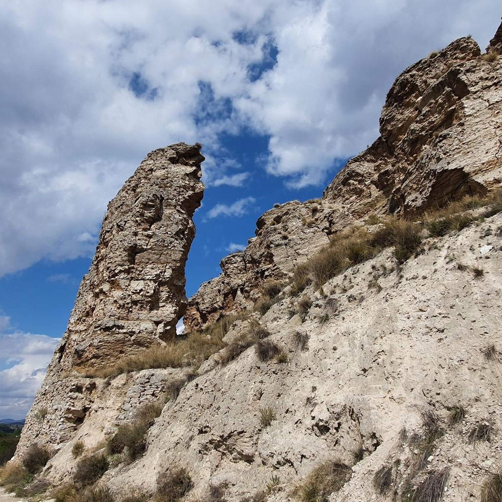
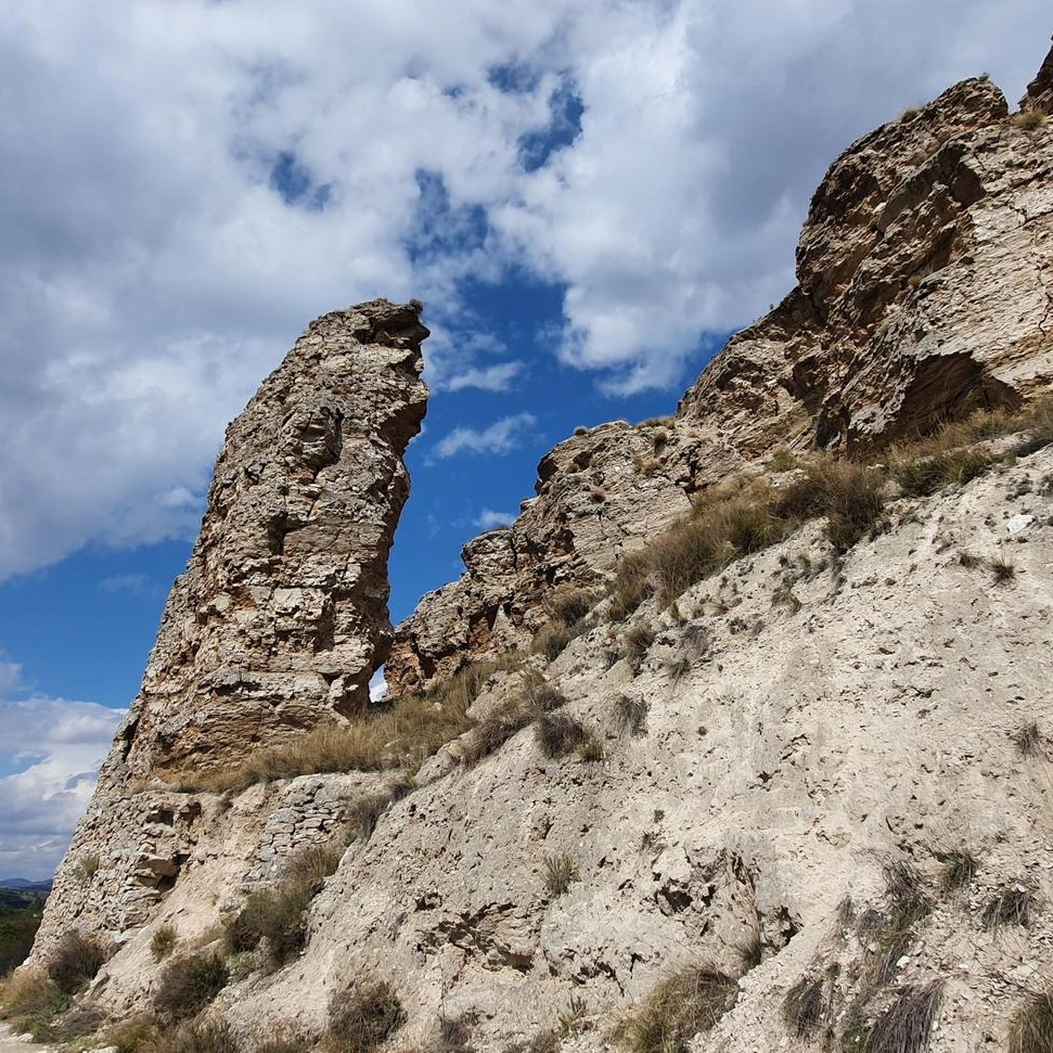
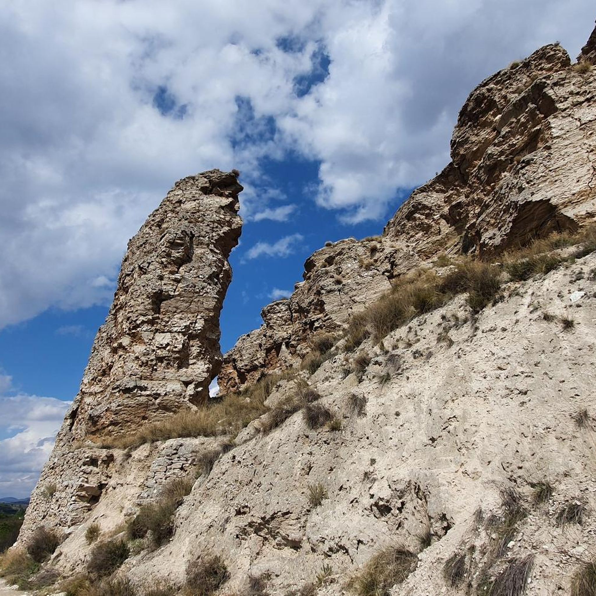
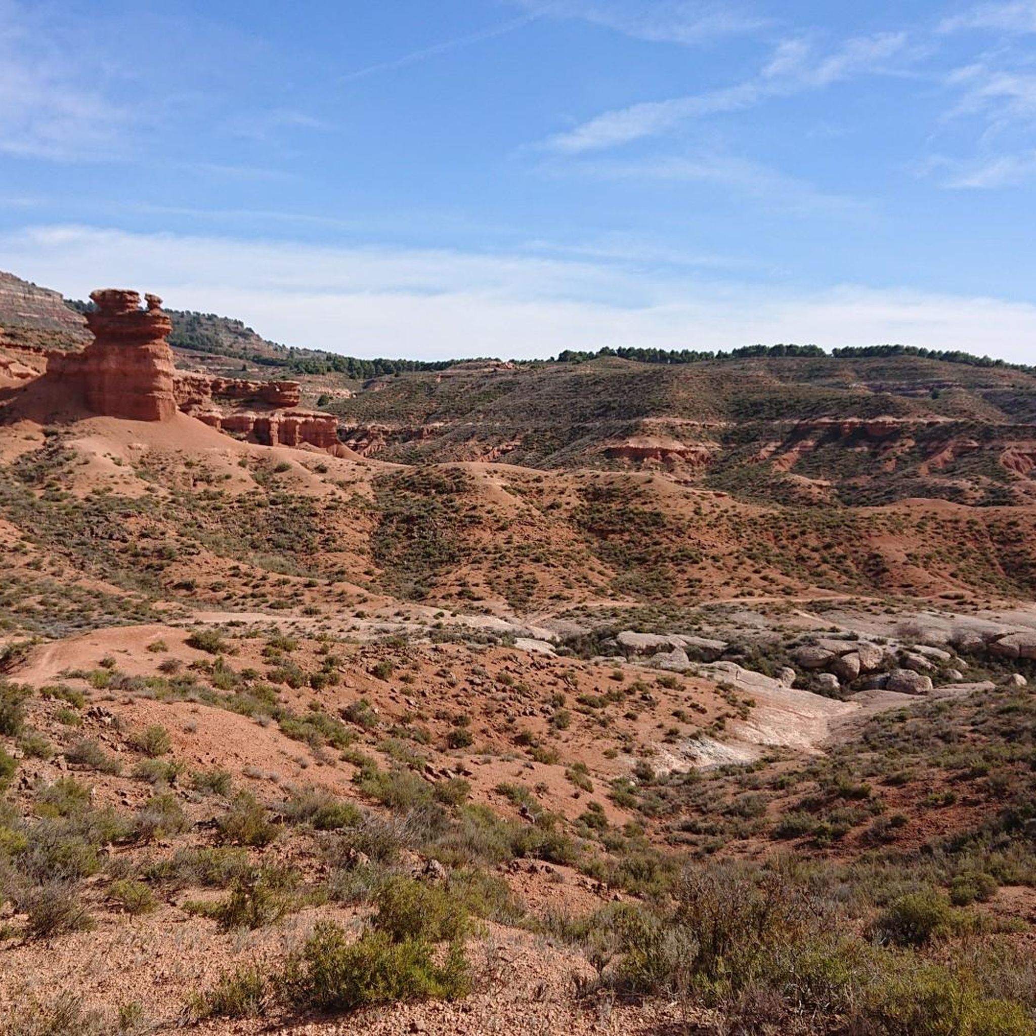
Impressive views on our way through the Far West trail as it could not bear another name. Without a doubt we will take out our camera to take some magazine photos in the also known as the Far West Bilbilitano
3
1
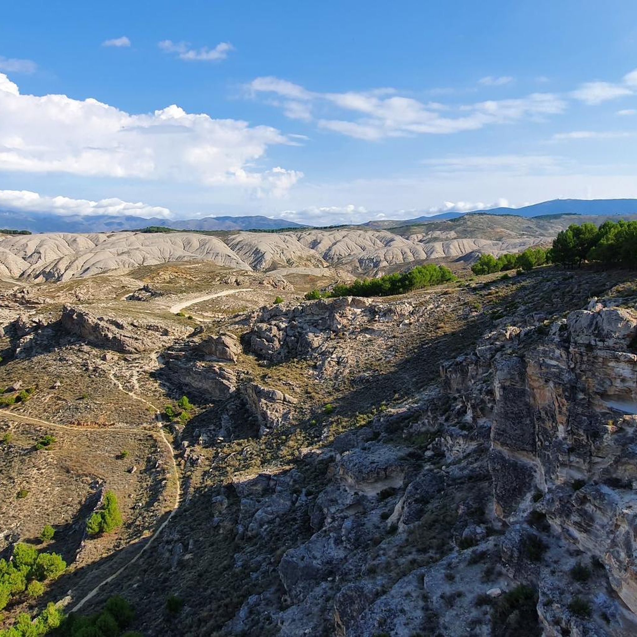
We are in the Sierra de Armantes, in a place shaped by wind and water. We would not say that we are in Zaragoza! What a beautiful print and what contrasts of colors, apart from some impressive views. It will remind us of the Far West, what's more, in Zaragoza they call it the Bilbilitano Far West.
4
1
Beautiful views of the Tranquera reservoir, from the town of Nuévalos, with the imposing Torre del Castillo behind us. If we are lucky enough to go with the reservoir's reserves fully loaded with water, we will see its spectacular emerald blue color. We will find fishermen, people bathing and a lot of fauna.
1
0
The peak of Rayo with 1,427 meters of altitude, is the highest peak of the Sierra Vicor. It is the second highest peak in the Iberian System of Zaragoza after Moncayo.
10
0
Frequently Asked Questions
What unique natural features can I explore around Paracuellos De Jiloca?
The region is known for its diverse natural features. You can discover striking geological formations like the Far West Bilbilitano Rock Formations, which offer impressive, 'Far West'-like landscapes. Additionally, the area features the therapeutic sulfurous waters of the Balneario de Paracuellos de Jiloca, with its natural lakes and extensive gardens, and the scenic Jiloca River that shapes the local terrain.
Are there any natural monuments with historical significance in the area?
Yes, the Castillo de Alcocer is a historical site that is also considered a natural monument. It is steeped in history, mainly known for its connection to the national hero El Cid, who besieged and conquered it in the 11th century.
Where can I find the best panoramic views of the region?
For magnificent panoramic views, head to Pico del Rayo, the highest peak of the Sierra Vicor at 1,427 meters. From here, you can see the Iberian System and Moncayo. Another excellent spot is the Castillejos Viewpoint (Sierra de Armantes), which offers impressive contrasts of colors and views shaped by wind and water.
What kind of outdoor activities can I do near the natural monuments?
The area around Paracuellos De Jiloca offers various outdoor activities. You can find numerous running trails, such as the 'Bilbilis loop from Calatayud' or 'Castillo Mayor – Castillo del Reloj loop'. For cyclists, there are road cycling routes like 'Calatayud – ⭐️ Puerta de Terrer loop' and challenging MTB trails including 'The Castles loop from Calatayud'. You can explore more options on the dedicated guides for running, road cycling, and MTB.
Are there hiking trails suitable for different difficulty levels?
Yes, the region offers a range of hiking experiences. While specific difficulty levels for trails directly to the natural monuments are not detailed, the nearby running and MTB routes include options from moderate to difficult, suggesting varied terrain for hikers. For example, the 'Castillo Mayor – Castillo del Reloj loop' is a moderate running trail that could be suitable for a hike.
What is the best time of year to visit the natural monuments?
While specific seasonal recommendations are not provided, the 'Far West Bilbilitano Rock Formations' are popular for photography, suggesting good visibility is key. Summertime at 'Pico del Rayo' sees fire surveillance personnel due to its impressive views, indicating it's a good time for clear vistas. Generally, spring and autumn offer pleasant temperatures for outdoor exploration and hiking.
Can I find natural areas suitable for relaxation and wellness?
Absolutely. The Balneario de Paracuellos de Jiloca, though not explicitly a 'natural monument,' is a significant natural attraction. It's renowned for its therapeutic sulfurous waters, natural lakes, and extensive gardens, providing a tranquil environment ideal for relaxation and disconnection.
What do visitors particularly enjoy about the natural monuments in Paracuellos De Jiloca?
Visitors are often captivated by the impressive views and unique geological formations. Many enjoy capturing 'magazine photos' at sites like the Far West Bilbilitano Rock Formations. The magnificent panoramic views from summits like Pico del Rayo are also highly appreciated, offering sweeping vistas of the Iberian System and Moncayo.
Are there any natural monuments that are particularly good for photography?
The Far West Bilbilitano Rock Formations are a highly recommended spot for photography, known for their impressive views and unique 'Far West' aesthetic. The Castillejos Viewpoint (Sierra de Armantes) also offers stunning contrasts of colors and views, making it another excellent location for capturing memorable images.
What kind of geological formations can be observed in the region?
The area is characterized by diverse geological formations. You can observe unique rock formations reminiscent of a 'Far West' landscape, particularly at the Far West Bilbilitano Rock Formations. The Castillejos Viewpoint (Sierra de Armantes) also showcases formations shaped by wind and water, creating impressive color contrasts. The presence of sulfurous waters at the Balneario is linked to the region's karstic Miocene gypsum deposits and Miocene sediments.
Is the Jiloca River a significant natural attraction in the area?
Yes, the Jiloca River plays a central role in the natural landscape of Paracuellos de Jiloca. The town is situated on its banks, and the river helps shape the local terrain. It is vital for local wildlife and agriculture, contributing to the region's overall natural beauty and ecosystem, and the Balneario itself is located along its course.
Most popular routes around Paracuellos De Jiloca
Most popular attractions around Paracuellos De Jiloca

Get inspired with the komoot mobile app


Explore more
Extend your search for the best caves by checking out these guides of the top ones around Paracuellos De Jiloca:
