Top 16 Natural Monuments around Cueva De Ágreda
Best natural monuments around Cueva De Ágreda are located in the Soria province of Spain, within the Araviana Valley and adjacent to the Moncayo mountain range. This area is recognized for its ecological value, forming part of the Red Natura 2000 as a Site of Community Interest and a Special Protection Area for Birds. The landscape features diverse ecosystems, from high mountain peaks to karstic formations and lush forests. It offers a range of natural features for exploration.
Best natural…
Last updated: July 1, 2026
Moncayo Summit
Highlight • Summit
Translated by Google •
Tip by

Peña del Tío Fresquito
Highlight • Viewpoint
Translated by Google •
Tip by
Sign up now to discover places like this
Get recommendations on the best single tracks, peaks, & plenty of other exciting outdoor places.
Sign up for free
Cueva de los Pilares
Highlight • Cave
Translated by Google •
Tip by
Pozo de las Truchas Waterfall
Highlight • Waterfall
Translated by Google •
Tip by
Cabezo de la Mata
Highlight • Viewpoint
Translated by Google •
Tip by

Sign up for free to discover even more natural monuments around Cueva De Ágreda.
Sign up for free
Already have an account?
Start today with a free account
Your next adventure awaits.
Login or Signup

Tips from the Community

Cabezo de la Mata is a peak located in the Sierra del Moncayo, in Aragon, Spain. With an altitude of 1,437 metres, it is one of the most accessible peaks in the area. One of the most popular routes to ascend Cabezo de la Mata begins at Fuente de los Frailes. This circular route offers spectacular views of the northeastern slope of the Sierra del Moncayo and the plain of the Ebro Valley. The route includes sections through beech and pine forests, and is suitable for all year round.
5
0
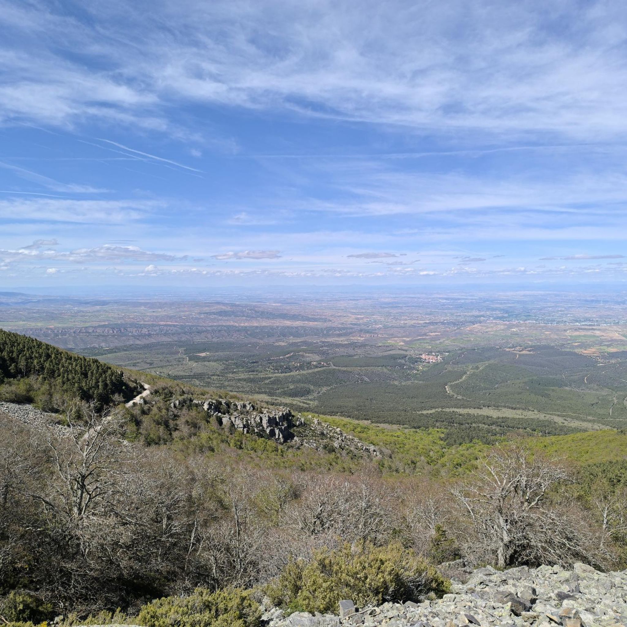
The summit of Moncayo, also known as Pico San Miguel, is the highest mountain in the Iberian system, with an altitude of 2315 metres. It is located between the provinces of Zaragoza (Aragon) and Soria (Castile and Leon) in Spain. To reach the summit, many hikers start from the Sanctuary of the Virgin of Moncayo, located at 1621 metres. From there, the route passes through the Cucharón cirque and the San Miguel basin before reaching the summit. The route offers spectacular views and is especially popular in spring and summer.
5
0

You need to be in shape, it is a climb that requires some climbing skill.
0
0

Moncayo never disappoints. From Cueva de Agreda the climb is longer and harder, but it is worth the sacrifice. The views from the summit, towards Aragon and towards Castilla, are impressive.
1
0

At the Collado de la Atalaya you have to head northeast along the slope of the mountain range following a level path marked with stone markers. The path crosses the Las Hoyas de los Portillos valley and climbs halfway through the pine forest towards the wall of the Muela del Cerro Morrón. In the pine forest you have to keep climbing towards the east and at the base of the walls connect with the path coming from the north face of the mountain. The landmarks are clear between the pine trees and the mole wall, they jump a couple of small slopes near other cavities and lead to the spectacular Cueva de los Pilares, a fantastic natural rock sanctuary with arches, vaults and giant columns. The climb to the summit of the mole leaves from the cave through the canal located to the west, it is a clear and obvious climb, it has stone markers and although it seems that there is no exit with good visibility, it is a simple section along some aerial ledges without too many complications, unless the rock is wet, it cannot even be classified as a climbing step, rather technical mountain hiking. The milestones enter the large inclined molar plain and take the direction of the summit through the center of the mountain.
0
1

Impressive views that can be seen: the Pyrenees, the Ebro depression...
1
0

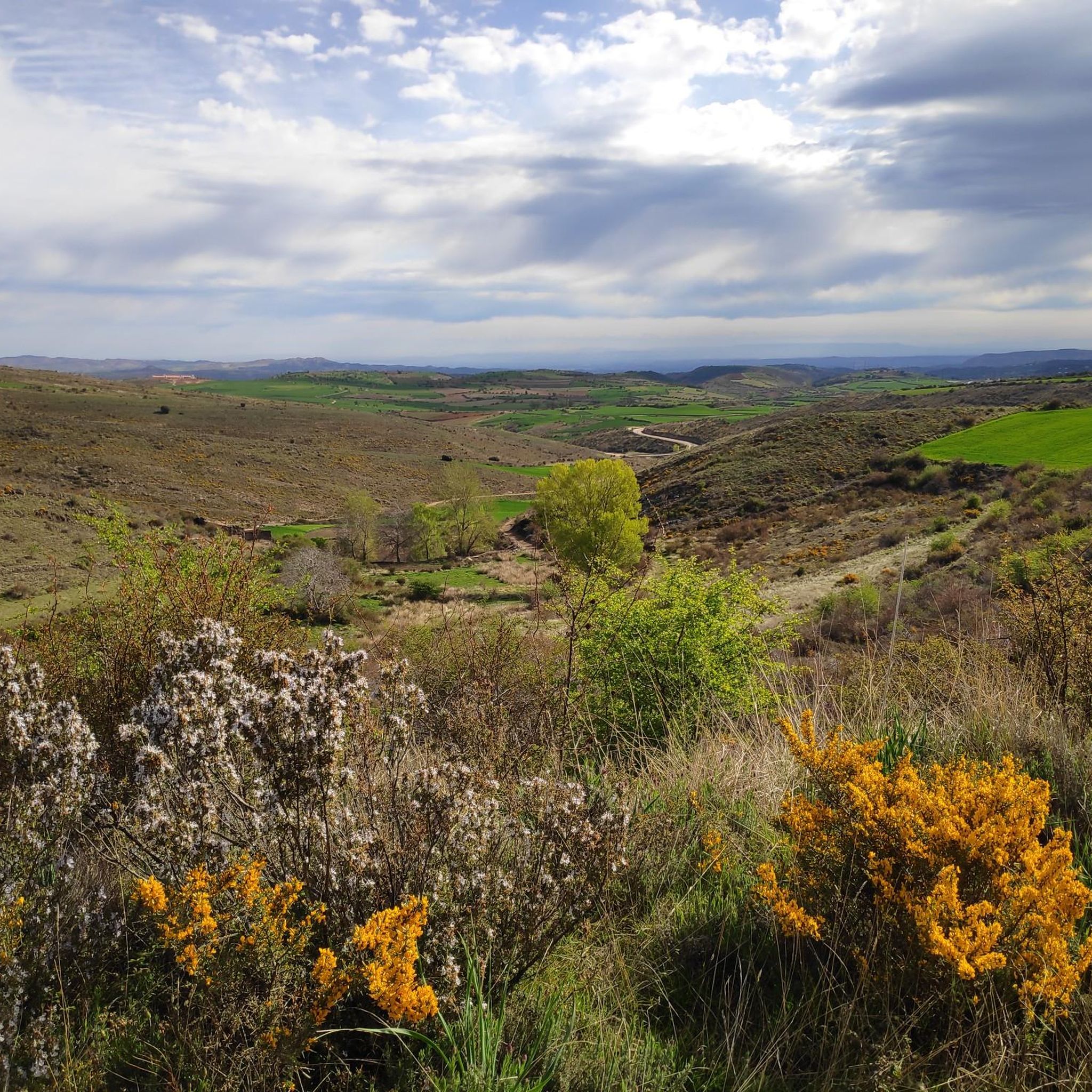
Running along the bottom of the Val ravine, we come across a sign that indicates the detour to the Peña del Tío Fresquito, which we will access by a small staircase and a subsequent climb. If we can do it, it is worth it for the good views it offers us of the Val valley.
1
0
Walking along the bottom of the Val ravine, we come across a sign that indicates the detour to the Peña del Tío Fresquito, which we will access by a small staircase and a subsequent climb. If we can do it, it is worth it for the good views it offers us of the Val valley.
1
0
Frequently Asked Questions
What unique natural monuments can I explore in Cueva de Ágreda?
Cueva de Ágreda offers a variety of unique natural monuments. You can explore the impressive Cueva de los Pilares, a natural rock sanctuary with arches and giant columns. Another fascinating site is the Karstic Complex, featuring large sinkholes like 'Simonda' and 'Similla,' and the distinctive rock carvings known as 'Las Patadas del Diablo.' Don't miss the serene 'Los Praos' meadows, perfect for relaxation.
Are there challenging hikes for experienced adventurers in the area?
Yes, the region around Cueva de Ágreda provides challenging options. The Moncayo Summit, also known as Pico San Miguel, is the highest point of the Iberian System and offers a demanding ascent with spectacular panoramic views. Another challenging climb is to Peña del Tío Fresquito, which rewards with great views of the Val valley. For more options, check out the Hiking around Cueva De Ágreda guide, which includes routes like the 'Moncayo from Cueva de Ágreda Trail'.
What kind of landscapes can I expect to see around Cueva de Ágreda?
The landscapes around Cueva de Ágreda are incredibly diverse, ranging from the majestic Moncayo mountain range with its lush forests and high peaks to the unique karstic formations of the Araviana Valley. You'll encounter calcareous caves, impressive sinkholes, serene meadows, and the tranquil environment of the Cañón del Río Val, home to the Pozo de las Truchas Waterfall.
Are there easy walks or trails suitable for families near the natural monuments?
Absolutely. 'Los Praos,' located just 2 kilometers from the village, offers an idyllic setting with meadows, an oak forest, and a natural pool, perfect for a relaxing family outing and picnics. The area around the Pozo de las Truchas Waterfall also features well-signposted paths in a peaceful natural environment. For more family-friendly options, explore the Hiking around Cueva De Ágreda guide.
Do any natural monuments in Cueva de Ágreda have local legends or historical significance?
Yes, several sites are steeped in local folklore. The Cueva de Caco, the namesake of the municipality, is said to be where the giant Caco hid stolen oxen from Hercules. The 'Las Patadas del Diablo' (The Devil's Kicks) furrows in the karstic complex come with an intriguing legend about a contest between God and the Devil. The Moncayo Massif itself is also enveloped in legends and a sense of mystery.
Can I see wildlife at the natural monuments in Cueva de Ágreda?
Yes, the region is rich in wildlife. The Cueva de Caco is home to a significant colony of bats, and the Interpretation Center of Moncayo and Bats in the village provides information and even a telescope for observation. The Moncayo Massif boasts diverse ecosystems, and the entire area is part of the Red Natura 2000 as a Site of Community Interest and a Special Protection Area for Birds, making it excellent for birdwatching.
What geological features are prominent in the Cueva de Ágreda area?
The Cueva de Ágreda area is renowned for its karstic landscape. You'll find impressive calcareous caves like Cueva de Caco with its stalactite and stalagmite formations, and the Cueva de los Pilares with its natural rock arches and columns. The Araviana Valley also features notable dolinas (sinkholes) such as 'Simonda' and 'Similla,' and the distinctive 'Las Patadas del Diablo' furrows, all formed by water dissolving limestone.
What outdoor activities are popular near these natural monuments?
The natural monuments around Cueva de Ágreda are excellent starting points for various outdoor activities. Hiking and mountaineering are very popular, especially in the Moncayo Massif, with routes like sections of the GR-86 Iberian Soria Trail. You can find detailed routes for Hiking, Running, and Mountain Biking in the region.
What do visitors enjoy most about the natural monuments in Cueva de Ágreda?
Visitors particularly appreciate the stunning panoramic views from high points like the Moncayo Summit and Cabezo de la Mata. The tranquil natural environments, such as the Pozo de las Truchas Waterfall and 'Los Praos,' are also highly valued for relaxation and picnics. The unique geological formations, like the arches and columns of Cueva de los Pilares, also leave a lasting impression.
Is there an information center for the natural monuments in Cueva de Ágreda?
Yes, the village of Cueva de Ágreda hosts the Interpretation Center of Moncayo and Bats. This center provides extensive information about the region's natural heritage, including the Moncayo Massif and the bat colony in Cueva de Caco, offering exhibition programs and a telescope for bat observation.
What is the best time to visit the natural monuments around Cueva de Ágreda?
While the Moncayo Massif can be explored year-round, spring and summer are especially popular for hiking to the Moncayo Summit due to more favorable weather conditions. However, the diverse landscapes, including forests and karstic areas, offer beauty in every season. Even in winter, specific routes like those to Cabezo de la Mata through beech and pine forests are suitable.
Are there any viewpoints offering scenic vistas of the region?
Yes, the area is rich in viewpoints. The Moncayo Summit offers splendid panoramic views of the surrounding landscape. From Cabezo de la Mata, you can enjoy beautiful vistas of the northeastern slope of the Sierra del Moncayo and the Ebro Valley plain. Additionally, Peña del Tío Fresquito provides excellent views of the Val valley.
Most popular routes around Cueva De Ágreda
Most popular attractions around Cueva De Ágreda

Get inspired with the komoot mobile app


Explore more
Extend your search for the best caves by checking out these guides of the top ones around Cueva De Ágreda:
