Top 20 Natural Monuments around Puurs
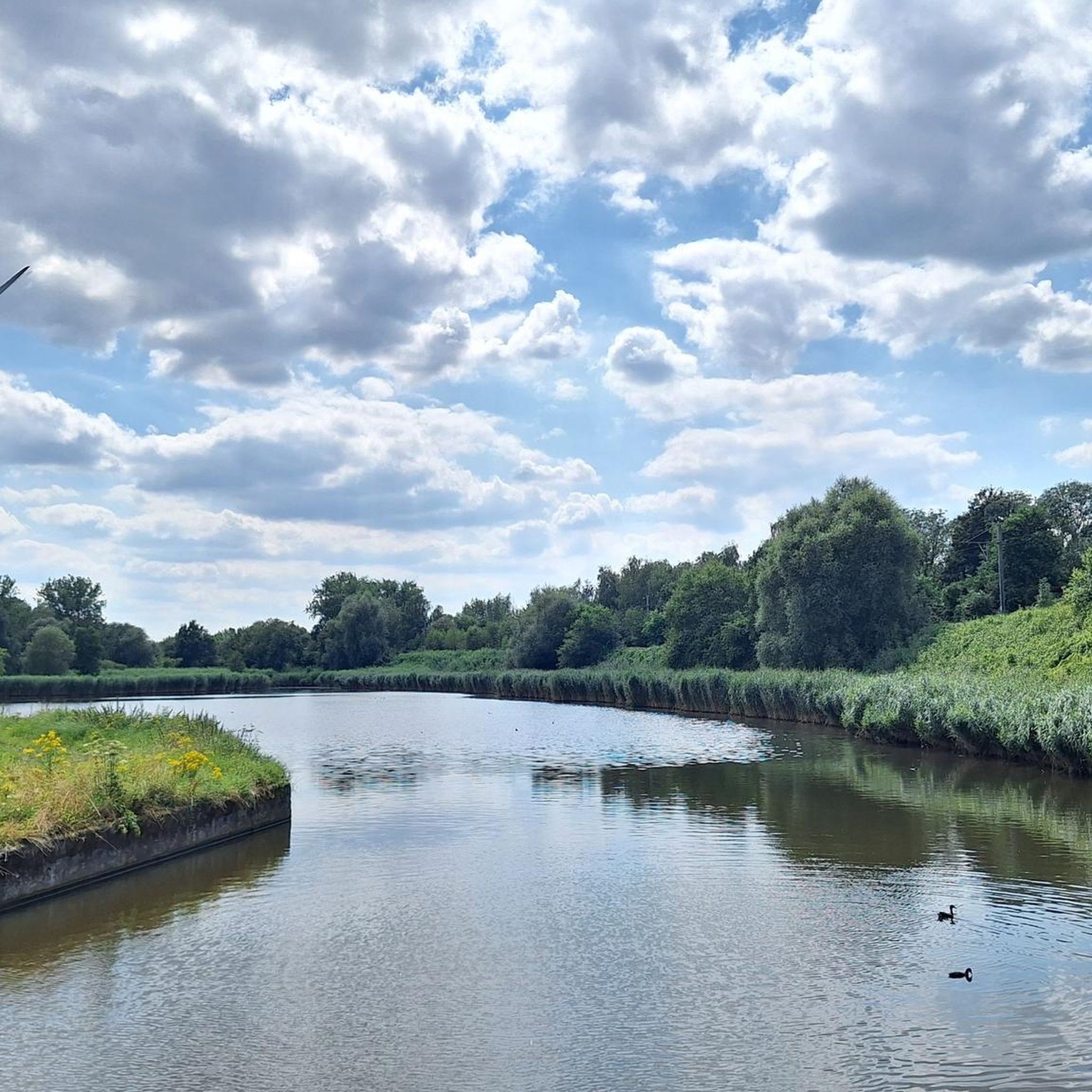
Best natural monuments around Puurs showcase a landscape defined by its riverine environment and extensive green spaces. The region features the winding Scheldt and Rupel rivers, characterized by green riverbanks, mudflats, and salt marshes. These natural areas provide significant ecological value and offer recreational opportunities for hiking and cycling. The "many greenlands" of Puurs-Sint-Amands contribute to its appeal for nature exploration.
Best natural monuments around Puurs
- The most popular natural monuments is Confluence of the Dijle and Nete = Rupel…
Last updated: October 2, 2026
Confluence of the Dijle and Nete = Rupel
Highlight • River
Translated by Google •
Tip by

Geographical Center of Flanders
Highlight • Monument
Translated by Google •
Tip by

Sign up now to discover places like this
Get recommendations on the best single tracks, peaks, & plenty of other exciting outdoor places.
The Putten van Lacourt
Highlight • Lake
Translated by Google •
Tip by

Hennenput Pond, Buggenhoutbos
Highlight • Lake
(Nature point)
Translated by Google •
Tip by
Benedenvliet - Schelle
Highlight • River
Translated by Google •
Tip by
Sign up for free to discover even more natural monuments around Puurs.
Already have an account?
Start today with a free account
Your next adventure awaits.
Tips from the Community

It is good to know where the center is in Flanders. Well, this is not the political center of Flanders, but the geographical center.
5
1

The geographical centre of Flanders was determined by students of the Faculty of Applied Sciences of the University of Leuven. Using GPS measurements and with the help of mathematics teacher Prof. Theo Van der Waeteren, the centre was determined in 1999: it is located in the far corner of East Flanders, a few dozen metres from the previously determined "three-province point" (East Flanders, Antwerp and Flemish Brabant). Just a few metres from the territory of Sint-Amands, it is just in Opdorp, a sub-municipality of Buggenhout. The coordinates are: 51° 2′ 16″ N, 4° 14′ 26″ E. A monument was placed at this point in 2003.
2
0

Today Komoot was asked to change the name of this Highlight to Hennenput.
11
0


The geographical center of Flanders was determined by students from the Faculty of Applied Sciences of the University of Leuven. The center was determined in 1999[source?] via GPS measurements and with the help of the mathematics teacher: it is located in the furthest corner of East Flanders, a few tens of meters from the previously determined "three-province point" (East Flanders, Antwerp and Flemish Brabant). It is just a few meters away from the territory of Sint-Amands in Opdorp, a sub-municipality of Buggenhout. The coordinates are: 51° 2′ 16″ N, 4° 14′ 26″ E. In 2003 a monument was placed at this point.
5
0
The Henneput, the largest water feature, is an attraction for almost all animals, a spawning ground for toads and frogs in the spring, a moment of relaxation for many hikers. (Nature point)
18
0
Resting on the benches can be good.
11
0

Beautiful water lilies, dragonflies, but dirty brownish water
5
2
Frequently Asked Questions
What are some unique natural features to explore around Puurs?
The region around Puurs is defined by its riverine environment. You can explore the Confluence of the Dijle and Nete = Rupel, where two rivers meet to form the Rupel, creating a striking landscape. Another notable area is the Zennegat Flood Area, which features gullies, mudflats, and salt marshes, providing a unique habitat for various plants and animals.
Are there family-friendly natural monuments in the Puurs area?
Yes, several natural monuments are suitable for families. The Confluence of the Dijle and Nete = Rupel is considered family-friendly, offering beautiful views. The Zennegat Flood Area is also family-friendly, with clear information boards about the area's history. Additionally, the Hennenput Pond, Buggenhoutbos, is a picturesque spot with benches, perfect for a relaxing family outing.
What kind of wildlife can I observe in the natural areas around Puurs?
The riverine landscapes, particularly the mudflats and salt marshes along the Scheldt and Rupel rivers, are ideal habitats for various flora and fauna. The Zennegat Flood Area, for instance, is known for providing an ideal habitat for rare plants and animals. The Hennenput Pond is an attraction for almost all animals, serving as a spawning ground for toads and frogs in spring.
What outdoor activities can I do near the natural monuments in Puurs?
The natural monuments around Puurs are excellent starting points for various outdoor activities. You can enjoy extensive cycling and hiking along the car-free towpaths of the Scheldt and Rupel rivers. For more structured routes, explore the many options for cycling, road cycling, and MTB trails in the wider Puurs area.
Are there specific hiking trails or walking routes near these natural monuments?
Yes, the region offers numerous opportunities for hiking. The towpaths along the Scheldt and Rupel rivers provide serene routes for walking. The 'Land of the Silent Waters' area is particularly known for its tranquil hiking experiences, with routes of varying lengths. You can find many walking and hiking routes that incorporate these natural monuments.
What do visitors enjoy most about the natural monuments around Puurs?
Visitors often appreciate the tranquility and natural beauty of the area. For example, the Putten van Lacourt is a popular spot for enjoying the surroundings, especially on weekdays when it's quieter. The scenic trails and green areas around the Confluence of the Dijle and Nete = Rupel are also highly valued for walks and hikes, offering a chance to immerse oneself in nature.
Is there a historical or cultural connection to any of the natural monuments?
While primarily natural, some areas have cultural links. The 'Land of the Silent Waters' trails, for instance, connect to the life and work of poet Emile Verhaeren, adding a cultural dimension to the natural exploration. Additionally, the Geographical Center of Flanders, while a man-made monument, marks a significant geographical point within the natural landscape.
What is the best time of year to visit the natural monuments around Puurs?
The natural monuments around Puurs, with their riverine landscapes and green spaces, are enjoyable throughout much of the year. Spring and autumn offer pleasant temperatures for hiking and cycling, with vibrant foliage or blooming flora. Even after rain, paths can be wet, as noted for The Putten van Lacourt, so appropriate footwear is always recommended.
Are there any hidden natural gems or lesser-known spots worth visiting?
Beyond the more popular spots, the extensive network of greenlands and riverbanks offers many serene corners. Exploring the car-free towpaths along the Scheldt and Rupel rivers can lead you to quiet stretches of mudflats and salt marshes, which are less frequented and offer a peaceful immersion in nature. These areas are rich in ecological value and provide beautiful views.
What should I be aware of when visiting natural monuments like The Putten van Lacourt?
When visiting places like The Putten van Lacourt, it's good to know that it can attract many visitors, especially on weekends. For a quieter experience, consider visiting on weekdays. Also, be mindful of weather conditions; paths can become wet and potentially muddy after rain, so suitable footwear is advisable.
Can I find viewpoints to appreciate the natural landscapes?
Yes, several natural monuments offer excellent viewpoints. The Confluence of the Dijle and Nete = Rupel provides a striking view of the rivers meeting. The Zennegat Flood Area offers beautiful views between the Canal Leuven-Mechelen and the Dyle. Additionally, the Hennenput Pond is a picturesque spot to relax and take in the scenery.
Most popular attractions around Puurs

Get inspired with the komoot mobile app


Explore more
Extend your search for the best caves by checking out these guides of the top ones around Puurs:
