Top 15 Natural Monuments around Tricarico
Natural monuments around Tricarico are concentrated within the Parco Regionale di Gallipoli Cognato Piccole Dolomiti Lucane, a regional park spanning over 27,000 hectares in Basilicata, Italy. This area is characterized by vast forests, diverse ecosystems, and unique geological formations. The park offers insight into Italy's natural heritage, providing opportunities for exploration and observation of its varied terrain. It is a biodiversity hotspot, home to various flora and fauna.
Best natural monuments around Tricarico
- The most popular natural monuments is Viewpoint…
Last updated: June 28, 2026
Castelmezzano
Highlight • Settlement
Translated by Google •
Tip by

Pietrapertosa
Highlight • Settlement
Translated by Google •
Tip by

Sign up now to discover places like this
Get recommendations on the best single tracks, peaks, & plenty of other exciting outdoor places.
Sign up for free
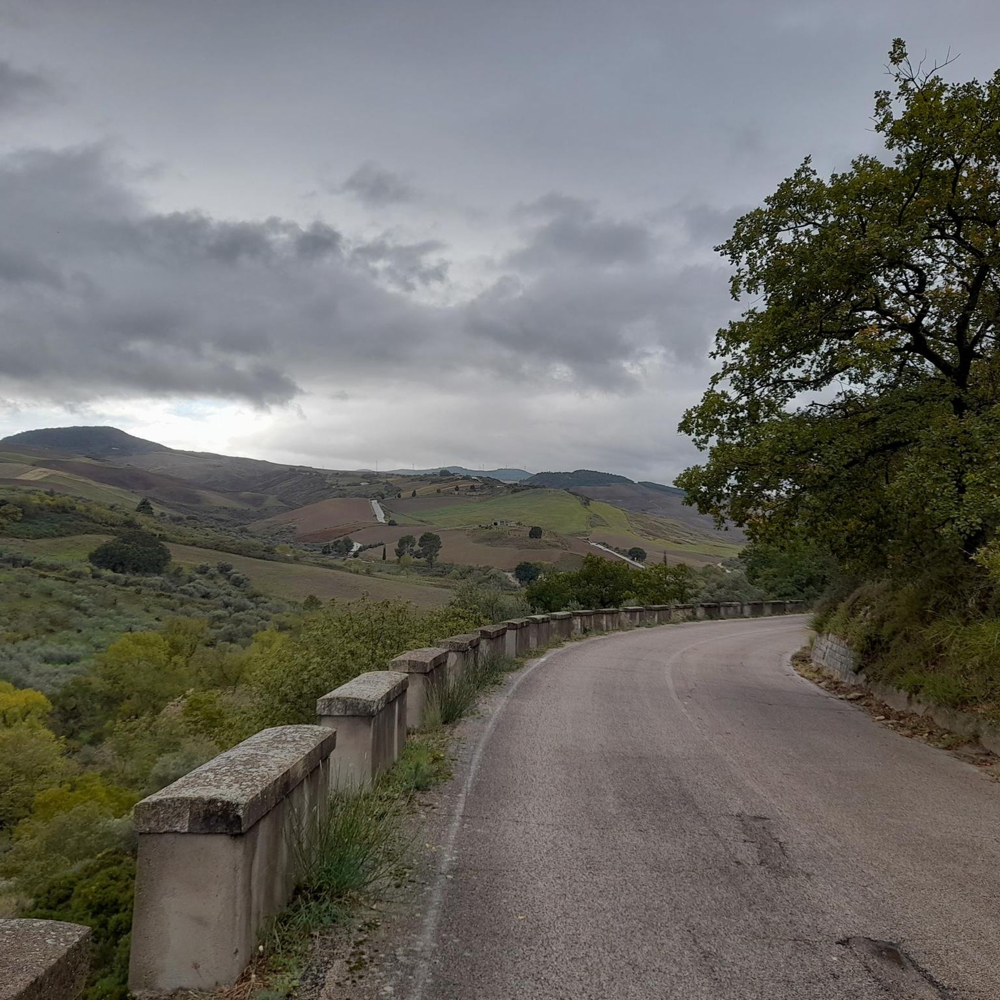
Road Between Pietrapertosa and Campomaggiore
Highlight (Segment) • Trail
Translated by Google •
Tip by

Petre de la Mola
Highlight • Natural Monument
Translated by Google •
Tip by

Viewpoint of Tomba 1 in Parco Regionale Gallipoli Cognato Piccole Dolomiti Lucane
Highlight • Viewpoint
Translated by Google •
Tip by

Sign up for free to discover even more natural monuments around Tricarico.
Sign up for free
Already have an account?
Start today with a free account
Your next adventure awaits.
Login or Signup
Tips from the Community

After the narrow alleys and steps through the old town, the climb to the rocks is worthwhile. Even in rainy weather, the rocks are easily accessible via iron stairs. In heavy rain, every small alley becomes a rushing stream.
3
0

Pietrapertosa, fabulous place, welcoming and very polite people! a magnificent place for those looking for relaxation
0
0

Steep stairs, narrow streets, some chapels and churches are waiting to be explored. There are beautiful views from the Piazza Emilio Caizzo of the village and the surrounding countryside.
2
0

A beautiful road with slopes not to be underestimated that connects Pietrapertosa and Campomaggiore. Guaranteed excellent views of the Lucanian Dolomites, especially towards Castelmezzano.
1
1

Castelmezzano is an enchanting village perched in the heart of the Little Lucanian Dolomites, in the province of Potenza. The historic center of the town, among houses carved into the rock, steep stairs and small alleys that offer unexpected views of the wonderful panoramas of the Lucanian Dolomites, have meant that Castelmezzano is counted among the most beautiful villages in Italy. Right above the town center there are particular and extremely characteristic sandstone rock formations which contribute to the spectacular nature of the landscape.
3
0

The Lucanian Dolomites. Spectacular village clinging to the rocks
3
0

Pietrapertosa is one of the most beautiful villages in Italy. It is located in the Lucanian Dolomites, perched at the foot of imposing rocks with very strange shapes. Not to be missed.
3
0

Pietrapertosa Pietrapertosa è un comune in provincia di Potenza situato in prossimità delle suggestive vette delle Dolomiti Lucane, fa parte del circuito dei Borghi più belli d’Italia. Pietrapertosa si mostra come un antico borgo che è riuscito a mantenere nel tempo la fisionomia medievale soprattutto nella parte più antica situata alle pendici del Castello che conserva, ancora oggi, l’antico nome saraceno di Arabat caratterizzato da strade strette e vicoli ciechi. Le case tipicamente unifamiliari disposte a file dall’alto verso il basso, si adattano all’andamento del terreno, e diventano parte integrante dell’ambiente circostante tanto che spesso la roccia assume la funzione di parete delle abitazioni.Pietrapertosa Pietrapertosa è un comune in provincia di Potenza situato in prossimità delle suggestive vette delle Dolomiti Lucane, fa parte del circuito dei Borghi più belli d’Italia. Pietrapertosa si mostra come un antico borgo che è riuscito a mantenere nel tempo la fisionomia medievale soprattutto nella parte più antica situata alle pendici del Castello che conserva, ancora oggi, l’antico nome saraceno di Arabat caratterizzato da strade strette e vicoli ciechi. Le case tipicamente unifamiliari disposte a file dall’alto verso il basso, si adattano all’andamento del terreno, e diventano parte integrante dell’ambiente circostante tanto che spesso la roccia assume la funzione di parete delle abitazioni. image Pietrapertosa (PZ) - Dolomiti Lucane Pietrapertosa (PZ) - Dolomiti Lucane Pietrapertosa (PZ) - Dolomiti Lucane Pietrapertosa (PZ) - Dolomiti Lucane Pietrapertosa (PZ) - Dolomiti Lucane Pietrapertosa (PZ) - Dolomiti Lucane Pietrapertosa (PZ) - Dolomiti Lucane Pietrapertosa (PZ) - Dolomiti Lucane Pietrapertosa (PZ) - Dolomiti Lucane image Visitando Pietrapertosa si ha la sensazione che tutto sia regolato in funzione della roccia, ad esempio le numerose scale, sono l’esemplificazione della simbiosi tra il paese, i suoi abitanti e la roccia, la manifestazione del vivere il proprio territorio che non può negare la presenza massiccia quasi prorompente della natura, ma deve renderla parte integrante della struttura urbanistica. Pietrapertosa prende il nome dall’antica Petraperciata, cioè forata per la presenza di una rupe forata da parte a parte, ed è il comune più alto della Basilicata, con i suoi 1088 m di altitudine, si sviluppa sulle rocce delle Dolomiti Lucane, ben protetta da eventuali incursioni dalla valle. Questo carattere di fortezza naturale e la possibilità di dominare la valle del Basento hanno contribuito a favorire la presenza dell’uomo sin dai tempi più remoti. Il turista che giunge a Pietrapertosa non può non salire sul Castello altrimenti si perderebbe uno spettacolo suggestivo e di eccezionale bellezza, difficile da descrivere. Lo sguardo può spaziare su monti, boschi, scintillio di torrenti e fiumi, colline, valli, che si alternano e sovrappongono tutto intorno; dalla vetta si vive l’ebbrezza di essere proiettato tra terra e cielo.Pietrapertosa Pietrapertosa è un comune in provincia di Potenza situato in prossimità delle suggestive vette delle Dolomiti Lucane, fa parte del circuito dei Borghi più belli d’Italia. Pietrapertosa si mostra come un antico borgo che è riuscito a mantenere nel tempo la fisionomia medievale soprattutto nella parte più antica situata alle pendici del Castello che conserva, ancora oggi, l’antico nome saraceno di Arabat caratterizzato da strade strette e vicoli ciechi. Le case tipicamente unifamiliari disposte a file dall’alto verso il basso, si adattano all’andamento del terreno, e diventano parte integrante dell’ambiente circostante tanto che spesso la roccia assume la funzione di parete delle abitazioni. image Pietrapertosa (PZ) - Dolomiti Lucane Pietrapertosa (PZ) - Dolomiti Lucane Pietrapertosa (PZ) - Dolomiti Lucane Pietrapertosa (PZ) - Dolomiti Lucane Pietrapertosa (PZ) - Dolomiti Lucane Pietrapertosa (PZ) - Dolomiti Lucane Pietrapertosa (PZ) - Dolomiti Lucane Pietrapertosa (PZ) - Dolomiti Lucane Pietrapertosa (PZ) - Dolomiti Lucane image Visitando Pietrapertosa si ha la sensazione che tutto sia regolato in funzione della roccia, ad esempio le numerose scale, sono l’esemplificazione della simbiosi tra il paese, i suoi abitanti e la roccia, la manifestazione del vivere il proprio territorio che non può negare la presenza massiccia quasi prorompente della natura, ma deve renderla parte integrante della struttura urbanistica. Pietrapertosa prende il nome dall’antica Petraperciata, cioè forata per la presenza di una rupe forata da parte a parte, ed è il comune più alto della Basilicata, con i suoi 1088 m di altitudine, si sviluppa sulle rocce delle Dolomiti Lucane, ben protetta da eventuali incursioni dalla valle. Questo carattere di fortezza naturale e la possibilità di dominare la valle del Basento hanno contribuito a favorire la presenza dell’uomo sin dai tempi più remoti. Il turista che giunge a Pietrapertosa non può non salire sul Castello altrimenti si perderebbe uno spettacolo suggestivo e di eccezionale bellezza, difficile da descrivere. Lo sguardo può spaziare su monti, boschi, scintillio di torrenti e fiumi, colline, valli, che si alternano e sovrappongono tutto intorno; dalla vetta si vive l’ebbrezza di essere proiettato tra terra e cielo. image Il Castello di Pietrapertosa Il Castello di Pietrapertosa Il Castello di Pietrapertosa Il Castello di Pietrapertosa Il Castello di Pietrapertosa Il Castello di Pietrapertosa Il Castello di Pietrapertosa Il Castello di Pietrapertosa Il Castello di Pietrapertosa Storia Le origini del paese sono incerte anche se le teorie più accreditate attestano una fortificazione, attorno al IV secolo a.C., da parte della tribù Utiana che occupava l’alta e media valle del Basento. Notizie più certe si hanno a partire dal X secolo quando il borgo fortificato fu occupato da una banda di Saraceni guidata dal capo Luca, un greco convertitosi all’Islam che compì numerose scorrerie nei centri limitrofi finchè fu scacciato dall’intervento del Catepano. Il castello fu ampliato successivamente dai Normanni per assicurare una migliore difesa del luogo contro eventuali incursori. La fortezza, a cui si accede da una scalinata situata a ridosso delle ultime case del paese, poggia direttamente sulla roccia e domina sull’abitato di Pietrapertosa.
0
1
Frequently Asked Questions
What unique natural features can I explore within the Parco Regionale di Gallipoli Cognato Piccole Dolomiti Lucane?
The park is a biodiversity hotspot featuring vast forests, diverse ecosystems, and unique geological formations. You can find ancient oak trees, maples, hornbeams, and holly, alongside endemic plant species. The varied terrain, shaped by river erosion and tectonic activity, has created deep gorges and impressive rock formations like those found at Pietrapertosa.
Are there opportunities for bouldering or rock climbing near Tricarico?
Yes, Pietra del Toro, located within the natural park near Campomaggiore, is renowned as one of Italy's largest outdoor bouldering areas. It features spectacular sandstone rock formations with over 400 climbing problems suitable for all skill levels.
What historical sites are integrated into the natural landscape around Tricarico?
You can visit the Viewpoint of Tomba 1 in Parco Regionale Gallipoli Cognato Piccole Dolomiti Lucane, which features an ancient settlement at 1150 meters above sea level, complete with an acropolis and defensive walls built with precisely squared blocks. Additionally, Petre de la Mola is a natural limestone rock formation believed to have been modified in the Bronze Age to serve as a 'stone calendar'.
What kind of wildlife can be observed in the Parco Regionale di Gallipoli Cognato Piccole Dolomiti Lucane?
The park is home to a variety of wildlife, including raptors such as the red kite, buzzard, kestrel, and peregrine falcon. Nocturnal birds like barn owls and tawny owls also inhabit the area, alongside deer and wild boars.
Are there any caves with historical significance near Tricarico?
Yes, the Grotta dei Briganti near Gorgoglione is a natural cave formation with small stalactites and calcitic crusts. It is historically significant for having served as a temporary refuge for brigands and is now used for various cultural events.
What are the best viewpoints to experience the Lucanian Dolomites?
The View of Castelmezzano from Pietrapertosa offers breathtaking panoramas of the Lucanian Dolomites. Another excellent option is the Road Between Pietrapertosa and Campomaggiore, which provides guaranteed excellent views of the dramatic landscape.
What outdoor activities can I do near the natural monuments around Tricarico?
The area offers various outdoor activities. You can find numerous hiking trails, including moderate routes like 'Pietra della Mola' and 'Eastern Trail of Monte Malerba'. For cycling enthusiasts, there are road cycling and touring bicycle routes, such as the 'Calciano, Garaguso, and Oliveto Lucano Loop' or the 'Tre Cancelli (Gate) – Norman Tower of Tricarico loop'. You can explore more options on the dedicated guides for Hiking around Tricarico, Road Cycling Routes around Tricarico, and Cycling around Tricarico.
Are there family-friendly natural monuments or activities around Tricarico?
The natural park itself offers a great environment for families to explore nature and observe wildlife. The unique geological formations and historical sites like the Grotta dei Briganti, which hosts cultural events, can be engaging for families. The village of Pietrapertosa, with its charming setting, is also a pleasant visit for all ages.
What is the best time of year to visit the natural monuments near Tricarico?
The regional park and its natural monuments are generally best visited during spring and autumn when the weather is mild and pleasant for outdoor activities like hiking and bouldering. These seasons also offer vibrant natural colors and comfortable temperatures for exploration.
What do visitors enjoy most about the natural monuments around Tricarico?
Visitors frequently praise the breathtaking views of the Lucanian Dolomites, especially from spots like View of Castelmezzano from Pietrapertosa. The unique rock formations, the historical significance of sites like Tomba 1, and the serene natural setting for activities like bouldering at Pietra del Toro are also highly appreciated. The charm of villages like Pietrapertosa, nestled among the rocks, is often highlighted.
How can I access the Parco Regionale di Gallipoli Cognato Piccole Dolomiti Lucane?
The park is accessible by car, with various entry points depending on which specific area or monument you wish to visit. While public transport options might be limited directly to all natural monuments, the towns within and around the park, such as Tricarico, serve as good starting points. It's advisable to check local transport schedules or consider driving for greater flexibility.
Are there any specific rituals or cultural events associated with the natural heritage of the park?
Yes, the park's natural heritage is deeply intertwined with local culture. Some towns within the park celebrate ancient arboreal rituals, such as the 'Maggio' festival, which highlights the connection between the community and the vast forests.
Most popular attractions around Tricarico

Get inspired with the komoot mobile app


Explore more
Extend your search for the best caves by checking out these guides of the top ones around Tricarico:
