Top 20 Natural Monuments around Fahrni
Best natural monuments around Fahrni showcase a diverse landscape, from secluded valleys to panoramic mountain peaks. The region features unique geological formations and offers various outdoor recreation opportunities. These sites are recognized for their natural beauty and ecological value, providing distinct experiences for visitors. Fahrni's natural monuments cater to different interests, including tranquil family outings and challenging hikes.
Best natural monuments around Fahrni
- The most popular natural monuments is Sigriswiler Rothorn, a summit that offers an impressive vantage point…
Last updated: June 26, 2026
Sigriswiler Rothorn
Highlight • Summit
Translated by Google •
Tip by

Glütschbachtal Stream and Grottos
Highlight • River
Translated by Google •
Tip by

Sign up now to discover places like this
Get recommendations on the best single tracks, peaks, & plenty of other exciting outdoor places.
Sign up for free
Uttigen Wave on the Aare River
Highlight • River
Translated by Google •
Tip by
Schafloch — West Entrance
Highlight • Cave
Translated by Google •
Tip by
Glütschbachtäli Stalactite Caves
Highlight (Segment) • Cave
Translated by Google •
Tip by

Sign up for free to discover even more natural monuments around Fahrni.
Sign up for free
Already have an account?
Start today with a free account
Your next adventure awaits.
Login or Signup
Tips from the Community

The hiking trail to the Sigriswiler Rothorn comes close to the tunnel entrance. However, the trail turns left 50 meters before that.
8
0
Beautiful and little-frequented summit with panoramic views
7
0

Difficult ascent including easy climbing but at the top everything is forgotten, the effort was worth it, the view is amazing.
0
1

The Sigriswiler Rothorn (2,051 m) is an impressive vantage point high above Lake Thun ⛰️🌊. The ascent is mostly along the ridge and requires surefootedness and a head for heights ⚠️🥾 – caution is advised, especially in wet conditions. At the top, you'll be rewarded with a fantastic 360° panorama: views of the Eiger, Mönch, and Jungfrau, the Mittelland, and Lake Brienz and Lake Thun 🏔️👀 – ideal for a summit rest and impressive photos 📸. Equipment: Sturdy hiking boots, weather protection 🧥, provisions 🥪, water 💧. No food or drink options along the way. Recommendation: Set off early ⏰, and avoid the ridge in uncertain weather. An absolutely worthwhile summit for experienced hikers!
1
0
The western entrance to the Schafloch is located slightly below the ridge and is easy to miss 👀 – pay attention to the trail markings! The entrance is via a short, steep path that can be slippery when wet ⚠️🥾. From here, the natural rock tunnel leads about 20m through the mountain – a fascinating experience 🪨⛰️. View: Right at the western portal, there is a magnificent view of Lake Thun and the Mittelland 🌄🌊 – be sure to pause for a moment and enjoy! Equipment: Sturdy hiking boots 🥾, possibly poles 🦯. A headlamp 🔦 is useful, as it is quite dark inside the tunnel. A cell phone 📱light will not suffice 😉. Safety: Not suitable in heavy rain or snow – the tunnel floor can become slippery. Recommended only for sure-footed hikers with a head for heights ⚠️. Special feature: The tunnel was formed by geological processes and is a rare natural phenomenon in Switzerland. It is one of the highlights of the Sigriswil ridge hike 🏞️.
1
0

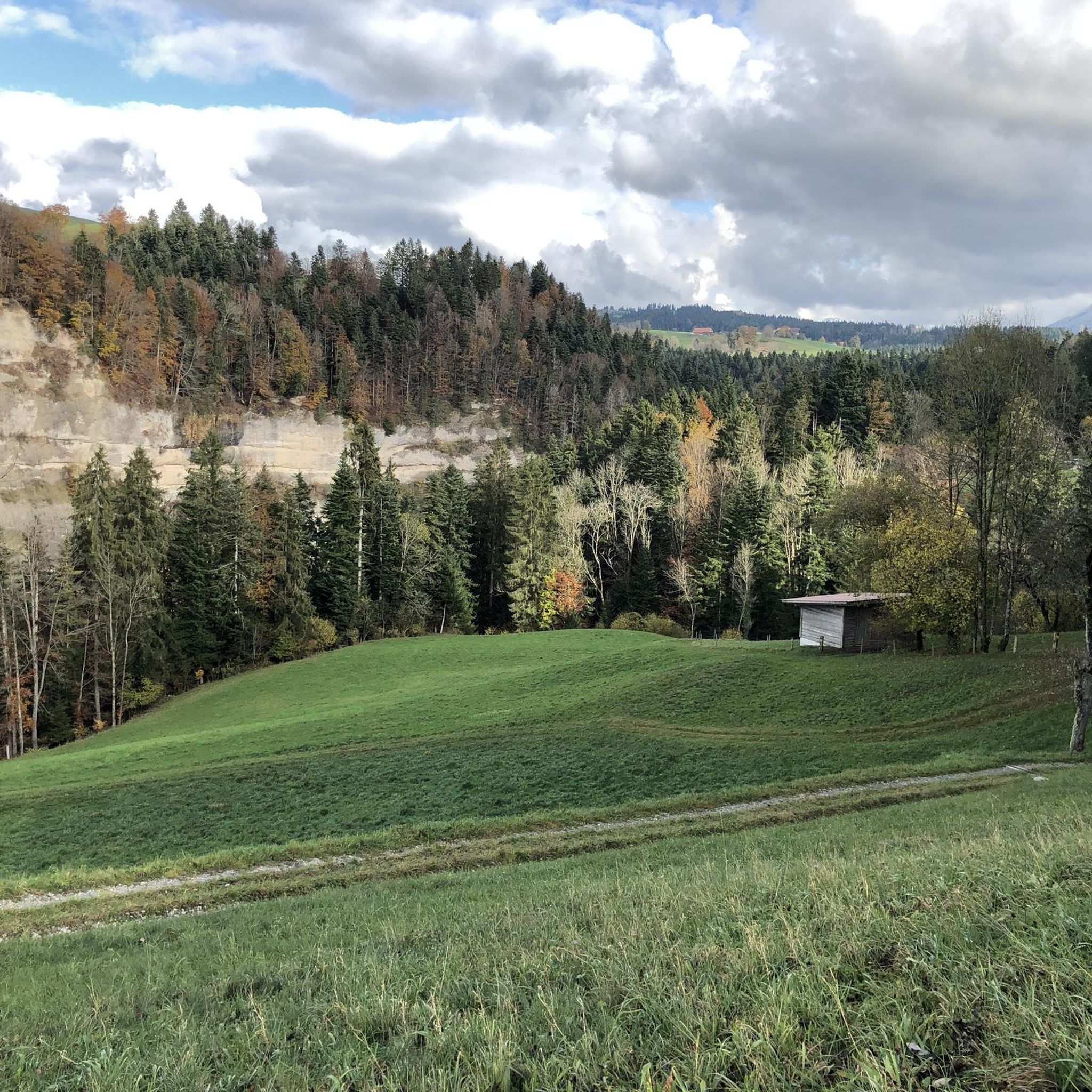
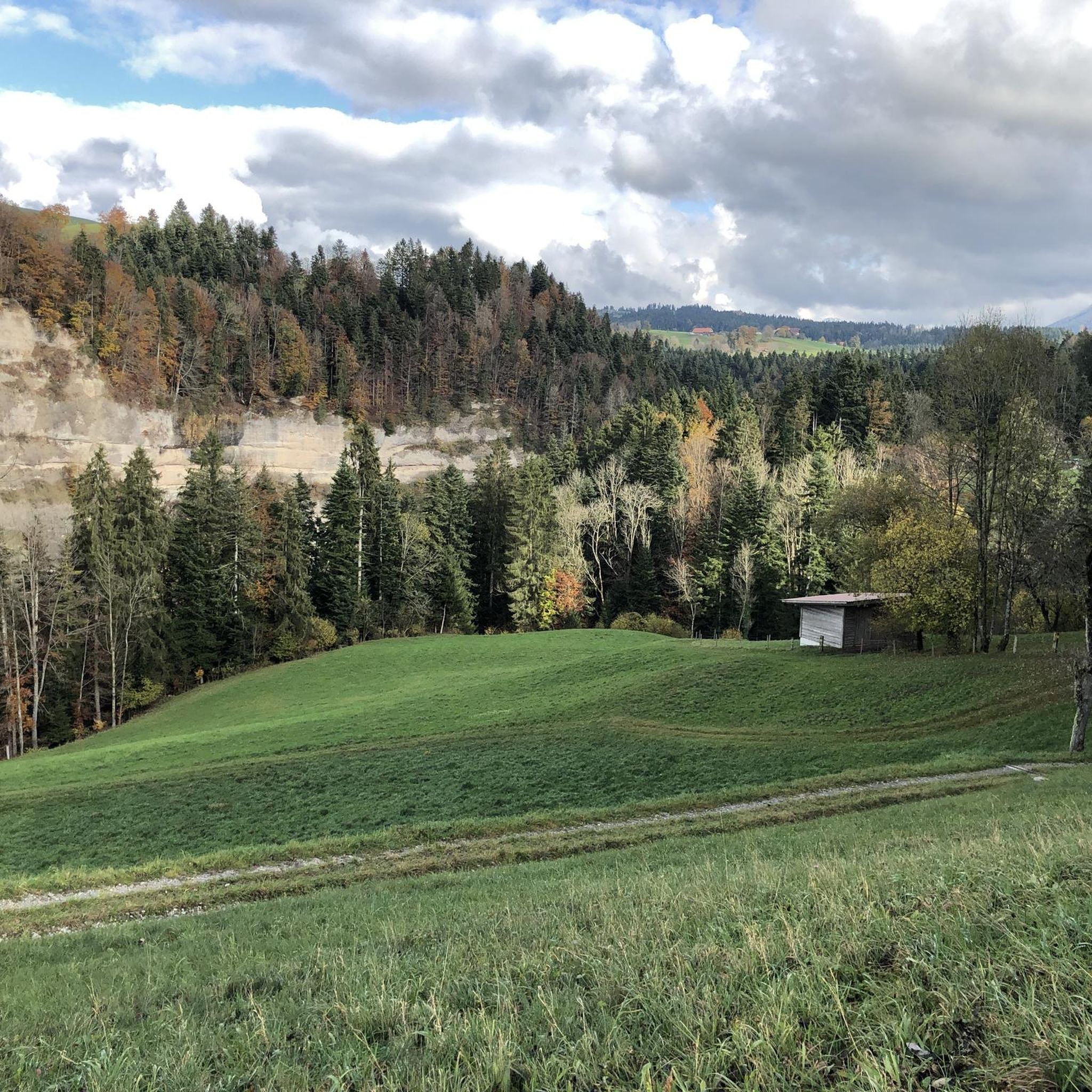
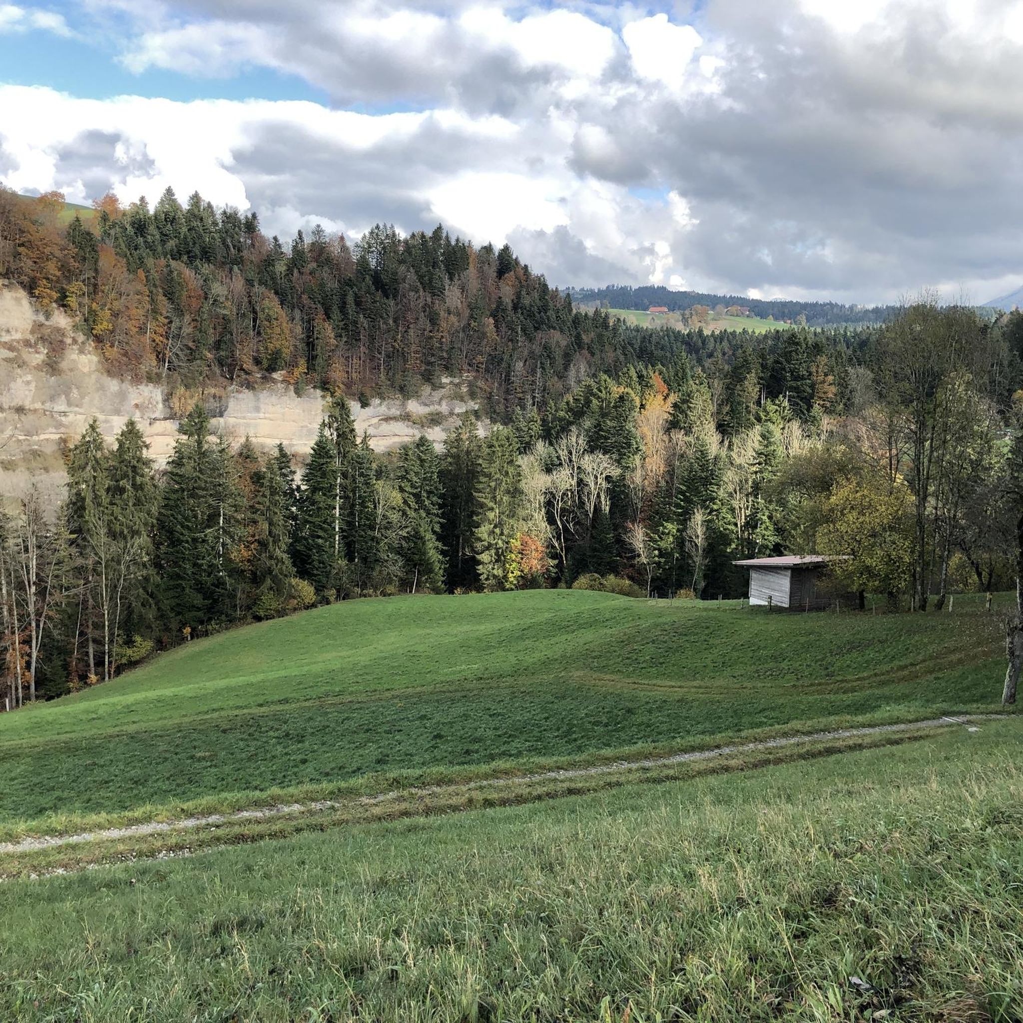
The Glütschbach or valley was the riverbed of the Kander until 1714. This also explains the deep incision for this small stream.
0
0

Has fire pits, a small stream and two grottos, pleasantly cool temperatures. Sometimes quite crowded on weekends.
0
0

Such a beautiful place to linger, enjoy, have a picnic... just make sure you don't bring any ticks with you.
0
0
Frequently Asked Questions
What are some unique geological features to explore around Fahrni?
The region around Fahrni offers several unique geological formations. You can explore the Glütschbachtal Stream and Grottos, a picturesque valley with stalactite caves. Another notable feature is the Schafloch — West Entrance, a 1000m long walkable tunnel under the Sigriswilgrat, which also has historical significance as a former military lock-up point.
Are there family-friendly natural monuments near Fahrni?
Yes, several natural monuments are ideal for families. The Glütschbachtal Stream and Grottos features a secluded valley with a footpath, leading to a large picnic area with tables and fire pits. Blauseeli, Uttigen, a ground-fed lake near the Aare River, is also very popular with families, offering two official barbecue areas and shallow water in summer.
What are the best viewpoints for panoramic scenery around Fahrni?
For breathtaking panoramic views, the Sigriswiler Rothorn is an excellent choice. Standing at 2,051 meters, this summit offers a fantastic 360° panorama, including views of the Eiger, Mönch, and Jungfrau mountains, the Mittelland, and both Lake Brienz and Lake Thun.
What outdoor activities can I do near these natural monuments?
The area around Fahrni provides diverse outdoor activities. You can find numerous hiking trails, including easy walks and more challenging routes. For cycling enthusiasts, there are various routes suitable for touring bicycles. Mountain biking is also popular, with several MTB trails available. You can explore more options on the dedicated guides for Hiking around Fahrni, Cycling around Fahrni, and MTB Trails around Fahrni.
What is the best time to visit the natural monuments in Fahrni?
The best time to visit largely depends on the activity. For challenging mountain ascents like the Sigriswiler Rothorn, it's recommended to set off early and avoid uncertain weather conditions, especially in wet seasons. Family-friendly spots like Blauseeli, Uttigen are particularly enjoyable during the summer months when the water is shallow and ideal for picnics. Generally, spring to autumn offers pleasant conditions for exploring the valleys and forests.
Are there any natural monuments suitable for easy walking trails?
Yes, the Glütschbachtal Stream and Grottos offers a picturesque and secluded valley with a footpath that meanders alongside the Glütschbach stream, providing romantic moments and an easy walk suitable for all ages. The area around Blauseeli, Uttigen also features gentle paths within the riparian forest.
What should I know before visiting the Sigriswiler Rothorn?
The ascent to Sigriswiler Rothorn is mostly along the ridge and requires surefootedness and a head for heights. Caution is advised, especially in wet conditions. You should bring sturdy hiking boots, weather protection, provisions, and water, as there are no food or drink options along the way. It's an absolutely worthwhile summit for experienced hikers.
Can I have a barbecue at the natural monuments?
Yes, you can. The Glütschbachtal Stream and Grottos has an extensive picnic area equipped with tables and fire pits, and wood is often provided. Similarly, Blauseeli, Uttigen offers two official barbecue areas. It's important to note that within this nature reserve, fires are not permitted outside designated fireplaces.
What makes the Uttigen Wave on the Aare River unique?
The Uttigen Wave on the Aare River is a natural monument known for its challenging conditions, particularly for water sports. It's a popular spot on warm summer days for those with inflatable boats, though kayaking requires a certain amount of practice. This wave is notorious among local 'Aareböötler' (Aare boaters) for its ability to capsize rubber boats, providing an unexpected thrill.
Are there any historical sites among the natural monuments?
While primarily natural, the Schafloch — West Entrance has a significant historical aspect. This approximately 1000m long tunnel, which crosses under the Sigriswilgrat, was expanded by the Swiss Army during World War II to serve as a lock-up point. Remains of entrance defenses and armories can still be seen, offering a glimpse into its past military use.
What kind of wildlife or nature can I expect to see in the Glütschbachtal?
The Glütschbachtal Stream and Grottos is a secluded valley nestled within a shady forest, making it an ideal habitat for various forest flora and fauna. Along the Glütschbach stream, you can enjoy the tranquil natural surroundings and observe local wildlife in their natural environment. It's a place to connect with the natural beauty of the region.
Most popular attractions around Fahrni

Get inspired with the komoot mobile app


Explore more
Extend your search for the best caves by checking out these guides of the top ones around Fahrni:
