The 2 Most Amazing Peaks in Duitama
Mountain peaks in Duitama, located in the Andean mountains of Boyacá, Colombia, provide access to high-altitude trails and panoramic views. The city itself sits at approximately 2,590 meters above sea level, serving as a gateway to higher Andean ecosystems. The region features varied landscapes, including páramo ecosystems and challenging ascents. These areas offer options for outdoor activities, from nature walks to technical climbs.
Best mountain peaks in Duitama
- The most popular mountain peak is Curies Summit, a mountain pass…
Last updated: July 5, 2026
Curies Summit
Highlight • Mountain Pass
Translated by Google •
Tip by

Alto del Portachuelo
Highlight • Mountain Pass
Translated by Google •
Tip by
Sign up now to discover places like this
Get recommendations on the best single tracks, peaks, & plenty of other exciting outdoor places.
Sign up for free
Summit of Alto de Guatika and Antennas
Highlight • Summit
Translated by Google •
Tip by
Duitama Antennas
Highlight • Structure
Translated by Google •
Tip by
El Gavilán Summit
Highlight • Summit
Translated by Google •
Tip by
Start today with a free account
Your next adventure awaits.
Login or Signup

Other adventures in Duitama

Tips from the Community

I did it by diverting onto an unpaved route from Santa Rosa de Viterbo, a good option if you want to avoid traffic on the main road, however, it is recommended on MTB or Gravel.
0
0

Summit between the municipalities of Santa Rosa de Viterbo and Belén. Elevation close to 3000 meters above sea level
0
0
Stop between the municipalities of Santa Rosa de Viterbo and Cerinza. Elevation 2974 meters above sea level.
0
0

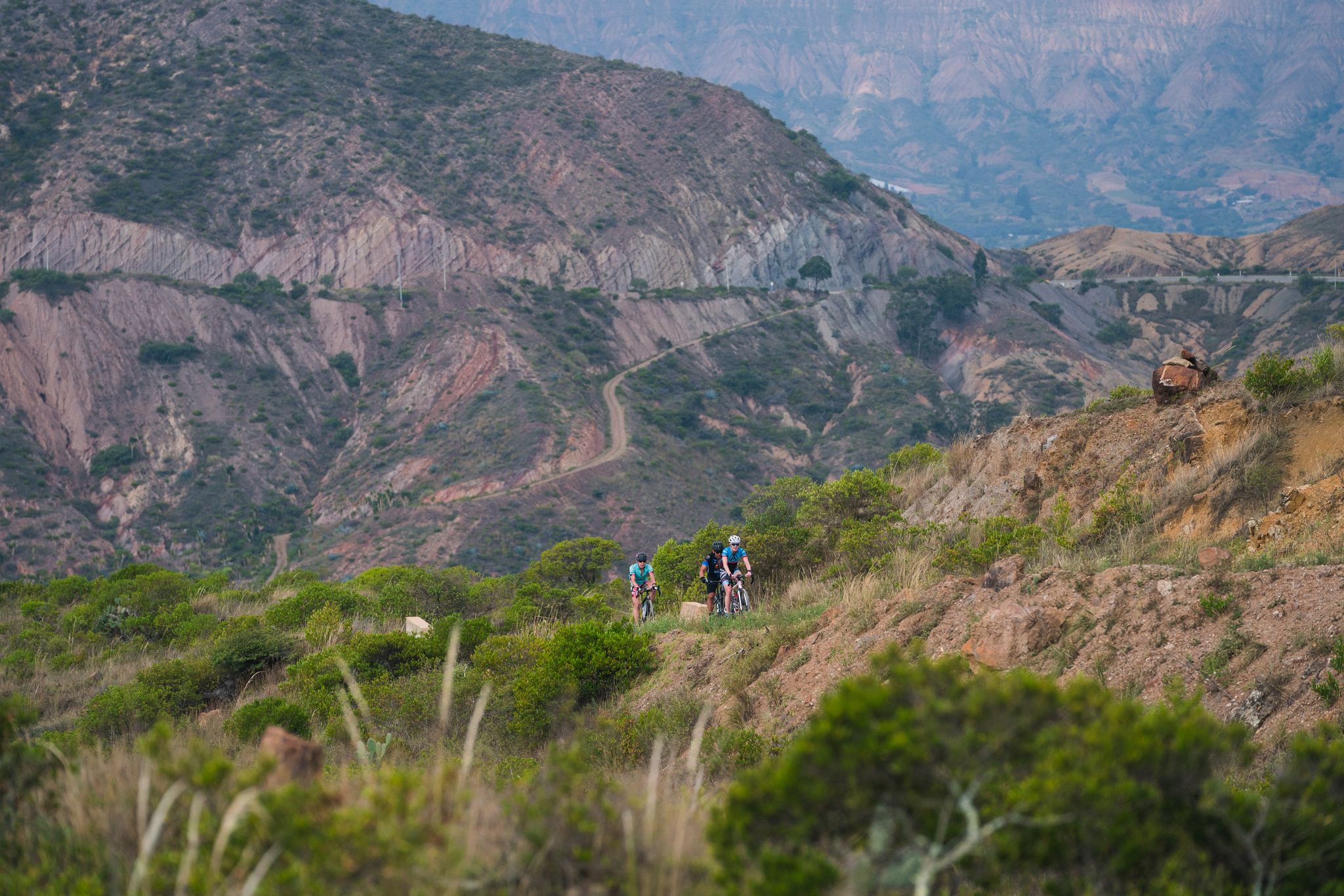
Summit of the Guatika hill. 3225 masl. The last kilometer is demanding given the condition of the road. A lot of loose rock makes it difficult to ride. The last 200 meters require a technical climb over rock slabs. The arrival is satisfactory given the effort, the height and the spectacular views. You can see Tibasosa, Sogamoso, Duitama, Paipa, Firavitoba, Iza, Nobsa, Punta Larga and Gámeza. It would be a spectacular cycling destination if they paved or had a tread plate in the last kilometer.
0
0
Uncovered route that crowns one of the most demanding segments. In July 2023, the vineyard was flattened with topdressing. It is difficult but doable.
0
0
After K8 (which is paved) begins an unpaved climb up to the antennas. Earrings up to 15%. Ascent to 3318 masl.
0
0
Mythical port very visited by road and mountain cyclists. Elevation of 2900 meters above sea level. Completely paved section from Firavitoba. From Paipa there are still some segments to be paved.
1
0
Frequently Asked Questions
What are some notable mountain peaks and trails around Duitama?
Duitama offers several significant mountain peaks and elevated trails. Among them are Curies Summit, known for cyclists, and the challenging Summit of Alto de Guatika and Antennas. Other popular spots include the Duitama Antennas and the El Gavilán Summit. For nature enthusiasts, the La Zarza Ecological Trail and Sendero Raizal Trail are also highly regarded.
How challenging are the mountain peaks in Duitama?
The difficulty varies. Peaks like Summit of Alto de Guatika and Antennas and Duitama Antennas are considered challenging, featuring unpaved sections, steep gradients up to 15%, and even technical climbs over rock slabs. Curies Summit is an intermediate climb, particularly popular with cyclists. Trails like La Zarza Ecological Trail offer a more varied landscape, suitable for different fitness levels.
Where can I find the best panoramic views in Duitama's mountains?
For spectacular panoramic views, the Summit of Alto de Guatika and Antennas is highly recommended. From its 3,225 meters above sea level, you can see numerous towns including Tibasosa, Sogamoso, Duitama, Paipa, Firavitoba, Iza, Nobsa, Punta Larga, and Gámeza. The Duitama Antennas also offer rewarding high-altitude views.
What kind of natural environments can I expect to see on Duitama's mountain trails?
You can experience diverse ecosystems. The La Zarza Ecological Trail, for instance, traverses a varied landscape that includes a meandering river, farmland, and the unique páramo ecosystem. These areas are rich in biodiversity, offering opportunities for birdwatching with species like the Smoky-brown Woodpecker and Mountain Caciques, as well as various butterflies and an endemic anole species.
Are there family-friendly or dog-friendly hiking options in Duitama's mountains?
While specific trails aren't explicitly tagged as 'family-friendly' or 'dog-friendly' in the highlight data, the La Zarza Ecological Trail is described as a significant draw for nature enthusiasts with interpretive signs, suggesting it could be suitable for families. The Sendero Raizal Trail also offers a chance to explore the beautiful outskirts of the city and experience rural life, which might be a good option for a more casual outing.
What outdoor activities can I do near these mountain peaks?
The Duitama region is excellent for various outdoor activities. You can find numerous routes for cycling, including challenging ascents like Curies Summit. There are also dedicated cycling routes and MTB trails in Duitama. For those who prefer running, there are several running trails available.
Are there specific hiking routes recommended for Duitama's mountains?
Yes, beyond the peaks themselves, trails like the La Zarza Ecological Trail offer a well-maintained path through varied landscapes, ideal for hiking and birdwatching. The Sendero Raizal Trail is also highlighted as one of the best hiking opportunities to explore the city's outskirts and nature.
What is the best time of year to visit Duitama's mountain peaks?
Duitama is located in the Andean mountains, which typically experience two main seasons: a dry season and a rainy season. Generally, the drier months (December to March and July to August) offer more stable weather conditions, clearer skies, and better visibility for panoramic views, making them ideal for hiking and cycling. However, the páramo ecosystem can be enjoyed year-round, with lush greenery during the wetter periods.
Are there parking facilities or permits required for Duitama's mountain trails?
While specific permit requirements for all trails are not detailed, the La Zarza Ecological Trail is a significant draw, suggesting accessible parking might be available. For other trails, especially those leading to higher, more remote peaks, it's advisable to check local conditions or inquire with local tourism offices regarding parking and any potential permit needs, though none are explicitly mentioned as mandatory for general access.
What should I wear when hiking Duitama's mountains?
Given the high altitude of Duitama (around 2,590 meters) and the even higher peaks, weather can change rapidly. It's recommended to dress in layers, including a waterproof and windproof outer shell. Comfortable hiking boots with good ankle support are essential, especially for trails with loose rock or technical sections. Don't forget sun protection (hat, sunglasses, sunscreen) and bring plenty of hydration, as advised for climbs like the Duitama Antennas.
What do visitors enjoy most about the mountain peaks in Duitama?
Visitors frequently appreciate the challenging ascents and the rewarding panoramic views from the summits, especially from places like the Summit of Alto de Guatika and Antennas. Cyclists particularly enjoy the 'mythical port' of Curies Summit. The natural beauty, opportunities for birdwatching, and the chance to experience the unique páramo ecosystem on trails like La Zarza Ecological Trail are also highly valued.
Most popular attractions in Duitama

Get inspired with the komoot mobile app


Explore more
See even more amazing summits in Duitama with these guides:
