The best running trails around Saint-Coutant
28
runners
6
runs
Jogging routes around Saint-Coutant traverse a tranquil rural region characterized by undulating paths, lush green countryside, and scenic riverbanks. The area features rolling hills and verdant fields, creating diverse and engaging running terrain. Proximity to rivers like the Charente and Boutonne offers routes along river valleys and floodplains. The Mellois plateau contributes to a varied landscape with both gentle and more challenging running experiences.
Best jogging routes around Saint-Coutant
- The most popular jogging route is Argentor Gardens loop from Champ de la Fontaine, a 6.4 miles (10.3 km) trail that takes 1 hour 8 minutes to complete. This moderate route features varied terrain suitable for a steady run.
- Another top favourite among local runners is Running loop from Le Grand-Madieu, a moderate 5.5 miles (8.9 km) path. This route offers a mix of open countryside and gentle ascents.
- Local runners also love the Running loop from Nieuil, a 3.4 miles (5.4 km) trail leading through rural landscapes, often completed in about 36 minutes.
- Jogging around Saint-Coutant is defined by undulating paths, green countryside, and river valleys. The network offers options for different ability levels, from moderate runs to more challenging trails.
- The guide includes highly-rated routes that showcase the best of the region's landscape. More than 20 runners have used komoot to explore Saint-Coutant's varied terrain.
Last updated: July 6, 2026
10
runners
10.3km
01:08
50m
50m
Moderate run. Good fitness required. Mostly paved surfaces. Suitable for all skill levels.
4
runners
8.93km
01:02
70m
70m
Moderate run. Good fitness required. Mostly paved surfaces. Suitable for all skill levels.

Sign up for free
3
runners
5.45km
00:36
50m
50m
Moderate run. Good fitness required. Mostly paved surfaces. Suitable for all skill levels.
2
runners
8.99km
00:58
90m
90m
Moderate run. Good fitness required. Mostly paved surfaces. Suitable for all skill levels.
3
runners
5.86km
00:43
70m
70m
Moderate run. Good fitness required. Mostly paved surfaces. Suitable for all skill levels.
Our route recommendations are based on thousands of hikes, rides, and runs completed by other people on komoot.
Start today with a free account
Your next adventure awaits.
Login or Signup


Tips from the Community

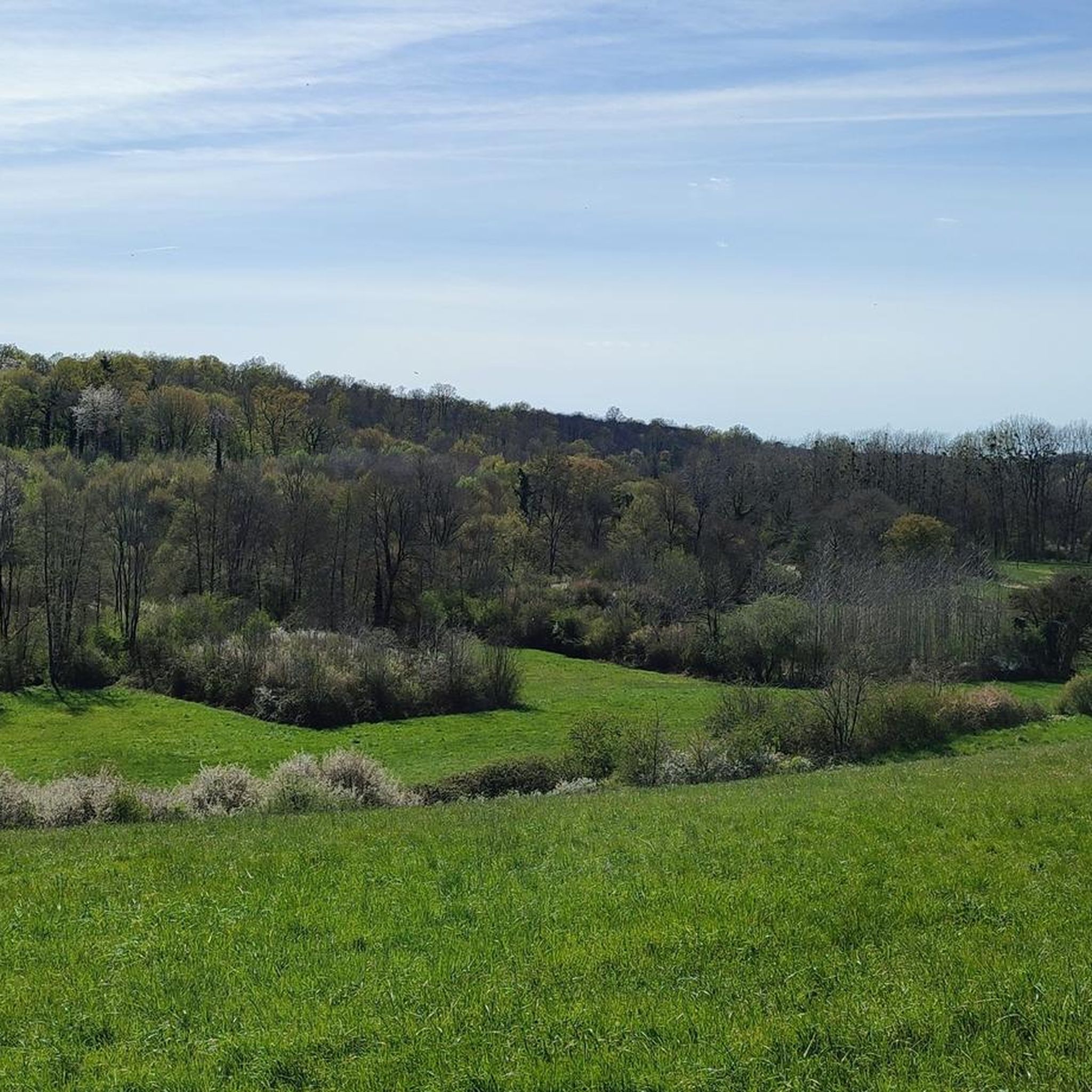
This arboretum features around sixty plant species. The site offers refreshing shade as the Argentor River passes by. This peaceful setting also features a picnic table and a small playground.
0
0
Frequently Asked Questions
What kind of terrain can I expect on running trails in Saint-Coutant?
Saint-Coutant offers a diverse landscape for runners, characterized by undulating paths, lush green countryside, and scenic riverbanks. You'll find a mix of open spaces and shaded sections, often through hedged landscapes. The region is on the edge of the Mellois plateau, providing varied scenery from gentle slopes to more challenging inclines.
Are there any easy jogging routes suitable for beginners in Saint-Coutant?
While all the routes currently listed are rated as moderate, their distances vary. For a shorter, less strenuous option, consider the Running loop from Nieuil, which is approximately 5.4 km. Another good choice is the Running loop from La Combe, around 5.9 km, offering a pleasant run through the local scenery.
Can I find longer running routes for more experienced runners?
Yes, for those looking for a longer run, the Argentor Gardens loop from Champ de la Fontaine is a great option, covering approximately 10.3 km. Another excellent choice is the Manoir d'Aizecq loop from Nanteuil-en-Vallée, which is about 9 km and features some varied elevation.
Are there any circular running routes in the Saint-Coutant area?
Yes, all the running routes featured in this guide are circular, allowing you to start and finish at the same point. For example, you can enjoy the Running loop from Le Grand-Madieu, which offers a scenic 8.9 km circular path.
What are some scenic highlights or points of interest I might encounter on a run?
The region is rich in natural beauty and historical charm. You might find yourself jogging along picturesque riverbanks of the Charente or Boutonne, through verdant fields, or past hedged landscapes. While specific highlights aren't detailed for every route, the area is known for its tranquil rural setting, with potential views of the Mellois plateau and local woods. Historically, you might pass by landmarks like the Saint-Gilles Church or sections of an ancient Gallo-Roman road.
Is Saint-Coutant suitable for family-friendly jogging or walks?
The tranquil and varied landscapes of Saint-Coutant make it suitable for families. While all listed jogging routes are moderate, their natural settings and circular paths can be enjoyed by active families. For a shorter family outing, the Running loop from Nieuil is a manageable 5.4 km.
What is the best time of year to go running in Saint-Coutant?
Saint-Coutant is beautiful throughout the year, but spring and autumn generally offer the most pleasant running conditions with milder temperatures and vibrant scenery. Summer can be warm, so early morning or late evening runs are recommended. Winter runs are also possible, with the landscape taking on a different, serene charm.
Are there any running routes that go through forests or shaded areas?
Yes, the region includes nearby forests like Forêt de Benon and Forêt de Saint-Trojan, as well as local woods, which provide shaded environments. Many of the undulating paths feature hedged landscapes, offering a mix of open spaces and cooler, shaded sections, particularly welcome during warmer months.
How many running routes are available in Saint-Coutant?
Currently, there are 6 dedicated jogging routes available in Saint-Coutant, ranging in distance and elevation to suit various preferences. These routes have been carefully selected to showcase the region's natural beauty.
What is the typical difficulty level of running trails in Saint-Coutant?
Most of the running routes in Saint-Coutant are rated as moderate. This means they are generally suitable for runners with a reasonable level of fitness, featuring varied terrain and some elevation changes, but typically without extreme technical challenges. There is also one route classified as difficult for those seeking a greater challenge.
Are there any running routes near water features like rivers or lakes?
Saint-Coutant's proximity to rivers like the Charente and its tributary, the Boutonne, means you can find beautiful routes along riverbanks, through river valleys, floodplains, and marshes. These areas offer picturesque views and a refreshing atmosphere for your run.

Get inspired with the komoot mobile app


Explore more
Browse the best Running Trails & Routes in other regions.
