The best cycling routes around A Gudiña
5.0
(3)
49
riders
6
rides
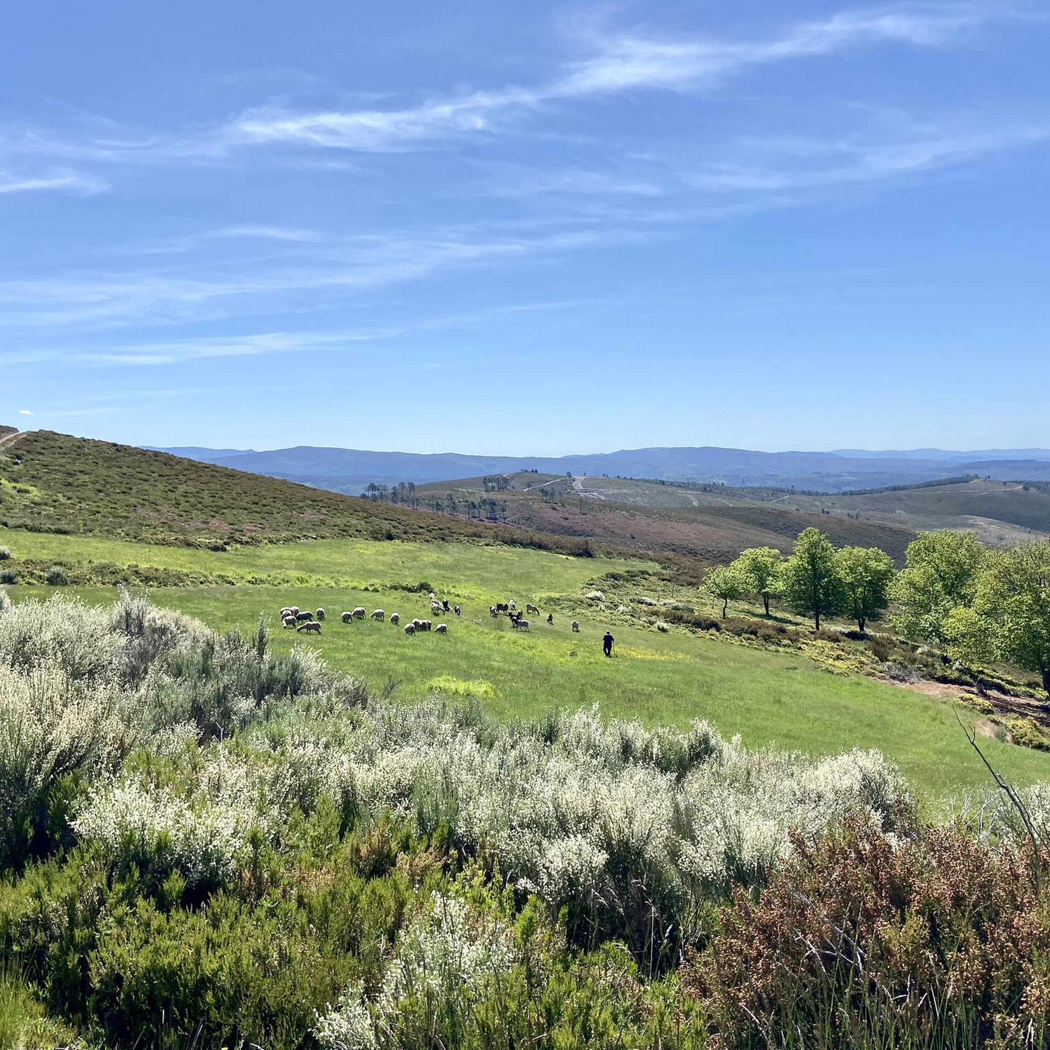
Touring cycling routes around A Gudiña are situated in a mountainous region of southern Galicia, characterized by diverse and challenging landscapes. The area features imposing mountains, lush valleys, and serene reservoirs, providing varied scenic backdrops for cycling. Notable natural features include the As Portas Reservoir and the mountainous terrain with significant elevation gains. The region also incorporates sections of historical routes like the Vía da Prata.
Best touring cycling routes around A Gudiña
- The most popular touring cycling route is…
Last updated: July 4, 2026
16
riders
130km
08:57
2,360m
2,370m
Hard bike ride. Very good fitness required. Mostly paved surfaces. Suitable for all skill levels.
5.0
(2)
15
riders
112km
07:53
2,120m
2,120m
Hard bike ride. Very good fitness required. Mostly paved surfaces. Suitable for all skill levels.

Sign up for free
8
riders
83.0km
06:09
1,880m
1,880m
Hard bike ride. Very good fitness required. Mostly paved surfaces. Suitable for all skill levels.
5.0
(1)
4
riders
105km
08:08
2,580m
2,580m
Hard bike ride. Very good fitness required. Mostly paved surfaces. Suitable for all skill levels.
2
riders
35.6km
02:39
830m
830m
Hard bike ride. Very good fitness required. Mostly paved surfaces. Suitable for all skill levels.
Our route recommendations are based on thousands of hikes, rides, and runs completed by other people on komoot.
Start today with a free account
Your next adventure awaits.
Login or Signup
Popular around A Gudiña
Tips from the Community

The Portela da Canda Pass, also known as the Canda Pass or simply A Canda, is a mountain pass of great geographical, historical, and cultural value that connects Galicia (province of Ourense) with Castile and León (province of Zamora). Located in the Sierra Segundera mountain range, within the Galician Massif, it has traditionally been a crossing point for travelers, merchants, and pilgrims. It forms part of the Sanabrés Way of St. James, an extension of the Silver Route (Vía de la Plata), and is the entry point into Galicia for pilgrims coming from the south. The surrounding area features Jacobean sculptures and wayside crosses (cruceiros) that guide the route, the work of the artist Nicanor Carballo.
5
0

Small Zamorana town near Portugal in the Sanabria region. Picturesque town with numerous fountains and a bar where you can stop to recharge your batteries.
0
0

It is worth the visit to this curious Cruceiro unique in Galicia
0
0
Ice cold water source, recommended by the locals (instead of the others that exist in the village). It has a perfect pool for a quick bath and a laundry room for clothes.
0
0
Good shaded table with unbeatable views
0
0

Laza, a rural town with a lot of charm, here an ancestral entroido of the most famous in Spain is celebrated
2
0

Portilla de la Canda is a mountain pass at 1260m above sea level and is the crossing point between the provinces of (Ourense) Galicia and Zamora (Castilla y León). There is a water feature and great views of the mountains and the highway road tunnel below.
1
1
Small mountain village at 1000m altitude on the trade route between Castilla y León and Galicia with traditional rural houses made of stone and wood.
1
0
Frequently Asked Questions
How many touring cycling routes are available in A Gudiña?
There are 4 touring cycling routes available around A Gudiña, all of which are considered difficult due to the mountainous terrain and significant elevation changes.
What kind of terrain can I expect on touring cycling routes around A Gudiña?
The touring cycling routes in A Gudiña are characterized by challenging mountainous terrain with significant elevation gains. You will encounter demanding climbs, picturesque scenery, and diverse panoramas, often passing through forested areas and rustic villages. The region's high elevation, starting at over 1000m, guarantees breathtaking vistas.
Are there any loop touring cycling routes in A Gudiña?
Yes, all the touring cycling routes listed for A Gudiña are loops. For example, you can explore the View of the Reservoir – A Venda da Teresa loop from A Gudiña-Porta de Galicia, which offers extensive reservoir views, or the Cruceiro de Laza – View of the Reservoir loop from A Gudiña-Porta De Galicia, winding through mountainous terrain.
What are some notable natural features or viewpoints I'll encounter on these routes?
Many routes feature the scenic As Portas Reservoir, offering stunning views. You can also expect impressive mountain views from passes like the Portela da Canda Pass. The region ascends to the Serra Seca, looking towards the O Invernadeiro hills, known for their green slopes and rocky mountain tops. The River Conso Valley also offers views of streams and waterfalls.
Are there any historical or cultural landmarks along the touring cycling routes?
Yes, the area is rich in historical significance, being part of the Camino de Santiago. You might encounter Jacobean sculptures and wayside crosses (cruceiros) at the Portela da Canda Pass. Other points of interest include the 17th-century Chapel of San Martiño and St. Peter's Church, showcasing rural Galician Romanesque and architectural styles. You can also find refreshing stops like the A Capela Spring or the Spring, Washhouse and Pool of Campobecerros.
What is the typical difficulty level for touring cycling in A Gudiña?
Touring cycling in A Gudiña is generally considered difficult. All routes feature significant elevation gains and challenging climbs, requiring good fitness levels. For instance, the View of the Reservoir – Pilgrim's Corner Café loop from Cortellos da Ribeira Pequena involves over 2,500 meters of elevation gain.
What do other touring cyclists enjoy the most about touring cycling in A Gudiña?
The area is highly rated by the komoot community, with an average score of 5.0 stars. Reviewers often praise the challenging climbs, the extensive reservoir views, and the scenic vistas offered by the mountainous terrain.
What is the best season for touring cycling in A Gudiña?
While specific seasonal recommendations are not provided, the region's mountainous terrain and high elevation suggest that spring and autumn would offer more moderate temperatures for challenging rides. Summers can be hot, and winters might bring colder conditions and potential snow at higher passes.
Are there any routes that follow historical pilgrimage paths?
Yes, A Gudiña is a significant starting point for cyclists on the Camino de Santiago. The last 200 km of the Via de la Plata, from A Gudiña to Santiago de Compostela, is particularly scenic. The Portela da Canda Pass, for example, is part of the Sanabrés Way of St. James.
Can I find shorter touring cycling routes in A Gudiña?
While most routes are long and challenging, there are options like the Porto do Espiño do Mourisco loop from Covelas, which is approximately 35.6 km long with around 830 meters of elevation gain, offering a shorter but still difficult experience.
Most popular routes around A Gudiña
Most popular attractions around A Gudiña

Get inspired with the komoot mobile app


Explore more
Browse the best Cycling routes in other regions.
