The best cycling routes around Vorspeicher Galgenbichl
4.8
(64)
540
riders
5
rides
Touring cycling routes around Vorspeicher Galgenbichl are situated in the Maltatal, a valley within Carinthia's Hohe Tauern mountains, offering diverse landscapes for cyclists. The area features glaciated streams, impressive Alpine vistas, and views of mountain ranges like the Ankogel Group. Routes often utilize paved or mostly paved surfaces, making them suitable for touring bikes. The region provides a strategic location for day trips or as a stop on longer journeys, with terrain varying from valley floors along the Malta River…
Last updated: October 16, 2026
7
riders
7.41km
00:44
160m
160m
Moderate bike ride. Good fitness required. Mostly paved surfaces. Suitable for all skill levels.
4.9
(15)
145
riders
15.8km
01:43
400m
400m
Moderate bike ride. Good fitness required. Mostly paved surfaces. Suitable for all skill levels.

4.4
(5)
47
riders
52.5km
04:42
1,510m
1,510m
Hard bike ride. Very good fitness required. Mostly paved surfaces. Suitable for all skill levels.
4.9
(20)
166
riders
49.1km
03:42
1,190m
1,190m
Hard bike ride. Very good fitness required. Mostly paved surfaces. Suitable for all skill levels.
4.9
(24)
175
riders
67.6km
04:49
1,330m
1,330m
Hard bike ride. Very good fitness required. Mostly paved surfaces. Suitable for all skill levels.
Our route recommendations are based on thousands of hikes, rides, and runs completed by other people on komoot.
Start today with a free account
Your next adventure awaits.
Popular around Vorspeicher Galgenbichl
Tips from the Community

Austria's highest dam (625 m long, 200 m high) is located at an altitude of 1,900m and is a successful millennium project.
0
0
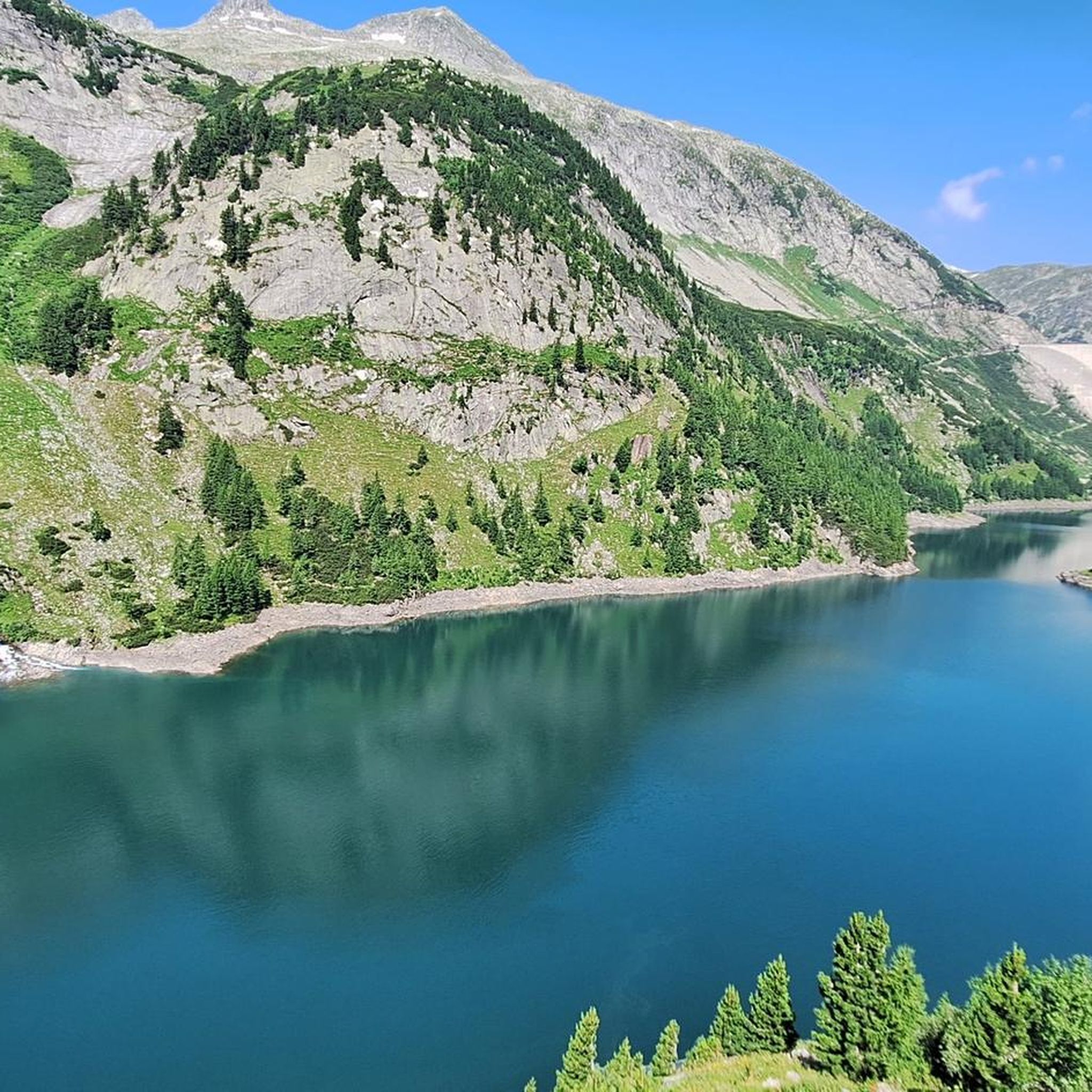
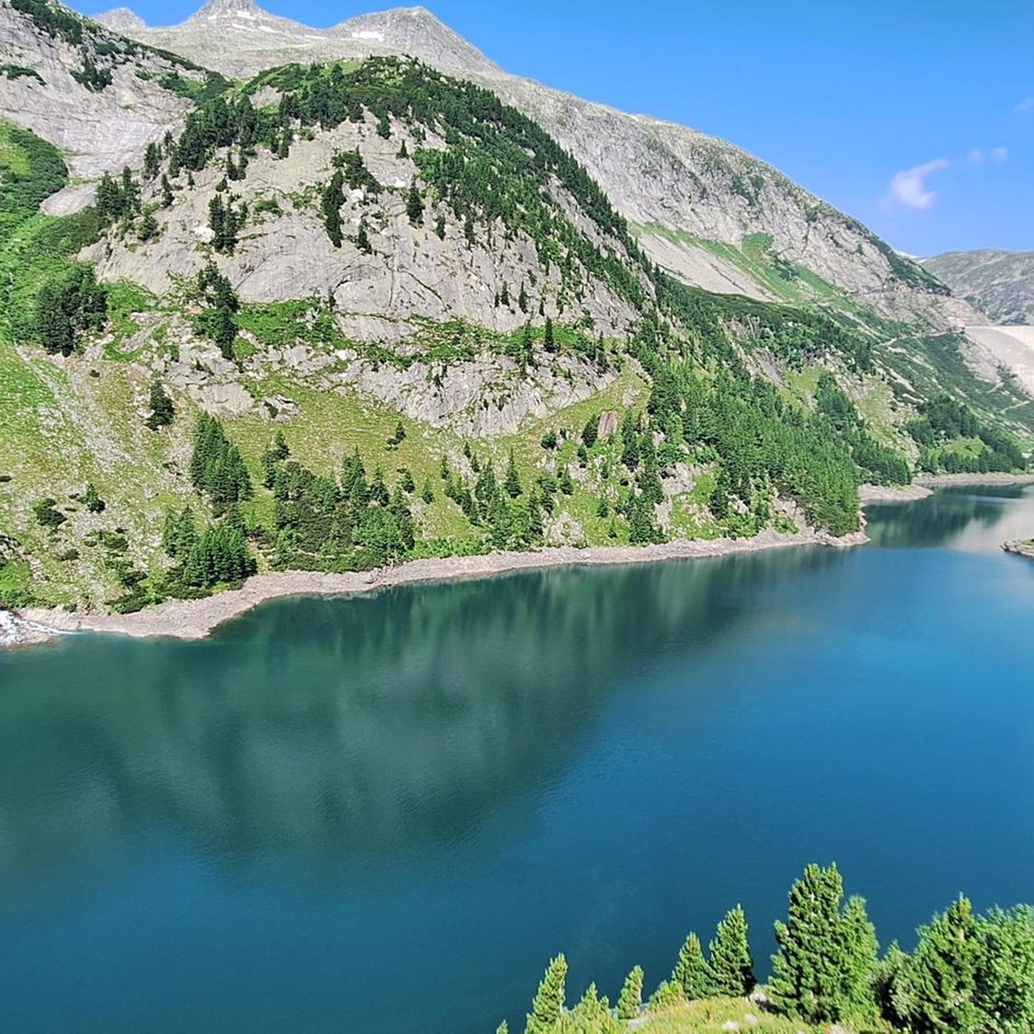
Behind Austria's highest dam (625 m long, 200 m high) lies the Kölnbrein reservoir. The lake and mountain scenery offer fantastic views and vistas.
0
0
The view of the Osnabrücker Hütte with the glacier in the background is very impressive and reminiscent of old mountain films à la "Heidi".
0
0
Austria's highest dam (625 m long, 200 m high) is located at an altitude of 1900m.
0
0
A great path with a fine gravel surface. Water keeps coming out of the field walls, sometimes with a slightly frightening noise level. As a result, there are numerous small watercourses along the route, sometimes empty, sometimes with running water.
0
0
An absolute eye-catcher at this altitude, the futuristic tower construction is clearly visible even during the ascent.
0
0
The ascent to the Kölnbreinsperre is via the asphalted Malta Hochalmstrasse. The maximum gradient is 13%. Six unlit tunnels must be passed, two of which have traffic light control and indication of waiting time. Tip: if the traffic light shows 2-3 minutes, start cycling as the first one. For your own safety, lights are required. Numerous waterfalls can be seen along the route.
1
0
A mountain hut that fits perfectly into the landscape, worth seeing!
0
0
Frequently Asked Questions
How many touring cycling routes are available around Vorspeicher Galgenbichl?
There are 5 touring cycling routes around Vorspeicher Galgenbichl listed on komoot. These routes offer a range of experiences, from moderate loops to more challenging, longer rides through the stunning Alpine landscape.
What kind of terrain can I expect on touring cycling routes in Vorspeicher Galgenbichl?
The terrain around Vorspeicher Galgenbichl is diverse, ranging from valley floors along the Malta River to more strenuous ascents around the reservoir. Many routes utilize paved or mostly paved surfaces, making them suitable for touring bikes. You'll encounter impressive Alpine scenery, glaciated streams, and dramatic views of the Hohe Tauern mountains.
Are there any moderate touring cycling routes suitable for less experienced riders?
Yes, there are moderate options available. For example, the Kölnbrein Dam – Snack station Kölnbreinstüberl loop from Kölnbrein Dam is a moderate 5.5-mile (8.8 km) route that offers great views of the dam. Another moderate choice is the Osnabrücker Hut – View of Osnabrücker Hütte loop from Kölnbrein Dam, which is 9.8 miles (15.8 km) long and provides views towards the Osnabrücker Hut.
What are some notable landmarks or viewpoints along the touring cycling routes?
The region is rich in natural beauty and impressive engineering. You'll encounter the majestic Hohe Tauern mountains, the scenic Maltatal, and the impressive Kölnbrein Dam, which is one of Austria's most significant engineering feats. Routes often provide breathtaking views of these features and the surrounding Alpine landscape.
Are there any touring cycling routes that pass by waterfalls?
Yes, you can find routes that include waterfalls. The Fallbach Waterfall – Kölnbrein Dam loop from Malta is a challenging 30.5-mile (49.1 km) route that takes you past the stunning Fallbach Waterfall. Another option is the longer Fallbach Waterfall – Kölnbrein Dam loop from Evangelische Kirche, which also features the waterfall.
What is the best time of year for touring cycling around Vorspeicher Galgenbichl?
The best time to visit for touring cycling is typically during the warmer months when the Malta High Alpine Road is open and free of snow. This allows full access to the higher elevations and the Kölnbrein Dam area. Always check local conditions and road openings before planning your trip, especially in early spring or late autumn.
Are there any circular touring cycling routes in the area?
Yes, several routes are designed as loops, allowing you to start and end at the same point. Examples include the moderate Kölnbrein Dam – Snack station Kölnbreinstüberl loop from Kölnbrein Dam and the more challenging Kölnbrein Dam – Osnabrücker Hut loop from Zirmhof, which covers 32.4 miles (52.2 km).
What do other touring cyclists enjoy most about the routes in Vorspeicher Galgenbichl?
The komoot community rates the routes highly, with an average score of 4.9 stars from over 50 reviews. Cyclists often praise the dramatic Hohe Tauern mountains, the impressive Kölnbrein Dam views, and the varied terrain that makes for an engaging touring experience.
Is it possible to combine touring cycling with exploring the unique flora of the region?
Absolutely. The landscape around Vorspeicher Galgenbichl is characterized by granite rock formations and patches of Swiss pine. Notably, it is a natural habitat for Sempervivum stiriacum (houseleek), with large rosettes displaying dark red or purple-red tips found growing amongst the rocks on the slopes above the reservoir's right bank. Keep an eye out for these unique plants during your ride.
Are there options for longer, more challenging touring cycling routes?
Yes, for experienced touring cyclists seeking a challenge, there are difficult routes available. The Kölnbrein Dam – Osnabrücker Hut loop from Zirmhof is a demanding 32.4-mile (52.2 km) route with significant elevation gain. Another challenging option is the Fallbach Waterfall – Kölnbrein Dam loop from Malta, covering 30.5 miles (49.1 km).
Are there any facilities like snack stations or cafes along the routes?
Some routes, like the Kölnbrein Dam – Snack station Kölnbreinstüberl loop from Kölnbrein Dam, specifically mention a snack station. It's advisable to check the route details on komoot for specific points of interest and facilities to plan your stops accordingly.
Most popular routes around Vorspeicher Galgenbichl

Get inspired with the komoot mobile app


Explore more
Browse the best Cycling routes in other regions.
