The best gravel rides around Gouvix
4.1
(8)
75
riders
9
rides
Gravel biking around Gouvix features routes through varied terrain in Normandy, characterized by woodlands, river valleys, and historical industrial sites. The region's landscape includes former mining areas and viaducts, offering diverse surfaces for gravel cyclists. Elevations are generally moderate, with some routes featuring sustained climbs. The network of gravel bike trails provides options for different skill levels, from moderate paths to more challenging long-distance rides.
Best gravel bike trails around Gouvix
- The most popular gravel bike trail is Sainte-Anne Viaduct…
Last updated: July 8, 2026
3.0
(1)
36
riders
110km
06:22
590m
590m
Hard gravel ride. Very good fitness required. Mostly paved surfaces. Suitable for all skill levels.
4.0
(2)
9
riders
46.1km
03:36
760m
760m
Hard gravel ride. Very good fitness required. You may need to push your bike for some segments of this route.

Sign up for free
5.0
(1)
8
riders
41.3km
02:31
320m
320m
Hard gravel ride. Good fitness required. You may need to push your bike for some segments of this route.
5
riders
165km
10:53
1,710m
1,710m
Hard gravel ride. Very good fitness required. You may need to push your bike for some segments of this route.
4.3
(3)
4
riders
26.9km
01:33
110m
110m
Easy gravel ride. Great for any fitness level. Mostly paved surfaces. Suitable for all skill levels.
Get access to more routes and recommendations from other explorers.
Sign up for free
Already have an account?
Our route recommendations are based on thousands of hikes, rides, and runs completed by other people on komoot.
Start today with a free account
Your next adventure awaits.
Login or Signup



Tips from the Community

Sometimes the most important thing is to be able to use a platform without having to learn complicated procedures. An organized environment helps you move around more calmly. On [url=https://dragonia-italia.it/]dragonia-italia.it[/url] everything seems designed to be simple and intuitive. The clear structure makes using it smoother and more natural. For many users, this represents a concrete advantage.
0
0

Unique image of the soldier who brings music with a bagpipe in the conquered area
0
0

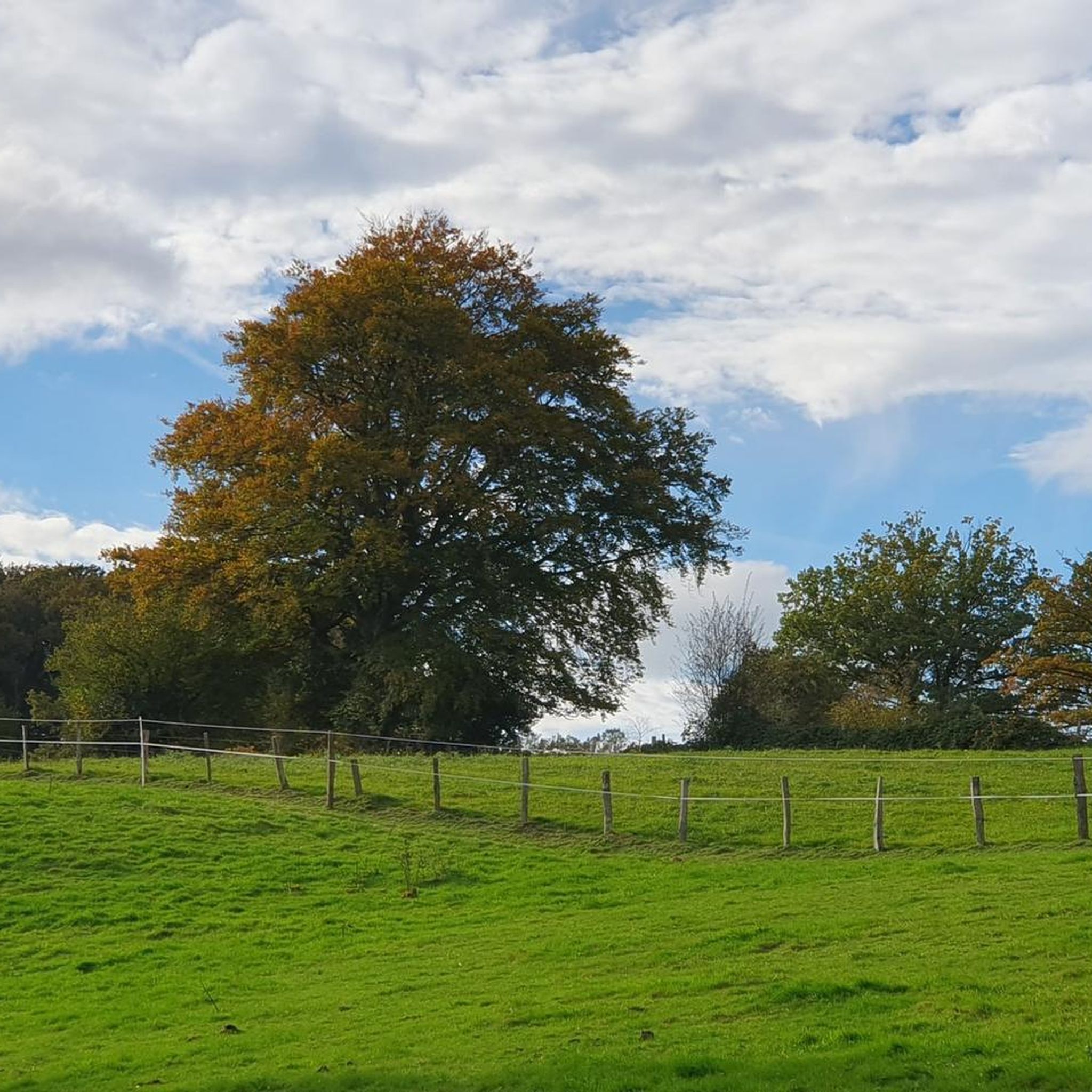
Pretty country road and very quiet.
0
0

The place is nice with beautiful paths but watch out for punctures. Twice on the paths I got a flat tire because of large thorns.
0
0

Very pleasant street where it is good to walk, especially when the PM has blocked the street, generally on weekends and during school holidays.
0
0


a passage between two rock walls just after the Orne
0
0

D-Day is omnipresent in this region. French soldiers stormed the Wehrmacht's bunkers and positions.
3
0
Frequently Asked Questions
How many gravel bike trails are available around Gouvix?
There are 10 gravel bike routes documented on komoot around Gouvix, offering a variety of experiences through woodlands, river valleys, and historical industrial sites.
Are there any easy gravel bike trails for beginners in Gouvix?
The gravel biking routes around Gouvix are generally categorized as moderate to difficult. While there are no routes specifically marked as 'easy', the Sainte-Anne Viaduct – Former mine at May-sur-Orne loop from Caen is a moderate 41.2 km option that combines scenic viaduct sections with historical areas, making it a good starting point for those comfortable with moderate distances.
What are the most scenic gravel bike routes in the Gouvix area?
Many routes offer scenic views, particularly those incorporating the region's viaducts and river valleys. The Sainte-Anne Viaduct – Living water loop from Mutrécy is a popular choice that features the impressive Sainte-Anne Viaduct and follows paths near water bodies. Another option is the Sainte-Anne Viaduct – Clécy Viaduct loop from L'Acre, which connects two significant viaducts.
Are there any challenging long-distance gravel bike routes near Gouvix?
Yes, Gouvix offers several challenging long-distance routes. For an extensive ride, consider the On the Banks of the Orne – Former mine at May-sur-Orne loop from Bretteville-sur-Laize, which spans 135.2 km. Another demanding option is the Baron sur Odon wood – Caen loop from Castine-en-Plaine, covering 90.2 km through woodlands.
What kind of terrain can I expect on gravel bike trails in Gouvix?
The terrain around Gouvix is varied, featuring woodlands, river valleys, and historical industrial sites. You'll encounter surfaces ranging from forest paths to former mining areas and sections near viaducts. Elevations are generally moderate, though some routes include sustained climbs.
What historical sites or landmarks can I see along the gravel bike trails?
The region is rich in history. Many routes pass by or near significant landmarks such as the Sainte-Anne Viaduct and the Former mine at May-sur-Orne, offering glimpses into the area's industrial past. You might also encounter other points of interest like the Tomb of Marie Joly or the Devil's Gap.
Are there any loop trails for gravel biking in Gouvix?
Yes, most of the gravel bike routes in Gouvix are designed as loops, allowing you to start and end at the same point. Examples include the Sainte-Anne Viaduct – Living water loop from Mutrécy and the Sainte-Anne Viaduct – Former mine at May-sur-Orne loop from Caen.
What do other gravel bikers say about the trails in Gouvix?
The gravel biking routes in Gouvix are highly rated by the komoot community, with an average score of 4.7 stars from 4 reviews. Riders often appreciate the varied terrain, the historical elements like the viaducts and former mines, and the natural beauty of the woodlands and riverbanks.
What is the best season for gravel biking in Gouvix?
Gouvix's varied landscape makes it suitable for gravel biking across multiple seasons. Spring and autumn offer pleasant temperatures and vibrant scenery, while summer provides longer daylight hours. Winter rides are also possible, though trail conditions may vary depending on recent weather.
Are there any gravel bike routes around 50km in Gouvix?
Yes, several routes are close to the 50km mark. The Sainte-Anne Viaduct – Living water loop from Mutrécy is 45.9 km, and the Sainte-Anne Viaduct – Former mine at May-sur-Orne loop from Caen is 41.2 km, both offering a substantial ride within that range.
Where can I find parking or trailheads for gravel biking in Gouvix?
Many of the routes start from nearby towns or villages, which typically offer public parking. For example, routes often begin from Mutrécy, Caen, Castine-en-Plaine, Bretteville-sur-Laize, or L'Acre. Specific parking details can usually be found on the individual route pages on komoot.
Most popular attractions around Gouvix

Get inspired with the komoot mobile app


Explore more
Browse the best Gravel rides in other regions.
