The 9 Most Amazing Peaks around San Martín Del Pimpollar
Best mountain peaks near San Martín Del Pimpollar are found within the Sierra de Gredos, a significant range in Spain's Central System. This mountain town, located in the province of Ávila, serves as a base for exploring the region. The surrounding natural environment is part of the Sierra de Gredos Regional Park, characterized by its glacial origins and diverse ecosystems. The area offers opportunities for outdoor activities such as hiking and climbing.
Best mountain peaks around San Martín Del Pimpollar
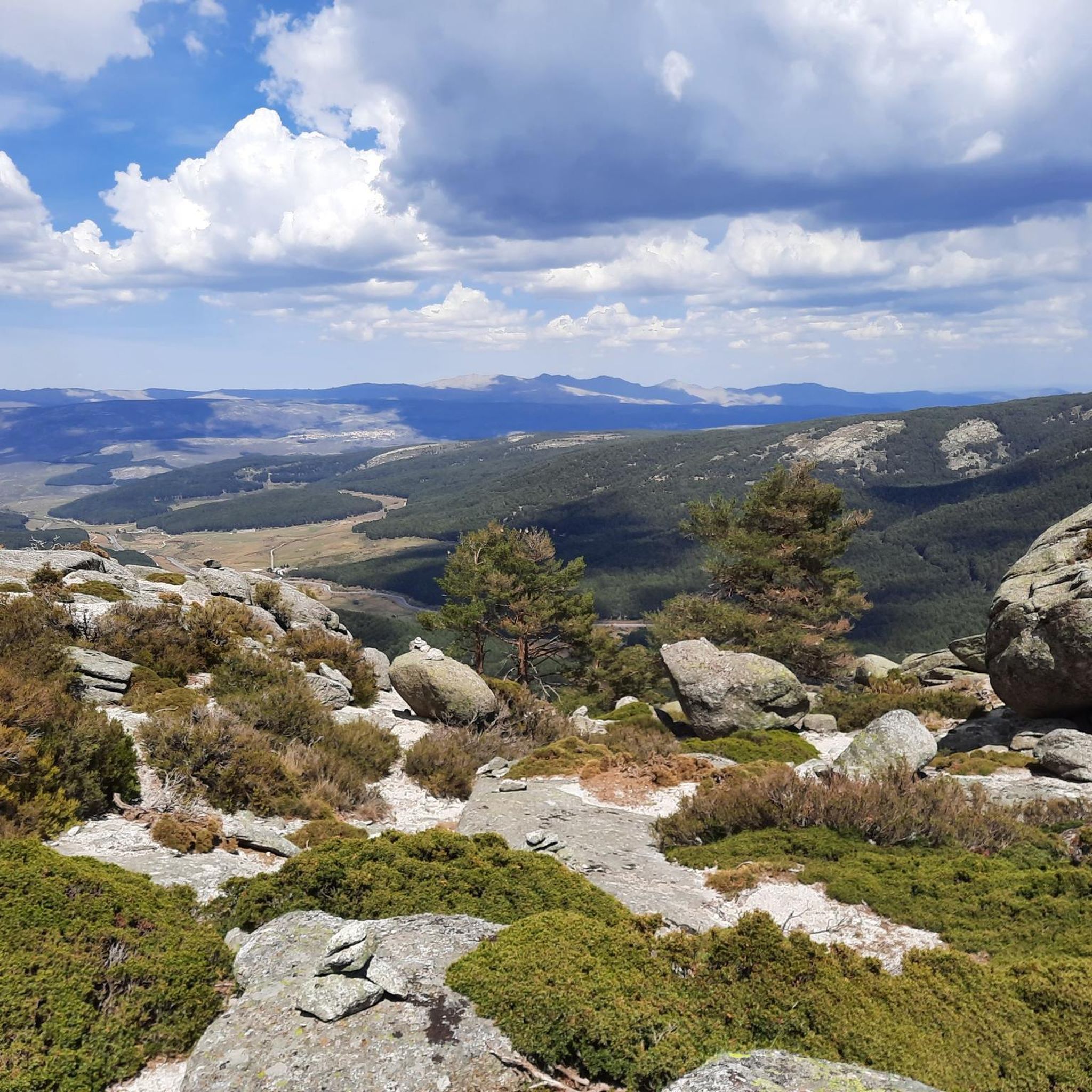
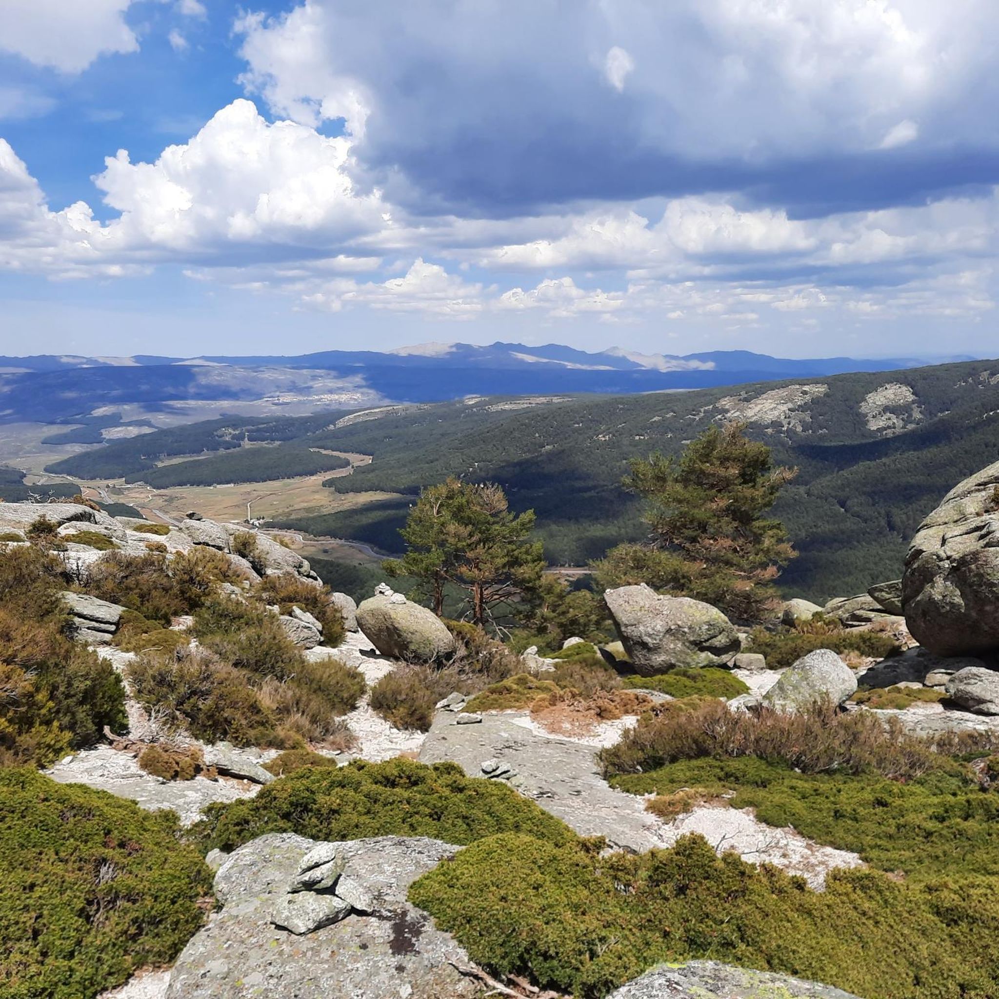
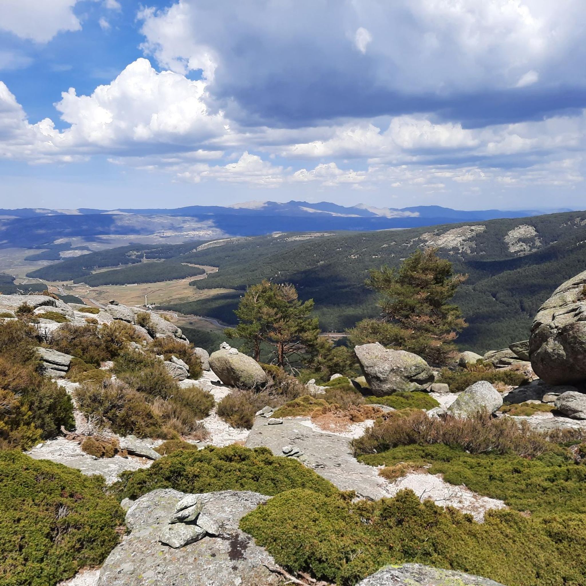
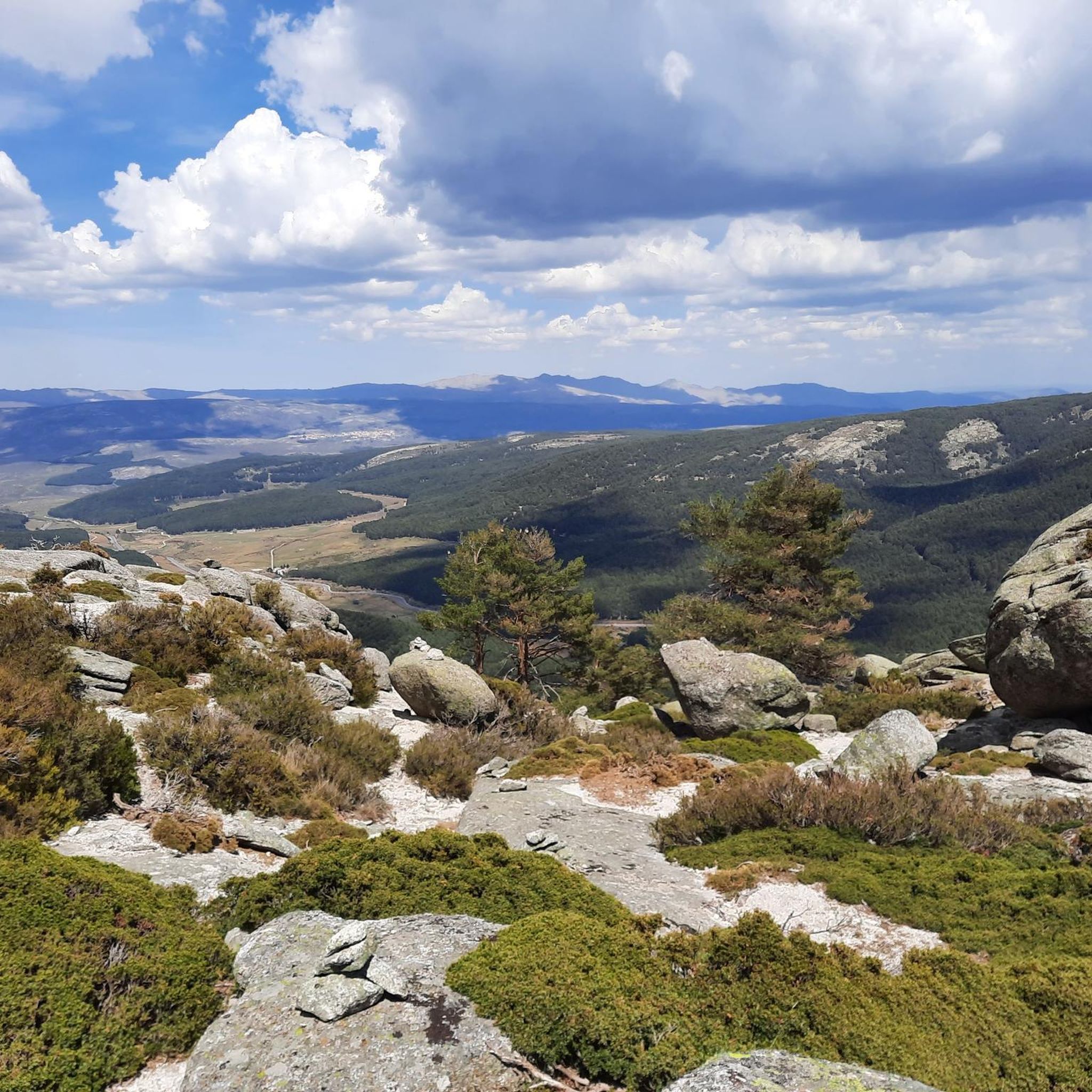
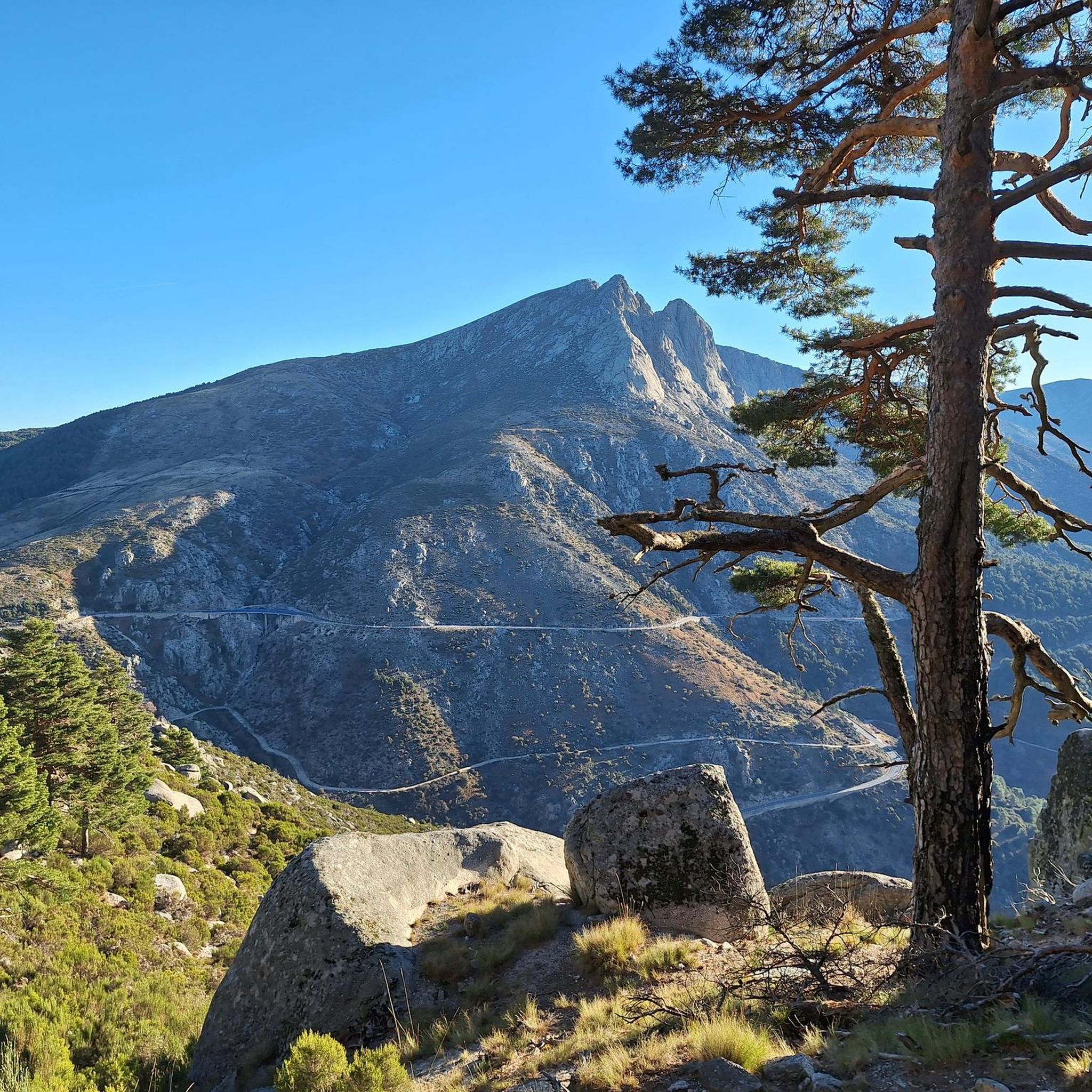
- The most popular mountain peaks is Pico Torozo, a summit located east of the port of Pico. It represents one of the western peaks in this area of the Sierra de Gredos, offering beautiful views.
- Another must-see spot is Serranillos Pass, a mountain pass known for its beauty and views of the Cinco Villas Valley and the Gredos peaks. Spectacular scenery is present throughout the climb.
- Visitors also love View of the Sierra de Gredos, a viewpoint offering impressive panoramas over the Valle de Tormes and the Gredos massif. The highest point in the range is Pico Almanzor at 2592 m.
- San Martín Del Pimpollar is known for its summits, mountain passes, and viewpoints. The variety of mountain peaks to see and explore caters to different levels of hiking and mountaineering.
- The mountain peaks around San Martín Del Pimpollar are appreciated by the komoot community, with 16 upvotes and 17 photos shared across various highlights.
Last updated: July 4, 2026
Serranillos Pass
Highlight • Mountain Pass
Views of the Cinco Villas Valley and the Gredos peaks.
Spectacular scenery throughout the climb.
Signage with gradient and remaining distance information.
Ideal for linking up with Puerto del Pico, Pedro Bernardo, and Mijares for an epic stage.
Translated by Google •
Tip by

Pico Torozo
Highlight • Summit
Translated by Google •
Tip by

Sign up now to discover places like this
Get recommendations on the best single tracks, peaks, & plenty of other exciting outdoor places.
Sign up for free
View of the Sierra de Gredos
Highlight • Viewpoint
Parador of the Gredos
Between crystalline waters, rugged rocks and the green pine forests of the Sierra de Gredos, the Parador de Gredos, the first of all Paradores, has been entrenched behind stately stone walls since 1928. In the interior, the rustic furnishings ensure comfort and a stately ambience at the same time. Here, on the ridge of the Alto del Risquillo, the majestic building offers impressive panoramas over the Valle de Tormes, the Sierrau de Piedrahita and Béjar mountain ranges and the Gredos massif.
Translated by Google •
Tip by

La Fría (1,983 m)
Highlight • Summit
Translated by Google •
Tip by

Serrota
Highlight • Summit
Translated by Google •
Tip by
Sign up for free to discover even more peaks around San Martín Del Pimpollar.
Sign up for free
Already have an account?
Start today with a free account
Your next adventure awaits.
Login or Signup
Tips from the Community

The Navarredonda de Gredos Stargazing Viewpoint is one of the most outstanding spots for astronomical observation in the Sierra de Gredos mountain range, within the Starlight Reserve, which guarantees dark skies free from light pollution. It is located in Navarredonda de Gredos (Ávila), at an altitude of approximately 1,600 meters, ensuring clear, unobstructed skies. It forms part of the network of stargazing viewpoints in the Gredos Regional Park, designed for astrotourism and night photography. It is near the Parador de Gredos hotel and the Navarredonda Children's Park, with easy access by car and a parking area.
1
0
The Serranillos Pass is one of the most iconic mountain passes in the Sierra de Gredos, famous for its beauty and for being a historic stage in the Vuelta a España (Hinault's legendary stage in 1983). Views of the Cinco Villas Valley and the Gredos peaks. Spectacular scenery throughout the climb. Signage with gradient and remaining distance information. Ideal for linking up with Puerto del Pico, Pedro Bernardo, and Mijares for an epic stage.
1
0

The Serranillos pass is one of the great classics of the Tour of Spain as it passes through the Sierra de Gredos. As the Vuelta has almost always ended in Madrid, the Gredos and Guadarrama mountain ranges offered very interesting alternatives to trace mountain stages in the last stages. The port of Serranillos is very iconic in the Sierra de Gredos for several reasons: type of port (long and long), rough and irregular road (but in good condition) and dryland landscape with little vegetation (very typical of this inland area of the Iberian Peninsula). The Serranillos port presents many climbing alternatives: - On its eastern side, there are 2 alternatives: from Burgohondo (the classic one, along the main highway AV-913) and from Navalosa along the AV P-419 highway, which joins the previous one in Navarrevisca. - on its west side, is where we will find more alternatives. I have come to count up to 5 alternatives. They are the following: (1) climb through Santa Cruz del Valle, starting from the N-502 and taking the AV p-706 highway, to later reach San Esteban del Valle and from there to the top; (2) leaving Mombeltrán on the AV-922 highway towards San Esteban del Valle and from there to the top; (3) starting from Cuevas del Valle and passing through Villarejo del Valle on the AV P-706 highway, reaching San Esteban del Valle and from there to the top; (4) starting from the N-502, in the middle of the climb to the Pico pass, taking a road that takes us to the Mirador de la Carretera del Sidrillo and to Esteban del Valle, and from there to the top; (5) previously crossing the Pedro Bernardo port on the AV-922 highway Although I have only done alternative 4 on the eastern slope by bike, they are all very similar. The slopes are gentle and the views, as there is little vegetation, cover a lot of territory.
0
0

The route continues along the path that runs along the mountain range. The path is marked with stone markers from the end of the firebreak, it goes up to the right of the first block of the Risco del Bierzo and then to the left of the main summit to the extensive Bierzo hill. The geodesic vertex of La Fría draws attention at the top of some isolated and solitary cliffs, you have to climb the “little stick” at least to take the photo and for the views, although the route of the ridge offers an extraordinary panoramic view at all times. El Torozo and La Mira get almost all the attention. The trail leaves the summit of La Fría (1,983 m) on the left and goes down the southeast slope to the Morillas de Cañamarejo hill. The rope is difficult to run, you need to have experience, strong ankles and a taste for these technical trails on the Gredos summits. The path looks for the best passes on the southeastern slope of the granite towers and reaches the summit of Risco de las Morillas (1,992 m), the highest peak of the ridge and the roof of the trail, although there is no milestone, cross, or vertex. or sculpture that distinguishes the summit. The track passes through the summit because it is the highest point in the mountain massif between the port of Arenal and the port of Pico, for summit collectors, but it can be avoided by taking a shortcut directly through the base of the cliff.
0
0


The Serrota is a mountain that reaches 2,292 meters in height, which means that you need to watch the time of its ascent, where the snow covers the area completely with low temperatures.
1
0
The peak of Torozo is located east of the port of Pico and represents one of the most western peaks in this area of the Sierra de Gredos. The views it offers are very beautiful, although in winter, the snow and the cold can make it difficult!!
1
0

In the final stretch of the ascent, milestones appear in several places and the best option is to find the optimal path according to the moment, the mountain conditions and personal taste. The geodesic vertex is visible long before you arrive, it is placed on a tower of rocks and the views are extraordinary, practically covering the entire Central System, from the Sierra de Guadarrama to the peaks of Las Batuecas and the distant Sierra de Gata. Below the channels that form the sources of Corneja and Adaja and a little further on is the valley of the highest Alberche, when it is not yet a river in the páramos of San Martín de la Vega del Alberche.
0
0
Frequently Asked Questions
What are some of the most prominent mountain peaks and passes around San Martín Del Pimpollar?
The region around San Martín Del Pimpollar, nestled in the Sierra de Gredos, offers several notable peaks and passes. Among them are Pico Torozo, known for its beautiful views, and Serranillos Pass, which provides spectacular scenery of the Cinco Villas Valley and the Gredos peaks. The highest point in the entire Central System, Pico Almanzor (2,592 m), is also part of this impressive range.
How difficult are the mountain peaks around San Martín Del Pimpollar to hike?
The difficulty varies significantly. Peaks like Pico Almanzor are considered extremely difficult, requiring specialized climbing skills and equipment for experienced mountaineers. Other summits such as Pico Torozo, La Fría (1,983 m), and Serrota are generally challenging, often involving rugged terrain. However, there are also moderate options like the ascent to Morezón (2,389 m) from the Plataforma de Gredos, which is accessible to hikers with good fitness.
What kind of terrain can I expect when hiking in the Sierra de Gredos?
Hikers in the Sierra de Gredos can expect a rugged, granite landscape characterized by dramatic massifs, U-shaped glacial valleys, and cirques. The trails often feature rocky paths, and higher elevations can involve scrambling or even technical climbing sections, especially on peaks like Pico Almanzor. The region is part of the Sierra de Gredos Regional Park, known for its diverse ecosystems.
What natural features and viewpoints can I discover in the Sierra de Gredos?
The Sierra de Gredos is rich in natural beauty. You can find stunning glacial lakes like Laguna Grande, and enjoy impressive panoramas from various viewpoints. The View of the Sierra de Gredos offers extensive vistas over the Valle de Tormes and the Gredos massif. Peaks like Morezón and La Mira also provide spectacular 360-degree views of the surrounding mountain range. The region is also home to diverse flora and fauna, including the Spanish ibex.
When is the best time to visit the mountain peaks around San Martín Del Pimpollar?
The best time to visit depends on your activity. For general hiking and enjoying the natural beauty, spring and early autumn offer pleasant temperatures and stable weather. Summer can be warm, especially at lower altitudes, but is ideal for higher-altitude treks. Winter brings snow and cold, making ascents to peaks like Pico Torozo and Serrota more challenging and potentially requiring specialized winter equipment.
Are there any family-friendly hikes among the mountain peaks?
While many of the higher peaks are challenging, the Sierra de Gredos Regional Park offers trails suitable for various levels. For family-friendly options, look for moderate walks in the valleys or lower slopes. For example, the 'Las Chorreras de San Martín del Pimpollar Trail' is a moderate hike featuring beautiful waterfalls and Roman bridges, providing a great outdoor experience without the extreme difficulty of summiting the highest peaks.
What outdoor activities can I do near these mountain peaks?
Beyond hiking and mountaineering, the area around San Martín Del Pimpollar offers a variety of outdoor activities. You can explore numerous cycling routes, such as the 'Senda de las Cinco Villas Trail' or challenging loops like 'Serranillos Pass – Cuevas del Valle loop from Mombeltrán'. There are also running trails, including the 'Senda del Pinar de Navarredonda de Gredos' and loops around 'El Sombrerito – Torozo'. For more details on routes, you can check the hiking guide, cycling guide, and running guide for the area.
Are there guided tours available for exploring the mountain peaks?
Yes, organizations like 'Gredos Guides Active Tourism' located in San Martín Del Pimpollar offer guided tours. These guides can help visitors explore the area safely, providing expertise for both moderate hikes and more challenging ascents, ensuring a rewarding experience in the Sierra de Gredos.
What do visitors enjoy most about the mountain peaks around San Martín Del Pimpollar?
Visitors frequently praise the stunning natural beauty, including the dramatic granite massifs and high-mountain lakes. The panoramic views from summits and passes, such as those from Serranillos Pass, are often highlighted. The diverse wildlife, particularly the Spanish ibex, and the extensive network of trails catering to all levels of hikers and mountaineers also contribute to a highly appreciated outdoor experience.
Where can I find accommodation or places to eat near the mountain trails?
San Martín Del Pimpollar serves as an excellent base for exploring the Sierra de Gredos, offering various amenities. Additionally, the Parador de Gredos, located on the ridge of the Alto del Risquillo, provides accommodation with impressive panoramas. You'll find cafes, pubs, and restaurants in the towns and villages surrounding the mountain range, offering places to refuel after your adventures.
What is the highest peak in the Sierra de Gredos and how accessible is it?
The highest peak in the Sierra de Gredos, and indeed the entire Central System, is Pico Almanzor, standing at 2,592 meters. Its ascent is considered extremely difficult and is primarily for experienced mountaineers. Routes typically begin from the Plataforma de Gredos and pass by Laguna Grande and Refugio Elola, often requiring specialized climbing skills and equipment for the final sections.
Most popular routes around San Martín Del Pimpollar
Most popular attractions around San Martín Del Pimpollar

Get inspired with the komoot mobile app


Explore more
See even more amazing summits around San Martín Del Pimpollar with these guides:
