The 9 Most Amazing Peaks around Nibbiano
Best mountain peaks around Nibbiano are found within the broader Val Tidone region, situated in Italy's Piacenza province. Nibbiano itself lies in a valley at an elevation of 284 meters above sea level. The Val Tidone extends into the Apennine mountains, offering diverse mountainous terrain. Monte Penice, standing at 1,460 meters, is a prominent peak in the vicinity, providing expansive views and access to the Apennines.
Best mountain peaks around Nibbiano
- The most popular mountain peaks is Monte Alpe,…
Last updated: June 29, 2026
Monte Alpe
Highlight • Summit
Translated by Google •
Tip by

View near Pan Perduto mountain
Highlight • Viewpoint
A short climb from here takes you out into the open along a steep dirt road, …
Translated by Google •
Tip by

Sign up now to discover places like this
Get recommendations on the best single tracks, peaks, & plenty of other exciting outdoor places.
Sign up for free
Start of MTB descents – Monte Bissolo E‑Bike Park
Highlight • MTB Park
Translated by Google •
Tip by

Monte Pradegna Summit
Highlight • Summit
Its summit can be reached by everyone, from here you can …
Translated by Google •
Tip by

Crocetta Pass
Highlight • Mountain Pass
Translated by Google •
Tip by

Sign up for free to discover even more peaks around Nibbiano.
Sign up for free
Already have an account?
Start today with a free account
Your next adventure awaits.
Login or Signup

Other adventures around Nibbiano

Tips from the Community

Hi @Cristiano Repetti, the names are always the same, the Ruino Clean Wheels is on the other side of the dam, I've never been there, so I can't tell you, but from the directions it should look similar to the Nera...
0
0

I saw they changed their names. On the website, they say BLU, ROSSA, NERA, MAMBA, and Ruino Clean Wheels. Can anyone who's ridden them tell me what their difficulty levels are?
0
0

An unimportant peak, the beautiful view can also be seen from the slopes of Lagobisione
0
0

Nice smooth climb In the middle of the woods and in silence
2
0


Small rural church surrounded by greenery
26
0

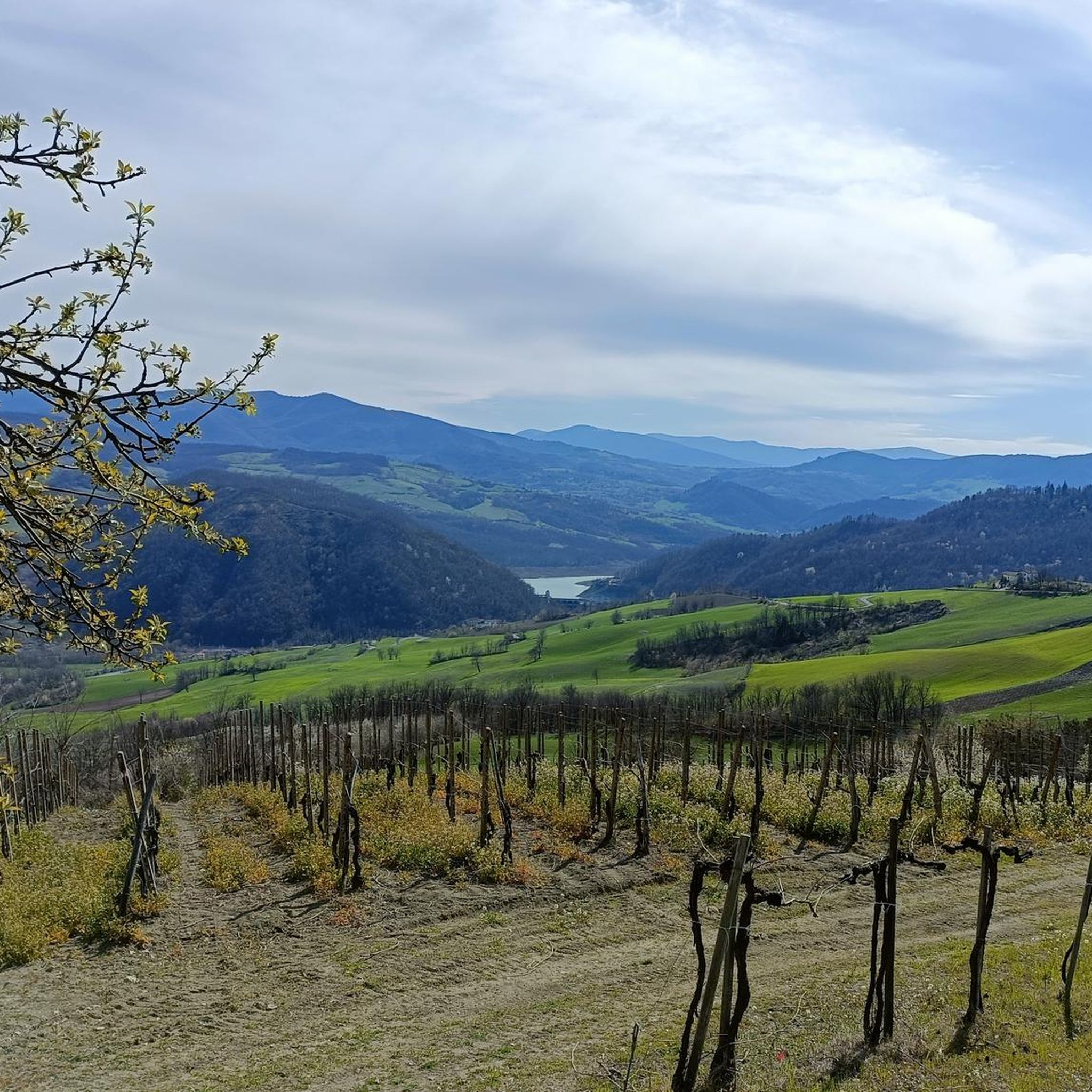
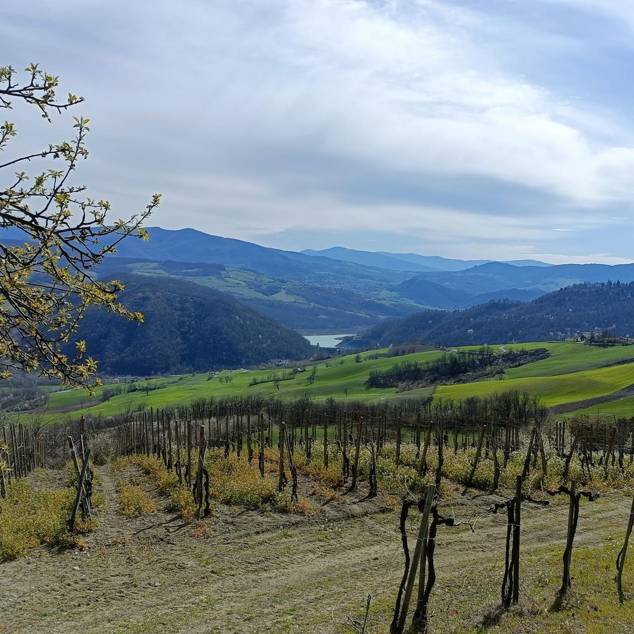
This pass of Mount Pan Perduto offers exposed terrain that allows for pleasant views. A short climb from here takes you out into the open along a steep dirt road, up to the nearby peak of Pan Perduto, which sits at an altitude of 1,065 metres. From the rocks of this peak, emerging from the large expanse of surrounding trees, an extensive panorama opens up that embraces the mountains that surround the Bobbio basin. Further away, along the ridge that extends towards the Nure valley, Mount Aserei is visible. Towards the south it is easy to spot Mount Penice and, on the horizon, Mount Alfeo. Looking towards the Oltrepò Pavese you can recognize Romagnese and Mount Calenzone.
3
0
The ascent is entirely pedaled, look at the highlight "Monte Bissolo_The ascent"
2
0
Frequently Asked Questions
What are some of the most popular mountain peaks around Nibbiano?
Among the most popular peaks is Monte Alpe, known for its nature reserve and grazing cows. Another favorite is Monte Pradegna Summit, which offers panoramic views and is accessible to everyone. The broader Val Tidone region also features prominent peaks like Monte Penice, which stands at 1,460 meters and offers expansive views.
Are there family-friendly mountain peaks to visit near Nibbiano?
Yes, Monte Pradegna Summit is considered family-friendly. Reaching 960 meters above sea level, its summit is accessible to everyone and provides beautiful panoramic views without requiring strenuous climbs.
What kind of natural features can I expect to see around Nibbiano's peaks?
The region offers diverse natural landscapes. You'll find dense forests, especially around highlights like Monte Alpe and Monte Bissolo E‑Bike Park. The Val Tidone, extending from the base of Monte Penice, features picturesque views that transition from vineyards to rugged Apennine landscapes, with opportunities to explore woods, rivers, and lakes.
Where can I find the best panoramic views of the region?
For expansive views, Monte Pradegna Summit is an excellent choice, offering beautiful panoramas. Additionally, the View near Pan Perduto mountain provides exposed terrain with pleasant views, and a short climb to the peak of Pan Perduto (1,065 meters) opens up an extensive panorama embracing the mountains around the Bobbio basin, including Mount Penice and Mount Alfeo on the horizon.
What outdoor activities are available near these mountain peaks?
The area around Nibbiano and the Val Tidone is excellent for various outdoor activities. You can find numerous opportunities for walking, mountain biking, and horse riding through woods and natural areas. For specific routes, consider exploring the Running Trails around Nibbiano, Gravel biking around Nibbiano, or Cycling around Nibbiano guides.
Are there mountain biking opportunities around Nibbiano's peaks?
Yes, the Start of MTB descents – Monte Bissolo E‑Bike Park offers five tracks of increasing difficulty, suitable for full-suspension mountain bikes. The blue and red tracks are noted for their fluidity and fun. You can also find more options in the Gravel biking around Nibbiano guide.
What is the best time to visit the mountain peaks around Nibbiano?
The Val Tidone region, including its mountain peaks, is generally pleasant for outdoor activities from spring through autumn. These seasons offer favorable weather for hiking, cycling, and enjoying the natural beauty. Winter conditions can vary, especially at higher elevations like Monte Penice, so checking local forecasts is advisable for winter visits.
Are there any historical or cultural sites near the mountain peaks?
While the peaks themselves are natural landmarks, the broader Val Tidone region is rich in historical sites. You can explore ancient boroughs, castles, and windmills, which add a cultural dimension to your natural exploration. For more information on the region's offerings, you might find details on the Visit Piacenza website.
What kind of hiking difficulty can I expect on trails near Nibbiano?
The area offers a range of difficulties. Accessible summits like Monte Pradegna Summit are suitable for everyone. Other trails, such as those leading to Pan Perduto mountain or through the Crocetta Pass, are generally intermediate. Some routes, like the running trails, can be quite challenging, so it's best to check individual route descriptions for specific difficulty ratings.
Can I find circular walks around the mountains near Nibbiano?
Yes, the region offers various circular routes for different activities. For example, the Running Trails around Nibbiano guide includes options like the "Castello di Corano loop from Trevozzo" and "Rocca d'Olgisio loop from Pianello Val Tidone," which are circular. You can find similar loop options in the cycling and gravel biking guides as well.
What do visitors enjoy most about the mountain peaks around Nibbiano?
Visitors appreciate the diverse natural beauty, from the serene Monte Alpe Nature Reserve with its grazing cows to the expansive panoramic views from summits like Monte Pradegna. The variety of trails for hiking, cycling, and mountain biking, along with the historical context of the Val Tidone, also contribute to a rich outdoor experience.
Most popular routes around Nibbiano
Most popular attractions around Nibbiano

Get inspired with the komoot mobile app


Explore more
See even more amazing summits around Nibbiano with these guides:
