The best walks and hikes around Prunedale
3.0
(1)
47
hikers
8
hikes
Hiking around Prunedale offers access to diverse landscapes, from the rolling hills and oak woodlands of the Salinas Valley to coastal wetlands and state beaches. The region is characterized by its proximity to Monterey Bay, providing trails that explore tidal sloughs, riverbanks, and coastal bluffs. The terrain generally consists of flat coastal paths and gentle ascents into nearby hills. These natural features create varied environments for outdoor recreation.
Best hiking trails around Prunedale
- The most popular hiking route is Slough Trail – Cherry Blossom Park Playground loop from Watsonville, a 5.4 miles (8.8 km) trail that takes 2 hours 15 minutes to complete. This moderate path follows the Watsonville Slough, offering a mix of paved and unpaved surfaces.
- Another top favourite among local hikers is Hiking loop from Elkhorn, an easy 2.4 miles (3.8 km) path. This route explores the area around Elkhorn Slough, a tidal wetland environment.
- Local hikers also love the Fremont Peak Plaque – View from Fremont Peak loop from Fremont Peak State Park, a 1.3 miles (2.0 km) trail leading to views over the Salinas Valley, often completed in about 40 minutes.
- Hiking around Prunedale is defined by coastal wetlands, sandy beach trails, and rolling inland hills. The trail network provides options for both easy hikes for beginners and more challenging routes with elevation gain.
- The guide includes highly-rated routes that showcase the best of the region's landscape. More than 30 hikers have used komoot to explore Prunedale's varied terrain.
Last updated: October 11, 2026
6
hikers
1.75km
00:31
50m
50m
Hike the Fremont Peak Loop in Fremont Peak State Park, a difficult 1.1-mile route with 172 feet of gain and panoramic views.
4
hikers
4.58km
01:15
70m
70m
The Manzanita County Park Loop offers a delightful journey through diverse landscapes, transitioning between peaceful wooded sections and sun-drenched open meadows. You'll find yourself surrounded by coastal chaparral and, depending on the season, vibrant wildflowers, creating a serene backdrop for your walk. This easy 2.8-mile (4.6 km) hike, with a gentle 237 feet (72 metres) of elevation gain, is a fantastic way to immerse yourself in nature without a strenuous effort.
To plan your visit, know that the Manzanita County Park Loop is a year-round accessible trail, making it a reliable option whenever you're in the mood for a hike. Parking is available directly at the park, and it's a good idea to arrive earlier in the day, especially on weekends, to ensure you get a spot. The route is also very dog-friendly, so feel free to bring your leashed canine companion along.
This loop is a popular choice for its versatility, accommodating not just hikers but also birders, trail runners, and horseback riders. The park's 433.6 acres provide a quiet natural setting in Prunedale, perfect for spotting local wildlife like hawks, songbirds, squirrels, and rabbits. It's an ideal spot for a relaxed outdoor experience that feels a world away from the everyday.

5.54km
01:25
20m
20m
The Elkhorn Slough and Moss Landing area offers a truly unique hiking experience, primarily characterized by its flat terrain and abundant wildlife. You'll find yourself immersed in diverse habitats, from expansive marshes and tidal creeks to woodlands and mudflats, with marsh boardwalks providing excellent vantage points. Keep an eye out for playful sea otters, harbor seals, and hundreds of bird species as you explore this vibrant estuary.
Access to the trails is often through the Elkhorn Slough National Estuarine Research Reserve, which features an accessible visitor center and an Overlook Trail suitable for mobility-impaired visitors. Remember to stay on designated trails to protect both yourself from poison oak and ticks, and the delicate ecosystem. A key conservation measure is to brush your shoes before hiking to prevent the spread of Sudden Oak Death.
This easy 3.4-mile (5.5 km) route, with a minimal 60 feet (18 metres) of elevation gain, typically takes around 1 hour and 24 minutes. It's a world-renowned destination for wildlife viewing, considered one of the top 10 birding spots in the nation, and one of California's largest estuaries. The 1,700-acre Reserve boasts varied coastal habitats, making it a significant ecological and educational site.
899m
00:14
0m
0m
The Dune Trail offers a delightful, easy walk through a unique coastal environment, perfect for a quick escape. You'll experience the soft, shifting sands characteristic of dunes, leading you towards the scenic Old Salinas River State Beach. This gentle route covers just 0.6 miles (0.9 km) with a mere 5 feet (1 metres) of elevation gain, making it an easy 13-minute stroll for all ages and fitness levels.
Planning your visit to the Dune Trail is simple; it's an accessible route that doesn't require extensive preparation. While specific parking and access details are often found at the trailhead, remember to bring water and consider sun protection, especially on brighter days. This trail is best enjoyed during the cooler morning or late afternoon hours, offering a refreshing break by the coast.
This trail provides a fantastic opportunity for wildlife spotting, as dune ecosystems are often home to migratory birds and specialized plant species adapted to sandy environments. The sensory experience of walking on soft sand, perhaps even barefoot in cooler conditions, adds to its charm. It's a great option for those seeking family friendly Dune Trail hikes or a beginner hiking route that showcases the natural beauty of the coast.
3.0
(1)
26
hikers
3.99km
01:04
40m
40m
Easy hike. Great for any fitness level. Easily-accessible paths. Suitable for all skill levels.
Get access to more routes and recommendations from other explorers.
Already have an account?
Our route recommendations are based on thousands of hikes, rides, and runs completed by other people on komoot.
Start today with a free account
Your next adventure awaits.
Popular around Prunedale
Tips from the Community

This is California’s largest coastal salt marsh, where you'll encounter a wide variety of birds and other wildlife. The area boasts five miles of trails that wind through oak woodlands, creeks, and open grasslands.
0
0

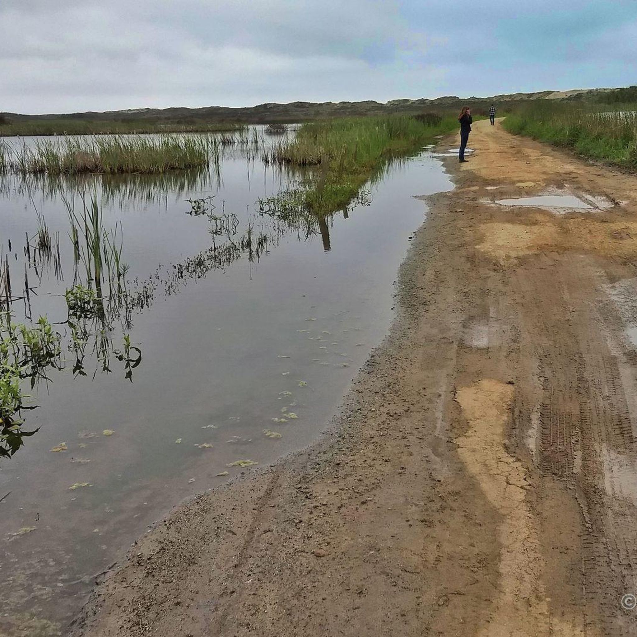
Rarely visited beach behind tall dunes inviting for long walks along the sea and back behind the dunes, past a little lake. Access road crosses a wetland and may be a bit muddy after rains.
1
0
Wild little-visited beach behind a very high dune reached either by a dirt road across the wetlands that can be flooded after rains , or via a sandy trail behind the private strawberry fields.
0
0
Frequently Asked Questions
Are there any easy, family-friendly hikes in the Prunedale area?
Yes, the region offers several great options for families and beginners. Royal Oaks Park and Manzanita County Park are both known for their gentle, shorter trails through oak woodlands. For a very flat and scenic walk, consider the Old Salinas River loop from Moss Landing, which is just under 2 miles (3.2 km) and perfect for all ages.
Where can I find dog-friendly hiking trails near Prunedale?
Many trails in the area welcome dogs, but one of the most popular choices is Garland Ranch Regional Park in Carmel Valley. It's highly regarded for its extensive network of trails where dogs are permitted. Always remember to keep your dog on a leash where required and to clean up after them.
What are the best local parks for hiking directly in or next to Prunedale?
Prunedale has two excellent local options. Manzanita County Park features about seven miles of trails through rolling hills and coastal chaparral. Nearby, Royal Oaks Park, the oldest in the county system, offers serene, shorter trails set among majestic oak trees, ideal for a peaceful walk.
Are there any hikes with good ocean or coastal views?
Definitely. Given Prunedale's proximity to the coast, you have great options for sea views. Garrapata State Park offers stunning coastal hiking with dramatic views of the Pacific. For a different perspective, the Hiking loop from Moss Landing State Beach provides a gentle walk along the shoreline with excellent opportunities for birdwatching.
What is the best time of year to hike around Prunedale?
Spring is a fantastic time to hike, as the hills are green and wildflowers are in full bloom. Autumn also offers pleasant, mild weather. Summers can be warm, especially on inland trails, so it's best to start early in the day. Coastal trails often have a cooling breeze, making them a good choice year-round.
Can I see wildlife while hiking near Prunedale?
Yes, the area is rich in wildlife. Elkhorn Slough Reserve is a premier destination for spotting sea otters, seals, and a huge variety of shorebirds and waterfowl. On inland trails, it's common to see deer, rabbits, and various bird species. Pinnacles National Park, a short drive away, is a famous sanctuary for the California Condor.
Are there any challenging hikes for more experienced hikers?
For those seeking a challenge, the Fremont Peak Plaque – View from Fremont Peak loop from Fremont Peak State Park offers a short but steep climb that rewards you with panoramic views of the Salinas and San Benito Valleys. For more extensive and strenuous trails, consider exploring the rugged terrain of Pinnacles National Park or the steeper ascents in Garland Ranch Regional Park.
What should I pack for a day hike in this region?
It's wise to dress in layers, as coastal weather can change quickly. Even on warm days, fog can roll in and bring a chill. Always carry plenty of water, especially for inland hikes. Sunscreen, a hat, and sturdy walking shoes are essential. It's also a good idea to have a map or a fully charged phone with the route downloaded.
Are there any long loop hikes available?
Yes, for a longer outing, the Slough Trail – Cherry Blossom Park Playground loop from Watsonville is a great option. It's a moderately-rated circular route of about 5.4 miles (8.8 km) that explores the Watsonville Slough system, offering a mix of natural scenery and park paths.
What kind of terrain can I expect on the trails?
The terrain is quite varied. You'll find flat, paved, or packed-dirt paths along the coast and around wetlands like Elkhorn Slough. In parks like Manzanita and Royal Oaks, expect rolling hills with wide, easy-to-navigate dirt trails. Further afield in places like Pinnacles or Garland Ranch, the trails become steeper, rockier, and more rugged.
Should I be concerned about rattlesnakes on the trails?
Rattlesnakes are native to the region and can be present, particularly on warmer days on sunny, rocky, or brushy trails. The best practice is to stay aware of your surroundings, stick to the trails, and watch where you step or place your hands. They are generally not aggressive if left alone.
Where can I go to see redwood trees near Prunedale?
While Prunedale itself is characterized by oak woodlands and chaparral, you can find beautiful redwood groves a short drive away. The Fall Creek Unit of Henry Cowell Redwoods State Park near Felton is a highly-rated destination offering shady trails that wind through impressive stands of coast redwoods.
Most popular routes around Prunedale
Most popular attractions around Prunedale

Get inspired with the komoot mobile app


Explore more
Browse the best Hikes in other regions.
