The best waterfall hikes and walks around Øvre Sjodalsvatnet
4.5
(2014)
10,901
hikers
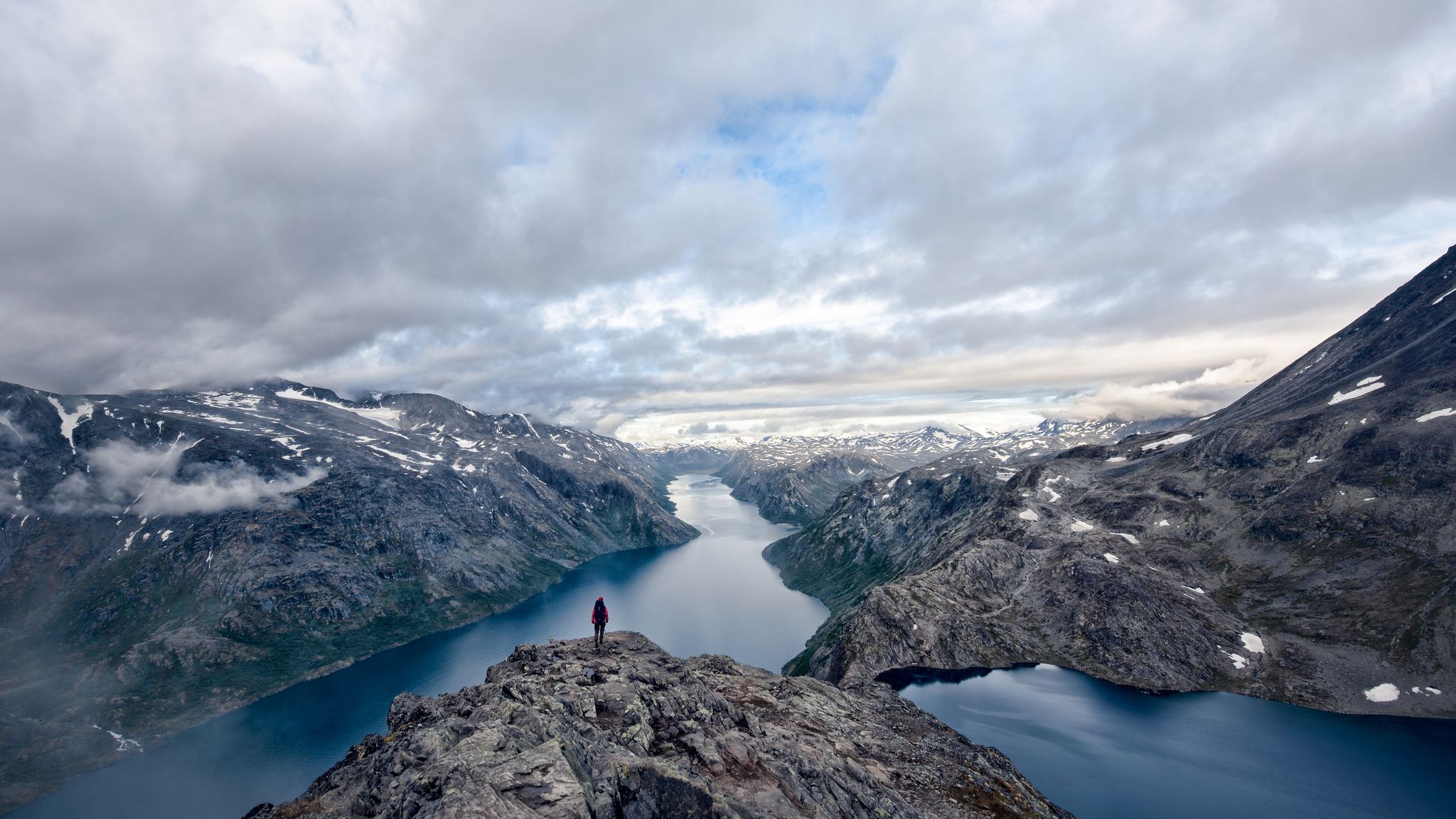
Waterfall hiking trails around Øvre Sjodalsvatnet are set within the Jotunheimen mountain range, characterized by dramatic alpine landscapes and pristine glacier waters. The region features the Sjoa River, which flows through the lake, contributing to a dynamic hydrological environment. Near the northern end of the lake, the Fjosranden Esker, a well-preserved gravel ridge, partially extends into the water. These trails offer varied terrain, from riverside paths to more elevated sections, providing access to the area's natural features.
Best waterfall hiking trails around Øvre Sjodalsvatnet
- The most popular waterfall hiking route is Stuttgongfossen – Stuttgonstien loop from Hindsæter, a 6.3 miles (10.1 km) moderate trail that takes 3 hours 26 minutes to complete. This route features significant elevation gain and views of the Stuttgongfossen waterfall.
- Another top favourite among local hikers is Hulderstigen – Bridge over the Sjoa loop from Hindvangen Fjellcamp, a moderate 11.2 miles (18.0 km) path. This trail follows the Sjoa River, offering varied scenery and a bridge crossing.
- Local hikers also love the Stuttgongkampen – Stuttgonstien loop from Hindsæter, a 6.5 miles (10.5 km) trail leading through varied terrain with significant elevation, often completed in about 3 hours 40 minutes.
- Hiking around Øvre Sjodalsvatnet is defined by majestic mountains, pristine glacier waters, and the Sjoa River, with routes offering options for different ability levels.
- The routes in Øvre Sjodalsvatnet are highly rated by the komoot community with an average score of 4.6 stars from more than 1300 reviews. More than 6000 hikers have used komoot to explore Øvre Sjodalsvatnet's varied terrain.
Last updated: October 11, 2026
4.9
(20)
76
hikers
10.1km
03:26
490m
490m
Moderate hike. Good fitness required. Mostly accessible paths. Sure-footedness required.
5.0
(2)
3
hikers
18.2km
05:00
280m
280m
Moderate hike. Good fitness required. Mostly accessible paths. Sure-footedness required.

5.0
(3)
20
hikers
10.5km
03:40
560m
560m
Moderate hike. Good fitness required. Easily-accessible paths. Suitable for all skill levels.
Our route recommendations are based on thousands of hikes, rides, and runs completed by other people on komoot.
Start today with a free account
Your next adventure awaits.
Popular around Øvre Sjodalsvatnet
Other adventures around Øvre Sjodalsvatnet

Tips from the Community


Great waterfall / path which is also good to do with kids. Beautiful forest. Very impressive after heavy rainfall.
0
0

Marshy but passable area. Well-signposted route and signs to learn about local flora and fauna
0
0

Very nice wooden bridge over the river.
1
0


Here you follow the river for a short time. There are also two to three flat shore spots for water tapping.
1
0
This rustic wooden bridge with a wide wooden gate sets the mood for a beautiful circular route right at the beginning of the nature trail. There are flat shore areas on both sides, which invite you to cool off in the river.
0
0

Great waterfall that you can get very close to!
2
0
Frequently Asked Questions
How many waterfall hiking trails are featured around Øvre Sjodalsvatnet?
This guide highlights three distinct waterfall hiking trails around Øvre Sjodalsvatnet, each offering unique views and experiences within the stunning Jotunheimen mountain range. These routes are carefully selected to showcase the region's natural beauty and its dynamic hydrological environment.
What is the general difficulty level of waterfall hikes in this area?
The waterfall hikes around Øvre Sjodalsvatnet are generally considered moderate. They involve varied terrain and significant elevation changes, requiring good fitness and sure-footedness. For example, the Stuttgongfossen – Stuttgonstien loop from Hindsæter has an elevation gain of nearly 500 meters over 10.1 km.
Are there any family-friendly waterfall hikes near Øvre Sjodalsvatnet?
While many trails in the broader Jotunheimen area can be challenging, the routes featured here are moderate. Families with older children who are accustomed to hiking and elevation gain may enjoy trails like the Stuttgongfossen – Stuttgonstien loop, which offers rewarding views of the Stuttgongfossen waterfall. Always consider the fitness level of all family members before embarking on a hike.
Can I bring my dog on the waterfall hiking trails?
Yes, dogs are generally welcome on hiking trails around Øvre Sjodalsvatnet. However, it is crucial to keep them on a leash, especially during the grazing season (typically June to October), to protect livestock and wildlife. Always ensure your dog is well-behaved and capable of handling the moderate terrain and distances.
What are some notable natural features or landmarks I might see on these trails?
Beyond the impressive waterfalls, you'll encounter the pristine glacier waters of Øvre Sjodalsvatnet and the dynamic Sjoa River. Near the northern end of the lake, you can observe the Fjosranden Esker, a well-preserved gravel ridge. The surrounding landscape is dominated by the majestic Jotunheimen mountains, offering dramatic backdrops for your hike.
Where can I park when visiting the waterfall trails?
Convenient access points and parking are available near accommodations such as Maurvangen campground and Bessheim mountain lodge, which are located near the southwestern shore of Øvre Sjodalsvatnet. These serve as excellent starting points for excursions into the area, including trails like the Stuttgongkampen – Stuttgonstien loop.
Is public transport available to reach the hiking trailheads?
The region is accessible via Route 51 (Valdresflye Scenic Road), which runs along the eastern shore of Øvre Sjodalsvatnet. While specific public transport stops directly at trailheads might be limited, bus services often operate along Route 51 during the peak season, connecting to major hubs. It's advisable to check local bus schedules for the most current information.
What is the best time of year to hike to the waterfalls?
The best time for waterfall hikes around Øvre Sjodalsvatnet is typically during the late spring, summer, and early autumn months (roughly June to September). During this period, the snow has melted, trails are generally clear, and the waterfalls are often at their most powerful due to snowmelt. Always check local weather conditions before heading out.
Are there any circular routes among the waterfall hikes?
Yes, this guide features several circular routes, allowing you to experience diverse scenery without retracing your steps. For instance, the Stuttgongfossen – Stuttgonstien loop from Hindsæter and the Hulderstigen – Bridge over the Sjoa loop from Hindvangen Fjellcamp are both excellent examples of circular trails.
What do other hikers say about the waterfall trails in Øvre Sjodalsvatnet?
The hiking experiences around Øvre Sjodalsvatnet are highly rated by the komoot community, with an impressive average score of 4.6 stars from over 1300 reviews. Hikers frequently praise the majestic mountain scenery, the pristine glacier waters, and the well-maintained trails that offer a true sense of wilderness adventure.
Are there places to eat or stay near the hiking areas?
Yes, the area around Øvre Sjodalsvatnet offers options for accommodation and dining. Maurvangen campground and Bessheim mountain lodge are located near the southwestern shore of the lake and serve as convenient starting points for hikes, often providing facilities for visitors. You can find cafes and pubs in the broader Sjodalen valley.
What kind of terrain can I expect on these waterfall hikes?
You can expect varied terrain on the waterfall hikes. Trails often combine riverside paths along the Sjoa River with more elevated sections that climb into the surrounding mountains. This means you'll encounter a mix of relatively flat stretches, rocky paths, and ascents, providing a dynamic and engaging hiking experience.

Get inspired with the komoot mobile app


Explore more
Browse the best Hikes in other regions.
