The best walks and hikes around Area H (The Slocan Valley)
3.9
(13)
138
hikers
8
hikes
Hiking around Area H (The Slocan Valley) offers diverse landscapes characterized by rugged mountain ranges, deep clear lakes, and dense old-growth forests. The region is nestled between towering green peaks of the Kootenay Rockies, providing a variety of terrain from valley-bottom trails to high-alpine routes. Valhalla Provincial Park is a significant feature, encompassing a large portion of the Valhalla Range and Slocan Lake shoreline. The area's natural features include numerous alpine lakes, waterfalls, and the Slocan River.
Best hiking trails around Area H (The Slocan Valley)
- The most popular hiking route is Gimli Peak via Mulvey Basin Trail — Valhalla Provincial Park, a 5.3 miles (8.6 km) moderate trail that takes 3 hours 57 minutes to complete. This route offers significant elevation gain and views within Valhalla Provincial Park.
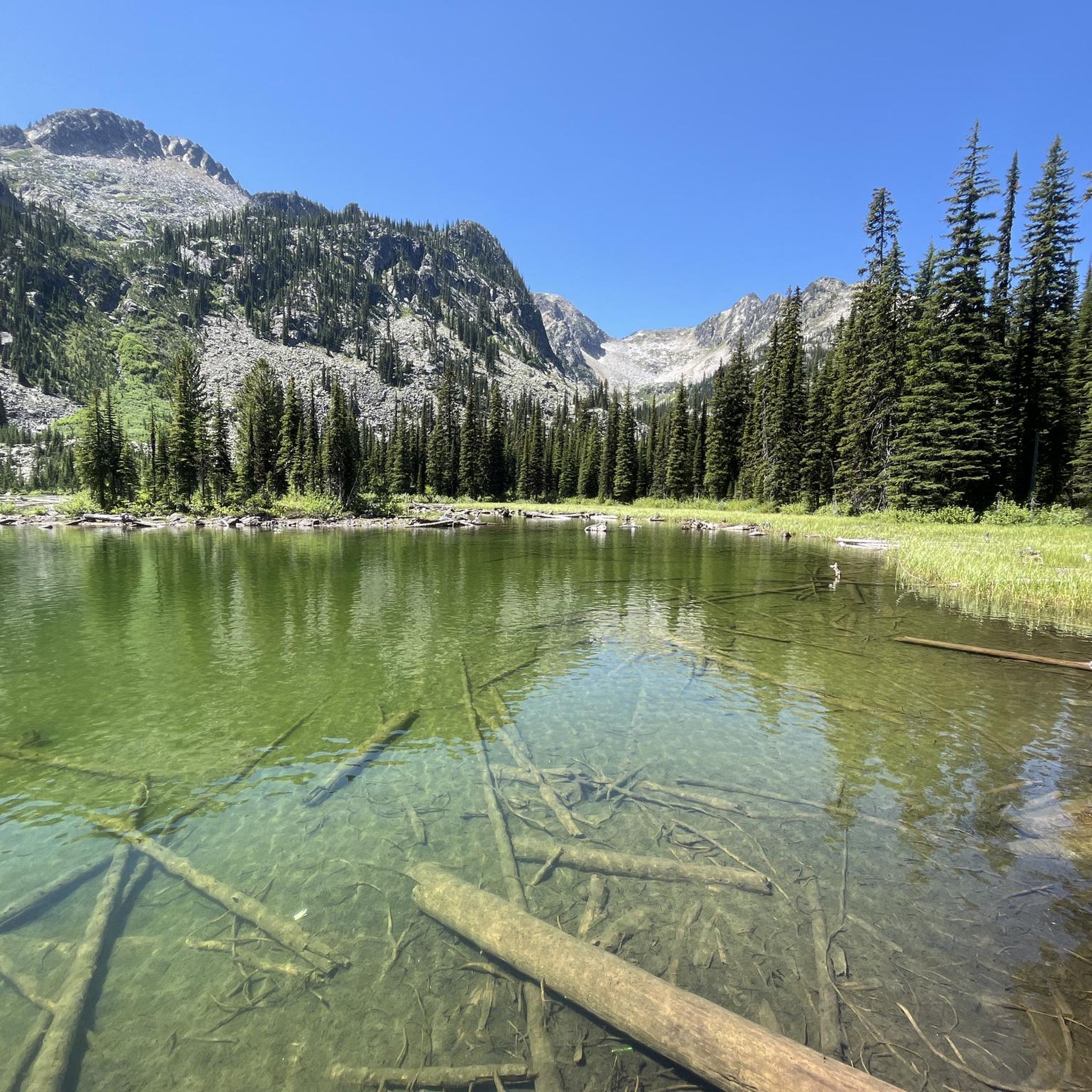
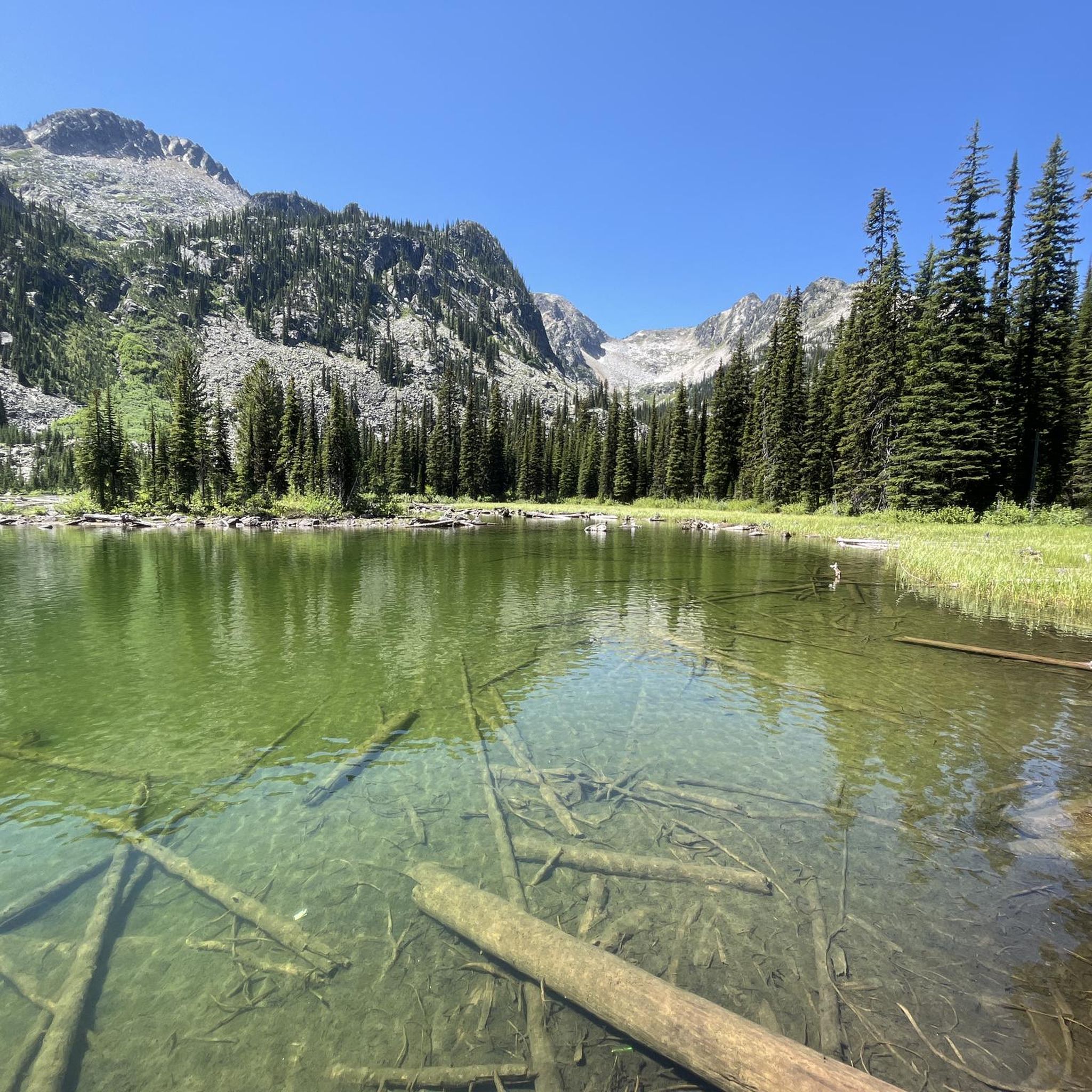
- Another top favourite among local hikers is Gwillim Lakes Trail, a moderate 6.6 miles (10.7 km) path. This trail leads to a chain of alpine lakes, providing scenic mountain vistas.
- Local hikers also love the Wilson Creek Falls Trail, a 2.2 miles (3.6 km) trail leading through forested areas to a waterfall, often completed in about 1 hour 10 minutes.
- Hiking around Area H (The Slocan Valley) is defined by towering mountain ranges, deep lakes, and old-growth forests. The network offers options for various ability levels, from easy riverside strolls to challenging alpine ascents.
- The routes in Area H (The Slocan Valley) are highly rated by the komoot community with an average score of 3.4 stars from over 5 reviews. More than 90 hikers have used komoot to explore Area H (The Slocan Valley)'s varied terrain.
Last updated: August 24, 2026
1.0
(1)
27
hikers
8.56km
03:57
860m
860m
Moderate hike. Good fitness required. Easily-accessible paths. Suitable for all skill levels.
4.0
(1)
21
hikers
10.7km
04:06
730m
730m
Hike the moderate 6.7-mile Gwillim Lakes Trail in Valhalla Provincial Park, gaining 2382 feet to reach stunning alpine lakes.

Sign up for free
5.0
(2)
18
hikers
2.58km
00:46
80m
80m
Easy hike. Great for any fitness level. Easily-accessible paths. Suitable for all skill levels.
5.0
(2)
6
hikers
3.63km
01:10
170m
170m
Easy hike. Great for any fitness level. Easily-accessible paths. Suitable for all skill levels.
4.0
(1)
4
hikers
16.5km
04:31
260m
260m
Moderate hike. Good fitness required. Easily-accessible paths. Suitable for all skill levels.
Get access to more routes and recommendations from other explorers.
Sign up for free
Already have an account?
Our route recommendations are based on thousands of hikes, rides, and runs completed by other people on komoot.
Start today with a free account
Your next adventure awaits.
Login or Signup
Popular around Area H (The Slocan Valley)
Tips from the Community

Kokanee Creek Old Growth Recreation Site protects a rare section of inland temperate rainforest in British Columbia’s Kootenays, where massive western red cedars and hemlocks tower above a forest floor thick with moss, ferns and fallen logs. Some of the cedars along the trail are estimated to be more than 800 years old, with interpretive signs explaining both the ecology of the forest and its logging history. Kokanee Creek flows through the site below steep forested slopes, adding to the cool and sheltered atmosphere beneath the canopy.
0
0
The Old Growth Recreation Trail winds through a dense stand of ancient western red cedar and hemlock forest in the inland rainforest region of British Columbia’s Kootenays. Thick moss covers the forest floor and fallen logs, while towering old growth trees line the route, creating a cool and shaded atmosphere even in summer. Short boardwalk sections and packed dirt paths make the trail relatively accessible, though conditions can become slippery after rain.
0
0

Wilson Creek Falls plunges 63 metres into a narrow canyon, creating a steady spray at the base. When you reach this opening in the forest with a viewpoint of the falls you can take in the view and take a picture.
0
0
Wilson Creek Falls Trail starts at the forest trail near the 4-Wheel-Drive Parking area. The trail starts off pretty easy, winding through the forest and gets steeper as you get closer to the canyon. Eventually you'll reach the boundary for Goat Range Provincial Park and will hear the waterfall as you get closer.
0
0
There are two parking areas for Wilson Creek Falls. This is the most accessible of the two, since the road from here becomes rough and steep. if you have a 4-Wheel-Drive vehicle that can handle then next stretch of road, then you can continue on to the parking area up the road.
0
0

The Galena Trail has a few trailheads. This trailhead in Three Forks, on the east side of Sandon Road, has parking and marks the easternmost point of the Galena Trail.
0
0
The Galena Trail was once the corridor of the 1890s Nakusp and Slocan Railway, and an important part of the "Silvery Slocan" mining boom. The trail today brings hikers and bikers through forests of western red cedars and Cedar-Hemlocks. Halfway through the trail, there is a cable car crossing the Carpenter Creek.
0
0
Galena Trail Cable Car is a unique river crossing. The cable car requires users to pull ropes to cross the creek, and bringing gloves for the cables is highly recommended. Users must cross one at a time and may bring their bike, with the car having a maximum load of 160 kilograms. There are clear directions and loading and unloading platforms at the cable car station.
0
0
Frequently Asked Questions
How many hiking trails are available in Area H (The Slocan Valley)?
Komoot offers a selection of 6 hiking trails in Area H (The Slocan Valley), ranging from easy strolls to more challenging routes. This includes 2 easy trails and 4 moderate trails, ensuring options for various fitness levels.
What kind of landscapes can I expect to see while hiking in the Slocan Valley?
The Slocan Valley is renowned for its rugged, wild, and naturally beautiful landscapes. You'll encounter towering green mountain ranges, deep clear lakes like Slocan Lake, and pristine rivers. Many trails lead through old-growth forests, to stunning alpine lakes such as the turquoise Gwillim Lakes, and into meadows that burst with wildflowers, especially in July and August. The region is nestled within the Kootenay Rockies, offering awe-inspiring views.
Are there any trails with waterfalls in the Slocan Valley?
Yes, the region features impressive waterfalls. You can explore the Wilson Creek Falls Trail, an easy 3.6 km route that leads directly to a beautiful waterfall.
What are some family-friendly hiking options in Area H (The Slocan Valley)?
For families, the Wilson Creek Falls Trail is an easy and rewarding option. Another great choice is the Bannock Point Trail, which is also considered easy and offers a pleasant experience for all ages. The Slocan Valley Rail Trail also provides leisurely, flat walks suitable for families.
Are there any long-distance or multi-day hiking opportunities?
While our current selection focuses on day hikes, the Slocan Valley is known for its extensive trail network. The New Denver to Three Forks via Galena Trail is a moderate 16.5 km route that can be part of a longer adventure. The Slocan Valley Rail Trail itself extends over 52 kilometers, offering opportunities for longer multi-day treks or cycling trips.
What kind of wildlife might I see on the trails?
The Slocan Valley is rich in diverse wildlife. Hikers often spot eagles, moose, elk, deer, swans, otters, beavers, and turtles. Mountain goats are a common sight on trails like Gimli Ridge, particularly in Valhalla Provincial Park.
Are there any trails that offer panoramic views of the mountains or lakes?
Absolutely. The region is known for its awe-inspiring vistas. The Gimli Peak via Mulvey Basin Trail in Valhalla Provincial Park provides amazing sweeping views of the valley and Mount Gimli's prominent peak. The Gwillim Lakes Trail also offers breathtaking mountain views surrounding the turquoise alpine lakes.
What is the best time of year to go hiking in the Slocan Valley?
The best time for hiking in the Slocan Valley is generally from late spring through early autumn. July and August are particularly popular for experiencing the alpine meadows bursting with wildflowers. While many routes are accessible during these months, some higher elevation trails might still have snow early in the season.
Are there any notable attractions or points of interest near the hiking trails?
Yes, the Slocan Valley offers several points of interest. You can find the Galena Trail Cable Car along the New Denver to Three Forks via Galena Trail. The majestic Valhalla Provincial Park itself is a major draw, encompassing a significant portion of the Selkirk Mountains and offering numerous backcountry opportunities. The Columbia and Western Rail Trail and Kootenay River and Kootenay Lake Route are also nearby.
What do other hikers enjoy most about hiking in Area H (The Slocan Valley)?
The komoot community rates the hiking experience in Area H (The Slocan Valley) highly, with an average score of 3.4 stars. Reviewers often praise the region's rugged and wild natural beauty, the stunning mountain and lake views, and the sense of profound connection with nature that the trails offer.
Are there any challenging high-alpine routes for experienced hikers?
For experienced hikers seeking a challenge, the Slocan Valley offers several demanding high-alpine routes. The Gimli Peak via Mulvey Basin Trail is a moderate 8.5 km route with significant elevation gain, leading to prominent peaks. The Gwillim Lakes Trail is another challenging 10.7 km round trip that leads to a chain of turquoise alpine lakes with breathtaking mountain views, perfect for those looking for a more strenuous adventure.
Most popular routes around Area H (The Slocan Valley)
Most popular attractions around Area H (The Slocan Valley)

Get inspired with the komoot mobile app


Explore more
Browse the best Hikes in other regions.
