The best road cycling routes around Castle Valley
3.0
(1)
193
riders
3
rides
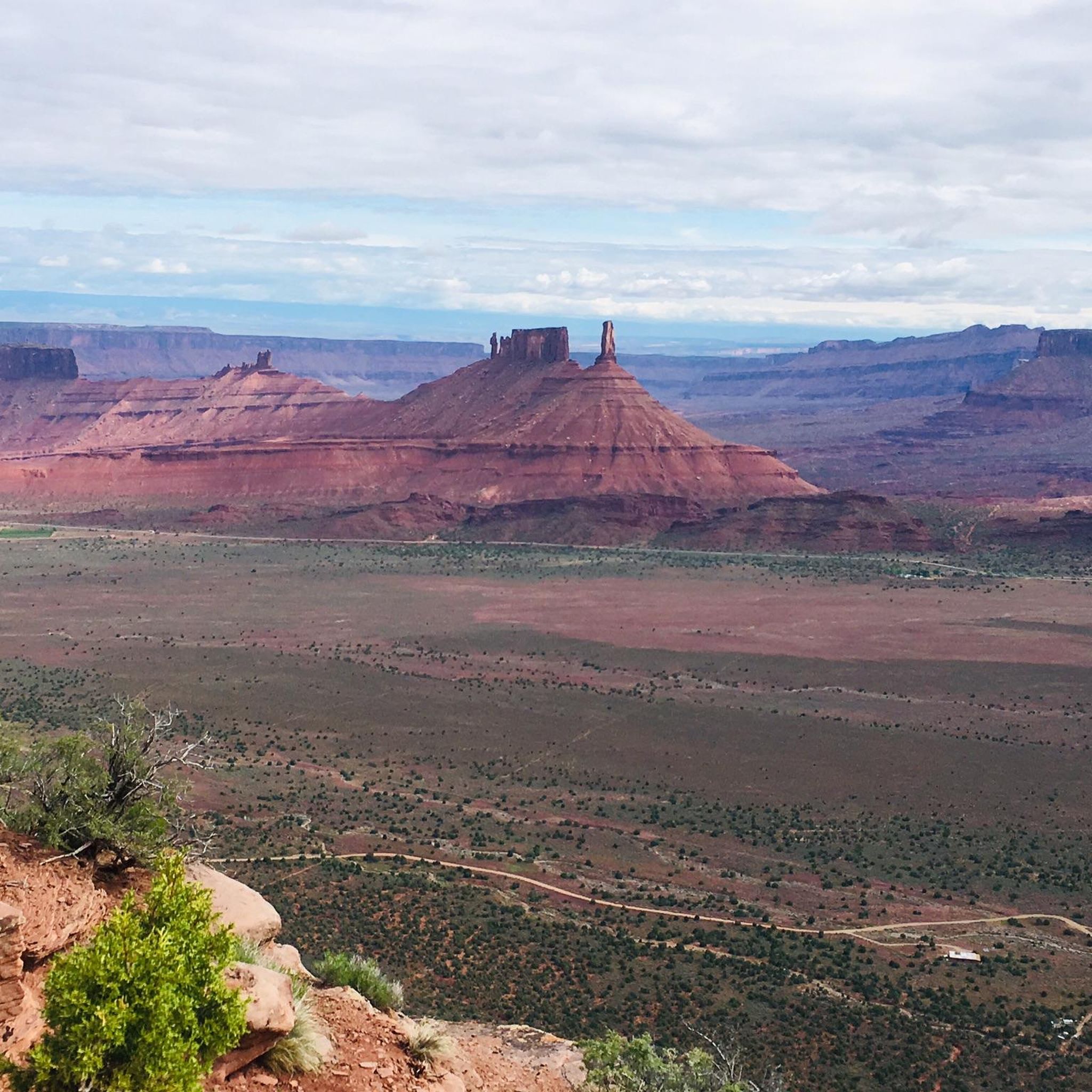
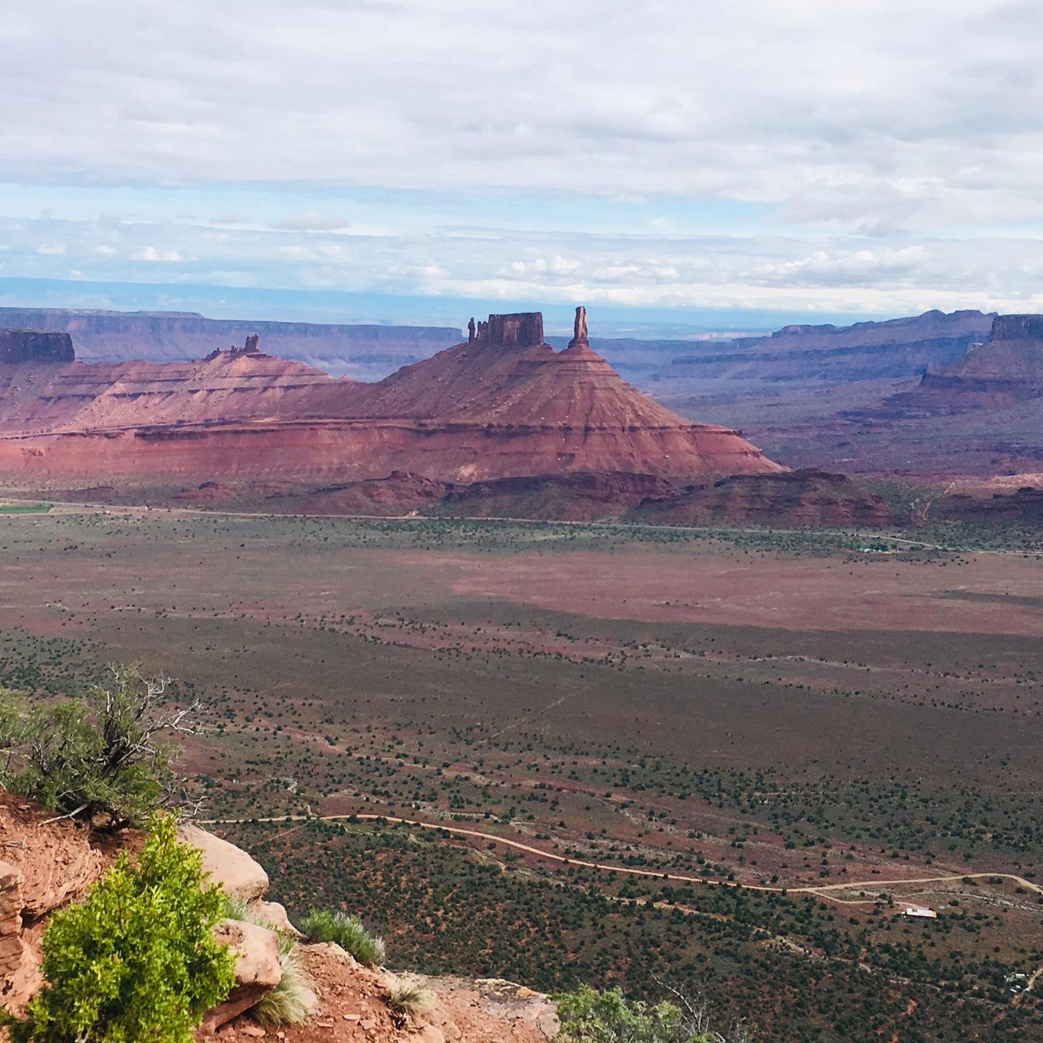
Road cycling around Castle Valley, Utah, features routes set against a backdrop of dramatic rock formations, including Castleton Tower and the Priest and Nuns. The region is characterized by high desert terrain, with the Colorado River winding through canyons and the La Sal Mountains providing alpine vistas to the south. Cyclists encounter varied landscapes, from flat river-side sections to significant ascents into mountain ranges.
Best road cycling routes around Castle Valley
- The most popular road cycling route is Bridge over…
Last updated: July 13, 2026
143
riders
103km
05:45
1,810m
1,810m
Hard road ride. Very good fitness required. Some segments of this route may be unpaved and difficult to ride.
3.0
(1)
37
riders
27.6km
01:19
360m
360m
Moderate road ride. Good fitness required. Mostly well-paved surfaces and easy to ride.

Sign up for free
13
riders
59.4km
04:06
1,380m
1,380m
Hard road ride. Very good fitness required. Some segments of this route may be unpaved and difficult to ride.
Our route recommendations are based on thousands of hikes, rides, and runs completed by other people on komoot.
Start today with a free account
Your next adventure awaits.
Login or Signup
Popular around Castle Valley
Tips from the Community

Parts of the cycle path along US-191
1
0


Moab is a desert gateway town built for adventurers, framed by red-rock arches and mesas all set along the Colorado River. It’s the ideal base for exploring world-famous landscapes like Arches and Canyonlands National Parks, plus slickrock mountain biking, rafting excursions, and scenic drives through rugged canyon country. Downtown offers a nice mix of good food, galleries, gear shops, and local hospitality.
0
0

Amazing 360 view! Definitely stop to enjoy the desert and the mountains
1
0

The Maob Canyon Pathway is a 9 mile paved bike path that starts on Highway 128, just north of Moab. It is a great way to get into or out of Moab without having to share the road with traffic.
1
0
Frequently Asked Questions
What kind of terrain and difficulty can I expect on road cycling routes in Castle Valley?
Road cycling in Castle Valley offers a diverse range of terrain, from flat sections along the Colorado River to significant ascents into the La Sal Mountains. Routes are generally categorized as moderate to difficult, featuring dramatic elevation changes and stunning backdrops of red rock formations and high desert landscapes.
Which routes offer the most challenging climbs and significant elevation gain in the area?
For a demanding ride with extensive elevation gain, consider the Bridge over the Colorado River – La Sal Loop Road - Info Kiosk loop from Moab. This difficult 63.7-mile route features over 5,900 feet of climbing through red rock canyons and towards the La Sal Mountains. Another challenging option is the La Sal Loop Road - Info Kiosk – La Sal Mountains Lookout Point loop from Bronco Off-Rodeo, a difficult 36.8-mile path ascending into the La Sal Mountains with panoramic views.
Are there any less strenuous or moderate road cycling options in Castle Valley?
Yes, for a more moderate experience, the Matrimony Spring – Moab Canyon Pathway loop from Site 8 is a great choice. This 16.9-mile route leads through scenic canyons alongside the Colorado River and is often completed in about 1 hour 18 minutes. Another moderate option is the Devils Garden Trailhead loop from Double Arch, which is 21.8 miles long.
What natural features and landmarks will I encounter while cycling in Castle Valley?
The region is renowned for its dramatic rock formations, including the iconic Castleton Tower, the Priest and Nuns, and Adobe Mesa. You'll also cycle alongside the winding Colorado River and enjoy views of the majestic La Sal Mountains. Nearby attractions include natural arches like North Window Arch, Turret Arch, and Double Arch, as well as the Morning Glory Natural Bridge and Grandstaff Canyon Creek.
When is the best time of year to go road cycling in Castle Valley?
Castle Valley offers excellent road cycling opportunities for much of the year. Spring and fall provide mild temperatures, making them ideal. Summer mornings are manageable for rides, and the sunny, low-precipitation winters are also suitable for staying active on two wheels.
Are there any circular road cycling routes available in Castle Valley?
Yes, several routes in the area are designed as loops. Examples include the challenging Bridge over the Colorado River – La Sal Loop Road - Info Kiosk loop from Moab and the more moderate Matrimony Spring – Moab Canyon Pathway loop from Site 8. These loops allow you to experience the diverse scenery without retracing your path.
What do other road cyclists enjoy most about cycling in Castle Valley?
The komoot community highly rates the road cycling experience in Castle Valley, with an average score of 3.0 stars. Cyclists frequently praise the dramatic sandstone formations, the scenic views of the Colorado River, and the distant La Sal Mountains that define the routes.
How many road cycling routes are available around Castle Valley?
There are at least 4 road cycling routes detailed for the Castle Valley area, offering a range of experiences from moderate to difficult, with varying distances and elevation gains.
Can I find routes that offer panoramic viewpoints of the region?
Absolutely. Many routes, particularly those ascending into the La Sal Mountains, provide spectacular panoramic views. The La Sal Loop Road - Info Kiosk – La Sal Mountains Lookout Point loop from Bronco Off-Rodeo, for instance, is specifically noted for its panoramic vistas of the surrounding high desert landscape.
Are there options for road cycling near national parks in the Castle Valley area?
Yes, Castle Valley is conveniently located near major national parks. Arches National Park, for example, has a 41-mile paved road that is excellent for cycling, leading to iconic sights like Balanced Rock and Skyline Arch. Canyonlands National Park's 'Island in the Sky' district also offers scenic drives accessible by bike, providing spectacular views.
What are the typical weather conditions for road cycling in Castle Valley?
The area generally experiences a high desert climate. This means mild temperatures in spring and fall, which are ideal. Summer can be hot, so early morning rides are recommended. Winters are often sunny with low precipitation, making them suitable for cycling, though temperatures will be cooler.
Most popular routes around Castle Valley
Most popular attractions around Castle Valley

Get inspired with the komoot mobile app


Explore more
Browse the best Road cycling routes in other regions.
