The best walks and hikes around Castelverrino
4.7
(5)
16
hikers
6
hikes
Hiking around Castelverrino offers exploration of a distinctive landscape in the Molise region of Italy. The village is situated at 610 meters above sea level on a rocky outcrop, characterized by steeply sloping sandstone banks and layers forming the side of Vallone La Rocca. The Verrino Valley features deep gorges and riparian vegetation along the Verrino River, while surrounding areas consist of gently undulating hills, often cultivated with forage, olives, and vines.
Best hiking trails around Castelverrino
- The most popular…
Last updated: June 29, 2026
5.0
(3)
5
hikers
4.71km
01:21
110m
110m
Easy hike. Great for any fitness level. Easily-accessible paths. Suitable for all skill levels.
4.0
(1)
2
hikers
Easy hike. Great for any fitness level. Easily-accessible paths. Suitable for all skill levels.

Sign up for free
2
hikers
4.85km
01:20
90m
90m
Easy hike. Great for any fitness level. Easily-accessible paths. Suitable for all skill levels.
5.0
(1)
4
hikers
Easy hike. Great for any fitness level. Easily-accessible paths. Suitable for all skill levels.
3
hikers
5.92km
01:41
140m
140m
Easy hike. Great for any fitness level. Easily-accessible paths. Suitable for all skill levels.
Our route recommendations are based on thousands of hikes, rides, and runs completed by other people on komoot.
Start today with a free account
Your next adventure awaits.
Login or Signup
Popular around Castelverrino


Tips from the Community

Agnone is a village in Upper Molise, an Orange Flag awarded to the region's most beautiful landscapes, perched at an altitude of approximately 830–840 meters on a hill overlooking the Verrino Valley. It is world-famous for the Marinelli Pontifical Bell Foundry and the Bell Museum, among the oldest foundries in Italy and the world. The historic center, with its Venetian quarter, historic buildings, and numerous churches, reflects a long artisan tradition, particularly in metalworking and quality cheesemaking.
0
0

The medieval village of Pescolanciano is located along the Lucera-Castel di Sangro sheep track. At the top of the town stands the Alessandro castle, from the Norman era.
2
0

A beautiful reserve with many paths for walking.
8
0

The Collemeluccio reserve is one of the two oriented nature reserves that are part of the "Collemeluccio-Montedimezzo Alto Molise" Biosphere Reserve, recognized by UNESCO in 1977. It is located in the province of Isernia, hosts one of the most beautiful beech woods in Italy and it can be visited with a ring itinerary that starts from the forest center.
5
0

Municipality which, given its conformation, is culturally divided into "terra di sotto" and "terra di sopra". The village is in fact built close to a rocky massif.
1
0
Country located on a hill and built on different heights. The city is in fact divided into an "Above" and a "Below".
1
0
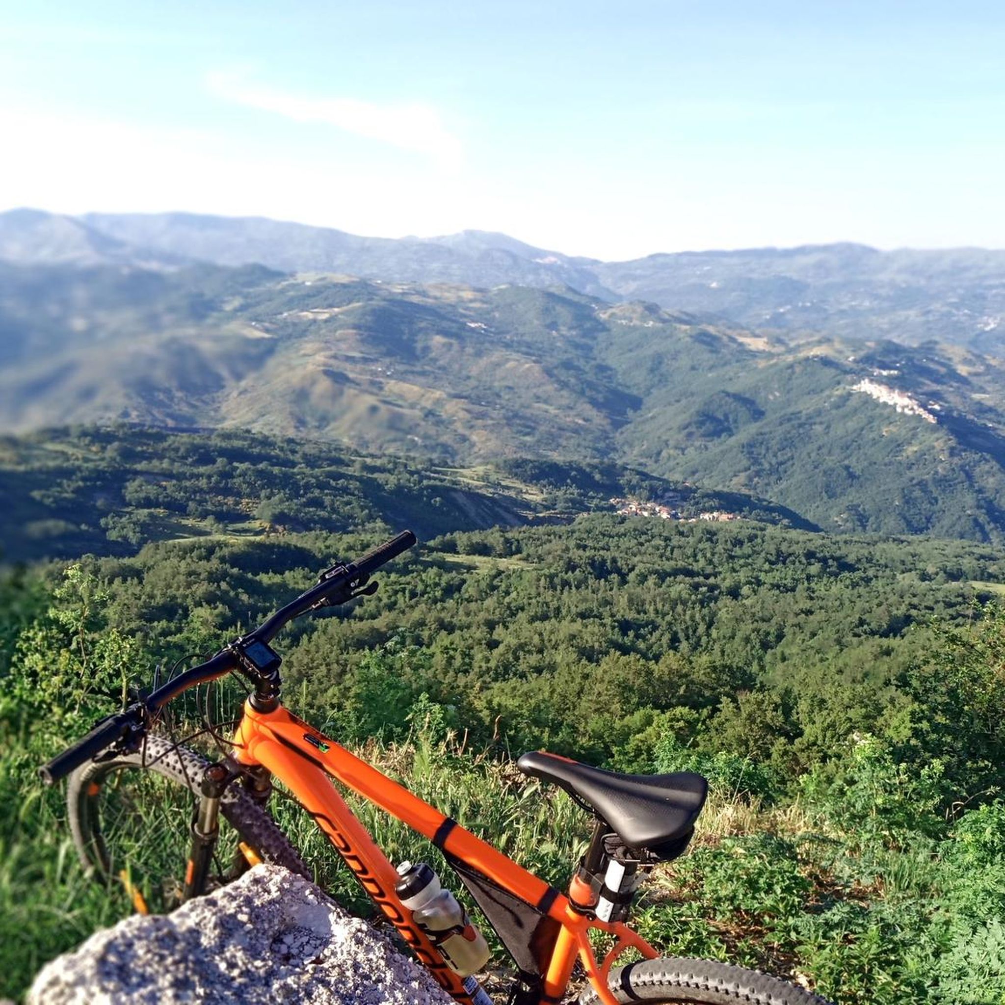
At this point you can admire a beautiful panorama. there are also benches to take a break and enjoy the tranquility of this reserve.
9
0

Il paese si trova nel cuore del Molise, in provincia di Isernia, ed è stato costruito su un rilievo collinare a ridosso di un massiccio roccioso che divide il fiume Trigno dal torrente Vella. L’incredibile posizione in cui sorge ha reso Bagnoli del Trigno un’attrazione turistica senza precedenti. In effetti, è come osservare un giocattolino intagliato dalla roccia dalle mani di un gigante, e la linearità delle costruzioni è elemento caratteristico del paesino. Essendo situato a due differenti altezze, a partire da 660 metri di altitudine sino ad arrivare ai 783 metri del punto più alto, il borgo è socialmente e culturalmente scisso in due zone, rispettivamente chiamate Terra di sotto e Terra di sopra. Passeggiare lungo le vie che, dal centro storico, si diramano per l’intero paese è come fare un vero e proprio viaggio nel tempo. Sulle origini di questo ameno borgo non si sa molto. Le leggende sulla nascita di Bagnoli del Trigno sono le più varie: chi fa cenno a una sorgente termale che diede vita al primo nucleo urbano, chi invece ritiene che tutto abbia avuto inizio per mano di una tribù in fuga dalle invasioni barbariche. Ciò che è certo è che le prime notizie ufficiali risalgono al medioevo, quando il centro abitato era un feudo appartenente al Contado del Molise. Le sue alterne vicende lo videro passare di mano in mano tra varie famiglie importanti, sia italiane che straniere. Nei secoli successivi, Bagnoli del Trigno divenne parte del Regno di Napoli e, in seguito, del Regno d’Italia. È proprio in questo periodo che visse il suo massimo splendore, prima di subire un fenomeno di emigrazione che lo portò quasi allo spopolamento. Moltissimi abitanti oggi risiedono a Roma, tanto che la capitale vanta un numero di bagnolesi più elevato rispetto a quello di coloro che si trovano ancora nella loro terra natia. Ma il piccolo borgo risplende ancora, grazie alle attività di artigianato e al turismo. Scopriamo alcune delle sue meraviglie. (fonte: https://siviaggia.it/varie/bagnoli-del-trigno-borgo-molise/251009/)
0
0
Frequently Asked Questions
How many hiking trails are available around Castelverrino?
Castelverrino offers a selection of 5 hiking routes. These trails explore the distinctive landscapes of the Molise region, characterized by rocky outcrops, river valleys, and undulating hills.
Are there easy hiking trails suitable for beginners in Castelverrino?
Yes, the majority of trails around Castelverrino are considered easy. For instance, you can explore In the Collemeluccio Nature Reserve – loop tour, which is an easy 2.9-mile (4.7 km) route. Another accessible option is the Pescolanciano loop from Pescolanciano, an easy 3.0-mile (4.8 km) trail through cultivated hills.
What natural features can I expect to see while hiking in Castelverrino?
Hikers in Castelverrino will encounter a diverse landscape shaped by its position on a rocky outcrop of Agnone flysch. You can expect to see steeply sloping sandstone banks, the deep gorges of the Verrino Valley with its riparian vegetation, and gently undulating hills cultivated with olives and vines. Notable natural attractions include the Collemeluccio Nature Reserve and the Colle Gendarme viewpoint, offering panoramic views.
Are there any waterfalls in the Castelverrino area?
Yes, the area around Castelverrino features the Verrino Waterfall, a natural highlight that adds to the scenic beauty of the Verrino Valley.
Are there historical sites or cultural landmarks to explore on hikes?
Beyond the natural beauty, Castelverrino offers cultural exploration. The village's historic center features stone houses and ancient portals. You can visit the parish church dedicated to Saints Simon and Jude, or the modern rural church of Santa Lucia by the Verrino River. The area is also part of 'The Walk of the Country Churches,' an extensive trail connecting historical centers and small churches. Additionally, you might encounter a Roman-era funerary stele in the main square.
Are there circular walks available in Castelverrino?
Yes, several routes in the area are designed as circular walks. For example, the In the Collemeluccio Nature Reserve – loop tour and the Collemeluccio Nature Reserve – Colle Gendarme viewpoint loop from Riserva Naturale di Collemeluccio–Montedimezzo are both excellent options for hikers looking for a loop experience.
What do other hikers say about the trails in Castelverrino?
The trails in Castelverrino are highly rated by the komoot community, with an average score of 5.0 stars from more than 4 reviews. Hikers often praise the pristine nature and breathtaking landscapes encountered on these routes.
Is Castelverrino a good destination for family-friendly hikes?
Given the prevalence of easy trails and the presence of attractions like the artificial lake and picnic area near the Santa Lucia church, Castelverrino can be a suitable destination for family-friendly hikes. The natural reserve loops also offer accessible paths for various ages.
What is the best time of year to hike in Castelverrino?
Castelverrino, nestled at 610 meters above sea level, offers pleasant conditions for hiking during spring, summer, and early autumn. These seasons provide comfortable temperatures to enjoy the lush river valleys and panoramic views. Summer also allows for swimming in the artificial lake near Santa Lucia church.
Where can I find parking for hiking trails in Castelverrino?
While specific parking areas for individual trailheads are not detailed, Castelverrino is a small village. Parking is generally available within the village, especially near the historic center. For trails leading into natural areas, local signage or information from the municipality might guide you to designated spots.
Are there any accommodations or places to eat in Castelverrino?
Castelverrino, though a small municipality, offers a glimpse into traditional Italian village life. While specific cafes, pubs, or accommodations are not detailed in the guide, the historic center and surrounding areas would be the place to look for local establishments. For broader options, nearby larger towns might offer more choices.
How can I reach Castelverrino using public transport for hiking?
Information on specific public transport links directly to trailheads is limited. Castelverrino is a small village in the Molise region. It is advisable to check local bus schedules or regional transport services that connect to larger towns in Molise, from which local connections to Castelverrino might be available. For detailed planning, consulting local Molise transport authorities would be beneficial.
Most popular attractions around Castelverrino

Get inspired with the komoot mobile app


Explore more
Browse the best Hikes in other regions.
