The best walks and hikes in Cantiere Forestale Di Paulilatino
4.5
(12)
58
hikers
8
hikes
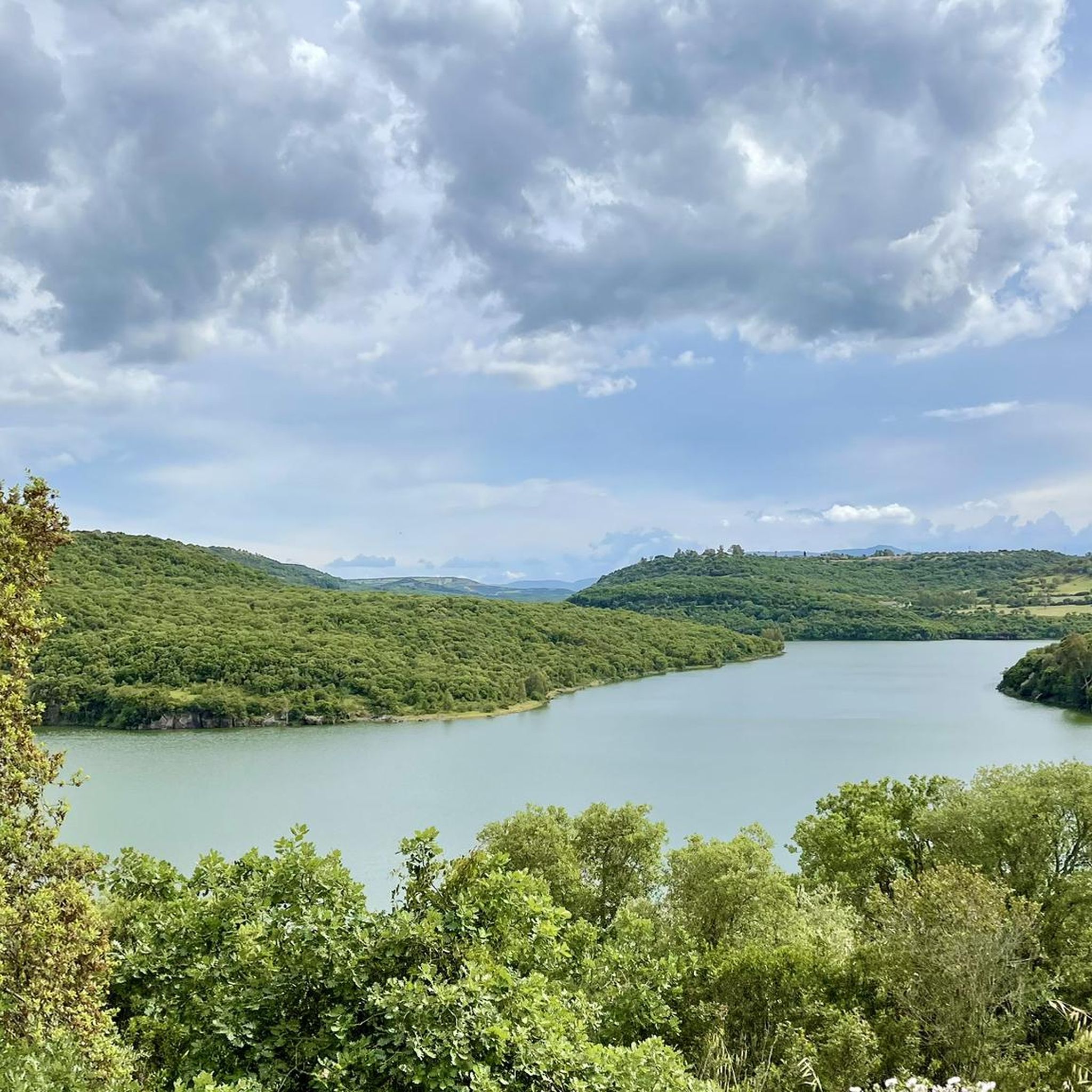
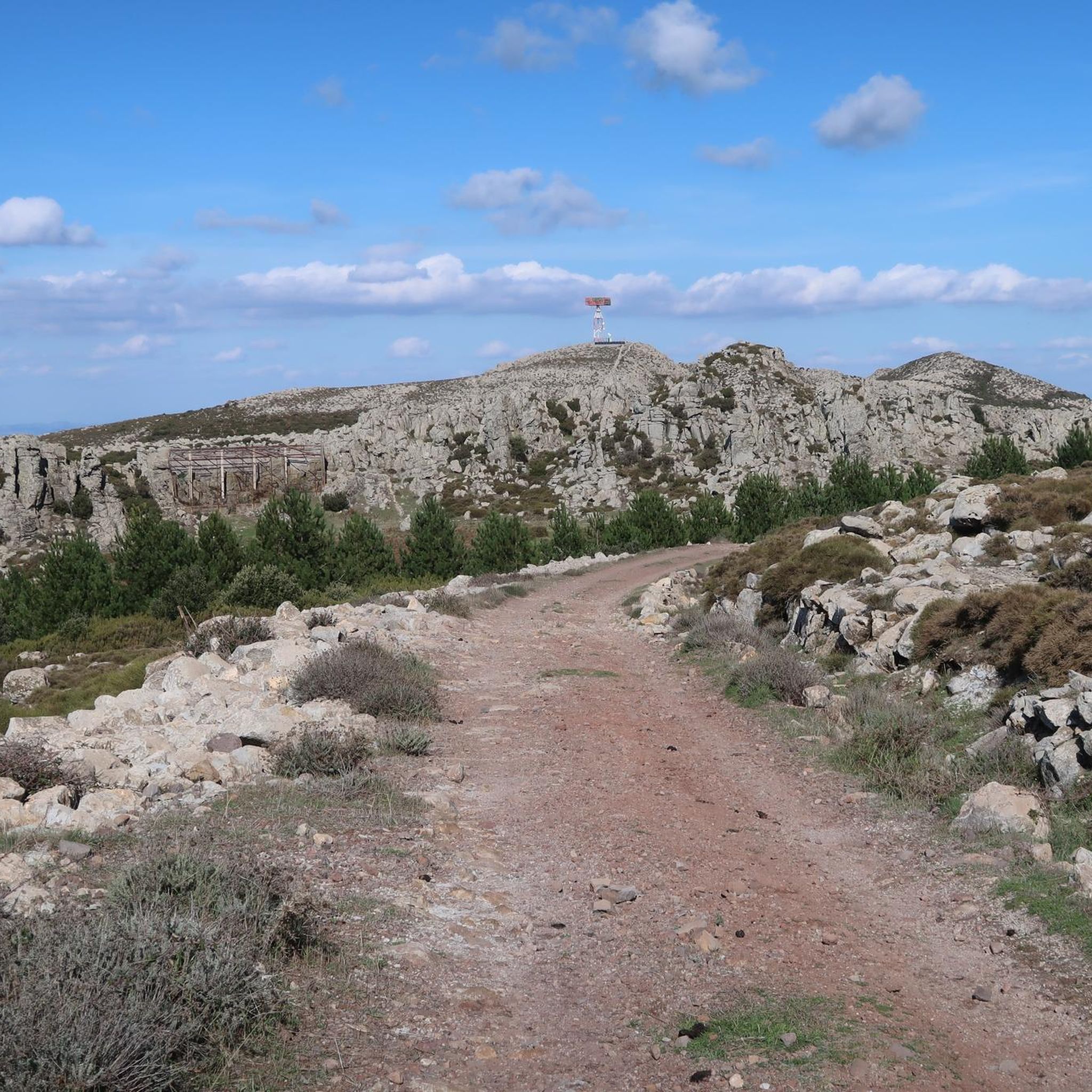
Hiking in Cantiere Forestale Di Paulilatino offers exploration within a characteristic Mediterranean landscape in Sardinia. This state forest, part of the Arci-Grighine complex, features dominant mastic, myrtle, arboreal heather, and strawberry trees. The region also preserves primary holm oak forests, particularly in rugged terrain within the Montiferru massif. Geologically, the area is diverse, with basalts, ignimbrites, tuffs, and quartz sandstones contributing to its varied topography.
Best hiking trails in Cantiere Forestale Di Paulilatino
- The most popular hiking route is Santa…
Last updated: July 10, 2026
4.3
(4)
12
hikers
Moderate hike. Good fitness required. Easily-accessible paths. Suitable for all skill levels.
5
hikers
Easy hike. Great for any fitness level. Easily-accessible paths. Suitable for all skill levels.

Sign up for free
5.0
(1)
6
hikers
Easy hike. Great for any fitness level. Easily-accessible paths. Suitable for all skill levels.
4.8
(4)
22
hikers
14.2km
04:02
320m
320m
Moderate hike. Good fitness required. Easily-accessible paths. Suitable for all skill levels.
4.0
(3)
8
hikers
6.35km
01:41
70m
70m
Easy hike. Great for any fitness level. Easily-accessible paths. Suitable for all skill levels.
Get access to more routes and recommendations from other explorers.
Sign up for free
Already have an account?
Our route recommendations are based on thousands of hikes, rides, and runs completed by other people on komoot.
Start today with a free account
Your next adventure awaits.
Login or Signup

Tips from the Community

Photo of the area inside a gate but unfortunately the nuraghe is not visible due to the dense vegetation that has grown over it...
0
0

In 1857, Giovanni Spano published an article that included a graphic overview of the monument. The Canon describes and interprets the sacred well in a rather convoluted way: he classifies it as a nuragic structure but is unable to discern its true function, mistaking it for a prison due to its similarity to other finds. In 1860, La Marmora, in his Itinéraire, praised the monument and compared it "to the Treasury of Atreus in Mycenae, Greece, described and illustrated by James Stuart." In the early years of the 20th century, other sacred wells in Sardinia were investigated: Antonio Taramelli, an archaeologist of the first half of the 20th century, finally surmised their function. His work is complemented by Raffaele Pettazzoni, who, in his book on the beliefs of the ancient Proto-Sardinians, describes the cult of water, also drawing on comparisons from outside the island.
1
1
In 1857, Giovanni Spano published an article that included a graphic overview of the monument. The canon describes and interprets the sacred well in a rather convoluted manner: it classifies it as a nuragic structure, but is unable to identify its true function, considering it a prison due to its similarity to other findings. In 1860, La Marmora, in his Itinéraire, praised the monument and compared it "to the Treasury of Atreus at Mycenae, Greece, described and illustrated by James Stuart." In the early years of the 20th century, other sacred wells in Sardinia were investigated: Antonio Taramelli, an archaeologist of the first half of the 20th century, finally divined their function. His work is rounded out by Raffaele Pettazzoni, who, in his book on the beliefs of the ancient Proto-Sardinians, describes the cult of water, also drawing comparisons outside the island.
2
0
«The country church of St. Christina, located in the territory of Paùli-Latìno, a quarter (4 km) from this town, also belongs to this priory (of Bonarcado), while it is two hours from Bonarcado. Nearby there are some casipole for the novenanti who compete there on the first of May. The main festival falls with great frequency on the 10th of the same and a pious procession to the fountain named after the saint, which has a peculiar shape and structure. On July 24th there is a memorial day on which the glorious death of the same is commemorated.»
2
0
«The country church of St. Christina, located in the territory of Paùli-Latìno, a quarter (4 km) from this town, also belongs to this priory (of Bonarcado), while it is two hours from Bonarcado. Nearby there are some casipole for the novenanti who compete there on the first of May. The main festival falls with great frequency on the 10th of the same and a pious procession to the fountain named after the saint, which has a peculiar shape and structure. On July 24th there is a memorial day on which the glorious death of the same is commemorated.»
1
1
In 1860, La Marmora, in his Itinéraire, praised the monument, comparing it "to the Treasury of Atreus at Mycenae, Greece, described and illustrated by James Stuart". In the early years of the 20th century, other sacred wells were investigated in Sardinia: Antonio Taramelli, an archaeologist of the first half of the 20th century, finally guessed their function. His work is completed by Raffaele Pettazzoni, who, in his book on the beliefs of the ancient proto-Sardinians, describes the cult of water, also referring to comparisons outside the island. Despite the importance of the monument and its excellent state of preservation, it was necessary to wait until 1953 for the first excavations and restorations, which then continued with the Athnitzi campaigns of 1967-73 and 1977-83. [9] The last excavation campaigns were carried out by Bernardini in 1989-90 and by Arnold Lebeuf between 2005 and 2010. Further research is planned, focusing mainly on the area of the Nuragic village (which, however, had not yet been carried out as of 2012).
1
1
In 1860, La Marmora, in his Itinéraire, praised the monument, comparing it "to the Treasury of Atreus at Mycenae, Greece, described and illustrated by James Stuart". [4] In the early years of the 20th century, other sacred wells were investigated in Sardinia: Antonio Taramelli, an archaeologist of the first half of the 20th century, finally guessed their function. [5][6][7] His work is completed by Raffaele Pettazzoni, who, in his book on the beliefs of the ancient proto-Sardinians[8], describes the cult of water, also referring to comparisons outside the island. Despite the importance of the monument and its excellent state of preservation, it was necessary to wait until 1953 for the first excavations and restorations, which then continued with the Athnitzi campaigns of 1967-73 and 1977-83. [9] The last excavation campaigns were carried out by Bernardini in 1989-90 and by Arnold Lebeuf[10] between 2005 and 2010. Further research is planned, focusing mainly on the area of the Nuragic village[1] (which, however, had not yet been carried out as of 2012).
1
0
In 1841, Angius published a first summary description of the monumental complex in the Angius-Casalis dictionary:[2] «The country church of St. Christina, located in the territory of Paùli-Latìno, a quarter (4 km) from this town, also belongs to this priory (of Bonarcado), while it is two hours from Bonarcado. Nearby there are some casipole for the novenanti who compete there on the first of May. The main festival falls with great frequency on the 10th of the same and a pious procession to the fountain named after the saint, which has a peculiar shape and structure. On July 24th there is a memorial day on which the glorious death of the same is commemorated."
1
0
Frequently Asked Questions
How many hiking trails are available in Cantiere Forestale Di Paulilatino?
There are over 5 hiking routes recorded in Cantiere Forestale Di Paulilatino, offering a variety of experiences within this Mediterranean landscape. These include 3 easy routes and 3 moderate routes, catering to different fitness levels.
What kind of terrain and natural features can I expect on the trails?
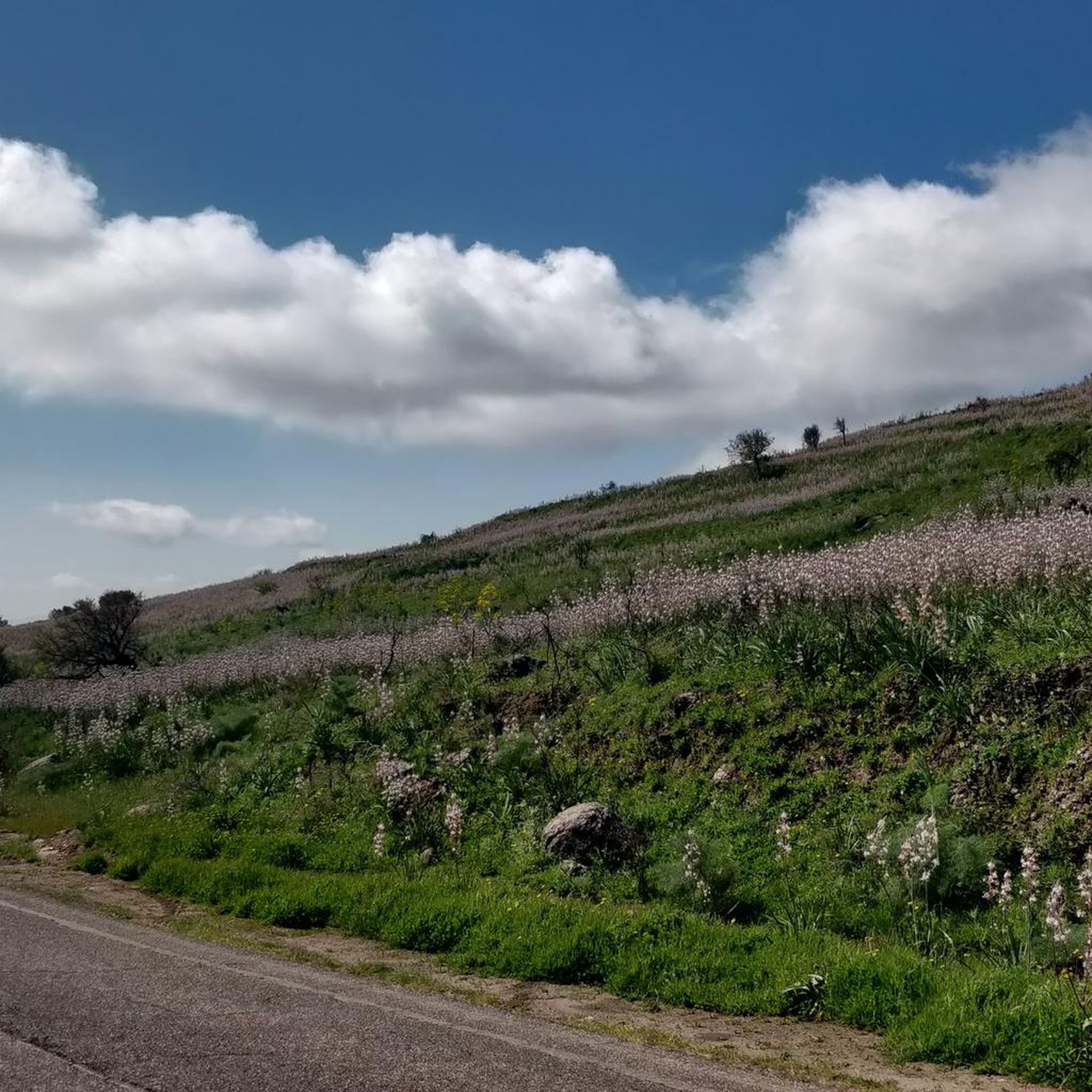
The trails in Cantiere Forestale Di Paulilatino traverse a characteristic Mediterranean landscape. You'll encounter dominant mastic, myrtle, arboreal heather, and strawberry trees. The region also features primary holm oak forests, especially in the rugged Montiferru massif. Geologically, the area is diverse, with basalts, ignimbrites, tuffs, and quartz sandstones contributing to a varied topography.
Are there any easy hiking routes suitable for beginners or families?
Yes, Cantiere Forestale Di Paulilatino offers several easy routes. For example, the Santa Cristina Country Church loop from Pozzo di Santa Cristina is an easy 3.8-mile (6.1 km) path that explores the area around the Sacred Well of Santa Cristina. Another easy option is the Casa Aragonese – Roman Baths of Fordongianus loop from Fordongianus, which is 4 miles (6.4 km) long.
What are the notable landmarks or historical sites I can visit while hiking?
The Paulilatino area is rich in archaeological heritage. Hikers can combine their outdoor pursuits with visits to significant sites such as the Sacred Well of Santa Cristina, a remarkably preserved Nuragic well temple. Other nearby attractions include Nuraghe Santu Antine, an emblematic Nuragic complex, and the Necropolis of Sant'Andrea Priu, featuring rock-cut tombs with ancient frescoes.
What is the best time of year to go hiking in Cantiere Forestale Di Paulilatino?
While specific seasonal details aren't provided, the Mediterranean climate suggests that spring and autumn would offer the most pleasant hiking conditions, with milder temperatures and blooming flora. Summers can be hot, and winters are generally mild but may bring rain.
Are there any circular hiking routes in the area?
Yes, many of the routes in Cantiere Forestale Di Paulilatino are circular. For instance, the Santa Cristina Country Church – Nuraghe Losa loop from Pozzo di Santa Cristina is a 9.2-mile (14.8 km) loop combining natural scenery with historical sites. Another option is the Casa Aragonese – Camper Area Near Roman Baths loop from Fordongianus, an 8.8-mile (14.2 km) loop.
What do other hikers say about the trails in Cantiere Forestale Di Paulilatino?
The routes in Cantiere Forestale Di Paulilatino are highly rated by the komoot community, with an average score of 4.4 stars from over 9 reviews. Hikers often praise the varied terrain and the opportunity to explore both natural beauty and ancient historical sites.
Is there parking available near the trailheads?
While specific parking locations are not detailed, the starting points for routes like the Santa Cristina Country Church – Nuraghe Losa loop from Pozzo di Santa Cristina and the Santa Cristina Country Church loop from Pozzo di Santa Cristina are indicated as 'from Pozzo di Santa Cristina', suggesting accessible starting points for visitors arriving by car.
Can I bring my dog on the hiking trails?
Generally, state forests in Sardinia, including Cantiere Forestale di Paulilatino, are welcoming to dogs, provided they are kept under control, especially to protect local wildlife and ensure the comfort of other hikers. It's always advisable to check local signage for any specific restrictions on individual trails.
Are there any viewpoints or scenic spots along the hikes?
The diverse topography, featuring basalts, ignimbrites, tuffs, and quartz sandstones, combined with the Mediterranean vegetation and ancient holm oak forests, naturally creates numerous scenic spots. The varied landscape offers opportunities for panoramic views, particularly in more rugged sections or areas overlooking the Montiferru massif.
What kind of flora and fauna can I observe in the forest?
The Cantiere Forestale di Paulilatino is characterized by typical Mediterranean vegetation, including mastic, myrtle, arboreal heather, and strawberry trees. You can also find primary holm oak forests. While not explicitly detailed, such environments are home to various Mediterranean wildlife, which hikers might encounter.
Are there any longer, more challenging routes for experienced hikers?
The area offers moderate routes for those seeking a longer challenge. The Santa Cristina Country Church – Nuraghe Losa loop from Pozzo di Santa Cristina is a moderate 9.2-mile (14.8 km) trail, and the Casa Aragonese – Camper Area Near Roman Baths loop from Fordongianus is an 8.8-mile (14.2 km) moderate trail, both offering a good workout and exploration.
Most popular routes in Cantiere Forestale Di Paulilatino

Get inspired with the komoot mobile app


Explore more
Browse the best Hikes in other regions.
