The best walks and hikes around Forollsjøen
5.0
(4)
39
hikers
3
hikes
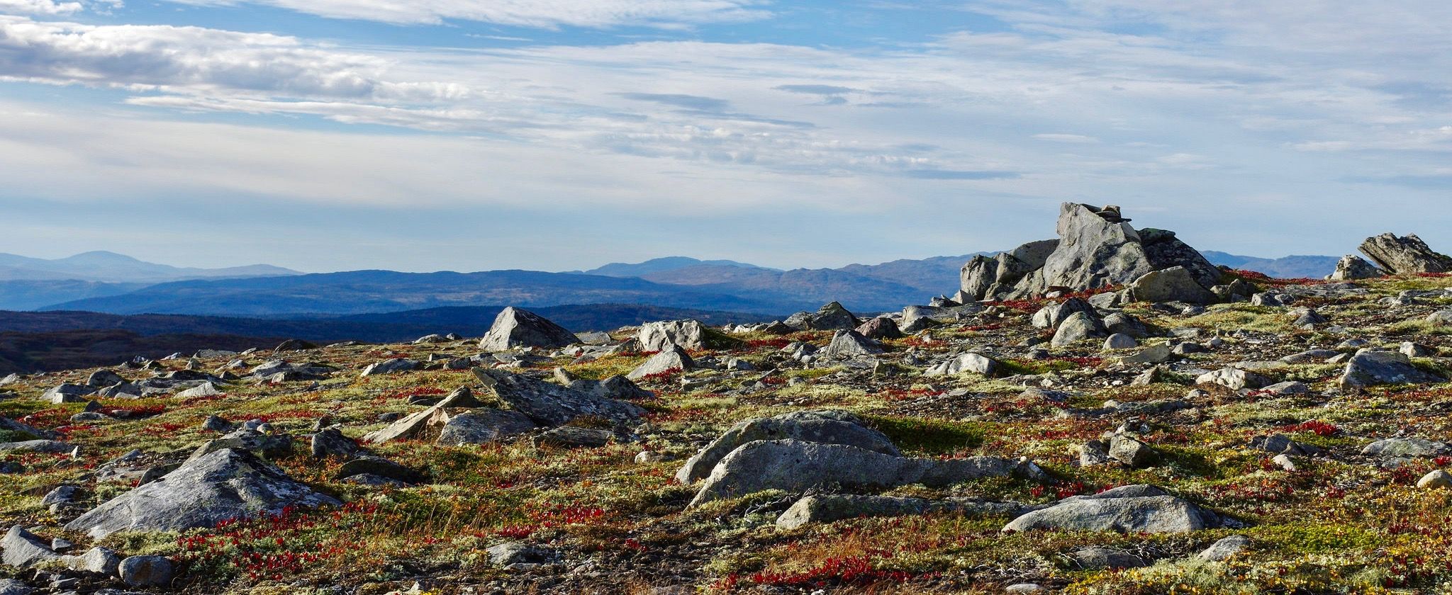
Hiking around Forollsjøen offers trails through a landscape characterized by open mountain plateaus, rolling hills, and the presence of the Forollhogna National Park. The region features varied terrain, including paths that lead towards summits and routes through valleys. These trails provide opportunities to explore the natural environment surrounding the lake and within the national park.
Best hiking trails around Forollsjøen
- The most popular hiking route is Østerdalen Path, an 8.4 miles (13.6 km) trail that takes 4 hours 11 minutes to complete. This moderate route explores the Østerdalen region.
- Another top favourite among local hikers is Forollhogna Summit Trail, a moderate 8.9 miles (14.3 km) path. This trail offers an ascent towards the Forollhogna summit, providing expansive views of the surrounding area.
- Local hikers also love the Forollhogna direct out and back – Forollhogna National Park, a 7.4 miles (11.9 km) trail leading through Forollhogna National Park, often completed in about 3 hours 56 minutes.
- Hiking around Forollsjøen is defined by open mountain landscapes, national park environments, and varied elevation changes. The network offers options for different ability levels, with all listed routes being of moderate difficulty.
- The routes in Forollsjøen are highly rated by the komoot community with an average score of 5.0 stars from 4 reviews. More than 30 hikers have used komoot to explore Forollsjøen's varied terrain.
Last updated: July 2, 2026
11
hikers
13.6km
04:11
440m
440m
Moderate hike. Good fitness required. Easily-accessible paths. Suitable for all skill levels.
5.0
(4)
27
hikers
14.3km
04:39
610m
610m
Moderate hike. Good fitness required. Easily-accessible paths. Suitable for all skill levels.

Sign up for free
1
hikers
11.9km
03:56
550m
550m
Moderate hike. Good fitness required. Easily-accessible paths. Suitable for all skill levels.
Our route recommendations are based on thousands of hikes, rides, and runs completed by other people on komoot.
Start today with a free account
Your next adventure awaits.
Login or Signup
Popular around Forollsjøen
Other adventures around Forollsjøen

Tips from the Community


The direct route to Forollhogna, the highest peak in Forollhogna National Park, is tremendously scenic. A number of streams cascade from the heights and the views in all directions are great.
0
0
This is a lovely section of woodland on the direct trail to Forollhogna from the parking at Synnerdalen. The tumbling Bua stream is a gorgeous companion.
0
0
This is a beautiful upland stream that is crossed on the way to the beautiful Forollsjøen or to the summit of Forollhogna. A small wooden platform provides a safe crossing point.
2
0
From the ascent to Forollhogna, you're treated to gorgeous views of Forollsjøen. Apparently, the lake was once a Sami sacrifice site.
1
0
At 4,370 feet (1,332 m), Forolhogna is a fine summit in the national park of the same name, as well as it's highest peak. It occupies an enviable position above the Forollsjøen in a wild feeling landscape.
0
0

From the summit of Forollhogna (1,332 m) there is a wonderful view of the fell.
2
0

For a great view worth the way up to the Forollhogna. For those who are not tired yet, instead of following the pilgrim route, they can climb up to the summit to enjoy a beautiful view of the surrounding fjell and Forollsjø just below the summit.
0
0
Frequently Asked Questions
What is the difficulty level of hiking trails around Forollsjøen?
The hiking trails around Forollsjøen are generally considered to be of moderate difficulty. This means they are suitable for hikers with a reasonable level of fitness and some experience. For example, routes like the Østerdalen Path and the Forollhogna Summit Trail involve varied terrain and elevation changes.
How long do hikes around Forollsjøen typically take?
Hikes around Forollsjøen vary in length and duration. For instance, the Østerdalen Path is about 8.4 miles (13.6 km) and takes approximately 4 hours 11 minutes. The Forollhogna direct out and back trail, at 7.4 miles (11.9 km), can be completed in around 3 hours 56 minutes.
Are there family-friendly hiking options near Forollsjøen?
While all listed routes are moderate, the open mountain landscape of Forollsjøen and Forollhogna National Park offers a great environment for families who are accustomed to longer walks. The trails provide opportunities to explore nature, but it's important to consider the length and elevation gain for younger children or those less experienced with hiking.
Can I bring my dog on the hiking trails in Forollsjøen?
Yes, dogs are generally welcome on hiking trails in the Forollsjøen area, which includes parts of Forollhogna National Park. However, it is crucial to keep dogs on a leash, especially during nesting seasons for birds and when livestock or reindeer are present. Always follow local regulations and respect wildlife.
Is parking available at the trailheads around Forollsjøen?
Specific parking information for individual trailheads is not detailed in the guide data. However, in national parks and popular hiking areas in Norway, designated parking areas are typically available near common starting points. It is advisable to check local signage upon arrival or consult detailed maps for specific parking locations.
How can I reach the Forollsjøen hiking trails by public transport?
Access to the Forollsjøen area, particularly the more remote trailheads within Forollhogna National Park, can be challenging by public transport. While some regional bus services might operate in the broader area, direct connections to specific trail starting points are often limited. A car is generally recommended for convenient access to most hiking routes.
What is the best time of year to go hiking around Forollsjøen?
The best time for hiking around Forollsjøen is typically during the summer months, from late June to early September. During this period, the snow has usually melted, trails are clear, and the weather is generally milder. Autumn also offers beautiful colors but can bring colder temperatures and earlier snowfalls.
What are the typical weather conditions for hiking in Forollsjøen, especially in winter?
Forollsjøen is located in a mountain region, meaning weather conditions can change rapidly and be unpredictable, even in summer. Expect cool temperatures, wind, and potential rain at any time. In winter, the area is covered in snow, and conditions can be harsh with strong winds and very low temperatures, making winter hiking suitable only for experienced individuals with proper equipment and knowledge of avalanche safety.
Are there any circular hiking trails around Forollsjøen?
The guide highlights routes that include out-and-back options, such as the Forollhogna direct out and back trail. While specific circular routes are not detailed, the open nature of the landscape often allows for creating loop variations by combining different paths, though this requires careful navigation.
What kind of wildlife can I expect to see while hiking around Forollsjøen?
Forollsjøen is part of Forollhogna National Park, which is known for its wild reindeer population. Hikers may also spot various bird species, including raptors, and potentially smaller mammals. Maintaining a respectful distance and observing quietly is key to experiencing the local wildlife.
What do other hikers say about the trails around Forollsjøen?
The hiking routes in Forollsjøen are highly rated by the komoot community, with an average score of 5.0 stars from 4 reviews. Reviewers often praise the expansive views, the sense of wilderness, and the well-maintained paths that lead through the unique mountain landscape of the national park.
Are there opportunities for wild swimming around Forollsjøen?
Forollsjøen itself is a large mountain lake, and the surrounding area features numerous smaller lakes and streams. While specific designated swimming spots are not mentioned, the clear, cold waters of these natural bodies offer opportunities for wild swimming, especially during warmer summer days. Always exercise caution due to cold water temperatures.

Get inspired with the komoot mobile app


Explore more
Browse the best Hikes in other regions.
