The best cycling routes in Entrerríos
15
riders
4
rides
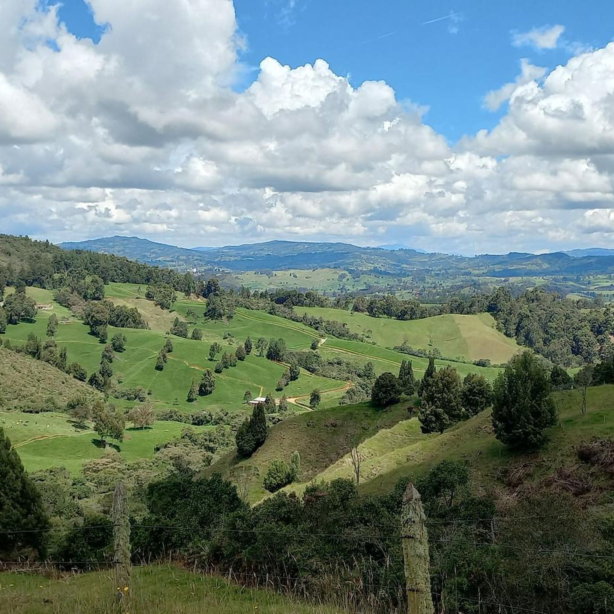
Touring cycling routes in Entrerríos are characterized by mountainous terrain and high-altitude landscapes, situated at approximately 2,300 meters above sea level. The region features dramatic, alpine-like settings with endless green hills and significant elevation changes. Key geographical features include the Riogrande II Reservoir and prominent natural lookout points such as Cerro de La Cruz. These routes often traverse rural areas, offering views of the region's distinct topography.
Best touring cycling routes in Entrerríos
- The most popular touring cycling route is…
Last updated: July 7, 2026
5
riders
29.2km
02:24
620m
620m
Hard bike ride. Very good fitness required. Mostly paved surfaces. Suitable for all skill levels.
4
riders
19.1km
01:29
500m
500m
Hard bike ride. Very good fitness required. Mostly paved surfaces. Suitable for all skill levels.

Sign up for free
2
riders
39.6km
02:55
850m
850m
Hard bike ride. Very good fitness required. Mostly paved surfaces. Suitable for all skill levels.
Our route recommendations are based on thousands of hikes, rides, and runs completed by other people on komoot.
Start today with a free account
Your next adventure awaits.
Login or Signup
Popular around Entrerríos
Tips from the Community

Great café with wifi, delicious food/drink and SÚPER friendly staff!
0
0

When you want to return, it is good to look for transportation by group. which could be more comfortable than coming on the normal routes ... and they can reach agreements with the drivers to leave them closer to a common place there are good restaurants around the park, but you can also find trout or interesting places in the peripheries.
0
0
Frequently Asked Questions
What kind of terrain can I expect on touring cycling routes in Entrerríos?
Touring cycling in Entrerríos is characterized by mountainous terrain and high-altitude landscapes, situated at approximately 2,300 meters above sea level. You'll encounter dramatic, alpine-like settings with endless green hills and significant elevation changes, often traversing rural areas with views of the region's distinct topography.
What is the best time of year for touring cycling in Entrerríos?
Entrerríos experiences a cool climate year-round, averaging around 14°C due to its high altitude. While cycling is possible throughout the year, the region's green hills and mountainous landscapes are particularly inviting during drier periods, allowing for more comfortable exploration of the challenging routes.
Are there challenging routes for experienced touring cyclists in Entrerríos?
Yes, all touring cycling routes in Entrerríos are rated as difficult, featuring substantial elevation gains. For example, the Idilios loop from San Pedro de los Milagros covers 29.2 km with significant climbing, and the longer Santa Rosa Sign loop from Santa Rosa de Osos spans 39.6 km with over 800 meters of elevation gain.
What natural features or landmarks can I see along the cycling routes?
The routes often provide expansive views of the mountainous landscape and rural surroundings. Key natural features in the region include the Riogrande II Reservoir and prominent natural lookout points such as Cerro de La Cruz. You'll also cycle through green hills that resemble an alpine setting, often dotted with coffee plantations and cattle pastures.
Are there any circular touring cycling routes available?
Yes, many of the touring cycling routes in Entrerríos are designed as loops. Popular options include the Bike loop from Entrerríos, which is 19.1 km, and the Idilios loop from San Pedro de los Milagros, a 29.2 km ride. These loops allow you to start and finish at the same point, making logistics easier.
What is the typical duration for a touring cycling route in Entrerríos?
The duration varies depending on the route length and your pace, but given the difficult terrain, routes generally take a few hours. For instance, the Bike loop from Entrerríos can be completed in about 1 hour 28 minutes, while the Santa Rosa Sign loop from Santa Rosa de Osos typically takes around 2 hours 55 minutes.
Are there options for long-distance touring cycling in Entrerríos?
While the individual routes listed are generally day trips, the region's extensive network of rural roads and mountainous terrain suggests potential for combining routes for longer, multi-day touring experiences. The longest single route listed is the Santa Rosa Sign loop from Santa Rosa de Osos, at nearly 40 km.
What kind of wildlife might I encounter on the cycling paths?
Cycling through the rural landscapes, native forests, and cattle farms of Entrerríos, you might encounter various local wildlife. The region's biodiversity, particularly in its green hills and natural areas, offers opportunities to observe birds and other small animals typical of high-altitude agricultural and forested environments.
Are there any family-friendly or easy touring cycling routes in Entrerríos?
The touring cycling routes in Entrerríos are generally rated as difficult due to significant elevation changes and mountainous terrain. There are no easy or moderate routes listed in this guide, suggesting that the area is best suited for experienced cyclists or families with strong cycling abilities looking for a challenge.
What are the parking options near the touring cycling routes?
As many routes start from towns like San Pedro de los Milagros or Santa Rosa de Osos, you can typically find parking within or near these communities. For routes like the Idilios loop from San Pedro de los Milagros, starting points in or near the town would be the most convenient for parking.
Can I find cafes or accommodation along the touring cycling routes?
The region is known for its rural tourism and farm stays, especially given the prevalence of coffee plantations and cattle pastures. While specific cafes on every route are not detailed, starting and ending in towns like Entrerríos, San Pedro de los Milagros, or Santa Rosa de Osos will provide access to local eateries and accommodation options.
What do other touring cyclists enjoy most about cycling in Entrerríos?
Cyclists exploring Entrerríos often praise the challenging mountainous terrain and the rewarding panoramic views of the 'endless green landscapes' and 'mountains that seem otherworldly.' The unique high-altitude setting and rural charm, including coffee plantations and cattle pastures, contribute to a memorable touring experience.
Most popular routes in Entrerríos

Get inspired with the komoot mobile app


Explore more
Browse the best Cycling routes in other regions.
