The best walks and hikes around Toulões
4.6
(10)
40
hikers
2
hikes
Hiking trails around Toulões are situated within the UNESCO Naturtejo Global Geopark, offering diverse landscapes for outdoor exploration. The region is characterized by the Serra da Murracha mountain range and extensive "montado" areas, featuring cork oak and holm oak forests. These natural features contribute to a varied terrain, including rural agricultural fields and the Toula Basin, providing a mix of gentle paths and more undulating routes.
Best hiking trails around Toulões
- The most popular hiking route is Penha Garcia Castle…
Last updated: October 7, 2026
4.3
(3)
15
hikers
2.99km
00:54
100m
100m
Easy hike. Great for any fitness level. Easily-accessible paths. Suitable for all skill levels.
5.0
(2)
11
hikers
13.0km
03:39
260m
260m
Moderate hike. Good fitness required. Easily-accessible paths. Suitable for all skill levels.

4.5
(2)
4
hikers
6.52km
01:53
160m
160m
Easy hike. Great for any fitness level. Easily-accessible paths. Suitable for all skill levels.
4.0
(1)
7
hikers
3.23km
00:55
70m
70m
Easy hike. Great for any fitness level. Easily-accessible paths. Suitable for all skill levels.
5.0
(2)
3
hikers
8.78km
02:29
190m
190m
Moderate hike. Good fitness required. Easily-accessible paths. Suitable for all skill levels.
Our route recommendations are based on thousands of hikes, rides, and runs completed by other people on komoot.
Tips from the Community

View of the water mills of Penha Garcia
0
0

Salvaterra do Extremo preserves numerous traditional stone constructions, especially in the peripheral areas of the historic center and in its rural surroundings, where old paths, pigsties and auxiliary structures typical of agricultural life can be found.
4
0

An old mill powered by the water flowing through the stream, well preserved. Currently it is a museum.
2
0
Flour mills were abundant in the region: they were traditional mechanisms for grinding grain using stones, although most have disappeared over time. In nearby towns like La Zarza (Badajoz), a mill called "Molino de la Rabia" (Mill of Rage) is still preserved, characterized by its five pairs of millstones and barrel vaults.
3
0
Salvaterra do Extremo is a picturesque village in Portugal, known for its stunning views and natural surroundings.
8
0

You can see how people used to live and work. If you're lucky, the huts are open. There is also a hut where you can look at fossils.
1
0

The border town of Salvaterra Do Extremo between Portugal and Spain sits high above the Erjes River gorge, opposite Peñafiel Castle.
3
1
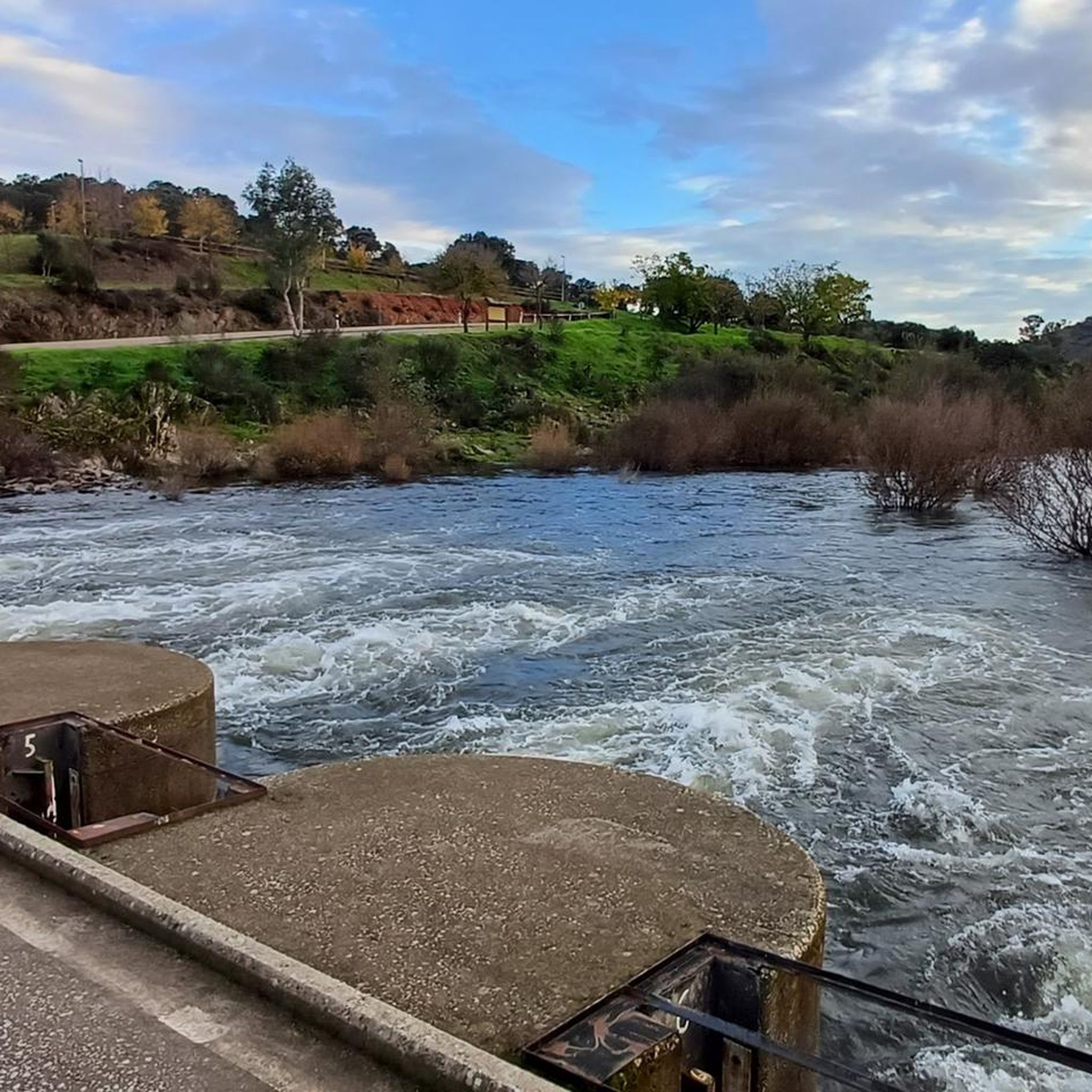
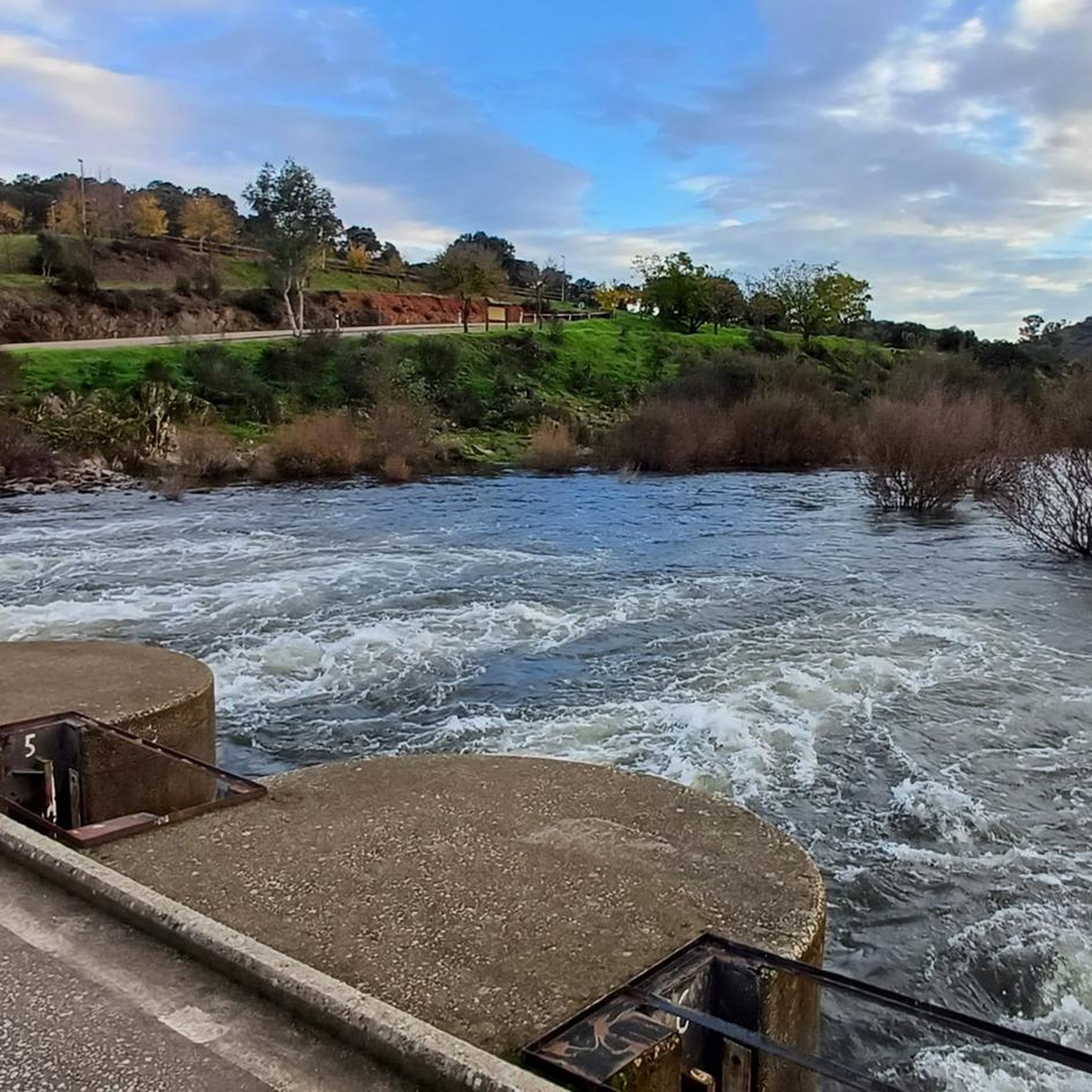
The spectacular Penha Garcia Reservoir is situated naturally in a gorge surrounded by mountains in the valley of the Ponsul River. The town of Penha Garcia, located near the border with Spain, is an inspiring place, with a medieval castle and geologically interesting rock formations. There is a river beach fed by a small waterfall where you can enjoy a swim during the summer.
2
0
Frequently Asked Questions
What kind of landscapes can I expect to see while hiking around Toulões?
Hiking around Toulões offers a diverse landscape, characterized by the UNESCO Naturtejo Global Geopark. You'll encounter the geological formations of the Serra da Murracha mountain range, extensive "montado" areas with cork and holm oak forests, rural agricultural fields, and the Toula Basin. The nearby Penha Garcia area also features ancient geological formations with visible trilobite fossils and scenic river valleys.
Are there any easy hiking trails suitable for beginners or families?
Yes, there are several easy trails. A great option is the Penha Garcia Castle – Small Waterfall loop from Penha Garcia, which is about 3 km long and takes around 1 hour. Another easy choice is the Old Miller's Village – Penha Garcia Castle loop from Penha Garcia, a 6.3 km path that can be completed in about 1 hour 50 minutes, offering varied terrain.
Can I find trails with waterfalls or natural swimming spots near Toulões?
Absolutely! The nearby Penha Garcia is home to the beautiful Penha Garcia Natural Swimming Pool and Waterfall, also known as Fonte do Pego river beach. This picturesque spot is fed by an irrigation channel and is perfect for swimming in warmer months. The Pego Waterfall is particularly impressive after rainfall in spring or autumn.
Are there any circular hiking routes available?
Yes, many of the trails around Toulões are circular, making them convenient for exploration. Examples include the View of Salvaterra do Extremo – Stone Mill loop from Salvaterra do Extremo, a moderate 13 km route, and the Penha Garcia Castle – Small Waterfall loop from Penha Garcia, an easy 3 km option.
What historical sites or landmarks can I explore while hiking?
The region is rich in history. You can visit the Penha Garcia Castle, perched atop a hill with panoramic views. The Old Miller's Village is another historical site you can explore, often integrated into hiking routes like the Old Miller's Village – Penha Garcia Castle loop. The area also features ancient geological formations with trilobite fossils, particularly along the 'Fossils Route' (Rota dos Fósseis – PR3) in Penha Garcia.
What is the best time of year to go hiking in Toulões?
Spring and autumn are generally the best seasons for hiking around Toulões. During these times, the weather is milder, and the natural landscapes are vibrant. The Pego Waterfall in Penha Garcia is also particularly impressive after rainfall in spring or autumn. Summer can be very hot, while winter offers a different, often quieter, experience.
What do other hikers enjoy most about the trails around Toulões?
The trails around Toulões are highly rated by the komoot community, with an average score of 4.7 stars. Hikers often praise the varied terrain, from rural agricultural fields to "montado" forests, and the unique geological features. The proximity to natural attractions like the Penha Garcia waterfall and historical sites like the castle are also frequently highlighted.
Are there any longer or more challenging hikes for experienced hikers?
For those seeking a moderate challenge, the View of Salvaterra do Extremo – Stone Mill loop from Salvaterra do Extremo is a good option. This 13 km route involves about 260 meters of elevation gain and typically takes around 3 hours 40 minutes to complete, exploring rural landscapes and traditional stone mills.
Can I combine hiking with exploring traditional villages?
Yes, several routes allow you to experience the charm of traditional villages. The Traditional Stone Shelter – Stone Mill loop from Salvaterra do Extremo, for instance, takes you through rural settings and past traditional stone mills, offering a glimpse into the local heritage.
What are the typical trail conditions and terrain like?
The terrain around Toulões is varied, ranging from gentle paths through rural agricultural fields to more undulating routes in the Serra da Murracha. You'll encounter paths through "montado" areas with cork and holm oak forests, as well as rocky sections, particularly in areas with ancient geological formations like those near Penha Garcia. Trails are generally well-maintained, offering a mix of natural surfaces.
Are there opportunities to see unique geological features?
Yes, the region is part of the UNESCO Naturtejo Global Geopark, making it an excellent place to observe unique geological features. Around Penha Garcia, you can find quartzite rocks dating back 480 to 600 million years, which contain visible trilobite fossils. The 'Fossils Route' (Rota dos Fósseis – PR3) is specifically designed to showcase these geological wonders.
Most popular routes around Toulões
Most popular attractions around Toulões

Get inspired with the komoot mobile app


Explore more
Browse the best Hikes in other regions.
