The best cycling routes around Area B (Shelter Bay/Mica Creek)
62
riders
4
rides
Touring cycling around Area B (Shelter Bay/Mica Creek) is characterized by routes that navigate through the Columbia-Shuswap Regional District of British Columbia. The region features majestic mountain ranges, including the Selkirk and Monashee Mountains, and expansive water bodies such as the Columbia River and Lake Revelstoke. Cyclists can expect diverse landscapes, from river valleys to areas with significant elevation changes, often on low-traffic roads. This setting provides varied terrain for touring cyclists.
Best touring cycling routes around Area B (Shelter Bay/Mica Creek)
- The most popular touring cycling route is Frisby Ridge loop from Jordan River, a 13.5 miles (21.7 km) trail that takes 2 hours 32 minutes to complete. This difficult route offers significant climbs with views of the surrounding mountain ranges.
- Another top favourite among local touring cyclists is Columbia River – Illecillewaet Greenbelt loop from Revelstoke, an easy 9.4 miles (15.2 km) path. This route follows the Columbia River and passes through greenbelt areas, offering a scenic and less challenging ride.
- Local touring cyclists also love the Big Eddy Bridge – Columbia River loop from Revelstoke Airport, a 19.2 miles (31.0 km) trail leading through the Columbia River valley, often completed in about 2 hours 27 minutes.
- Touring cycling around Area B (Shelter Bay/Mica Creek) is defined by routes along the Columbia River, through mountain valleys, and past significant dams. The network offers options for different ability levels, from easy riverside loops to more challenging mountain ascents.
- The guide includes highly-rated routes that showcase the best of the region's landscape. More than 40 touring cyclists have used komoot to explore Area B (Shelter Bay/Mica Creek)'s varied terrain.
Last updated: October 16, 2026
35
riders
21.7km
02:32
740m
740m
Hard bike ride. Very good fitness required. Mostly paved surfaces. Suitable for all skill levels.
8
riders
15.5km
01:08
70m
70m
Easy bike ride. Great for any fitness level. Mostly paved surfaces. Suitable for all skill levels.

14
riders
Hard bike ride. Very good fitness required. Mostly paved surfaces. Suitable for all skill levels.
5
riders
13.8km
00:52
120m
120m
Easy bike ride. Great for any fitness level. Mostly paved surfaces. Suitable for all skill levels.
Our route recommendations are based on thousands of hikes, rides, and runs completed by other people on komoot.
Start today with a free account
Your next adventure awaits.
Popular around Area B (Shelter Bay/Mica Creek)
Tips from the Community

This ski-in ski-out hotel sits at the base of Revelstoke Mountain Resort and has everything you need for your visit, no matter the time of year. Of course skiing and snowboarding dominate during with, but Revelstoke has a lot to offer in the summer as well with plenty of hiking and mountain biking trails starting right from the hotel and surrounding area.
0
0


The Illecillewaet River flows 62 kilometers before meeting the Columbia River. The turquoise color comes from glaciers at the river's starting point at Rogers Pass. This river is home to rainbow trout, bull trout, and mountain whitefish, and the all-important beavers, building dams along its course.
0
0
The Marc Kingsbury Memorial Bridge is a pedestrian and cycling bridge spanning the Illecillewaet River, connecting downtown Revelstoke to the Illecillewaet Greenbelt and trails on the river’s south side. It was named after Marc Kingsbury, a beloved Revelstoke resident and outdoor enthusiast who passed away in a kayaking accident. Stop in the middle of the Marc Kingsbury Bridge on clear evenings and watch Mount Begbie glow pink with alpenglow, and in the spring.
1
0
The Illecillewaet Greenbelt runs through cottonwood and spruce forests and marshland, offering great riverside views. The trail is wide and well-maintained, open to walking, jogging, cycling, dog walking, birdwatching, photography, cross-country skiing, or snowshoeing in winter. The greenbelt creates easy access downtown for dining and shopping.
2
0
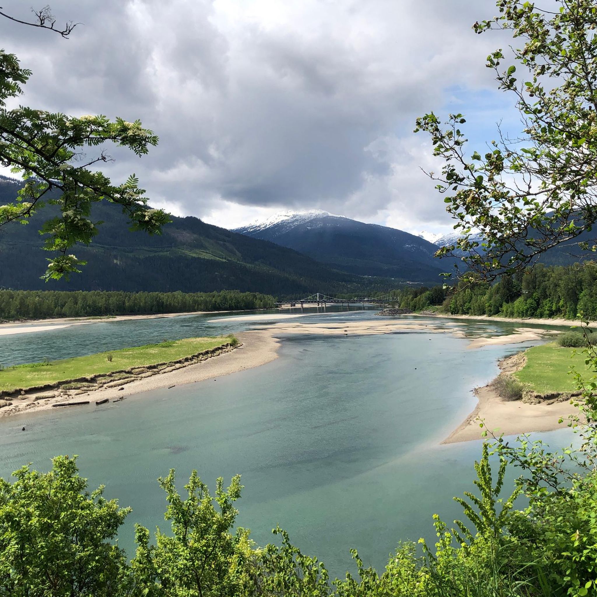
The Columbia River flows through Revelstoke and is surrounded by dramatic mountain scenery with views of Mount Begbie and the Selkirk Mountains. This stretch of the river is heavily controlled by dams and reservoirs and provides power through the Columbia Basin hydro system. Animals such as bald eagles, ospreys, and herons call this river home.
0
0


This single-lane car bridge crosses the Columbia River. Traffic is regulated by traffic lights. There is a separate lane for pedestrians and cyclists.
0
0
Frequently Asked Questions
How many touring cycling routes are available in Area B (Shelter Bay/Mica Creek)?
There are over 4 touring cycling routes available in Area B (Shelter Bay/Mica Creek) documented on komoot. These routes offer a mix of easy and difficult options, catering to various skill levels.
What are the difficulty levels of touring cycling routes in Area B?
Area B offers a balanced selection of touring cycling routes. You'll find 2 easy routes, perfect for a relaxed ride, and 2 difficult routes for those seeking more challenging terrain and significant climbs. An example of an easy route is the Columbia River – Illecillewaet Greenbelt loop from Revelstoke, while the Frisby Ridge loop from Jordan River presents a more demanding option.
What is the best time of year for touring cycling in Area B?
The best time for touring cycling in Area B is typically during the warmer months, from late spring to early autumn. This period offers the most favorable weather conditions for enjoying the scenic routes and minimizing snow or ice on higher elevation sections. The region is known for its stunning views of the Selkirk and Monashee Mountains, which are best appreciated in clear weather.
Are there any circular touring cycling routes in Area B?
Yes, Area B features several excellent circular touring cycling routes. For instance, the Frisby Ridge loop from Jordan River offers a challenging ride with mountain views, and the Big Eddy Bridge – Columbia River loop from Revelstoke Airport provides a longer loop through the Columbia River valley.
What natural attractions can I see while touring cycling in Area B?
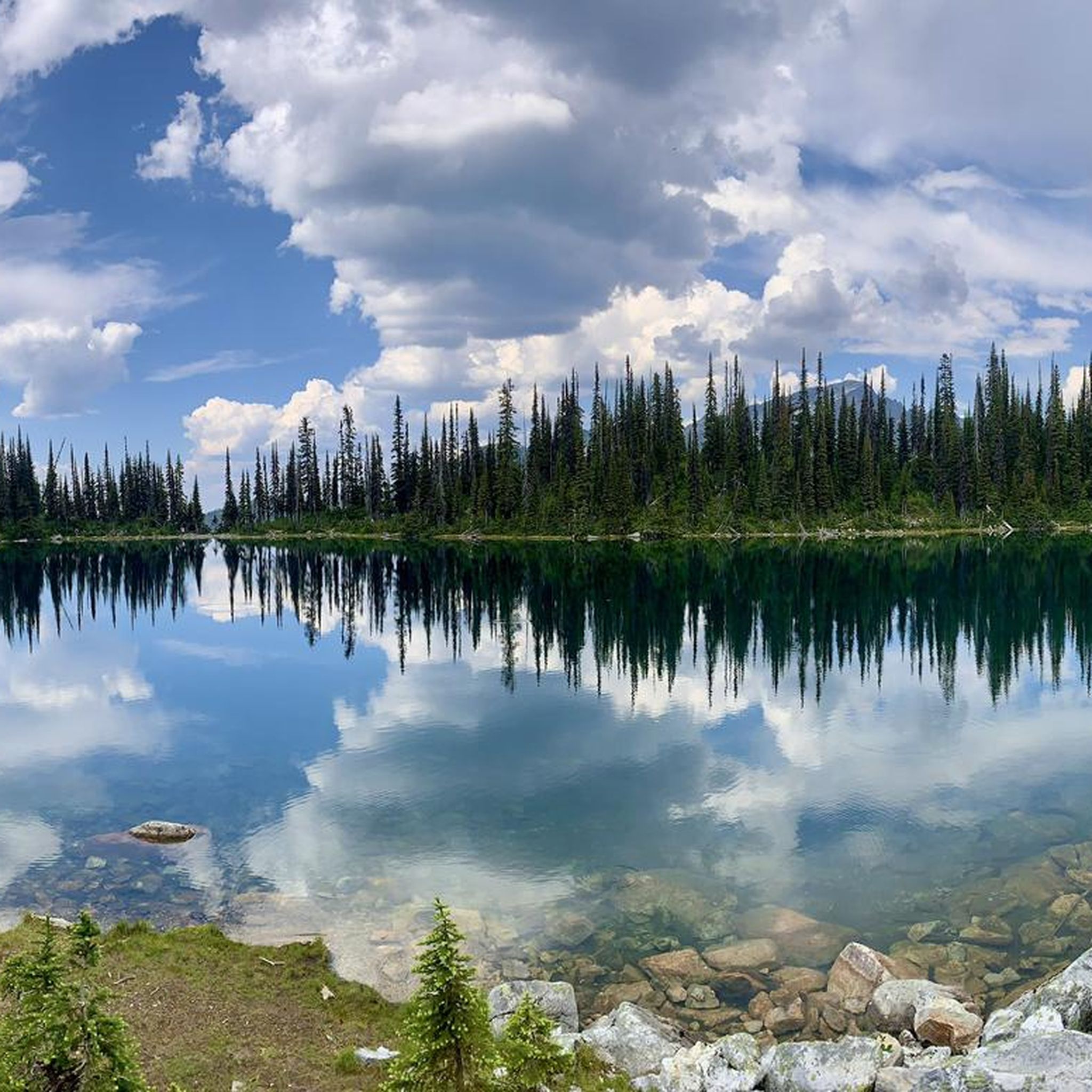
Touring cycling in Area B offers access to numerous natural attractions. You can explore the unique Giant Cedars Boardwalk, which is part of the world's only inland temperate rainforest. Other highlights include impressive hydro-electric dams like the Revelstoke Dam and Mica Dam, and scenic views of Eva Lake and Miller Lake. The routes often follow the Columbia River, providing expansive valley views.
Are there any waterfalls accessible from touring cycling routes?
Yes, you can find waterfalls near some touring cycling routes in Area B. The Broken Bridge Waterfall is a notable attraction in the area, offering a beautiful natural sight that can be incorporated into your cycling adventure or visited as a side trip.
Are there family-friendly touring cycling routes in Area B?
For families looking for an easier ride, the Columbia River – Illecillewaet Greenbelt loop from Revelstoke is an excellent choice. This easy 9.4-mile path follows the Columbia River and passes through greenbelt areas, offering a scenic and less challenging experience suitable for various ages and skill levels.
Can I bring my dog on touring cycling routes in Area B?
While many outdoor areas in British Columbia are dog-friendly, specific regulations can vary by trail and park. It's always best to check local signage or park websites for the most current rules regarding dogs on cycling routes, especially within provincial parks or protected areas. Generally, dogs should be kept on a leash and their waste properly disposed of.
Where can I find parking for touring cycling routes in Area B?
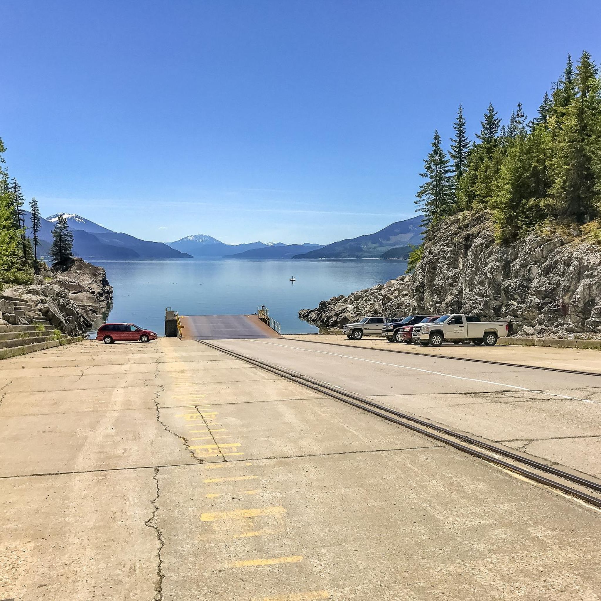
Parking for touring cycling routes in Area B is often available at trailheads, designated recreation sites, or near points of interest. For routes starting near Revelstoke, you might find parking in or around the town. For routes like those along Highway 23 South, Shelter Bay Provincial Park at the ferry terminal offers camping and lake access, which could include parking options.
What kind of wildlife might I encounter while cycling in Area B?
Area B's diverse landscapes, including mountain ranges and river valleys, support a variety of wildlife. While touring cycling, you might spot animals such as black bears, caribou, moose, and bighorn sheep. Always maintain a safe distance from wildlife and carry bear spray as a precaution, especially in more remote areas.
Are there places to eat or stay near the touring cycling routes?
The region, particularly around Revelstoke, offers various options for accommodation and dining. Recreation sites along Lake Revelstoke, accessible from routes like Highway 23 North, provide excellent spots for breaks or overnight stays. Shelter Bay Provincial Park also offers camping facilities. For more extensive services, the nearby Revelstoke Town Centre is a good resource for cafes, pubs, and accommodation.
Are there any less-trafficked roads ideal for touring cycling in Area B?
Area B is renowned for its quiet roadways, making it ideal for touring cycling. Highway 23 North, often called 'The Road to Nowhere,' is a 150-kilometer paved route towards the Mica Dam known for its minimal traffic and incredible views. Similarly, Highway 23 South to the Arrow Lakes Ferry offers quiet stretches along the Columbia River valley, providing a peaceful and immersive cycling experience.
What unique natural features can I explore in Area B?
Beyond the stunning mountain ranges and the Columbia River, Area B offers unique natural features like the world's only inland temperate rainforest, accessible via trails such as the Giant Cedars Boardwalk. The impressive Revelstoke Dam and Mica Dam are also significant landmarks and destinations, showcasing both natural beauty and human engineering.
Most popular routes around Area B (Shelter Bay/Mica Creek)
Most popular attractions around Area B (Shelter Bay/Mica Creek)

Get inspired with the komoot mobile app


Explore more
Browse the best Cycling routes in other regions.
